The best road cycling routes in Harry Waring Marsupial Reserve Nature Reserve
5.0
(2)
162
riders
7
rides
Road cycling routes in Harry Waring Marsupial Reserve Nature Reserve traverse a diverse landscape spanning 572.6 acres in Western Australia. The region features well-maintained trails, offering a mix of terrain including wetlands, Bassendean Dunes, and Spearwood Dunes. Cyclists can find routes on mostly paved surfaces, with some options including unpaved segments. The reserve provides a setting for outdoor activities, with amenities such as parking lots and shelters available.
Best road cycling routes in Harry Waring Marsupial Reserve Nature Reserve
- The most popular road cycling route is Mount Henry Bridge – Canning Bridge loop from Aubin Grove, a 65.2 miles (104.9 km) trail that takes 4 hours 36 minutes to complete. This moderate route features a total elevation gain of 1523 feet (464 meters).
- Another top favourite among local road cyclists is Elizabeth Quay Bridge – Perth Water Bike Trail loop from Aubin Grove, a moderate 53.3 miles (85.7 km) path. This route offers views of the Perth Water area and includes 1504 feet (458 meters) of ascent.
- Local road cyclists also love the Canning Bridge – Mt Henry Bridge loop from Cockburn Central, an 18.6 miles (29.9 km) trail leading through varied terrain, often completed in about 1 hour 14 minutes.
- Road cycling in Harry Waring Marsupial Reserve Nature Reserve is defined by diverse terrain, wetlands, and dune systems. The network offers options for different ability levels, from easy loops to more challenging rides with higher elevation gains.
- The routes in Harry Waring Marsupial Reserve Nature Reserve are highly rated by the komoot community with an average score of 4.7 stars from a few reviews. More than 200 road cyclists have used komoot to explore Harry Waring Marsupial Reserve Nature Reserve's varied terrain.
Last updated: July 9, 2026
13
riders
104km
04:35
440m
440m
Moderate road ride. Good fitness required. Some segments of this route may be unpaved and difficult to ride.
7
riders
84.9km
03:53
460m
460m
Moderate road ride. Good fitness required. Some segments of this route may be unpaved and difficult to ride.

Sign up for free
142km
06:26
1,030m
1,030m
Hard road ride. Very good fitness required. Some segments of this route may be unpaved and difficult to ride.
5.0
(2)
104
riders
30.0km
01:15
100m
100m
Easy road ride. Great for any fitness level. Mostly well-paved surfaces and easy to ride.
3
riders
103km
04:39
740m
740m
Moderate road ride. Good fitness required. Mostly well-paved surfaces and easy to ride.
Get access to more routes and recommendations from other explorers.
Sign up for free
Already have an account?
Our route recommendations are based on thousands of hikes, rides, and runs completed by other people on komoot.
Start today with a free account
Your next adventure awaits.
Login or Signup
Popular around Harry Waring Marsupial Reserve Nature Reserve


Tips from the Community

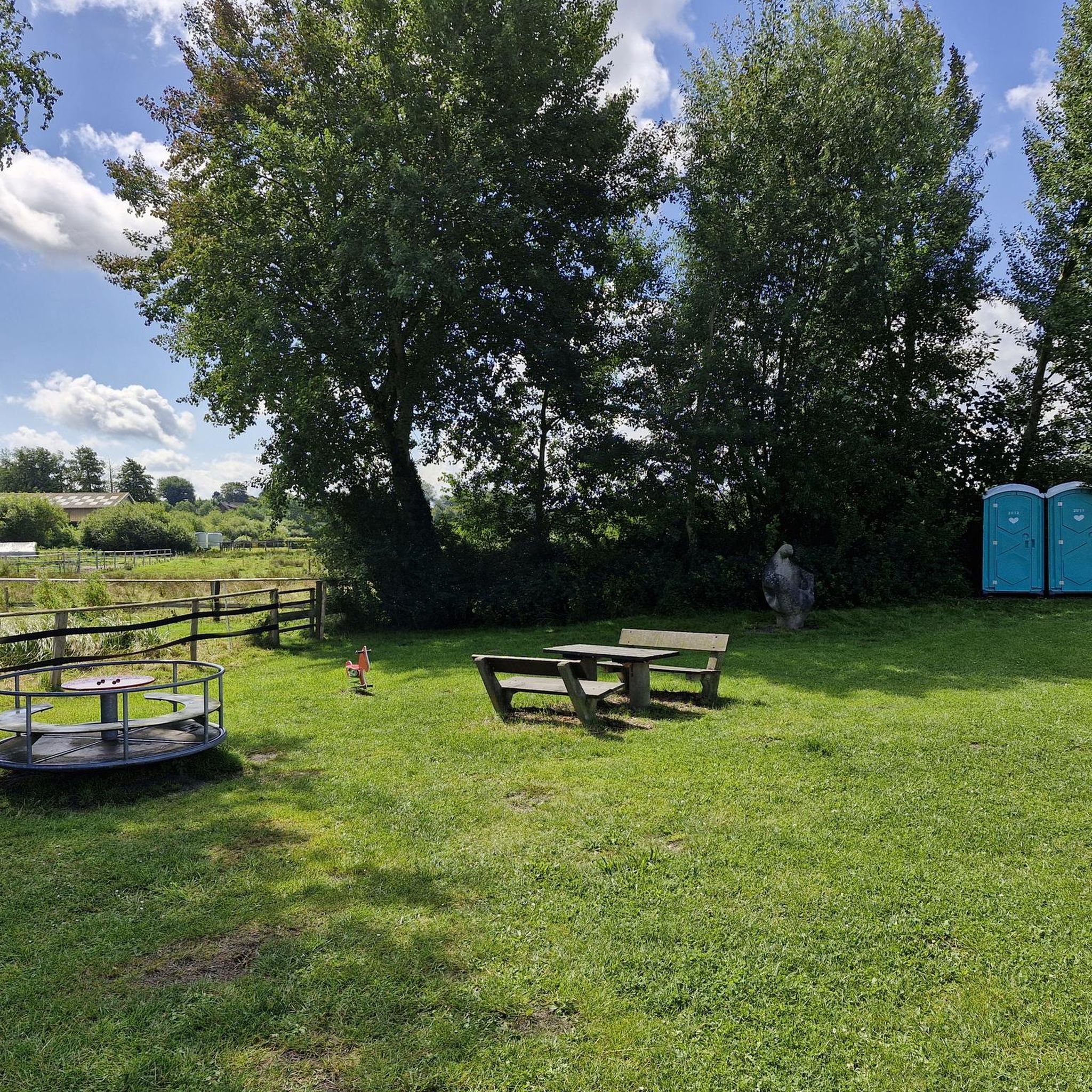
Mount Henry Bridge Reserve sits directly in the shadow of the historic Mount Henry Bridge. It's a popular riverside stop for families, fitness enthusiasts, and walkers with public toilets, manicured grassy picnic fields, park benches, and a large car park. The kids' playgrounds here are a stand-out amenity, with modern design including shade sails. For adults, there's free fitness equipment, the Mount Henry Jetty and the Kerbside Café.
0
0

The waterfront path does a little loop at the 'Fragment' sculpture, created by artist Kevin Draper. You can see downtown Perth across the water, and it's possible to follow the trail from here to walk or cycle basically the entire visible coast of the Swan River.
0
0

Trafalgar Bridge crosses the narrow entrance to Claisebrook Cove, connecting the waterfront promenades in East Perth. From the bridge, the views open up east across the Swan River toward Optus Stadium, and below, the marina and waterside apartments of Claisebrook Cove, which is a quieter contrast to the busy city skyline. Ferries, moored boats and reflections on the sheltered water give this section of the foreshore a peaceful harbourside feel.
0
0
This large conserved greenspace is made up of forests, marshlands and a park, spanning almost 100 hectares. Fern Park sitting on its northern end with amenities like shaded picnic areas, BBQs, restrooms, and the Lo Quay River Cafe.
0
0

Kwinana Freeway PSP is a principal shared path running for over 20 kilometres alongside the freeway, designed mainly for cycling and commuting. It’s fully sealed, mostly flat, and direct. However, around the Swan River section, it feels less like a typical commuter route, with open views across the water and towards the city skyline on the western side.
0
0

Bibra Lake, known as Walliabup in the local Nyungar language, is a freshwater lake that forms part of a chain of wetlands that make up Beeliar Regional Park. You can follow the shared cycle and walking path that loops around the shoreline, giving you easy access to bird hides and plenty of quiet spots to pause and watch the water. You’re likely to see a mix of local birdlife, especially in the early morning when the lake is still and reflective.
0
0
Canning Bridge is a major road bridge that carries Canning Highway across the Canning River between the suburbs of Applecross and Como. Originally built in the 1930s, this key bridge has been rebuilt several times over the years. Under the bridge, various walking and cycling paths wind along the river, connecting several of the surrounding foreshore parklands and offering plenty of options for exploring this beautiful area.
0
0
Kwinana Freeway Shared Path is a major walking and cycling route that runs alongside the Kwinana Freeway through Perth’s southern suburbs. Part of Perth’s Principal Shared Path (PSP) network, the sealed trail provides a direct corridor used by both recreational users and commuters. This quiet section offers a beautiful view of the Canning River and is ideal for connecting to several river foreshore routes and nearby suburbs.
0
0
Frequently Asked Questions
How many road cycling routes are available in Harry Waring Marsupial Reserve Nature Reserve?
There are currently 9 road cycling routes mapped in Harry Waring Marsupial Reserve Nature Reserve, catering to various skill levels. These include 4 easy, 4 moderate, and 1 difficult route.
Are there road cycling routes suitable for beginners or families in the reserve?
Yes, the reserve offers several easy routes perfect for beginners or families. An excellent option is the Canning Bridge – Mt Henry Bridge loop from Cockburn Central, which is 29.9 km long and takes about 1 hour 14 minutes to complete. Another family-friendly choice is the Twilight View of the Lake – Wild Bakery loop from Lake Coogee, an easy 22.9 km ride.
What kind of terrain can I expect on road cycling routes in Harry Waring Marsupial Reserve Nature Reserve?
The reserve features diverse terrain, including wetlands, Bassendean Dunes, and Spearwood Dunes. Most routes are on well-paved surfaces, offering a smooth ride. However, some more challenging routes may include unpaved segments, so it's good to check the route details if you prefer entirely paved paths.
Are there any long-distance or more challenging road cycling routes for experienced riders?
Experienced riders will find several moderate to difficult routes. The Mount Henry Bridge – Canning Bridge loop from Aubin Grove is a moderate 104.9 km route with a significant elevation gain of 464 meters. Another substantial option is the Elizabeth Quay Bridge – Perth Water Bike Trail loop from Aubin Grove, covering 85.7 km with 458 meters of ascent.
Are there any loop road cycling routes in the area?
Yes, many of the road cycling routes in Harry Waring Marsupial Reserve Nature Reserve are designed as loops, offering convenient starting and ending points. Examples include the Mount Henry Bridge – Canning Bridge loop from Aubin Grove and the Canning Bridge – Mt Henry Bridge loop from Cockburn Central.
What are the best seasons for road biking in Harry Waring Marsupial Reserve Nature Reserve?
The reserve's serene ambiance and diverse landscape make it enjoyable for road cycling throughout much of the year. However, for optimal comfort, spring and autumn generally offer the most pleasant temperatures. Winter conditions are typically mild, but it's always advisable to check local weather forecasts and route conditions before heading out.
Is parking available for road cyclists at Harry Waring Marsupial Reserve Nature Reserve?
Yes, the reserve is equipped with essential amenities, including parking lots, making it convenient for cyclists to access the trails. You'll find designated parking areas to start your ride.
Can I spot wildlife while road cycling in the reserve?
Harry Waring Marsupial Reserve Nature Reserve is known for its native flora and fauna. While cycling, you might encounter various native shrubs, Banksia Woodland, and a good native bird population, including many Honeyeaters and Wrens. The serene natural beauty provides opportunities for wildlife observation.
What do other road cyclists enjoy most about the routes in Harry Waring Marsupial Reserve Nature Reserve?
The routes in Harry Waring Marsupial Reserve Nature Reserve are highly rated by the komoot community, with an average score of 4.7 stars. Reviewers often praise the diverse terrain, the mix of paved and unpaved segments for varied challenges, and the overall natural beauty and serene ambiance of the reserve.
Are there any specific restrictions for cycling within Harry Waring Marsupial Reserve Nature Reserve?
While the reserve is welcoming to cyclists, it's important to respect the natural environment. Always stay on marked trails to protect the native flora and fauna. There are no specific restrictions mentioned regarding dogs on cycling trails, but it's always best to check local signage or official park guidelines for the most current information on pet policies.
Are there any viewpoints or notable natural features along the road cycling routes?
The reserve offers a picturesque setting with diverse natural features. Cyclists can enjoy views of Banganup Lake and traverse areas characterized by Bassendean Dunes and Spearwood Dunes. The routes wind through unspoiled landscapes, providing ample opportunities to appreciate the natural beauty and native vegetation complexes like Banksia Woodland.
Most popular routes in Harry Waring Marsupial Reserve Nature Reserve

Get inspired with the komoot mobile app


Explore more
Browse the best Road cycling routes in other regions.
