The best walks and hikes in Mount White Bush Reserve
5.0
(8)
127
hikers
4
hikes
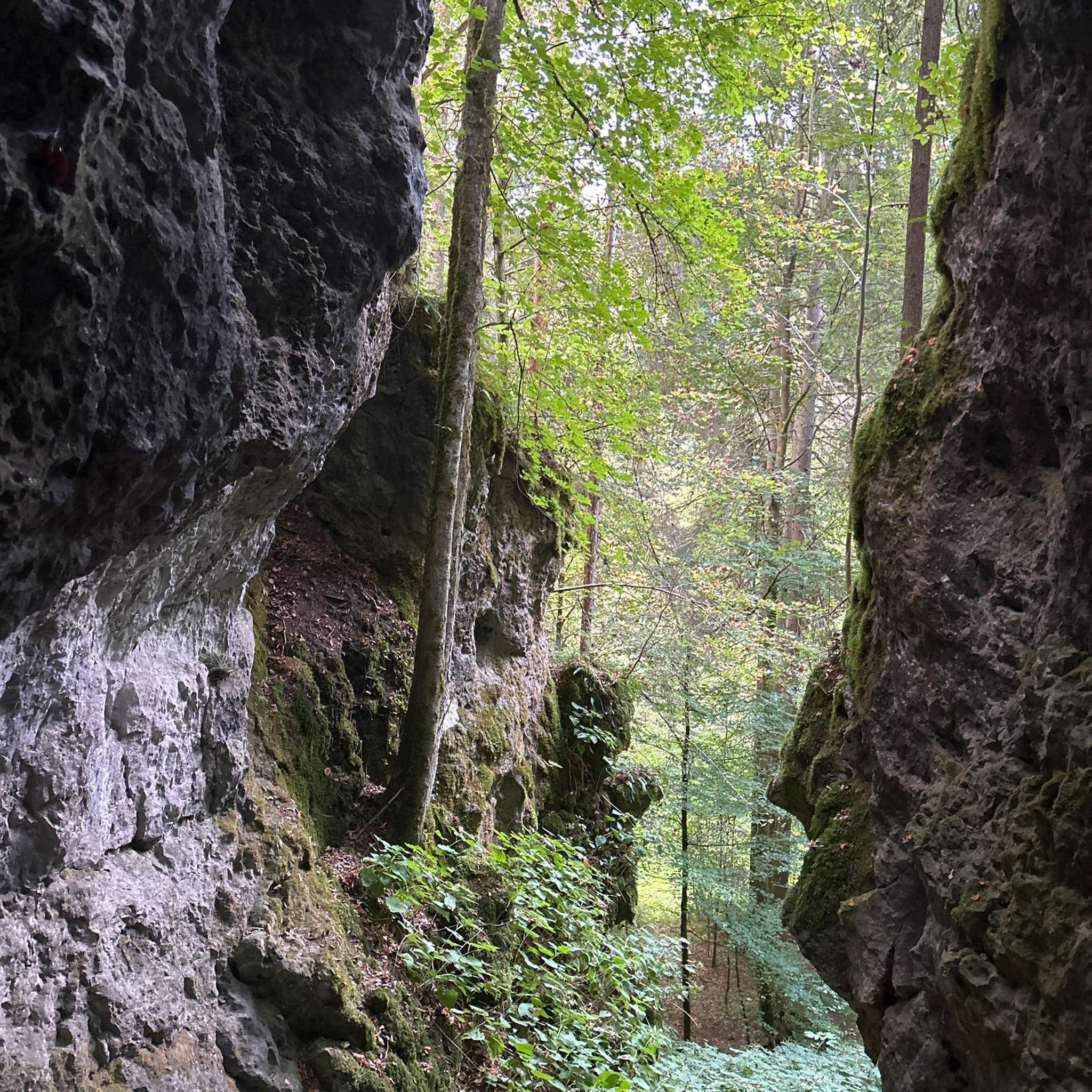
Hiking in Mount White Bush Reserve offers diverse landscapes characterized by natural slopes, rock outcrops, and extensive bushland. The terrain includes watercourses, waterholes, and a hanging swamp, providing varied exploration opportunities. From various vantage points, hikers can experience expansive views, including vistas up Mangrove Creek and across rural properties. The summit of Mount White, at 286 meters above sea level, provides panoramic views of the surrounding area.
Best hiking trails in Mount White Bush Reserve
- The most popular hiking route is Emerald Pool – Mount Olive loop from Glenworth Valley, a 10.1 miles (16.3 km) trail that takes 4 hours 52 minutes to complete, traversing varied bushland and offering views of the surrounding valleys.
- Another top favourite among local hikers is Emerald Pool loop from Popran National Park, a moderate 4.6 miles (7.4 km) path. This route leads through natural bushland, featuring waterholes and diverse plant communities.
- Local hikers also love the Pindar Cave loop from Wondabyne, a 7.3 miles (11.7 km) trail leading through bushland and past rock formations, often completed in about 3 hours 29 minutes.
- Hiking in Mount White Bush Reserve is defined by natural slopes, rock outcrops, and bushland, with routes offering varied terrain and panoramic views. The network provides options for different ability levels, from moderate to difficult.
- The routes in Mount White Bush Reserve are highly rated by the komoot community with an average score of 5.0 stars from over 2 reviews. More than 40 hikers have used komoot to explore Mount White Bush Reserve's varied terrain.
Last updated: July 4, 2026
4
hikers
16.3km
04:53
500m
500m
Moderate hike. Good fitness required. Mostly accessible paths. Sure-footedness required.
5.0
(1)
11
hikers
7.44km
02:05
150m
150m
Moderate hike. Good fitness required. Easily-accessible paths. Suitable for all skill levels.

Sign up for free
5.0
(3)
41
hikers
4.86km
01:44
110m
100m
Hard hike. Great for any fitness level. Sure-footedness, sturdy shoes and alpine experience required.
5.0
(1)
20
hikers
11.7km
03:29
340m
340m
Moderate hike. Good fitness required. Easily-accessible paths. Suitable for all skill levels.
5.0
(2)
23
hikers
5.18km
01:26
80m
80m
Moderate hike. Great for any fitness level. Mostly accessible paths. Sure-footedness required.
Our route recommendations are based on thousands of hikes, rides, and runs completed by other people on komoot.
Start today with a free account
Your next adventure awaits.
Login or Signup
Popular around Mount White Bush Reserve
Tips from the Community

It takes a bit of a scramble to get down here, but once you do you'll be treated to a very unique waterfall and cliffside pool perched above the valley below. In the warmer months the water can be quite low, so it's best to time your hike for after rainfall is visiting at this time.
0
0

Piles Creek Loop is a short circuit that follows the creek through a shaded valley. The track includes multiple creek crossings using stepping stones, along with sections of uneven sandstone and exposed roots. Waterfalls and smaller cascades appear along the route, particularly after rain.
0
0
This small cascade sits directly off the Piles Creek Loop, where the creek drops over a series of low rock ledges. It’s easy to miss compared to larger falls nearby, but the track passes close enough to see the water moving through the rocks. Flow depends on recent rainfall.
0
0
Andamira Lookout looks down into Andamira Falls as it drops into the gorge below. The viewpoint sits above the creek, with the waterfall framed by surrounding vegetation. Flow varies depending on recent rainfall, with a more visible cascade after wet rainfall.
0
0

Brisbane Water National Park protects more than 11,000 hectares of rugged sandstone ridges, sheltered valleys and coastal waterways on the Central Coast north of Sydney. The park is known for its network of bushwalking tracks, including sections of the Great North Walk. Its mix of scenic lookouts, Aboriginal heritage sites and quiet forest trails makes it a popular escape for walkers exploring the region.
0
0
This management trail forms part of longer bushwalking routes to some of the park’s quieter backcountry walking paths, passing through the wetlands of Woy Woy Creek and along dry eucalypt forest and sandstone bushland typical of the Central Coast hinterland. It’s typically used as the main access route for circuits leading toward Mount Wondabyne and other remote tracks in this section of the park.
0
0
Frequently Asked Questions
What kind of terrain can I expect when hiking in Mount White Bush Reserve?
Mount White Bush Reserve features diverse terrain, including natural slopes, rock outcrops, and extensive bushland. You'll encounter watercourses, waterholes, and even a hanging swamp, providing varied landscapes to explore. Trails range from moderate to difficult, often requiring good fitness.
Are there any notable viewpoints or natural features to see in Mount White Bush Reserve?
Yes, the reserve offers several impressive natural features and viewpoints. You can enjoy expansive vistas up Mangrove Creek and across rural properties. The summit of Mount White, at 286 meters above sea level, provides excellent panoramic views. The area also features beautiful waterholes, and you might spot distinctive gymea lilies.
What is the difficulty level of hikes in Mount White Bush Reserve?
The hiking trails in Mount White Bush Reserve are generally rated as moderate to difficult. For example, the Emerald Pool – Mount Olive loop from Glenworth Valley is a moderate 16.3 km route, while the Mount Wondabyne circuit via Tunnel Fire Trail is considered difficult, covering 7.7 km. There are no easy trails listed within the reserve.
Are dogs allowed on the hiking trails in Mount White Bush Reserve?
No, dogs are generally not permitted within Mount White Bush Reserve to protect the natural environment and wildlife.
Are there any circular hiking routes in Mount White Bush Reserve?
Yes, several circular routes are available. You can explore the Emerald Pool loop from Popran National Park, a moderate 7.4 km path, or the Pindar Cave loop from Wondabyne, which is 11.7 km long. For a more challenging option, consider the difficult Mount Wondabyne loop from Monastir Road Bush Reserve.
What historical or cultural attractions can be found in Mount White Bush Reserve?
Mount White Bush Reserve is rich in Aboriginal heritage. You can find numerous rock art sites, including over 50 grinding grooves along creeks, an unusual engraving of a two-masted sailing ship, and shelters containing charcoal figures. Possible Aboriginal stone arrangements also add to the area's cultural significance.
Is Mount White Bush Reserve suitable for family-friendly hikes?
Given that all listed routes are moderate to difficult and require good fitness, Mount White Bush Reserve may be more suitable for families with older children or those accustomed to more challenging hikes. There are no easy trails specifically designated as family-friendly for beginners or very young children.
What do other hikers say about Mount White Bush Reserve?
The area is highly rated by the komoot community, with an average score of 5.0 stars from over 2 reviews. Hikers often praise the diverse bushland, varied terrain, and the panoramic views from various vantage points.
How can I access Mount White Bush Reserve, and is there parking available?
Access to the reserve is often via Crown Land along Glenworth Valley Road. While specific parking locations for trailheads are not detailed, visitors typically find parking near these access points. It's advisable to check local signage for any restrictions.
Are there any specific permits required for hiking in Mount White Bush Reserve?
The region research does not indicate specific permits are required for general hiking within Mount White Bush Reserve. However, it's always a good practice to check with local authorities or park management for any updated regulations before your visit.
What is the best time of year to visit Mount White Bush Reserve for hiking?
While specific seasonal recommendations are not provided, the diverse bushland and varied terrain can be enjoyed year-round. Consider visiting during cooler months to avoid extreme heat, or after rainfall to see waterholes at their fullest. Always check the weather forecast before heading out.
What kind of views can I expect from the summit of Mount White?
The summit of Mount White, at 286 meters above sea level, hosts a 'White Trig' station and offers excellent panoramic views. You can expect expansive vistas across the surrounding natural landscape, including up Mangrove Creek and over rural properties.
Most popular routes in Mount White Bush Reserve

Get inspired with the komoot mobile app


Explore more
Browse the best Hikes in other regions.
