The best road cycling routes in Gigerline Nature Reserve
4.5
(5)
140
riders
5
rides
Road cycling routes in Gigerline Nature Reserve traverse a landscape characterized by varied terrain, including areas around water bodies like Lake Tuggeranong and parklands such as Fadden Pines. The region offers a mix of gentle gradients and more significant climbs, with some routes featuring over 1200 meters of elevation gain. This natural reserve in the Australian Capital Territory provides diverse road cycling experiences for different skill levels.
Best road cycling routes in Gigerline Nature Reserve
- The most popular road cycling…
Last updated: July 16, 2026
3.0
(1)
19
riders
22.7km
01:04
100m
100m
Easy road ride. Great for any fitness level. Mostly well-paved surfaces and easy to ride.
5.0
(1)
35
riders
36.1km
01:36
180m
180m
Easy road ride. Great for any fitness level. Mostly well-paved surfaces and easy to ride.

Sign up for free
5.0
(1)
25
riders
33.7km
01:30
220m
220m
Easy road ride. Great for any fitness level. Mostly well-paved surfaces and easy to ride.
2
riders
68.1km
03:17
740m
740m
Moderate road ride. Good fitness required. Mostly well-paved surfaces and easy to ride.
26
riders
26.4km
01:11
200m
200m
Easy road ride. Great for any fitness level. Mostly well-paved surfaces and easy to ride.
Our route recommendations are based on thousands of hikes, rides, and runs completed by other people on komoot.
Start today with a free account
Your next adventure awaits.
Login or Signup
Popular around Gigerline Nature Reserve



Tips from the Community

Ngadyung Beach is a small, sandy, quiet lakeside area nestled along Lake Tuggeranong. The beach sits along open grass and the shared path that forms part of the Lake Tuggeranong Circuit. It's a peaceful place to stop along the lake for views across the water and a short break during a walk or cycle.
0
0
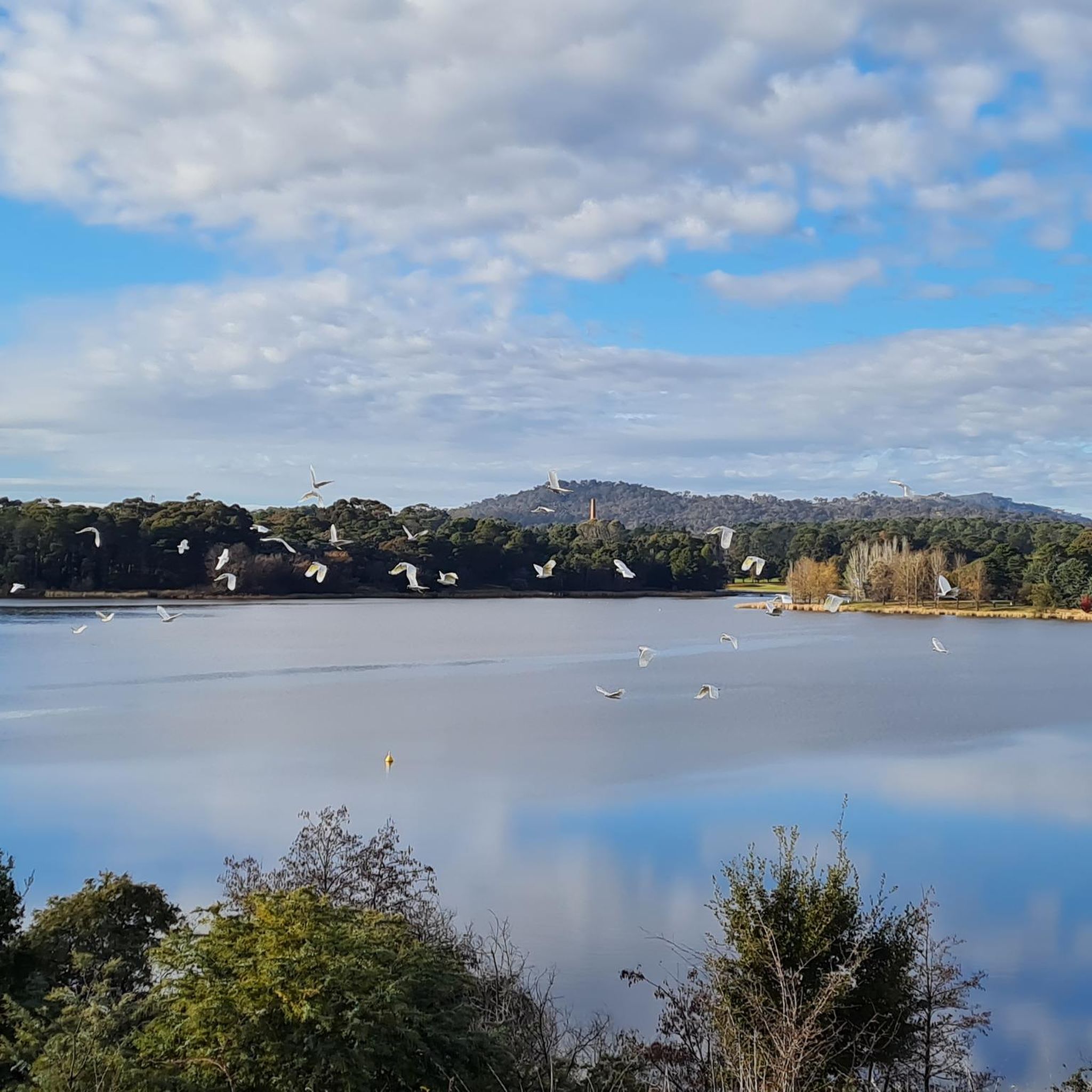
Lake Tuggeranong is a beautiful artificial lake in Canberra’s Tuggeranong district, created in the 1980s as part of the suburb’s town centre development. There is a shared walking and cycling path that circles the lake, passing parks, wetlands, and recreation areas along the shoreline. The lake is a popular local spot ideal for walking, cycling, kayaking, and birdwatching.
0
0
Tuggeranong Town Park Beach is a small sandy lakeside area within Tuggeranong Town Park on the northern shore of Lake Tuggeranong. The beach sits along open lawns and playgrounds, making it a popular place for families to relax by the water. Nearby facilities include picnic tables, barbecues, public toilets, playgrounds, and plenty of walking paths around the lake.
0
0


Nice quiet cycling paths for all levels and abilities through the pines. Also useful as a link to the gravel and singletrack of Mount Mugga Mugga
0
0
Frequently Asked Questions
What types of road cycling routes can I find in Gigerline Nature Reserve?
Gigerline Nature Reserve offers a diverse range of road cycling routes, from easy loops around water bodies like Lake Tuggeranong to challenging rides with significant elevation gains. You'll find paths traversing parklands such as Fadden Pines and routes that climb over 1200 meters.
Are there road cycling routes suitable for beginners in Gigerline Nature Reserve?
Yes, beginners can enjoy several easy road cycling routes. For instance, the Lake Tuggeranong – Mimi's Pit Stop loop from Banks is an easy 22.5 km path with minimal elevation gain, perfect for a gentler ride. Another option is the Fadden Pines – Lake Tuggeranong loop from Conder, which is 36.8 km and also considered easy.
What are the options for advanced road cyclists seeking a challenge?
Advanced cyclists looking for a significant challenge will appreciate routes with substantial elevation. The Roadbike loop from Banks is a difficult 66.6 km trail featuring over 1250 meters of elevation gain, offering a demanding ride through varied terrain.
How long do road cycling routes typically take in Gigerline Nature Reserve?
Route durations vary depending on length and elevation. Shorter, easier routes like the Lake Tuggeranong – Mimi's Pit Stop loop from Banks can be completed in about 1 hour and 3 minutes. More challenging routes, such as the Roadbike loop from Banks, typically take around 3 hours and 56 minutes.
Are there any circular road cycling routes in the reserve?
Yes, many of the road cycling routes in Gigerline Nature Reserve are designed as loops. Popular options include the Roadbike loop from Tharwa Bridge Recreation Area and the Lake Tuggeranong – Mimi's Pit Stop loop from Banks, allowing you to start and finish at the same point.
What is the best season for road cycling in Gigerline Nature Reserve?
The Australian Capital Territory generally experiences pleasant cycling conditions during spring (September-November) and autumn (March-May) with milder temperatures. Summer can be hot, while winter mornings can be chilly, but often clear and suitable for cycling later in the day.
Are there viewpoints or scenic spots along the road cycling routes?
Many routes offer scenic views, particularly those around Lake Tuggeranong and through parklands like Fadden Pines. While specific named viewpoints are not detailed, the varied terrain and natural setting of the reserve provide numerous picturesque stretches.
What do other road cyclists say about their experience in Gigerline Nature Reserve?
The road cycling routes in Gigerline Nature Reserve are highly rated by the komoot community, with an average score of 4.3 stars. Cyclists often praise the mix of lakeside paths, parkland sections, and the variety of challenges available for different skill levels.
Are there less crowded road cycling trails in Gigerline Nature Reserve?
While popular routes like the Roadbike loop from Tharwa Bridge Recreation Area see regular use, the reserve offers a network of trails. Exploring some of the less-trafficked sections or riding during off-peak hours (weekdays, early mornings) can provide a more solitary experience.
Can I find road cycling routes that pass by cafes or amenities?
Routes that pass through or near urban areas, such as those around Lake Tuggeranong or starting from Banks or Conder, are more likely to have access to cafes or other amenities. For example, the Lake Tuggeranong – Mimi's Pit Stop loop from Banks specifically mentions 'Mimi's Pit Stop', suggesting a potential refreshment point.
Is public transport available to access road cycling routes in Gigerline Nature Reserve?
Access to Gigerline Nature Reserve by public transport is possible, particularly to areas bordering the reserve in the Australian Capital Territory. Check local bus services (Transport Canberra) for routes that serve suburbs like Banks, Conder, or Tharwa, which are common starting points for these cycling routes.
What are the parking options for road cyclists in Gigerline Nature Reserve?
Parking is generally available at common starting points for routes, such as the Tharwa Bridge Recreation Area or in the vicinity of suburbs like Banks and Conder. Look for designated parking areas near trailheads or public spaces when planning your ride.

Get inspired with the komoot mobile app


Explore more
Browse the best Road cycling routes in other regions.
