The best running trails in Lanyon Landscape Conservation
4.2
(6)
378
runners
30
runs
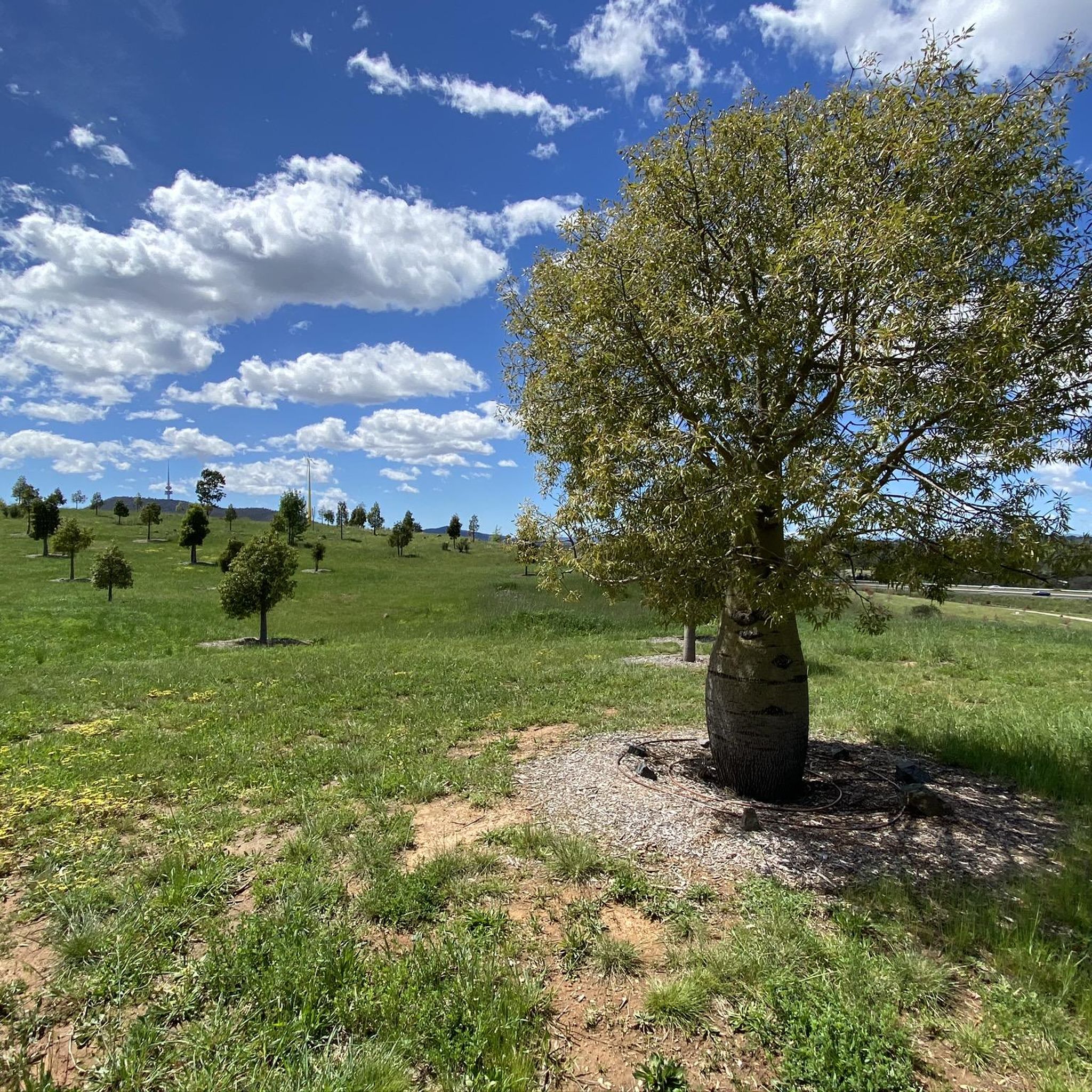
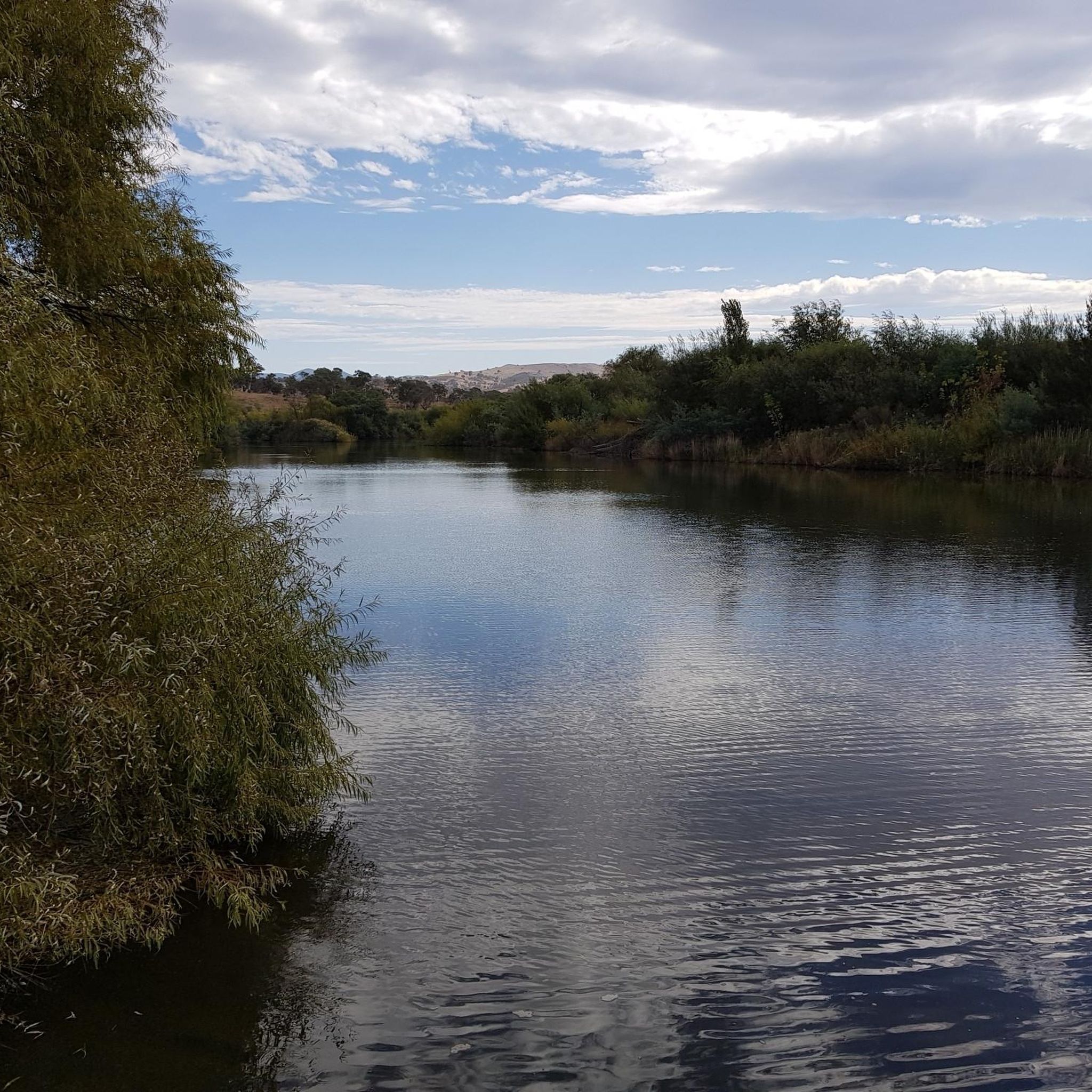
Jogging routes in Lanyon Landscape Conservation traverse a diverse landscape characterized by the Lanyon Bowl, an expansive area featuring rolling hills, riverfronts, and open grazing lands. The region includes remnant natural woodlands and extensive grasslands, offering varied terrain for runners. The Murrumbidgee River flows through the area, providing serene riverside paths, while views of the distant Brindabella mountains add to the scenic appeal. The Lanyon Homestead and its historic gardens also offer unique backdrops for running.
Best jogging routes in…
Last updated: October 20, 2026
3.0
(1)
54
runners
5.40km
00:34
30m
30m
Moderate run. Good fitness required. Mostly paved surfaces. Suitable for all skill levels.
3.0
(1)
56
runners
6.05km
00:38
30m
30m
Moderate run. Good fitness required. Mostly paved surfaces. Suitable for all skill levels.

13
runners
20.4km
02:57
960m
960m
Hard run. Very good fitness required. Mostly paved surfaces. Suitable for all skill levels.
7
runners
9.25km
01:02
40m
40m
Moderate run. Good fitness required. Mostly paved surfaces. Suitable for all skill levels.
4
runners
8.61km
01:03
220m
220m
Moderate run. Good fitness required. Mostly paved surfaces. Suitable for all skill levels.
Get access to more routes and recommendations from other explorers.
Already have an account?
Our route recommendations are based on thousands of hikes, rides, and runs completed by other people on komoot.
Start today with a free account
Your next adventure awaits.
Popular around Lanyon Landscape Conservation


Tips from the Community

Point Hut Pond District Park is a large neighbourhood recreation spot centred around a peaceful pond, with walking paths, open lawns, picnic tables, barbecues, and playgrounds. It’s a popular destination for families and outdoor recreation, with shelters for shade, toilets, and an off-leash dog area, making it an easy place to relax, enjoy a picnic, or stretch your legs by the water.
0
0
This path is flat and mostly sealed, and is a lovely route that circles Point Hut Pond, making it ideal for walkers, runners, cyclists, and prams. As you make your way around, you’ll pass open parkland and picnic areas with beautiful views across the pond along the way. It’s an easy loop that’s perfect for a stroll or, if you’re looking for more exercise, a great route for a few laps around the water.
0
0
Point Hut Pond is an urban reservoir designed to improve stormwater quality before it flows into the Murrumbidgee River. It’s a picturesque centrepiece for recreation in the park, with calm water surrounded by open green space and a walking path around the shoreline. It’s a peaceful spot to enjoy the views, watch waterbirds, or cast a line from the bank.
0
0
The summit of Mount Tennent rises to about 1,375 metres, making it one of the most prominent peaks visible from southern Canberra. From the top, there are beautiful views across Namadgi National Park, including the Gudgenby Valley and distant peaks of the Australian Alps.
0
0
Cypress Pine Lookout is one of the main viewpoints along the Mount Tennent Track, roughly halfway up the mountain. The lookout sits near stands of native cypress pine and opens up to wide views across the Gudgenby Valley toward the surrounding ranges of Namadgi National Park. It’s an ideal place for a scenic break before continuing the climb toward the summit.
0
0
Mount Tennent Track is a relatively challenging route that climbs steadily to the summit. The well-formed path passes through dry forest and rocky slopes, gaining significant elevation as it winds up the mountain’s ridgeline. Along the way, there are several viewpoints with expansive views across the Gudgenby Valley and surrounding ranges.
0
0

Relatively new trail cut to the summit that's a lot less boggier and easier on your feet.
0
0
Frequently Asked Questions
How many running routes are available in Lanyon Landscape Conservation, and what are their difficulty levels?
Lanyon Landscape Conservation offers a diverse network of over 35 running routes. These include 3 easy routes, 22 moderate routes, and 11 more challenging routes, ensuring options for all fitness levels.
Are there many loop running trails in Lanyon Landscape Conservation?
Yes, many of the running trails in Lanyon Landscape Conservation are loops, providing convenient circular routes. Popular examples include the Point Hut Pond loop from Gordon and the Stranger Pond loop from District of Tuggeranong, allowing you to start and finish at the same point.
What kind of terrain can I expect on the jogging routes in Lanyon Landscape Conservation?
The terrain varies significantly, from serene riverside paths along the Murrumbidgee River to rolling hills and open grasslands within the Lanyon Bowl. You'll encounter a mix of remnant natural woodlands and open country, offering both sun and shade, with views extending to the distant Brindabella mountains.
Are the jogging trails in Lanyon Landscape Conservation dog-friendly?
While Lanyon Landscape Conservation is a natural area, specific regulations regarding dogs on trails can vary. It's always best to check local signage or the official Lanyon Homestead website for the most current information on dog-friendly areas and leash requirements to ensure a pleasant experience for everyone.
Are there family-friendly running paths in Lanyon Landscape Conservation?
Yes, there are several easy and moderate routes suitable for families. The relatively flat sections around Point Hut Pond, such as the Point Hut Pond loop from Banks, are great for a leisurely run or walk with children, offering scenic views in a manageable distance.
What historical or natural attractions can I see while running in Lanyon Landscape Conservation?
Joggers can explore a rich landscape blending natural beauty with history. You can run past the historic Lanyon Homestead and its rambling gardens, which include features like a Nut Lawn and Rose Garden. The Murrumbidgee River offers serene views, and you might spot Aboriginal scar trees. The area also functions as a working farm, so you may see kangaroos, sheep, and cattle.
What do other runners enjoy the most about jogging in Lanyon Landscape Conservation?
The area is highly rated by the komoot community, with an average score of 4.7 stars from 3 reviews. Runners often praise the diverse and scenic landscapes, from riverfront paths to open grasslands, and the peaceful, rural atmosphere that provides a great escape for invigorating runs.
Where can I find parking for the running routes in Lanyon Landscape Conservation?
Parking is generally available at key access points to the conservation area and near popular trailheads. For specific routes, it's advisable to check the route details on komoot for designated parking areas or nearby facilities.
Is public transport available to access the jogging routes in Lanyon Landscape Conservation?
While Lanyon Landscape Conservation offers a rural escape, public transport options might be limited directly to all trailheads. It's recommended to check local bus schedules or consider driving for more convenient access to the various running routes.
What is the best time of year to go running in Lanyon Landscape Conservation?
The Lanyon Landscape Conservation area offers pleasant running conditions throughout much of the year. Spring and autumn generally provide mild temperatures and beautiful scenery. Summer mornings or evenings are ideal to avoid the heat, while winter runs can be crisp and clear, offering a different perspective of the landscape.
Are there any challenging running trails with significant elevation gain?
Yes, for those seeking a more strenuous workout, Lanyon Landscape Conservation offers routes with significant elevation gain. For example, the Mount Tennent – Cypress Pine Lookout loop from Tharwa is a difficult route with over 760 meters of ascent, providing a substantial challenge and rewarding views.
Can I combine my run with a visit to Lanyon Homestead?
Absolutely! The Lanyon Homestead is an integral part of the landscape. You can incorporate a visit to the historic 1850s pastoral property and its beautiful gardens into your running day. For more information on visiting hours and facilities, you can check the official site: Lanyon Historic Precinct.
Most popular routes in Lanyon Landscape Conservation

Get inspired with the komoot mobile app


Explore more
Browse the best Running Trails & Routes in other regions.
