
The best running trails in Orosi
3.0
(2)
89
runners
11
runs
Jogging in Orosi offers diverse landscapes, characterized by lush vegetation, the Reventazón River, and surrounding mountains. The region sits between the Irazú Volcano and Tapantí-Macizo de la Muerte National Park, providing varied terrain for running. Its altitude, up to 4,300 feet above sea level, contributes to a moderate climate suitable for physical activity. Runners can explore winding roads, coffee plantations, and trails near Lake Cachi.
Best jogging routes in Orosi
- The most popular jogging route is Ruinas de Santiago Apóstol…
Last updated: July 1, 2026
11
runners
19.2km
02:00
140m
140m
Hard run. Very good fitness required. Mostly paved surfaces. Suitable for all skill levels.
3.0
(1)
5
runners
13.3km
01:27
150m
150m
Moderate run. Good fitness required. Mostly paved surfaces. Suitable for all skill levels.

Sign up for free
4
runners
5.64km
00:35
40m
40m
Moderate run. Good fitness required. Mostly paved surfaces. Suitable for all skill levels.
4
runners
10.4km
01:05
60m
60m
Moderate run. Good fitness required. Mostly paved surfaces. Suitable for all skill levels.
3
runners
10.6km
01:06
60m
60m
Moderate run. Good fitness required. Mostly paved surfaces. Suitable for all skill levels.
Get access to more routes and recommendations from other explorers.
Sign up for free
Already have an account?
Our route recommendations are based on thousands of hikes, rides, and runs completed by other people on komoot.
Start today with a free account
Your next adventure awaits.
Login or Signup
Popular around Orosi
Frequently Asked Questions
How many running routes are available in Orosi?
Orosi offers a good selection of running routes, with over 10 trails available for exploration. These routes vary in difficulty, catering to different fitness levels.
What kind of terrain can I expect on Orosi's running trails?
The Orosi Valley is characterized by diverse terrain, including lush green vegetation, winding roads, and paths through coffee plantations. You'll find routes with moderate elevation changes, such as the Running loop from Oreamuno, as well as more challenging options like the Ruinas de Santiago Apóstol loop from Oreamuno, which features varied surfaces.
Are there any scenic viewpoints along the jogging routes in Orosi?
Yes, the Orosi Valley is known for its breathtaking scenery. Many routes offer views of the Reventazón River, surrounding mountains, and coffee farms. The Mirador de Orosi provides panoramic views of the entire valley, and while it has walking paths, it's a great spot for a warm-up or cool-down with stunning vistas.
Can I find routes suitable for families or beginners in Orosi?
While many routes are moderate, there are options that can be suitable for beginners or families looking for a less strenuous run. For instance, the Running loop from Paraíso is a shorter, moderate trail that can be completed in about 35 minutes, offering a good starting point.
What natural attractions or landmarks can I see while jogging in Orosi?
Orosi's running routes often pass by or near significant natural and historical landmarks. You might encounter lush rainforests, coffee plantations, and the Reventazón River. Some trails offer views of waterfalls, such as the Waterfall in Reserva Forestal Los Santos or the San Gerardo de Dota Waterfall. The Río Orisí in Tapantí National Park is another beautiful natural feature.
What is the best time of year to go jogging in Orosi?
The Orosi Valley enjoys a moderate and cool average yearly temperature of 55-79°F (13-26°C) due to its altitude, making it comfortable for physical activity year-round. However, the dry season (roughly December to April) might offer more consistent sunny weather, while the rainy season brings lush greenery and occasional afternoon showers.
Are there circular running routes in Orosi?
Yes, many of the running routes in Orosi are designed as loops, providing a varied experience without retracing your steps. Examples include the popular Ruinas de Santiago Apóstol loop from Oreamuno and the Quijongo El Guarco loop from El Tejar.
Is public transport available to access running trails in Orosi?
While specific public transport routes directly to trailheads might be limited, local buses connect the main towns within the Orosi Valley, such as Orosi, Paraíso, and Oreamuno. From these towns, many running routes are accessible, or you might need a short taxi ride to reach more remote starting points.
Where can I park my car when visiting Orosi's jogging routes?
Parking availability varies by trailhead. In towns like Oreamuno or Paraíso, you can often find street parking or designated lots near central points. For routes starting in more rural areas or near attractions like Tapantí National Park, there might be specific parking areas provided. It's advisable to check the starting point of your chosen route for parking information.
Do I need any special permits to jog in certain areas of Orosi?
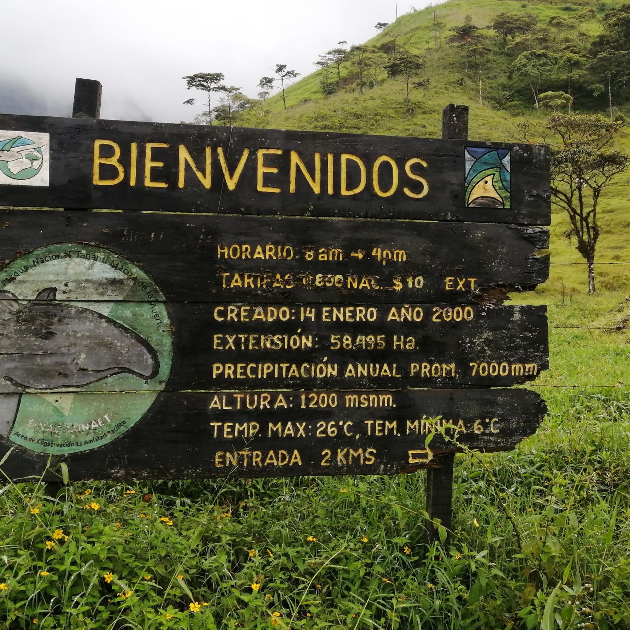
Generally, jogging on public roads and established trails in the Orosi Valley does not require special permits. However, if your route takes you into protected areas like Tapantí National Park, there will be an entrance fee. Always check the regulations for specific parks or reserves before entering.
What do other runners say about the jogging experience in Orosi?
The running routes in Orosi are highly rated by the komoot community, with an average score of 3.0 stars from several reviews. Runners often praise the lush green vegetation, the scenic views of the Reventazón River, and the peaceful atmosphere of the coffee plantations, making for a truly immersive outdoor experience.
Can I find coffee shops or places to refuel near the running trails?
The Orosi Valley is renowned for its coffee production, so you'll find numerous coffee plantations and local cafes, especially in and around the towns. Many offer tours and have shops where you can enjoy fresh Costa Rican coffee and snacks, perfect for refueling after a run. Look for options in Orosi town or Paraíso.
Are there less crowded running options in Orosi?
While popular routes can see more activity, the extensive network of rural roads and trails throughout the Orosi Valley means you can often find quieter paths. Exploring routes slightly off the main tourist areas or running during off-peak hours can lead to a more solitary experience amidst nature. The trails within Tapantí National Park, while popular, are extensive enough to offer moments of solitude.
Most popular routes in Orosi
Most popular attractions in Orosi

Get inspired with the komoot mobile app


Explore more
Browse the best Running Trails & Routes in other regions.
