The best walks and hikes in Tello
4.8
(22)
163
hikers
2
hikes
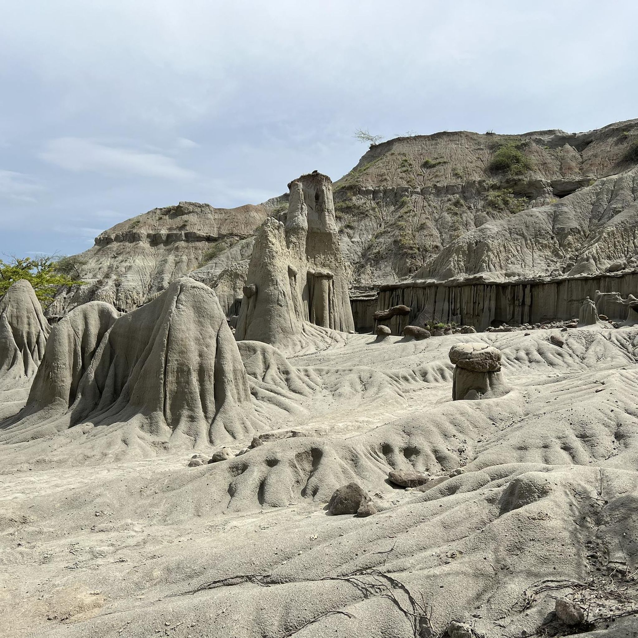
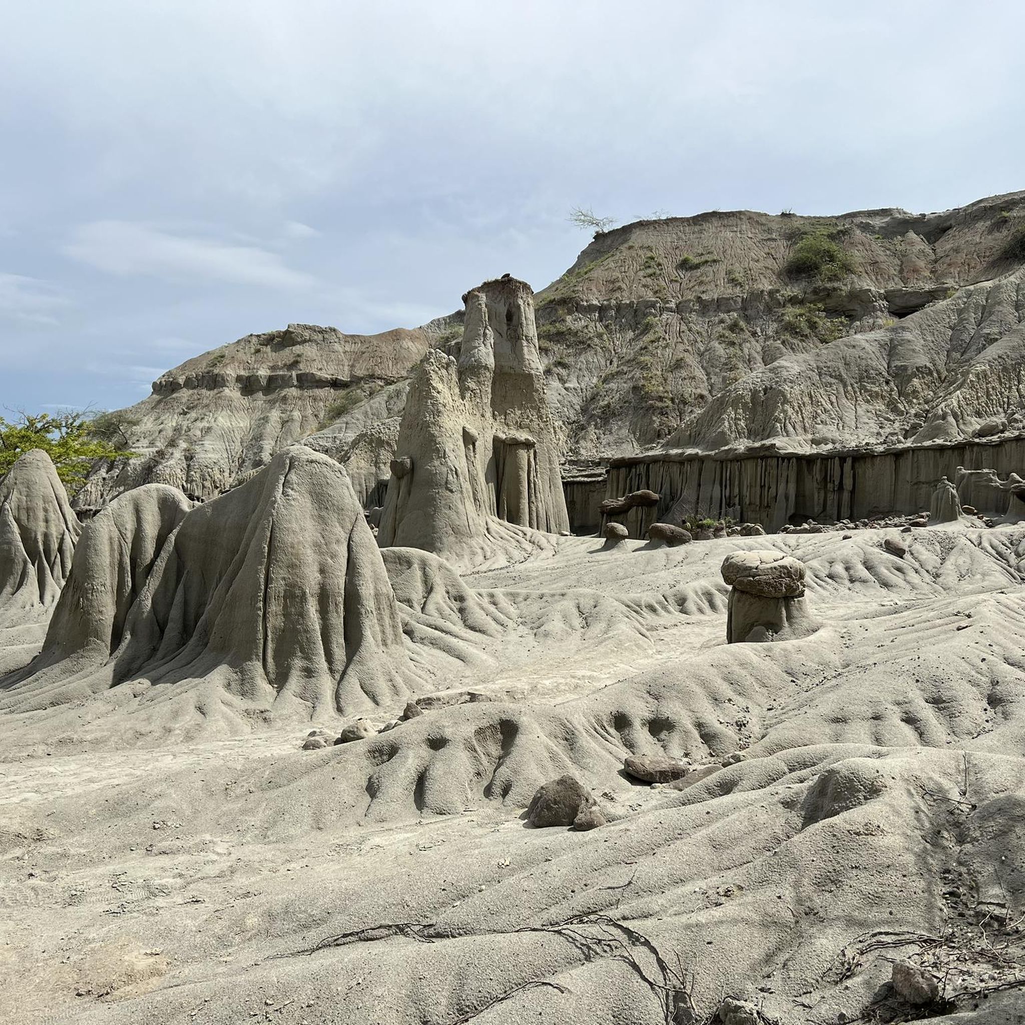
Hiking in Tello features routes through the unique Tatacoa Desert, characterized by its arid landscapes and distinctive red and gray eroded cliffs. The region offers trails that navigate through these desert formations, providing views of its geological structures. The terrain primarily consists of desert paths with some elevation changes, suitable for exploring the natural environment.
Best hiking trails in Tello
- The most popular hiking route is Tatacoa Desert – Red Desert of Tatacoa loop from Casa de campo los cactus…
Last updated: July 13, 2026
5.0
(5)
38
hikers
Easy hike. Great for any fitness level. Easily-accessible paths. Suitable for all skill levels.
4.3
(3)
44
hikers
Moderate hike. Good fitness required. Easily-accessible paths. Suitable for all skill levels.

Sign up for free
5.0
(4)
22
hikers
15.6km
04:12
190m
190m
Moderate hike. Good fitness required. Easily-accessible paths. Suitable for all skill levels.
4.7
(3)
19
hikers
Hard hike. Very good fitness required. Easily-accessible paths. Suitable for all skill levels.
6
hikers
Easy hike. Great for any fitness level. Easily-accessible paths. Suitable for all skill levels.
Our route recommendations are based on thousands of hikes, rides, and runs completed by other people on komoot.
Start today with a free account
Your next adventure awaits.
Login or Signup
Popular around Tello
Tips from the Community

After the dusty bike ride from Villavieja past the red Tatacoa to the gray, the pool and kiosk invite you to take a refreshing dip and rest. It feels like an oasis in the desert.
0
0
The Tatacoa Desert (Spanish: Desierto de la Tatacoa) is an approximately 330 km² desert in Colombia. It is located in the northern part of the Departamento del Huila in the valley of the Río Magdalena in the municipality of Villavieja, about 40 km north of the department capital Neiva and only about 3° north of the equator. The average temperature is over 28 °C. The Tatacoa Desert owes its existence to the special geographic location between the two mountain ranges of the Central and Eastern Cordillera in a dry basin at the foot of the Eastern Cordillera. As a result, it lies in the double rain shadow and usually remains low in precipitation even in the rainy season. Due to the high average temperature, the amount of precipitation of around 1000 mm per year is not sufficient to compensate for evaporation. The name Tatacoa comes from a species of snake originally native to the desert but now extinct. Source: https://de.wikipedia.org/wiki/Tatacoa-W%C3%BCste
2
0
Incredible to discover such a refreshing swimming pool in the middle of the unreal hot desert. Vendors sell cool drinks, snacks, and ice cream.
0
0

The Tatacoa Desert is a unique landscape and is an extraordinary experience in Colombia.
2
0
Frequently Asked Questions
What kind of hiking trails can I expect in Tello?
Hiking in Tello primarily features routes through the unique Tatacoa Desert. You'll find arid landscapes, distinctive red and gray eroded cliffs, and geological formations. The terrain consists mainly of desert paths with varying elevation changes.
How many hiking routes are available in Tello?
There are several hiking routes available in Tello, offering options for different ability levels. Komoot lists 5 distinct routes for you to explore.
What is the difficulty level of hiking trails in Tello?
Tello offers a range of difficulties. You can find easy loops like the Tatacoa Desert – Red Desert of Tatacoa loop from Casa de campo los cactus, moderate paths such as Los Hoyos – The Gray Tatacoa – Tatacoa Desert Eroded Cliffs loop from Desert Tatacoa, and more challenging routes like the Tatacoa Desert Eroded Cliffs – Los Hoyos – The Gray Tatacoa loop from El rincón del cabrito.
Are there any circular hiking routes in Tello?
Yes, many of the trails in Tello are designed as loops, allowing you to start and end at the same point. Examples include the Tatacoa Desert – Red Desert of Tatacoa loop from Villavieja and the Red Desert of Tatacoa – Tatacoa Desert loop from El rincón del cabrito.
What do other hikers say about the trails in Tello?
The hiking routes in Tello are highly rated by the komoot community, with an average score of 4.8 stars from over 20 reviews. Hikers often praise the unique desert landscapes and the opportunity to explore the distinctive geological formations.
Are there any easy hikes suitable for beginners in Tello?
Yes, Tello has easy routes perfect for beginners. The Tatacoa Desert – Red Desert of Tatacoa loop from Casa de campo los cactus is an easy 4.6-mile (7.4 km) trail that provides an accessible introduction to the desert's red formations.
What is the best time of year to go hiking in Tello?
Given the arid desert environment of Tello, it's generally best to hike during cooler parts of the day or during seasons with milder temperatures to avoid extreme heat. Always check local weather conditions before heading out.
What should I wear when hiking in Tello's desert environment?
When hiking in Tello's desert, it's crucial to wear lightweight, breathable clothing, a hat, and sunglasses for sun protection. Sturdy hiking shoes are recommended for the desert paths. Always carry plenty of water to stay hydrated.
Are there any specific landmarks or viewpoints to look out for on the trails?
While specific highlights are not detailed, the trails in Tello are known for their natural landmarks, including the distinctive red and gray eroded cliffs and unique geological formations within the Tatacoa Desert itself. These formations serve as the primary points of interest.
Is there parking available near the Tello hiking trails?
While specific parking information for each trailhead is not provided, it is common for popular hiking areas, especially those near natural attractions like the Tatacoa Desert, to have designated parking areas. It's advisable to check local resources or tour descriptions for details on parking availability at your chosen starting point.
Can I find challenging hikes in Tello?
Yes, for those seeking a more strenuous experience, Tello offers challenging routes. The Tatacoa Desert Eroded Cliffs – Los Hoyos – The Gray Tatacoa loop from El rincón del cabrito is a difficult 12.6-mile (20.3 km) trail with significant elevation changes.
Most popular routes in Tello

Get inspired with the komoot mobile app


Explore more
Browse the best Hikes in other regions.
