The best MTB trails in Nocaima
5.0
(38)
436
riders
37
rides
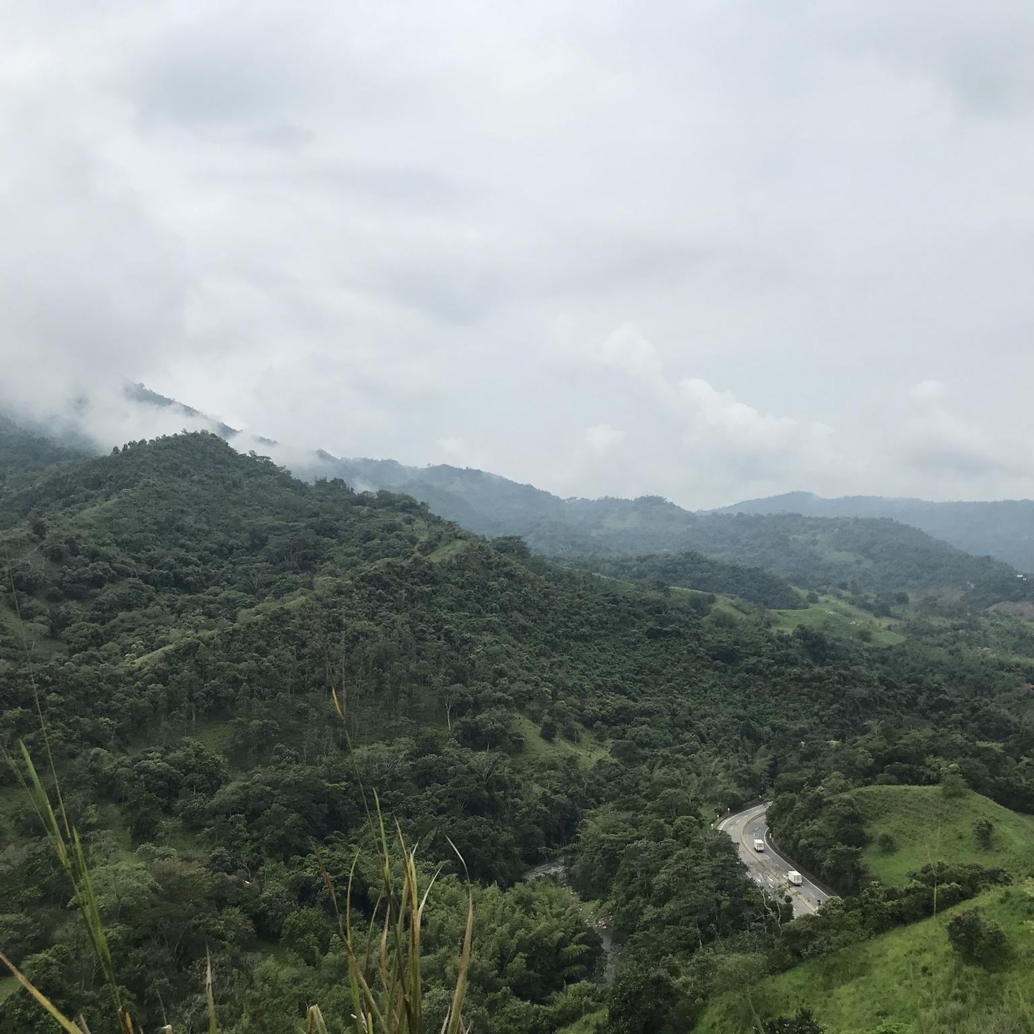
Mountain biking in Nocaima offers diverse terrain within a mountainous landscape, characterized by varied elevations ranging from 11 to 1,100 meters above sea level. The region features rugged jeep tracks and natural paths that wind through remote mountain passes, alongside lush vegetation and coffee plantations. Rivers like the Tobia River and natural waterfalls enhance the scenic beauty, providing opportunities for refreshing stops. This topography provides a mix of challenging climbs and exhilarating descents, ideal for mountain biking.
Best mountain bike…
Last updated: July 11, 2026
5.0
(1)
24
riders
34.8km
03:35
1,130m
1,130m
Hard mountain bike ride. Very good fitness required. Suitable for all skill levels.
5.0
(1)
15
riders
45.5km
04:09
1,460m
1,460m
Hard mountain bike ride. Very good fitness required. Suitable for all skill levels.

Sign up for free
13
riders
52.8km
04:37
1,470m
1,480m
Hard mountain bike ride. Very good fitness required. Suitable for all skill levels.
5.0
(1)
13
riders
32.0km
03:17
1,210m
1,210m
Hard mountain bike ride. Very good fitness required. Suitable for all skill levels.
14
riders
109km
08:56
3,120m
3,120m
Hard mountain bike ride. Very good fitness required. Suitable for all skill levels.
Get access to more routes and recommendations from other explorers.
Sign up for free
Already have an account?
Our route recommendations are based on thousands of hikes, rides, and runs completed by other people on komoot.
Start today with a free account
Your next adventure awaits.
Login or Signup
Popular around Nocaima
Tips from the Community

A safe place to train!!!
0
0

Perfect for starting out or training, the plan to get there develops your resistance
0
0

Crossing point for La Peña and Nimaima.
0
0

It is a route to relax... little slope, flat, constant... here you can go out to Villeta and La Vega, municipalities of Cundinamarca... the weather can vary.
0
0


Very good ride, if it is only on the Sabana side, good plan and final ascent. If it is for the Vega, then excellent, very good proof of ascent of the 1st category. Very safe, very crowded, go down carefully, go up regulated and finish the last 5 kms
0
0
Good training, also for a walk, in La Vega start with a good roscón resobo, and take to eat at the top. Safe route, good berm, many fellow cyclists of all levels, so as not to feel alone.
0
0
Frequently Asked Questions
What kind of terrain can I expect on mountain bike trails in Nocaima?
Nocaima offers a diverse mountainous landscape with varied elevations ranging from 11 to 1,100 meters above sea level. You'll encounter rugged jeep tracks and natural paths winding through remote mountain passes, lush vegetation, and coffee plantations. The region's topography provides a mix of challenging climbs and exhilarating descents, often with sweeping views of valleys and forests.
How challenging are the mountain bike trails in Nocaima?
The majority of mountain bike trails in Nocaima are considered difficult, with 35 out of 41 routes falling into this category. These routes often feature significant elevation gains and require good fitness and advanced riding skills. There are also 6 moderate routes available for those looking for a slightly less intense experience.
What natural attractions can I see along the mountain bike trails in Nocaima?
Many trails in Nocaima offer scenic beauty enhanced by natural features. You can expect to encounter rivers like the Tobia River and picturesque waterfalls such as Chupal Falls and La Chorrera Natural Waterfall, which provide refreshing stops. Some routes also pass through lush coffee plantations and offer views of Laguna El Tabacal.
What is the best time of year to go mountain biking in Nocaima?
Nocaima generally enjoys a warm climate year-round, with temperatures often ranging between 22 and 26°C. This makes it comfortable for mountain biking throughout the year. However, it's always advisable to check local weather forecasts for specific conditions, especially regarding rainfall, which can affect trail conditions.
Are there any family-friendly mountain bike trails in Nocaima?
While many trails in Nocaima are rated as difficult, the region's diverse network may offer options suitable for families with varying skill levels. It's recommended to check the specific route details on komoot for elevation profiles and terrain descriptions to find trails that match your family's experience. Currently, there are no routes specifically classified as easy.
Can I combine mountain biking with other outdoor activities in Nocaima?
Yes, Nocaima's location allows for unique combined adventures. For instance, some routes lead down to rivers like the Rio Fonce, where activities such as rafting can be enjoyed. The region also offers opportunities for ziplining across canyons, providing a 'ride, explore, and fly' experience over the jungle canopy.
What do other mountain bikers enjoy the most about mountain biking in Nocaima?
The mountain bike trails in Nocaima are highly rated by the komoot community, with an average score of 5.0 stars from over 30 reviews. Riders often praise the diverse mountainous terrain, the challenging climbs and exhilarating descents, and the beautiful natural scenery including rivers, waterfalls, and coffee plantations.
Are there any circular mountain bike routes in Nocaima?
Yes, Nocaima offers several excellent circular mountain bike routes. Popular options include the Mountainbike loop from Tobia, a 21.6-mile trail, and the Paso del Rejo loop from Vergara, which covers 32.8 miles through mountainous terrain.
How accessible is Nocaima for mountain bikers traveling from Bogotá?
Nocaima is quite accessible from Bogotá, located approximately 90 minutes (about 66 km) away. This makes it a convenient escape for city dwellers seeking outdoor adventures. While specific public transport details to trailheads are not provided, its proximity allows for relatively easy travel by car.
What is the longest mountain bike route available in Nocaima?
One of the longest and most challenging mountain bike routes in the area is the Alto del Vino – Parador Alto del Vino loop from Villeta. This difficult route spans 67.7 miles (108.9 km) and involves over 3,100 meters of elevation gain, typically taking around 9 hours to complete.
Are there any routes that offer sweeping views of valleys and forests?
Absolutely. Many trails in Nocaima traverse mountainous areas that provide breathtaking vistas. For example, the La Vega Park loop from QuicaSua Glamping is a difficult 28.3-mile route specifically noted for its sweeping views of valleys and forests.
Most popular routes in Nocaima

Get inspired with the komoot mobile app


Explore more
Browse the best MTB trails in other regions.
