The best cycling routes in Tunja
4.7
(123)
960
riders
80
rides
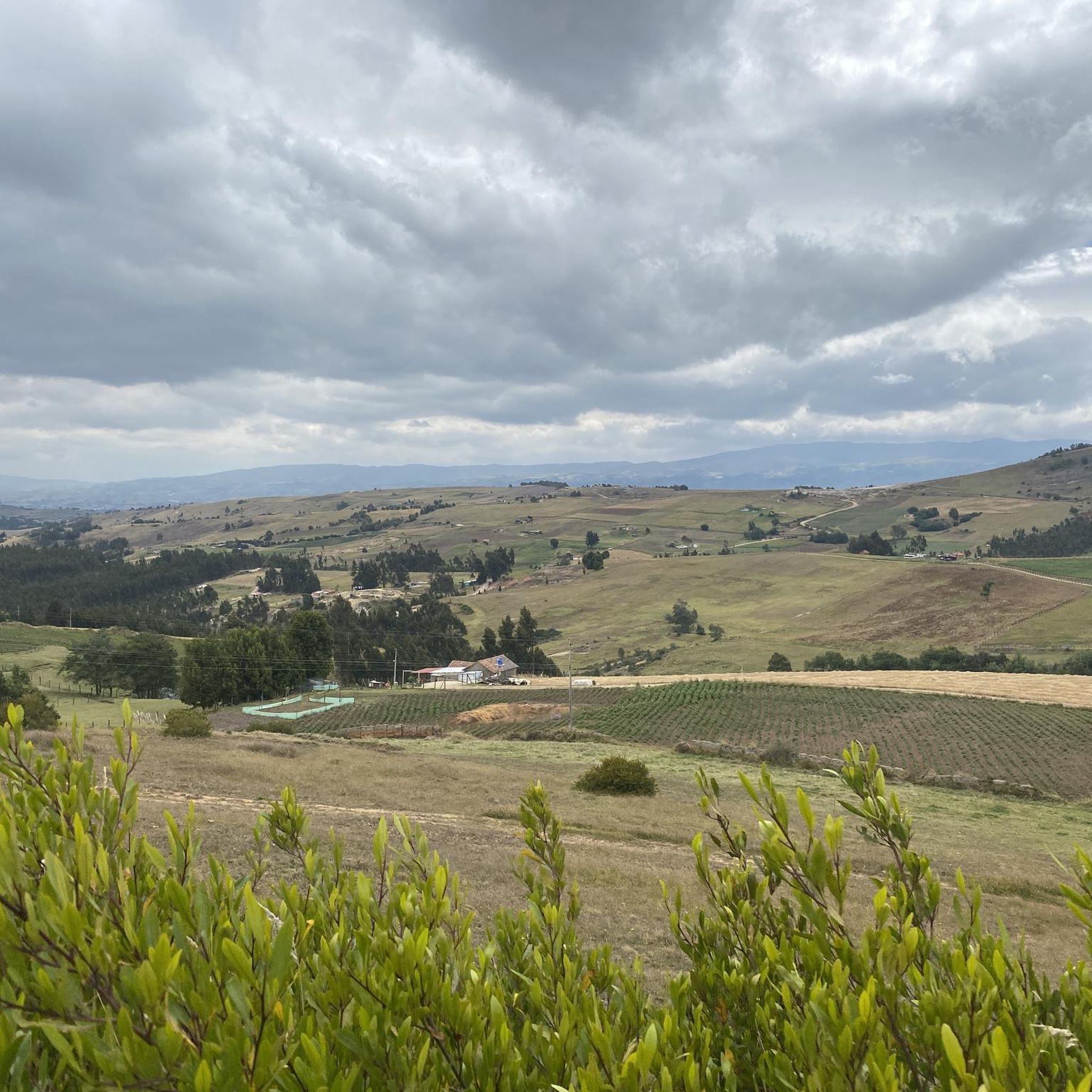
Touring cycling in Tunja offers routes through the high-altitude Andean mountain range, characterized by fertile lands, valleys, and mountains. The region is situated at approximately 9,252 feet (2,820 meters) above sea level, providing cooler temperatures and panoramic views. This area features varied terrain, including mostly paved surfaces, with some routes incorporating unpaved or challenging segments. Tunja's landscape provides a diverse environment for cycling, from moderate to difficult routes.
Best touring cycling routes in Tunja
- The most popular touring cycling route…
Last updated: July 15, 2026
5.0
(11)
55
riders
30.8km
02:09
430m
430m
Moderate bike ride. Good fitness required. Mostly paved surfaces. Suitable for all skill levels.
3.0
(5)
31
riders
19.0km
01:35
320m
320m
Moderate bike ride. Good fitness required. Mostly paved surfaces. Suitable for all skill levels.

Sign up for free
4.8
(5)
30
riders
41.3km
03:17
920m
920m
Hard bike ride. Very good fitness required. Mostly paved surfaces. Suitable for all skill levels.
5.0
(3)
25
riders
57.2km
03:57
970m
970m
Hard bike ride. Very good fitness required. Mostly paved surfaces. Suitable for all skill levels.
5.0
(2)
25
riders
69.6km
05:17
1,650m
1,650m
Hard bike ride. Very good fitness required. Mostly paved surfaces. Suitable for all skill levels.
Get access to more routes and recommendations from other explorers.
Sign up for free
Already have an account?
Our route recommendations are based on thousands of hikes, rides, and runs completed by other people on komoot.
Start today with a free account
Your next adventure awaits.
Login or Signup


Tips from the Community

Frequently Asked Questions
How many touring cycling routes are available in Tunja?
Tunja offers a wide selection of touring cycling routes, with over 80 options recorded on komoot. These routes cater to various skill levels, from moderate to very challenging, allowing cyclists to explore the diverse Andean landscapes.
What is the typical terrain like for touring cycling in Tunja?
The terrain around Tunja is characterized by the high-altitude Andean mountain range, featuring green, fertile lands, valleys, and mountains. Routes often traverse mostly paved surfaces, but some may include unpaved or more challenging segments, providing a varied cycling experience.
Are there any beginner-friendly touring cycling routes in Tunja?
While many routes in Tunja are challenging due to the mountainous terrain, there are a few easier options. For instance, the region offers 3 routes classified as easy, and 18 as moderate. A good moderate starting point is the Chivatá Viewpoint loop from Tunja, which is 30.8 km long with a manageable elevation gain of 427 meters.
What are some challenging touring cycling routes for experienced riders in Tunja?
Experienced touring cyclists will find plenty of challenging routes in Tunja, with 64 classified as difficult. Options include the Work – Boyacá loop from Tunja, a demanding 69.2 km route with over 1650 meters of ascent, or the Work – San Lázaro Church loop from La Colorada, which covers 41.3 km with 921 meters of elevation gain.
What kind of views can I expect on touring cycling routes around Tunja?
Cycling in Tunja offers panoramic views of the surrounding Andean natural beauty. Given the city's high altitude of approximately 2,820 meters (9,252 feet), routes often provide expansive vistas of green valleys, fertile lands, and distant mountains. You'll also encounter high-altitude plains known as 'paramos'.
What do other cyclists say about touring cycling in Tunja?
The komoot community highly rates touring cycling in Tunja, with an average score of 4.7 stars from nearly 100 reviews. Over 900 touring cyclists have explored the area using komoot, often praising the diverse terrain and the stunning Andean scenery.
Are there any circular touring cycling routes in Tunja?
Yes, many touring cycling routes in Tunja are designed as loops, allowing you to start and end in the same location. Examples include the moderate Chivatá Viewpoint loop from Tunja, or more challenging options like the Work loop from Tunja.
What are some notable natural attractions near Tunja that can be explored by bike?
While specific routes may not directly pass through all, Tunja provides access to significant natural wonders. The stunning Laguna de Tota, Colombia's largest glacial lake, is within reach for longer expeditions. The high-altitude plains, or 'paramos,' also offer unique Andean ecosystems for exploration.
What is the best time of year for touring cycling in Tunja?
Tunja's high altitude means cooler temperatures year-round compared to lower regions. While specific weather patterns vary, the region generally offers a pleasant climate for cycling. It's always advisable to check local weather forecasts closer to your travel dates, especially for rain, which can affect unpaved segments.
Are there any historical or cultural landmarks accessible by touring bike from Tunja?
Yes, touring cycling routes from Tunja can lead to areas with historical significance. The historic Puente de Boyacá, a national monument, is a notable stop for those exploring the region. Additionally, some routes might pass near culturally significant Muisca sacred sites like the 'Zaque's Cushions' (Hunza Zaque Sanctuary), which offer ecological hikes.
What is the typical elevation gain on touring cycling routes in Tunja?
Due to its location in the Andean mountain range, touring cycling routes in Tunja often involve significant elevation gain. Even moderate routes like the Chivatá Viewpoint loop from Tunja include over 400 meters of ascent, while difficult routes can feature over 1600 meters of climbing, such as the Boyacá loop from Tunja.

Get inspired with the komoot mobile app


Explore more
Browse the best Cycling routes in other regions.
