The best MTB trails in Tibasosa
4.9
(267)
681
riders
27
rides
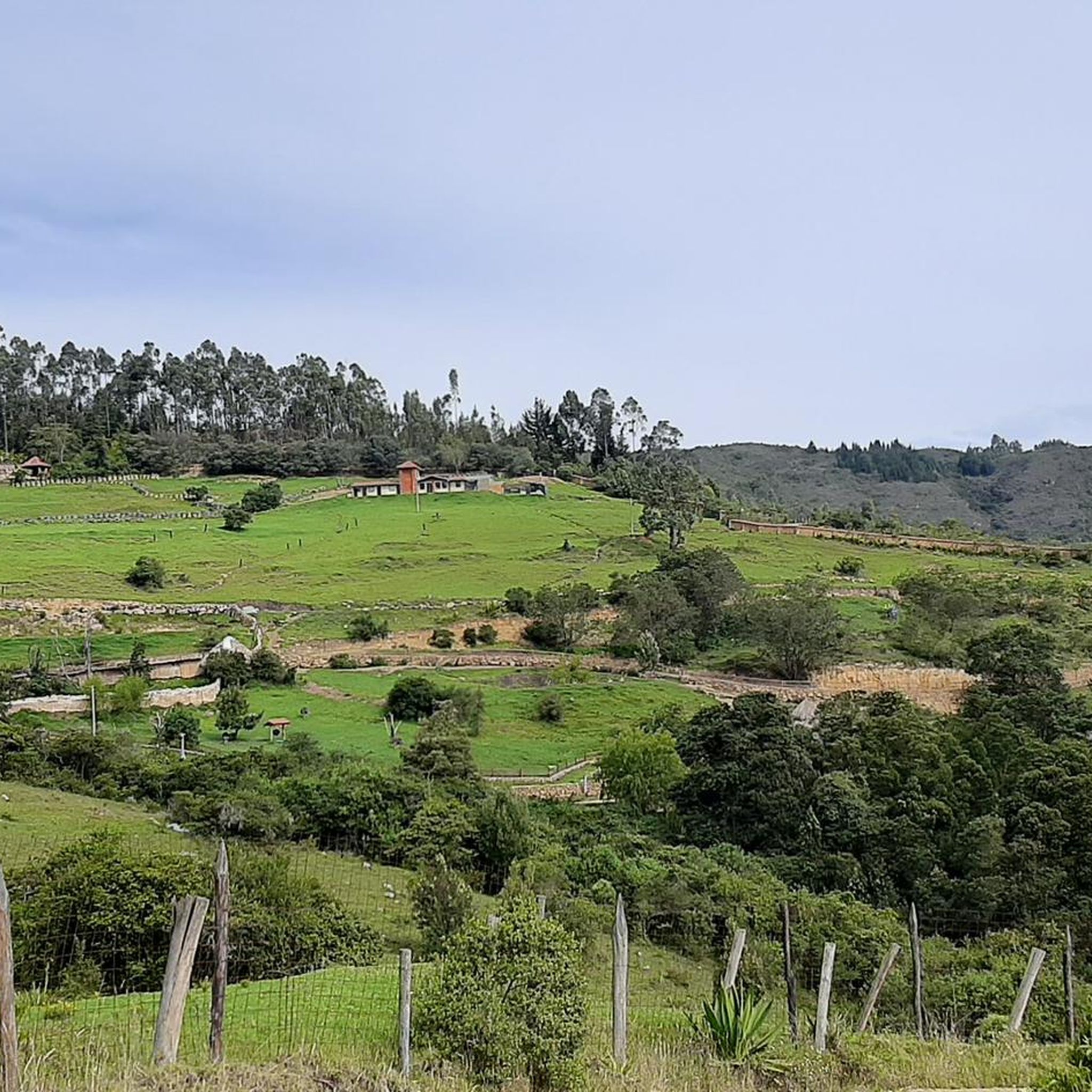
Mountain bike trails in Tibasosa traverse a region characterized by lush, green landscapes and varied topography. Elevations reach up to 2900 meters above sea level, providing diverse gradients and challenges for cyclists. The area features high-altitude wetlands, known as páramos, and prominent peaks like Cerro de Guática, offering panoramic views. This terrain supports a range of mountain biking experiences, from challenging ascents to long-distance routes.
Best mountain bike trails in Tibasosa
- The most popular mountain bike trail is Main Park…
Last updated: July 15, 2026
5.0
(10)
36
riders
56.6km
04:11
1,050m
1,050m
Hard mountain bike ride. Very good fitness required. Suitable for all skill levels.
5.0
(9)
26
riders
54.7km
03:47
850m
850m
Moderate mountain bike ride. Good fitness required. Suitable for all skill levels.

Sign up for free
4.9
(13)
22
riders
68.8km
04:33
700m
700m
Moderate mountain bike ride. Good fitness required. Suitable for all skill levels.
4.8
(4)
18
riders
43.0km
02:51
550m
560m
Moderate mountain bike ride. Good fitness required. Suitable for all skill levels.
5.0
(1)
12
riders
44.5km
04:41
1,420m
1,420m
Hard mountain bike ride. Very good fitness required. Suitable for all skill levels.
Get access to more routes and recommendations from other explorers.
Sign up for free
Already have an account?
Our route recommendations are based on thousands of hikes, rides, and runs completed by other people on komoot.
Start today with a free account
Your next adventure awaits.
Login or Signup
Popular around Tibasosa


Tips from the Community

Monument to Rafael Reyes, president of Colombia born in Santa Rosa de Viterbo
0
0
Detour to Making Biafra. At this point there is a house of the national army called the Casa del Soldado. There is a large eucalyptus.
0
0
From this point you can divert to the path that leads to the village of El Tendido and Patrocio Alto. From the road, the climb is challenging with inclinations greater than 15% on stony terrain.
0
0
Crossroads with the road that leads to the Pantano de Vargas. To the south west it leads to 4 Esquinas to the north east it leads to the hill of Guatika
0
0
El Milagro Farm detour going up from Biafra. unpaved road
0
0
El Laguito Park and Iwoka Shopping Center. Meeting point for rides.
0
0
Road detour. Excellently paved (As of July 2023)
0
0
Segment where there are some train tracks below the road.
0
0
Frequently Asked Questions
How many mountain bike trails are available in Tibasosa?
Tibasosa offers a diverse network of over 25 mountain bike trails, catering to various skill levels. You'll find options ranging from easy routes to challenging ascents, with the majority being moderately difficult.
What is the general difficulty level of mountain biking in Tibasosa?
The mountain bike trails in Tibasosa offer a range of difficulties. While there is one easy route, the majority (over 20) are considered moderate, and five routes are classified as difficult. This variety ensures options for different experience levels, from beginners to advanced riders.
What kind of terrain and elevation can I expect on Tibasosa's mountain bike trails?
Tibasosa's terrain is characterized by lush, green landscapes and varied topography, with elevations reaching up to 2900 meters above sea level. You can expect diverse gradients, including challenging ascents and descents. The region features high-altitude wetlands, known as páramos, and prominent peaks like Cerro de Guática, offering panoramic views and a mix of paved and unpaved sections.
Are there any family-friendly mountain bike trails in Tibasosa?
Yes, Tibasosa offers at least one easy mountain bike route, making it suitable for families or those new to the sport. The region's generally favorable climate and picturesque scenery also contribute to a pleasant family outing. For specific recommendations, look for routes with lower elevation gains and shorter distances.
What are some notable landmarks or points of interest I might encounter on the trails?
Along the mountain bike trails in Tibasosa, you can discover several interesting landmarks. These include the Church of the Virgin of the O of Morcá, the Monument to the Lancers of the Vargas Swamp, and the Curies Summit. Some routes, like the Calicanto Bridge of Monguí – Panadería Vals Castro loop from Tibasosa, connect directly to local historical sites.
What do other mountain bikers say about the trails in Tibasosa?
The mountain biking experience in Tibasosa is highly rated by the komoot community, with an average score of 4.9 stars from over 200 reviews. Riders often praise the lush landscapes, varied topography, and the rewarding challenges offered by the region's high-altitude páramos.
Are there any long-distance mountain bike routes in Tibasosa?
Yes, Tibasosa features several longer routes for endurance riders. For example, the Panadería Mistral – Iza loop from Tibasosa is a 42.8-mile (68.8 km) trail that typically takes over 4 hours to complete, offering varied terrain and a significant distance challenge.
Can I find circular mountain bike routes starting from Tibasosa?
Absolutely. Many of the mountain bike routes in Tibasosa are designed as loops, often starting and ending in the town. A popular example is the Main Park of Tibasosa – Puerta de Cuche loop from Tibasosa, which is a moderate 42.9 km (26.7 miles) trail.
What is the best time of year to go mountain biking in Tibasosa?
Tibasosa generally enjoys a favorable climate for ecotourism, with an average temperature of around 15°C. This temperate climate makes it suitable for mountain biking throughout much of the year. However, it's always advisable to check local weather forecasts before heading out, especially if planning to explore higher elevations or páramos where conditions can change rapidly.
Are there any challenging routes for experienced mountain bikers?
Yes, experienced mountain bikers will find challenging routes in Tibasosa. The region's varied topography includes significant elevation gains. A prime example is the Main Park of Tibasosa – Crucero Surtipan loop from Tibasosa, a difficult 34.5-mile (55.5 km) trail featuring over 1000 meters of elevation gain.
Where can I find more information about Tibasosa as a destination?
For additional information about Tibasosa, including its cultural attractions and general tourism details, you can visit the official tourism website for the region at visitsugamuxi.com.
Most popular attractions in Tibasosa

Get inspired with the komoot mobile app


Explore more
Browse the best MTB trails in other regions.
