The best walks and hikes in San Lucas Sacatepéquez
4.2
(33)
313
hikers
16
hikes
Hiking in San Lucas Sacatepéquez offers access to natural landscapes and a cool climate ideal for outdoor activities. The region is characterized by extensive forests, hills like Cerro Alux, and varied terrain suitable for different fitness levels. Its location also provides proximity to more ambitious volcanic hiking opportunities.
Best hiking trails in San Lucas Sacatepéquez
- The most popular hiking route is Valley Viewpoint – El Cucurucho Hill loop from Antigua Guatemala, a 14.4 miles (23.2 km) difficult trail that…
Last updated: July 5, 2026
4.7
(7)
34
hikers
19.0km
05:40
550m
550m
Hard hike. Very good fitness required. Easily-accessible paths. Suitable for all skill levels.
4.0
(5)
50
hikers
22.7km
07:44
1,150m
1,150m
Hard hike. Very good fitness required. Easily-accessible paths. Suitable for all skill levels.

Sign up for free
4.3
(3)
45
hikers
5.49km
01:57
340m
340m
Moderate hike. Good fitness required. Easily-accessible paths. Suitable for all skill levels.
4.8
(4)
17
hikers
9.02km
02:55
420m
420m
Moderate hike. Good fitness required. Easily-accessible paths. Suitable for all skill levels.
3
hikers
7.75km
02:16
190m
190m
Moderate hike. Good fitness required. Easily-accessible paths. Suitable for all skill levels.
14
hikers
2.43km
00:42
60m
60m
Easy hike. Great for any fitness level. Easily-accessible paths. Suitable for all skill levels.
2.3
(3)
8
hikers
12.0km
03:44
430m
430m
Moderate hike. Good fitness required. Easily-accessible paths. Suitable for all skill levels.
10
hikers
Easy hike. Great for any fitness level. Easily-accessible paths. Suitable for all skill levels.
8
hikers
11.3km
03:21
310m
310m
Moderate hike. Good fitness required. Easily-accessible paths. Suitable for all skill levels.
3.0
(1)
1
hikers
9.63km
02:29
40m
40m
Moderate hike. Good fitness required. Easily-accessible paths. Suitable for all skill levels.
Get access to more routes and recommendations from other explorers.
Sign up for free
Already have an account?
Our route recommendations are based on thousands of hikes, rides, and runs completed by other people on komoot.
Start today with a free account
Your next adventure awaits.
Login or Signup

Tips from the Community

Market hall with great artisan items, souvenirs
0
0
Is the best preserved baroque building in the old capital of the country. The Mercedarian Order was founded in 1218 by Peter Nolascus in the Kingdom of Aragon. De.m.wikipedia.org
0
0
Created in 1612 More information Aprende.guatemala.com
1
0
Located on the central square of Antigua in Guatemala. It serves as the headquarters of the Guatemalan Institute of Tourism, the Antigua Tourism Association, the National Police, and the Government of the Department of Sacatepquez. Wikipedia
2
0
Built in 1677 Architect: Josef de Porres More info Laantiguaguatemala.com
1
0
The Cathedral of Antigua Guatemala was the episcopal church of Antigua Guatemala, the former capital of the Spanish Captaincy General of Guatemala (wikipedia)
1
0
Very nice square, with cathedral, fountain, benches to linger. Ideal to start a walk around Antigua
1
0
Behind the San Jose Cathedral, entrance is at 3a Avenida Norte, is the ruin. You can see that it was once magnificent. Entrance costs 3 USD, in cash.
2
0
Frequently Asked Questions
How many hiking trails are available in San Lucas Sacatepéquez?
San Lucas Sacatepéquez offers a diverse network of over 10 hiking trails. These routes cater to various skill levels, from easy strolls to more challenging treks through the region's natural landscapes.
What kind of terrain can I expect when hiking in San Lucas Sacatepéquez?
Hikers in San Lucas Sacatepéquez can expect varied terrain, characterized by extensive forests and hills. Notable areas like Cerro Alux offer immersive walks through nature, with some trails featuring significant elevation gains and others providing gentler paths. The region's cool climate contributes to a refreshing outdoor experience.
Are there any easy hiking trails suitable for beginners or casual walkers?
Yes, San Lucas Sacatepéquez has several easy hiking options. For example, the Santa Catalina Arch – Central Park Fountain, Antigua loop from Antigua Guatemala is an easy 3.4-mile (5.5 km) trail that can be completed in about 1 hour 25 minutes, leading through both urban and natural landscapes. Another easy option is the Hiking loop from Antigua Guatemala.
Are there any challenging hikes for experienced trekkers?
Absolutely. For experienced trekkers, the region offers more demanding routes. The Valley Viewpoint – El Cucurucho Hill loop from Antigua Guatemala is a difficult 14.4-mile (23.2 km) trail with significant elevation gain, typically taking nearly 8 hours to complete and offering expansive views.
Are there circular hiking routes in San Lucas Sacatepéquez?
Yes, many of the trails in San Lucas Sacatepéquez are designed as loops, providing a convenient way to explore without retracing your steps. Examples include the moderate Cerro Las Minas loop from Santa Isabel and the Picnic Area loop from San Andrés Ceballos.
What are some notable natural features or landmarks to see while hiking?
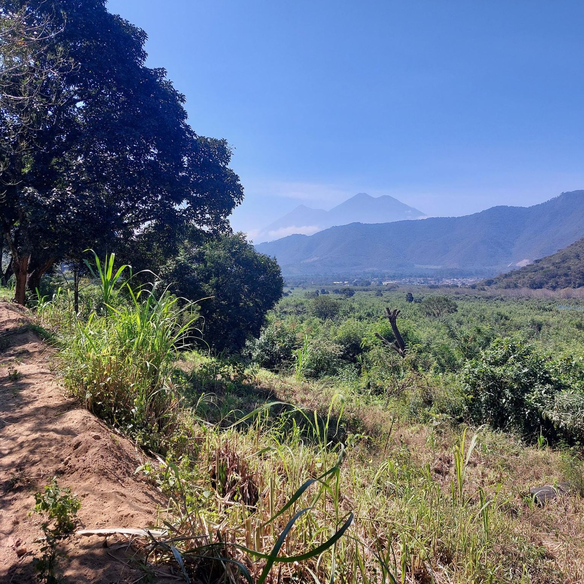
A primary draw for hikers is Cerro Alux (Senderos de Alux), an ecological reserve with extensive forests and a viewpoint offering vistas of the capital. The region's cool climate also supports numerous nurseries with a wide variety of flowers. While not directly within San Lucas Sacatepéquez, the area also serves as an ideal base for exploring nearby volcanic hikes like Pacaya Volcano and Volcán de Agua.
What do other hikers say about the trails in San Lucas Sacatepéquez?
The routes in San Lucas Sacatepéquez are highly rated by the komoot community, with an average score of 4.2 stars from over 40 reviews. Hikers often praise the diverse terrain, the refreshing cool climate, and the accessibility of trails for different ability levels.
Is San Lucas Sacatepéquez a good destination for family-friendly hikes?
Yes, the region offers trails suitable for families. With a variety of routes, including several easy options, families can find paths that are manageable for different ages and fitness levels. The extensive forests and cool climate provide a pleasant environment for outdoor activities with children.
Are the hiking trails in San Lucas Sacatepéquez dog-friendly?
While specific regulations can vary by trail or protected area, many natural outdoor spaces in San Lucas Sacatepéquez are generally welcoming to dogs, especially on leash. It's always recommended to check local signage or specific trail guidelines before heading out with your pet to ensure a pleasant experience for everyone.
What is the best time of year to go hiking in San Lucas Sacatepéquez?
San Lucas Sacatepéquez experiences a subtropical highland climate, characterized by dry, cold winters and rainy, cool summers. The cool climate generally makes it pleasant for hiking year-round. However, for drier conditions, the winter months (roughly November to April) might be preferred, while the summer offers lush greenery but with the possibility of rain.
Are there any hikes that offer great viewpoints?
Yes, several trails provide excellent viewpoints. The Valley Viewpoint – El Cucurucho Hill loop from Antigua Guatemala is specifically known for offering expansive views. Additionally, Cerro Alux features a viewpoint that provides vistas of the capital, making it a rewarding destination for scenic hikes.
How long do hikes in San Lucas Sacatepéquez typically take?
Hike durations vary significantly depending on the route's distance and difficulty. Easy trails like the Santa Catalina Arch – Central Park Fountain, Antigua loop can take around 1 hour 25 minutes, while more challenging routes such as the Valley Viewpoint – El Cucurucho Hill loop can require nearly 8 hours to complete.
Most popular routes in San Lucas Sacatepéquez

Get inspired with the komoot mobile app


Explore more
Browse the best Hikes in other regions.
