The best walks and hikes in the Greenwater Range
4.7
(185)
2,121
hikers
21
hikes
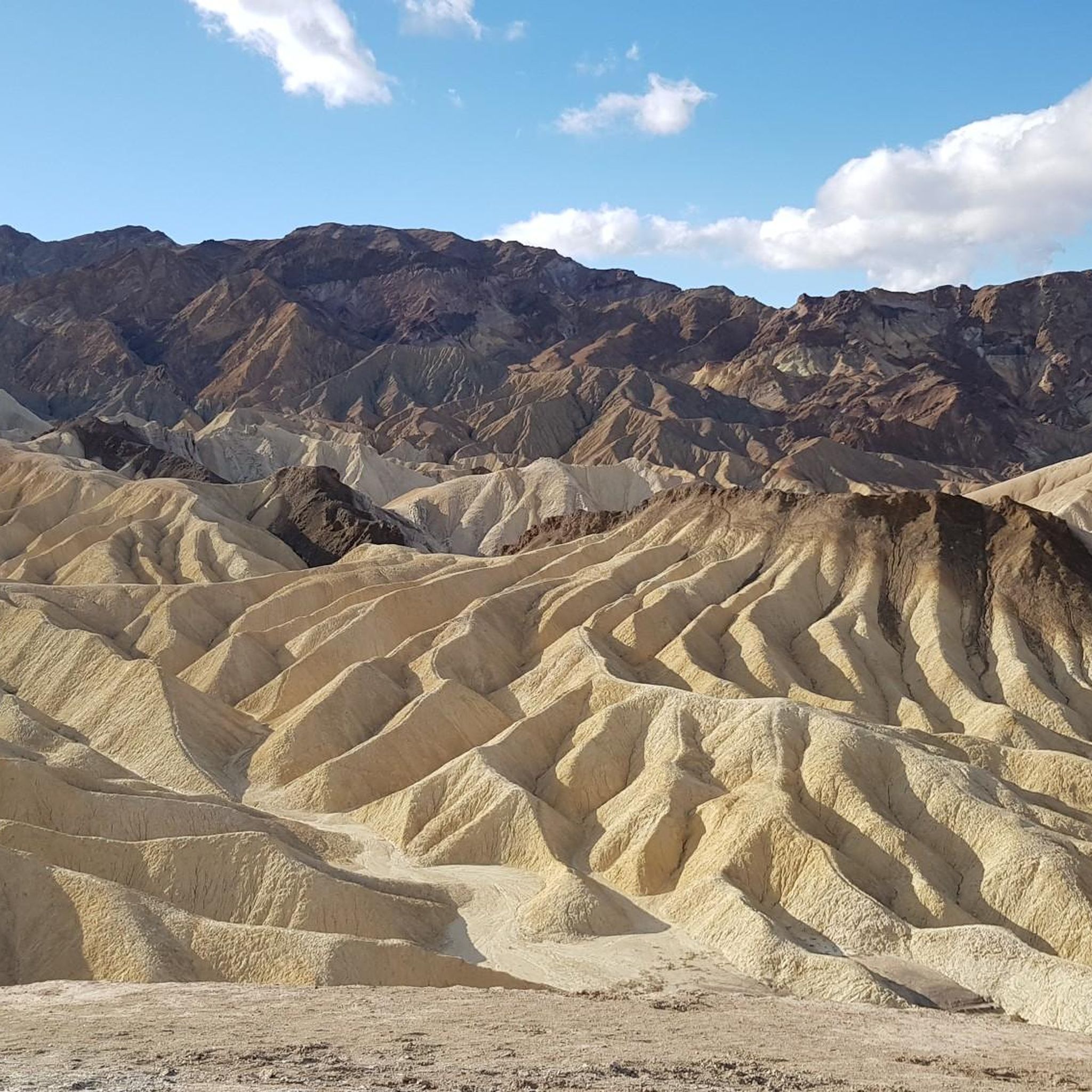
Hiking in the Greenwater Range offers diverse experiences across distinct geographical areas. In Death Valley National Park, the range presents dramatic desert landscapes with unique geological formations and varied rock layers. Trails often provide panoramic views of the vast Badwater Basin and distant peaks. The terrain can be rugged and exposed, requiring preparation for challenging conditions.
Best hiking trails in the Greenwater Range
- The most popular hiking route is Golden Canyon & Gower Gulch loop from Zabriskie Point — Death…
Last updated: June 23, 2026
4.9
(80)
644
hikers
9.69km
02:52
290m
290m
Moderate hike. Good fitness required. Easily-accessible paths. Suitable for all skill levels.
1
hikers
4.33km
01:13
130m
30m
Easy hike. Great for any fitness level. Easily-accessible paths. Suitable for all skill levels.

Sign up for free
2.16km
00:34
30m
0m
Easy hike. Great for any fitness level. Easily-accessible paths. Suitable for all skill levels.
5.0
(2)
4
hikers
2.04km
00:34
40m
40m
Easy hike. Great for any fitness level. Easily-accessible paths. Suitable for all skill levels.
26
hikers
1.66km
00:26
20m
20m
Easy hike. Great for any fitness level. Easily-accessible paths. Suitable for all skill levels.
5.0
(1)
18
hikers
4.70km
01:22
130m
130m
Easy hike. Great for any fitness level. Easily-accessible paths. Suitable for all skill levels.
3.0
(1)
15
hikers
2.59km
00:44
60m
60m
Easy hike. Great for any fitness level. Easily-accessible paths. Suitable for all skill levels.
7
hikers
Easy hike. Great for any fitness level. Easily-accessible paths. Suitable for all skill levels.
4.5
(4)
11
hikers
29.3km
08:29
720m
720m
Hard hike. Very good fitness required. Easily-accessible paths. Suitable for all skill levels.
9
hikers
7.34km
02:06
180m
180m
Moderate hike. Good fitness required. Easily-accessible paths. Suitable for all skill levels.
Get access to more routes and recommendations from other explorers.
Sign up for free
Already have an account?
Our route recommendations are based on thousands of hikes, rides, and runs completed by other people on komoot.
Start today with a free account
Your next adventure awaits.
Login or Signup
Popular around Greenwater Range
Tips from the Community

Oasis with date palms in the Valley of Death
0
0

The heat should not be underestimated… Despite the short distance
1
0

Harmony Borax Works and the famous Twenty mule teams brought the desert of Death Valley to homes across America. After borax was discovered near Furnace Creek Ranch (then called Greenland) in 1881, William T. Coleman built the Harmony Works and began processing the ore in late 1883 or early 1884. When fully operational, the Harmony Borax Works employed 40 men, producing three tons of borax daily. The little evidence that remains indicates that the majority of this workforce were Chinese laborers. The Chinese workers collected the impure mineral fragments from the valley floor and loaded them into horse-drawn wagons for transport to the borax works.
4
0
This is one of the famous viewpoints of the park. It is surrounded by wild, sandy, barren mountains.
4
1

Zabriskie Point is a lookout point in the Amargosa Range in Death Valley National Park, known for its bizarre erosion landscapes around the former Lake Manly. It was named at the beginning of the 20th century after Christian Brevoort Zabriskie from Wyoming, the vice president and general manager of the Pacific Coast Borax Company, which was commissioned to mine borax in the area.
3
0

Furnace Creek Visitor Center offers information to visitors about the Death Valley and the small community of Furnace Creek. Here you can find water fountains, bathrooms, food services and small exhibitions about the ecosystem and the village.
0
0

The Red Cathedral is a crimson cliff that stands out 183 meters above and behind the yellow and brown slopes and walls of the Golden Canyon. The origin of the name comes from the red rocks that have eroded into pillars in some places
0
0
Frequently Asked Questions
What kind of terrain can I expect when hiking in the Greenwater Range?
The Greenwater Range offers two distinct types of terrain. In Death Valley National Park, you'll find dramatic desert landscapes with unique geological formations, varied rock layers, and rugged, exposed trails. In contrast, the Greenwater area in Washington State features lush old-growth forests, winding rivers, and alpine lakes, with trails ranging from relatively flat to challenging ascents with mountain views.
Are there any easy, family-friendly hikes in the Greenwater Range?
Yes, the Greenwater Range offers several easy options. In Death Valley, a good choice is the Zabriskie Point — Death Valley National Park route, which is relatively short and offers stunning views. For a slightly longer but still easy option, consider the Zabriskie Point – Manly Beacon loop from Snow Mountain. In Washington State, the initial miles of the Greenwater Lakes Trail are known for being flat and suitable for families.
What are some notable landmarks or viewpoints to see along the trails?
In Death Valley National Park, you can experience breathtaking panoramic views of the vast Badwater Basin from trails like the Zabriskie Point – Golden Canyon Trail loop. Other significant points of interest include Zabriskie Point itself, the historic Harmony Borax Works, and the Dante's View Climb. In Washington State, trails often offer views of Mount Rainier and access to alpine lakes.
When is the best time of year to hike in the Greenwater Range?
The ideal time depends on the specific location. For the Greenwater Range in Death Valley, cooler months from late fall to early spring are best to avoid extreme summer temperatures. In Washington State, late spring through early fall offers pleasant conditions for hiking, with vine maples providing spectacular fall colors.
Are there any circular or loop trails available?
Yes, several loop trails are available, particularly in Death Valley National Park. Popular options include the Golden Canyon & Gower Gulch loop from Zabriskie Point and the Zabriskie Point – Badlands Loop in Gower Gulch loop from Snow Mountain. These loops allow you to experience diverse scenery without retracing your steps.
What kind of wildlife might I encounter?
In the Greenwater Range area of Washington State, the forests and trails are home to various wildlife, including deer and elk. In Death Valley National Park, while less visible, desert adapted wildlife can be found, though sightings are less common due to the harsh environment.
How many hiking trails are there in the Greenwater Range?
There are over 14 hiking trails documented in the Greenwater Range, offering a variety of experiences for different skill levels. These include 11 easy routes, 2 moderate, and 1 difficult trail.
What do other hikers enjoy most about hiking in the Greenwater Range?
The Greenwater Range is highly rated by the komoot community, with an average score of 4.7 stars from over 160 reviews. Hikers often praise the dramatic desert landscapes and unique geological formations in Death Valley, as well as the stunning views and diverse terrain found in both the desert and the forested areas of Washington State.
Are there any trails that feature water elements like rivers or lakes?
Yes, particularly in the Greenwater Range area of Washington State. The Greenwater River is a constant companion on many trails, and the area features placid Greenwater Lakes, Echo Lake, and Lost Lake. Picturesque bridges and waterfalls can also be found along trails like the Greenwater Lakes Trail.
What should I know about parking and permits for hiking in the Greenwater Range?
For the Greenwater Range within Death Valley National Park, standard National Park entrance fees apply. Parking is generally available at trailheads and visitor centers like the Furnace Creek Visitor Center. For the Greenwater area in Washington State, specific parking regulations or permits may apply depending on the trailhead, especially near wilderness areas or national forests. It's advisable to check local regulations before your visit.
Are there any challenging hikes for experienced trekkers?
Yes, for those seeking a more strenuous experience, the Greenwater Range offers challenging options. In Death Valley, routes like the Golden Canyon Trail – Manly Beacon loop from Furnace Creek can be demanding due to length and exposure. In Washington State, ascents to places like Echo Lake or the Nannie Ridge-Sheep Lake trail involve significant elevation gain and are suited for experienced hikers.
Most popular routes in the Greenwater Range
Most popular attractions in the Greenwater Range

Get inspired with the komoot mobile app


Explore more
Browse the best Hikes in other regions.
