The 7 Most Amazing Peaks around Kappel-Grafenhausen
Best mountain peaks around Kappel-Grafenhausen are characterized by their diverse natural landscapes and historical significance. The region offers a mix of elevated viewpoints, forested summits, and historical castle ruins perched on hills. These peaks provide opportunities to explore the natural environment and discover local heritage.
Best mountain peaks around Kappel-Grafenhausen
- The most popular mountain peaks is Hünersedel Observation Tower and Grill Area, a viewpoint that offers extensive panoramic views, including the Feldberg and Vosges mountains. It features an observation…
Last updated: July 8, 2026
Hünersedel Observation Tower and Grill Area
Highlight • Viewpoint
Translated by Google •
Tip by

Ruins of Kirnburg Castle
Highlight • Castle
Translated by Google •
Tip by

Sign up now to discover places like this
Get recommendations on the best single tracks, peaks, & plenty of other exciting outdoor places.
Sign up for free
Geisberg Summit
Highlight • Summit
Translated by Google •
Tip by

Schillinger Berg
Highlight (Segment) • Summit
Translated by Google •
Tip by

Hinterer Geißberg
Highlight • Viewpoint
Translated by Google •
Tip by
Sign up for free to discover even more peaks around Kappel-Grafenhausen.
Sign up for free
Already have an account?
Start today with a free account
Your next adventure awaits.
Login or Signup
Tips from the Community

The Hünersedel is a mountain in the central Black Forest with a height of 744.3 m above sea level. Its name means "giant's seat". In a document from the year 926, the mountain is called "Stoufinberc". It lies in the border area of the two municipalities of Schuttertal and Freiamt. The summit of the mountain is at the northern end of the municipality of Freiamt. The river Schutter rises at the Hünersedel. The Hünersedel was the highest mountain in the old district of Lahr. From the tower you have a gigantic view.
4
0

a very nice lookout tower. Very suitable for taking a break, with a barbecue area.
5
0

the road in the direction of Biederbach/Elzach is used very little and is therefore recommended
2
0

Related Links https://de.wikipedia.org/wiki/Kirnburg https://www.kirnburg.de/
2
0

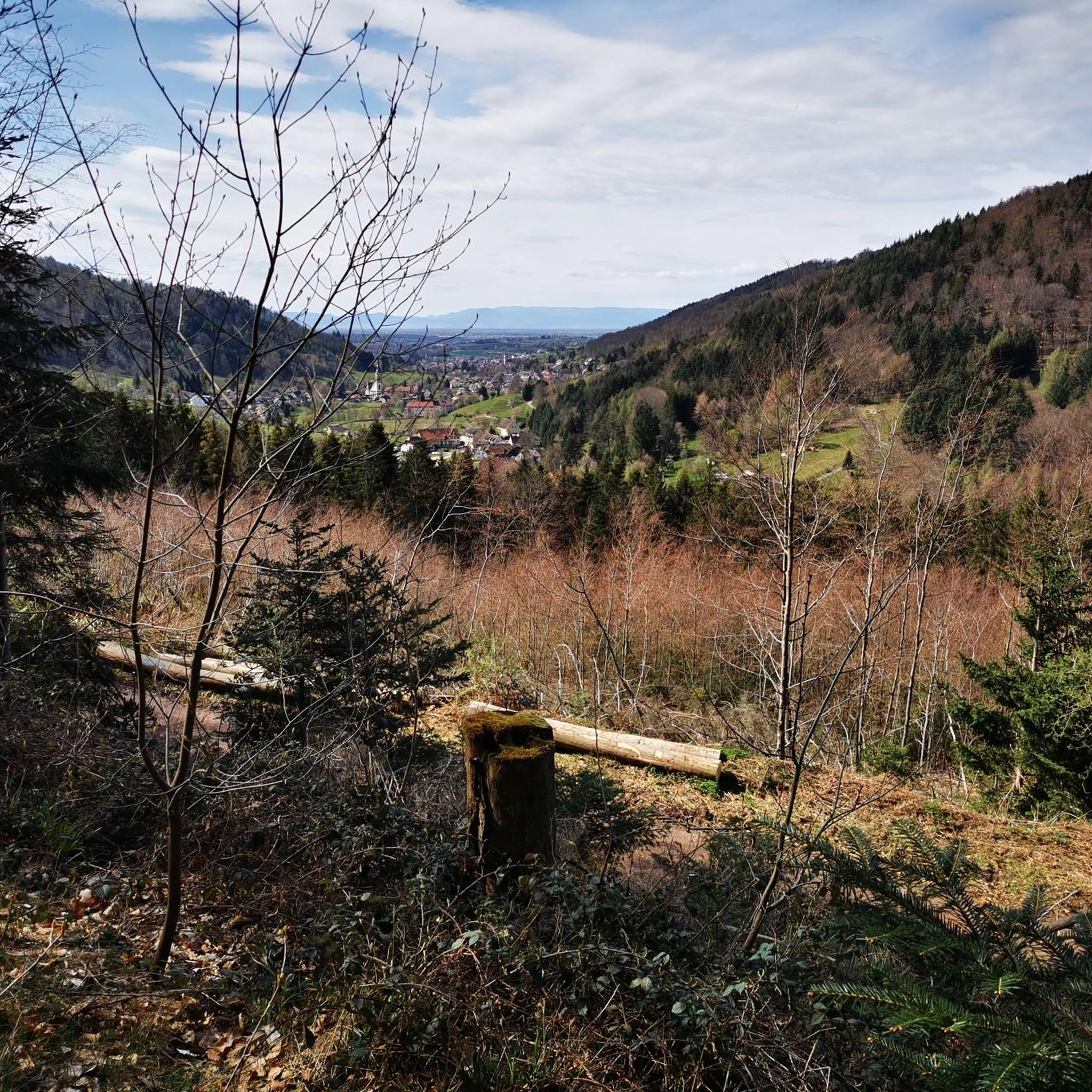
The Schillingerberg can be reached either from Siegelau (Elz Valley side) or Reichenbach (Freiamter side). A few drops of sweat whether the percentage is included. From up here, however, you are rewarded for all your efforts and there is a fantastic Black Forest panorama with Rohrhardsberg, Hörnliberg and Kandel.
0
0

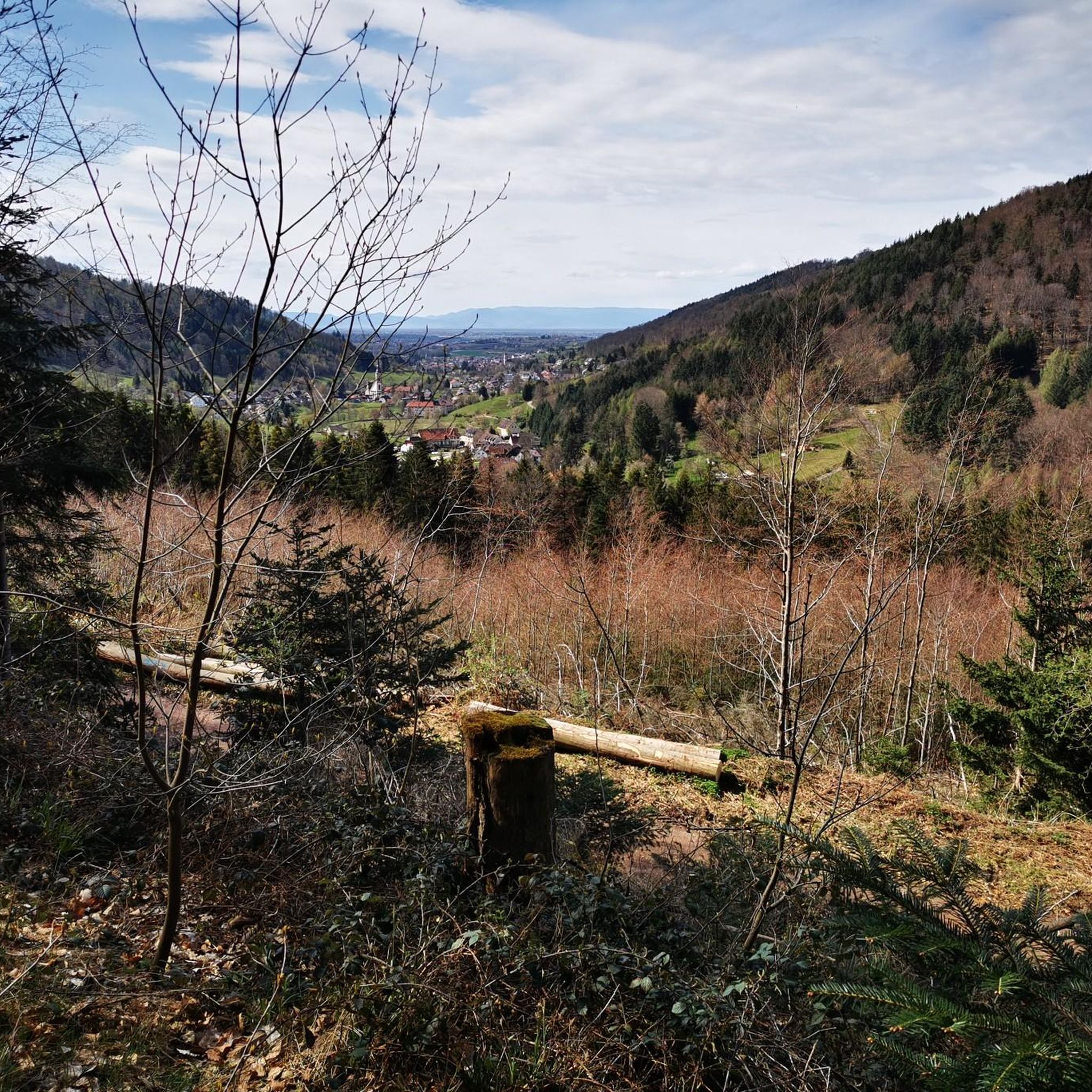
Above Schweighausen at the apex in the direction of Welschensteinach is the rear Geisberg on which there is also a small chapel. From the Geisberg you can approach many points from which you have a great view of the Schuttertal or the Kinzig valley
1
0

From Bleichheim you start the tour to Kürnberg Castle on the Ölberg and climb up the Kammergraben. The route is well signposted here. Those who hike the Vierburgenweg from Emmendingen (or from the Schlüpfingerhof) can use the 113 road between Bombach and Heimbach for a route to Kirnburg. The entrance here is a parking lot for hikers.
4
1
2019 marks the 800th anniversary of the first documentary evidence of Kürnberg Castle. This anniversary was an occasion to take a closer look at the landmark of the Bleichtal. With newly designed information boards, excursions and lectures, the current state of research is compiled and prepared for those interested in history from near and far. For more than 400 years, the castle was a representative residence, fortification, rulership and administrative center in northern Breisgau. Only the remains of the wall, traces of the terrain, some written sources and archaeological finds testify to the former stately Kürnberg Castle. Anyone who embarks on a voyage of discovery can also find a lot of interesting things in the area around the former weir system. See: www.kirnburg.de We hope you enjoy exploring the castle
3
1
Frequently Asked Questions
What are some of the most popular mountain peaks and viewpoints around Kappel-Grafenhausen?
Visitors frequently enjoy the Hünersedel Observation Tower and Grill Area for its extensive panoramic views, including the Feldberg and Vosges mountains. Another popular spot is the Ruins of Kirnburg Castle, offering historical insights and views over the Rhine plain.
Are there family-friendly mountain peaks or walks in the Kappel-Grafenhausen region?
Yes, the Ruins of Kirnburg Castle is categorized as family-friendly. Its historical significance and views make it an engaging destination for all ages, and there's a parking lot for convenient access.
What kind of views can I expect from the mountain peaks in Kappel-Grafenhausen?
The peaks offer diverse vistas. From the Hünersedel Observation Tower, you can see the Feldberg and Vosges mountains. The Ruins of Kirnburg Castle provide views over the Rhine plain to the Vosges. From Geisberg Summit, you can see the Elztal and Kinzigtal, while Schillinger Berg offers magnificent views of the Elz and Simonswalder valley.
Are there facilities like kiosks or grill areas available at any of the mountain peaks?
Yes, the Hünersedel Observation Tower and Grill Area features a kiosk that is open on weekends, offering hot dishes and various cakes. It also has a grill area for visitors.
What historical sites can be found among the mountain peaks?
The Ruins of Kirnburg Castle is a significant historical site located at 382 meters above sea level. This 13th-century castle ruin offers a glimpse into the region's past and provides views over the Rhine plain.
What outdoor activities can I do near these mountain peaks?
The region around Kappel-Grafenhausen offers a variety of outdoor activities. You can find numerous hiking trails, such as the easy 4.9 km 'Dornskopf in the Taubergießen' loop, or moderate routes like the 'Boat dock in Taubergießen – Elz Trail' loop. For cycling enthusiasts, there are MTB trails and gravel biking routes available. You can explore more options on the Hiking around Kappel-Grafenhausen, MTB Trails around Kappel-Grafenhausen, and Gravel biking around Kappel-Grafenhausen guide pages.
Are there hiking trails near the mountain peaks, and what are some examples?
Yes, there are many hiking trails. For instance, near the peaks, you can find routes like the 'Dornskopf in the Taubergießen – Taubergießen Wetlands loop' (4.9 km, easy) or the 'Boat dock in Taubergießen – Elz Trail loop' (9.9 km, moderate). More hiking options are detailed in the Hiking around Kappel-Grafenhausen guide.
What do visitors enjoy most about the mountain peaks around Kappel-Grafenhausen?
Visitors particularly appreciate the panoramic views, especially from spots like the Hünersedel Observation Tower. The combination of natural beauty, historical sites like the Ruins of Kirnburg Castle, and well-maintained trails contributes to a highly rated experience, with highlights receiving over 700 upvotes and more than 500 photos from the komoot community.
How accessible are the mountain peaks by car, and is parking available?
Some peaks offer convenient access. For example, the Ruins of Kirnburg Castle has a dedicated parking lot for hikers. For other areas, it's advisable to check specific trailheads or highlight descriptions for parking information.
What is the highest point among the mountain peaks in this guide?
The Geisberg Summit reaches 681 meters, offering views over the Elztal and towards the Kinzigtal from its highest point.
Are there any challenging mountain trails for experienced hikers or cyclists?
While many trails are intermediate, some sections can be demanding. For instance, the ascent to Hinterer Geißberg includes crisp and steep sections with gradients of 12-14%. Cyclists tackling Geisberg Summit from Steinach or Schweighausen will also encounter steep climbs.
Can I find circular walks around the Kappel-Grafenhausen mountain region?
Yes, many of the hiking and cycling routes in the area are designed as loops. For example, the 'Dornskopf in the Taubergießen – Taubergießen Wetlands loop' is an easy hiking option. You can find more circular routes in the Hiking around Kappel-Grafenhausen guide.
Most popular routes around Kappel-Grafenhausen
Most popular attractions around Kappel-Grafenhausen

Get inspired with the komoot mobile app


Explore more
See even more amazing summits around Kappel-Grafenhausen with these guides:
