The best road cycling routes around Blindbothel
4.6
(103)
5,899
riders
183
rides
Road cycling routes around Blindbothel benefit from the area's location within the Lake District National Park, offering diverse terrain for cyclists. The region features a mix of country lanes, challenging climbs over fells, and quiet roads, providing varied landscapes for exploration. Cyclists can expect routes that traverse lakeside scenery, dramatic mountain views, and semi-natural woodlands. The geology of the area, shaped by volcanic activity and glaciation, contributes to the distinct character of its cycling paths.
Best road cycling routes around…
Last updated: July 10, 2026
5.0
(1)
316
riders
105km
05:31
1,820m
1,820m
Hard road ride. Very good fitness required. Mostly well-paved surfaces and easy to ride.
4.9
(7)
259
riders
31.1km
01:43
590m
590m
Moderate road ride. Good fitness required. Mostly well-paved surfaces and easy to ride.

Sign up for free
5.0
(1)
203
riders
70.0km
03:42
1,090m
1,090m
Hard road ride. Very good fitness required. Mostly well-paved surfaces and easy to ride.
5.0
(1)
32
riders
37.1km
01:58
640m
640m
Moderate road ride. Good fitness required. Some segments of this route may be unpaved and difficult to ride.
20
riders
46.1km
02:25
580m
580m
Moderate road ride. Good fitness required. Some segments of this route may be unpaved and difficult to ride.
Get access to more routes and recommendations from other explorers.
Sign up for free
Already have an account?
Our route recommendations are based on thousands of hikes, rides, and runs completed by other people on komoot.
Start today with a free account
Your next adventure awaits.
Login or Signup

Tips from the Community


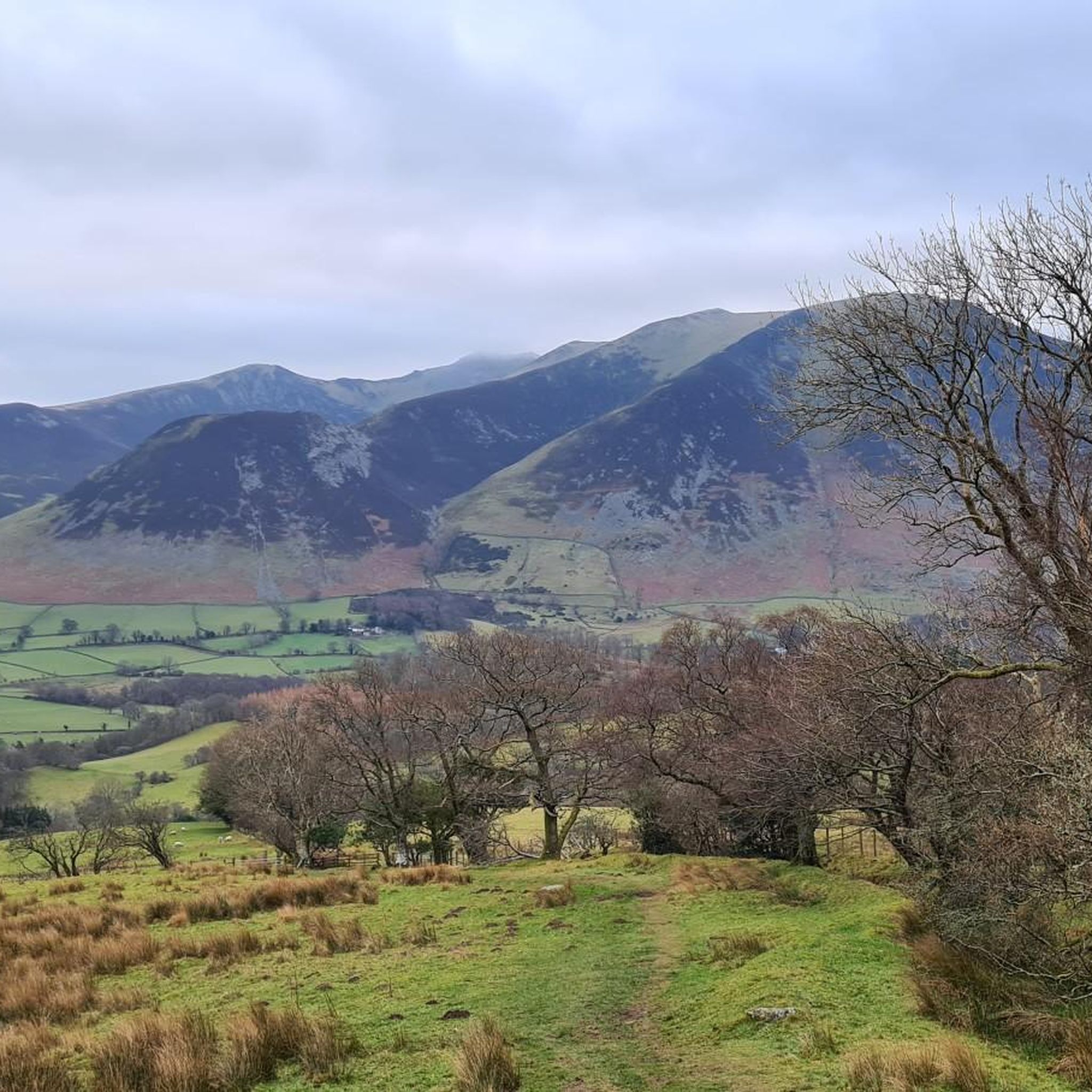
Amazing scenery of the lake and fells, good place for photos
0
0

Honister Pass links the Buttermere Valley to the eastern end of Borrowdale. At 356 metres (1,167 feet), it’s one of the highest passes in Cumbria, featuring a steep 1-in-4 (25%) gradient.
3
0

The lake is fed by numerous streams including the beck from Scale Force. The River Cocker starts from here, flowing towards Cockermouth where it joins the River Derwent.
0
0
National Cycle Network route 71 crosses from the Buttermere Valley into Lorton Vale. It's known as the C2C route and has stunning views over Crummock Water.
0
0

The decent on the A5091 from Matterdale End to Ullswater is super nice with good roads and views to boot. The scenery is simply sublime to look at, and after Dockray it gets better with Ullswater coming into view in the last mile or so. Simply a great ride!
1
0
This is a stunning, quiet lane running from Hawes End to the Grange, going past Borrowdale Rainforest National Nature Reserve, overlooking Derwent Water. This is pristine Lake District scenery with lush green undulating wooded scenery with a backdrop of high peaks. All this with some good quiet tarmac underneath your tires. Awesome piece of road!
1
0
Frequently Asked Questions
How many road cycling routes are available around Blindbothel?
There are over 190 road cycling routes around Blindbothel, offering a wide range of options for different skill levels and preferences. This includes 49 easy routes, 129 moderate routes, and 16 difficult routes.
What kind of terrain can I expect on road cycling routes near Blindbothel?
Road cycling routes near Blindbothel offer diverse terrain, from quiet country lanes to challenging climbs over the fells. You'll find scenic stretches along lakesides, dramatic mountain views, and paths through semi-natural woodlands, all within the stunning Lake District National Park.
Are there any family-friendly road cycling routes around Blindbothel?
Yes, the area offers 49 easy road cycling routes that are generally suitable for families. These routes often utilize quieter country lanes, providing a more relaxed experience away from heavy traffic. While specific 'family-friendly' designations aren't always explicit, the easier routes are a good starting point.
What are some scenic viewpoints or landmarks I can see while cycling near Blindbothel?
Many routes offer spectacular views of the Lake District's natural beauty. You can cycle past lakes like Buttermere Lake and Ennerdale Water, or enjoy panoramic vistas from spots like View of Buttermere and Crummock Water from Rannerdale Knotts. Other notable natural features include Hopegill Head and Ling Fell Summit.
What do other road cyclists say about the routes in Blindbothel?
The road cycling routes around Blindbothel are highly rated by the komoot community, with an average score of 4.7 stars from nearly 100 reviews. Cyclists often praise the stunning scenery, varied terrain, and the opportunity to explore the unique landscapes of the Lake District.
Are there any challenging road cycling routes for experienced riders?
Absolutely. For experienced riders seeking a challenge, there are 16 difficult routes available. One such route is the View of Derwent Water – Grasmere Lake loop from Lorton, which covers 104.6 km with significant elevation gain, offering extensive views of two major Lake District bodies of water. Another challenging option is the Caldbeck Village – View of the Northern Fells loop from Lorton.
Can I find circular road cycling routes in the Blindbothel area?
Yes, many of the road cycling routes around Blindbothel are designed as loops, allowing you to start and finish in the same location. Examples include the moderate Crummock Water – Newlands Valley loop from Lorton and the View of Loweswater – Crummock Water loop from Low Fell (summit).
What is the best time of year for road cycling around Blindbothel?
The Lake District, including the Blindbothel area, is beautiful year-round, but spring through autumn generally offers the most favorable conditions for road cycling. During these seasons, you can expect milder weather and longer daylight hours, making for more enjoyable rides through the diverse landscapes.
Are there any routes that pass by lakes or offer lakeside views?
Many routes in the Blindbothel area feature stunning lakeside scenery. For example, the Crummock Water – Newlands Valley loop from Lorton offers scenic stretches along Crummock Water. You can also find routes with views of Loweswater, Buttermere, and Ennerdale Water.
Where can I find information about parking for road cycling routes near Blindbothel?
While specific parking details for every route are not listed here, many routes start from villages or trailheads where public parking is typically available. It's advisable to check local information for specific starting points like Lorton or Pardshaw for available parking facilities before your ride.
Are there any moderate-difficulty road cycling routes that offer a good balance of challenge and scenery?
Yes, there are 129 moderate routes available. A great option is the View of Loweswater – View of Hundith Hill loop from Pardshaw, which is 46.3 km long and offers a balanced ride with beautiful views without being overly strenuous. Another excellent choice is the View of Loweswater – Crummock Water loop from Low Fell (summit).
Most popular routes around Blindbothel
Most popular attractions around Blindbothel

Get inspired with the komoot mobile app


Explore more
Browse the best Road cycling routes in other regions.
