The 4 Most Amazing Peaks around Münzenberg
Best mountain peaks around Münzenberg are characterized by notable hills and elevated points rather than towering peaks. The region, situated in the Wetterau district of Hesse, Germany, features gentle hills, lush meadows, and forests, making it suitable for hiking. These elevated locations offer historical significance, panoramic views, and recreational opportunities. The area provides diverse natural settings for exploration.
Best mountain peaks around Münzenberg
- The most popular mountain peaks is Hausberg Tower, a viewpoint that offers a 360-degree panorama of…
Last updated: October 17, 2026
Volkssternwarte Wetterau Observatory
Highlight • Monument
sternwartewetterau.de/sternwarte
Translated by Google •
Tip by

Monte Scherbelino Viewpoint
Highlight • Viewpoint
Translated by Google •
Tip by

Sign up now to discover places like this
Get recommendations on the best single tracks, peaks, & plenty of other exciting outdoor places.
Hardtberg
Highlight • Forest
Showing Translation
Tip by

Start today with a free account
Your next adventure awaits.
Tips from the Community

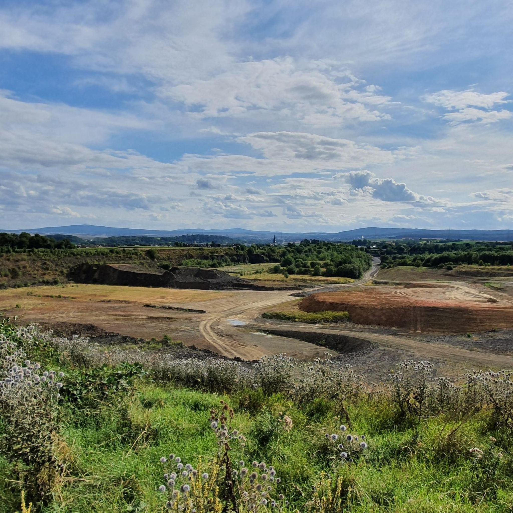
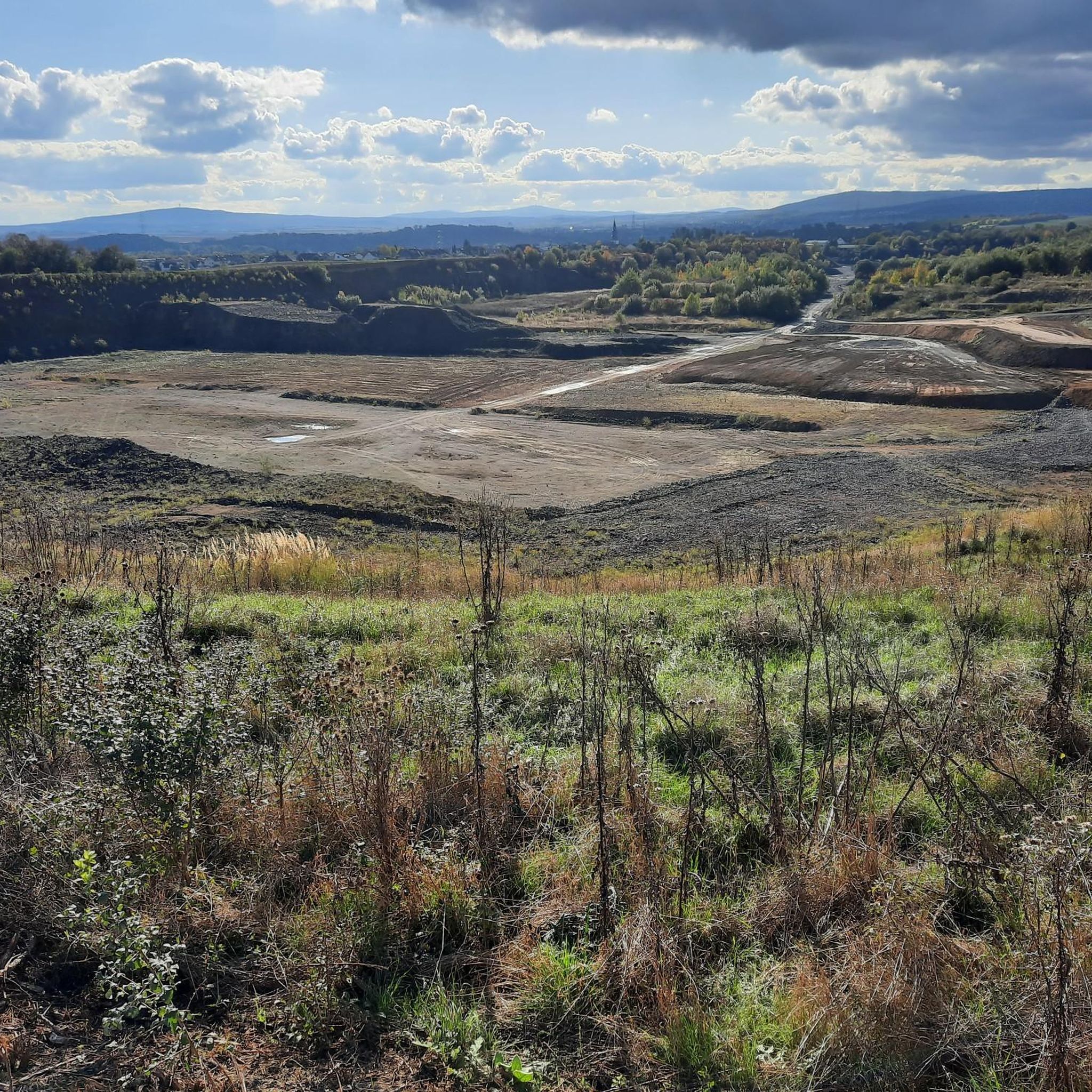
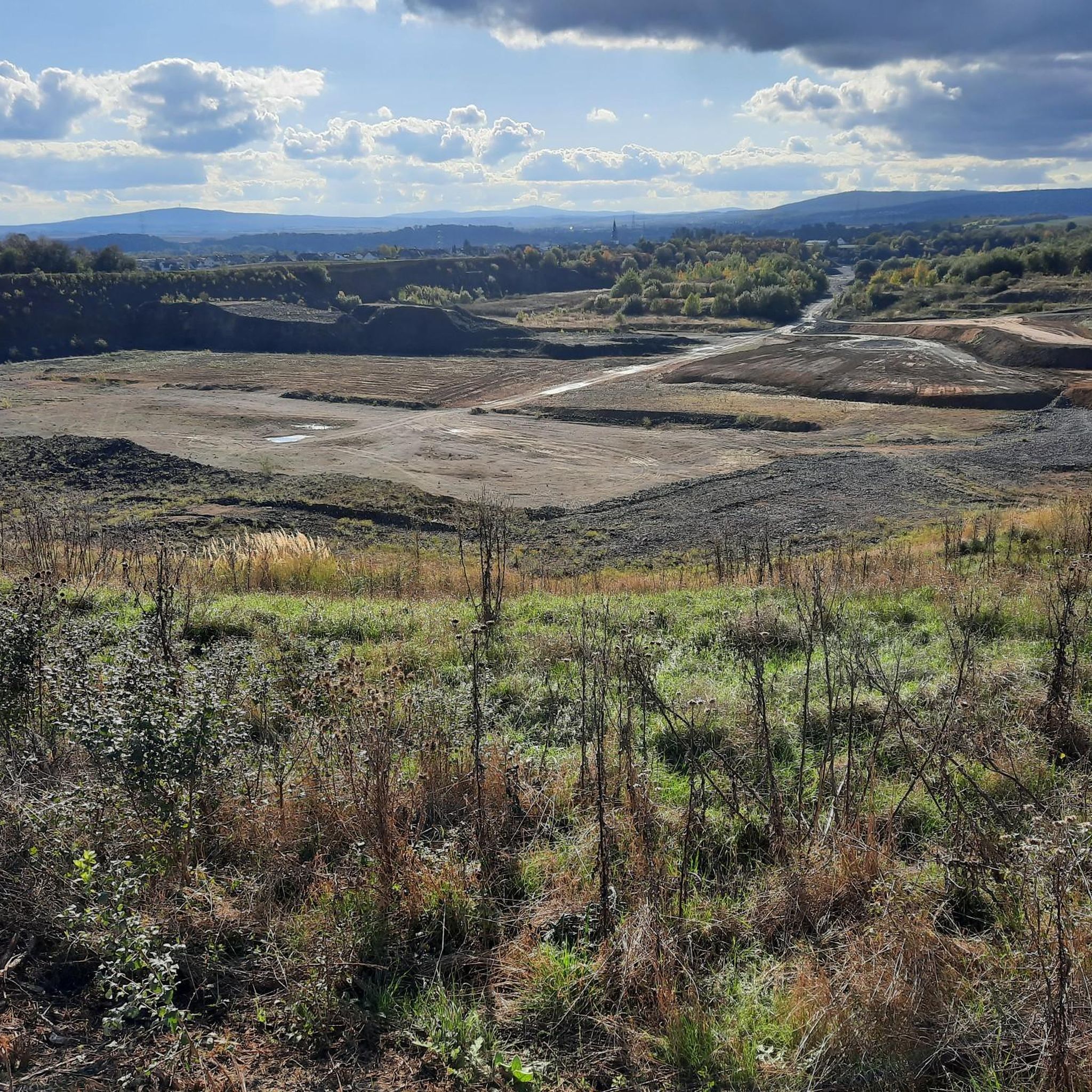
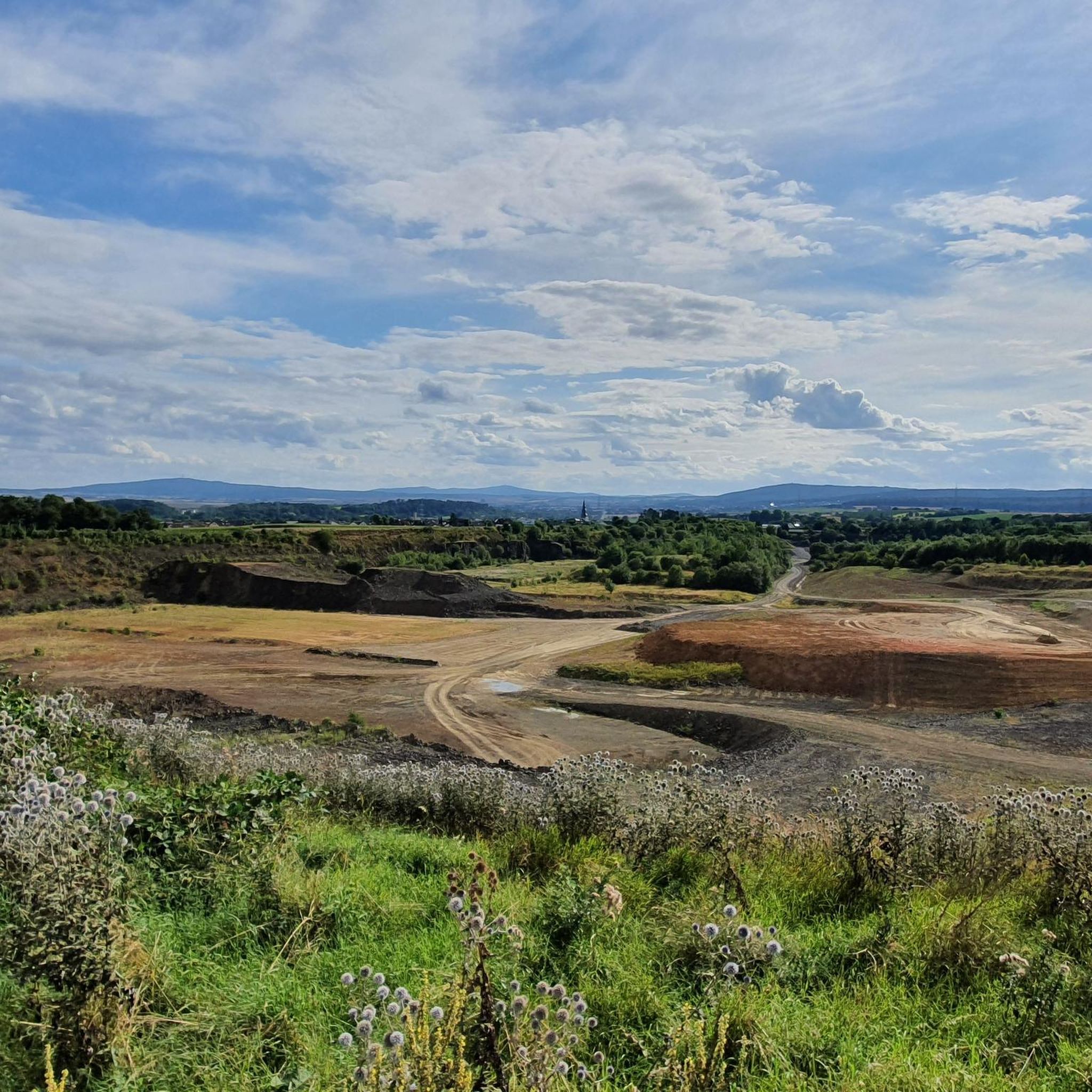
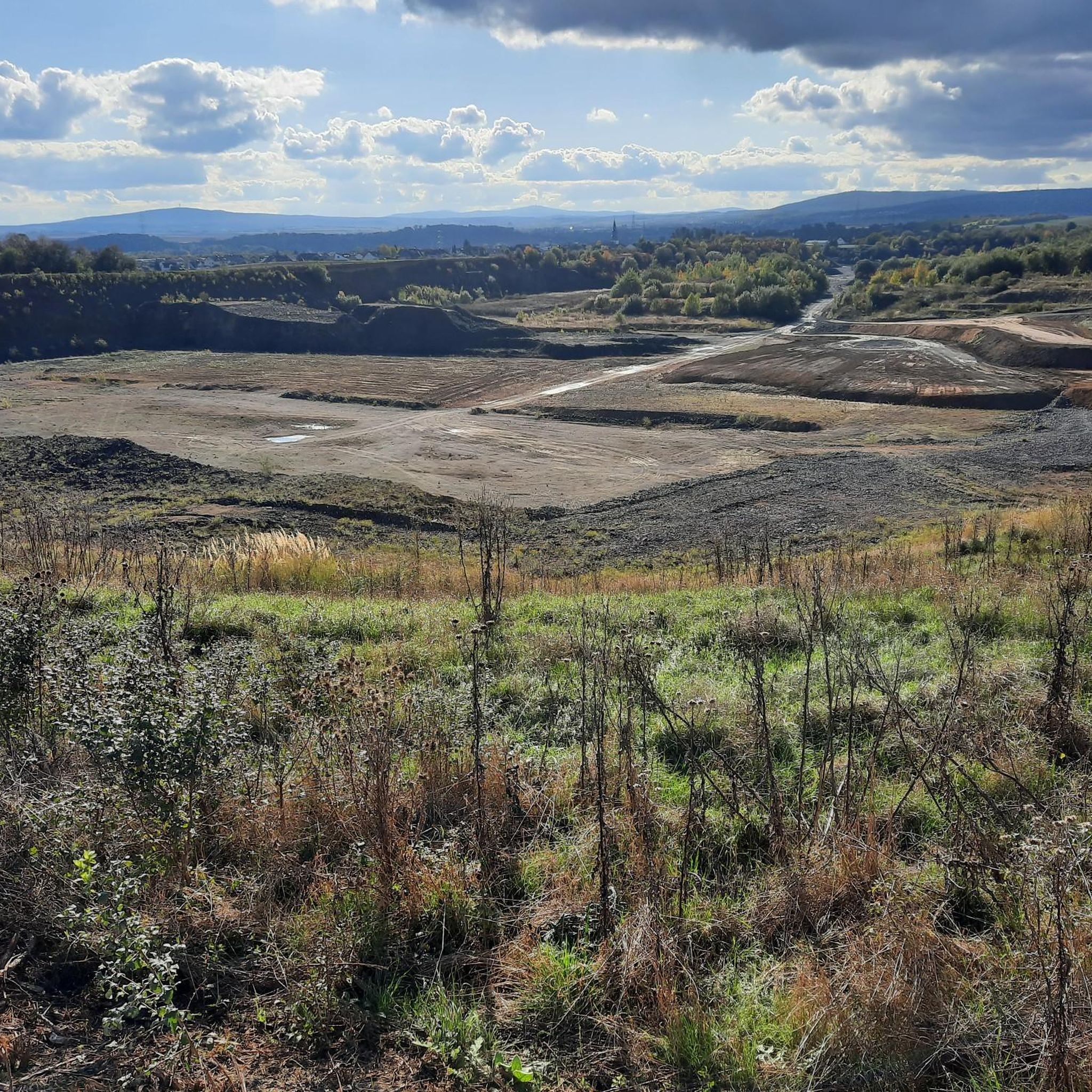
The viewing summit is 225 meters above sea level and is a garbage dump in the Giessen district, popularly known as Monte Scherbelino. Many discarded items are buried here under a thick layer of earth. Today, it's a fantastic location with a magnificent panoramic view and constant air movement.
3
0

Johannesberg Observation Tower - Bad Nauheim 🚴♂️ Cycling up to the Johannesberg Observation Tower via Höhenweg Street is a must-do for any Bad Nauheim tour...🚴♂️ Once you reach the top, you'll be rewarded with a unique view over Bad Nauheim, far out into the Wetterau region, all the way to the Vogelsberg and the city of Frankfurt. The tower on the Johannisberg, visible from afar, dates back to the Middle Ages and belonged to a mission church that was located on the Johannisberg from the 8th century onwards. The octagonal tower itself was probably not built until around 1300. During the Reformation, however, the church was abandoned and quickly fell into disrepair. Only the church tower survived in its foundations and was converted into an observation tower in 1866. Since 1965, the tower has housed the public observatory. Bad Nauheim's local mountain is 268 meters high. Due to its outstanding location, the Johannisberg was a place of worship for pagan, Celtic, and Germanic customs long before Christianity. Archaeological finds indicate settlement as early as the Stone and Bronze Ages. The hill is also home to the listed Café Restaurant Johannisberg, a traditional inn that was once visited by Empress Elisabeth of Austria during her spa stay. 🚴♂️ https://www.bad-nauheim.de/de/erlebnisreich/sehenswertes/johannisberg-roemischer-signalturm
2
1

In Roman times there was a signal tower here from the 2nd century, which belonged to the Upper Germanic Limes system. Structurally, it resembled a Limes watchtower. It was probably used to transmit optical signals from the Limes to Friedberg Castle, which had no direct line of sight to the nearest Limes watchtower on the Gaulskopf. There were other rear watchtowers of this type on the Kapellenberg near Hofheim and near Wölfersheim-Wohnbach. The remains of the Roman signal tower were restored in 2010 and it was also made clear which parts are original and which are additions. This Roman tower should not be confused with the tower still standing today, the base of which dates from around 1300. The octagonal tower was part of the westwork of the church of a medieval monastery, which goes back to a mission church that is said to have been built here in 779. This St. John's Church is considered the baptismal and mother church and original parish of the entire northern Wetterau. The right of patronage to the church was transferred to the Mainz cathedral chapter in 1254 by Ulrich II von Münzenberg.
4
1

A fine example for citizens. The lectures are absolutely worth seeing!
3
2

Nice little tower he is sleepy on the planet path.
3
2

The vantage point is located on the former landfill site of Giessen Allendorf. From the summit you have a sensational view. Information boards show you what conditions are in the distance.
3
0

The Planetary Trail, with the observatory as its destination, is a walkable model of our solar system on a reduced scale. Walkers here cover "galactic" distances, with one step corresponding to a distance of 2.8 million kilometers.
6
2
Frequently Asked Questions
What are the most rewarding viewpoints around Münzenberg?
For breathtaking panoramic views, consider visiting the Hausberg Tower. On clear days, you can see up to 100 kilometers, encompassing mountain ranges like the Taunus, Westerwald, and Vogelsberg. Another unique spot is the Monte Scherbelino Viewpoint, a transformed former landfill offering expansive vistas with informational signs to identify distant landmarks.
Are there historical sites associated with the elevated points in Münzenberg?
Yes, the town of Münzenberg itself is built around Münzenberg Hill, home to the impressive Münzenberg Castle. This 12th-century ruined hill castle is considered one of Germany's best-preserved from the High Middle Ages. Additionally, the Volkssternwarte Wetterau Observatory is located on the tower of an old Gothic church from the 13th century, offering both historical context and a unique vantage point.
What kind of terrain can I expect when hiking around Münzenberg?
The region around Münzenberg is characterized by gentle hills, lush meadows, and forests, rather than towering alpine peaks. This makes it ideal for leisurely hikes and walks, offering diverse natural settings and scenic views without extreme elevation changes.
Are there family-friendly elevated points or viewpoints in the Münzenberg area?
Absolutely. The Monte Scherbelino Viewpoint is noted as family-friendly, providing excellent panoramic views from a unique elevated spot. The general terrain of gentle hills and well-maintained trails also makes many areas suitable for families.
What is the best time of year to visit the elevated points around Münzenberg?
While enjoyable year-round, spring and autumn offer particularly pleasant conditions for hiking with mild temperatures and beautiful foliage. Clear days are always best for maximizing the panoramic views from spots like the Hausberg Tower.
What outdoor activities can I do near the elevated points around Münzenberg?
Beyond hiking to the viewpoints, the area is excellent for cycling. You can explore various routes, including gravel biking, road cycling, and traffic-free bike rides, many of which offer views of the elevated landscape and Münzenberg Castle.
Are there specific hiking trails to reach these viewpoints?
Yes, numerous hiking trails lead to and around the elevated points. For example, you can find routes that incorporate the Hausberg Tower or offer views of Münzenberg Castle. For detailed routes, explore the hiking guides for Münzenberg.
Are there places to eat or drink near the viewpoints?
Yes, the Volkssternwarte Wetterau Observatory is conveniently located right next to the Johannisberg cafe/restaurant, offering a place to refresh after your visit. There are also various cafes and restaurants in the nearby towns and villages.
Can I bring my dog on trails around Münzenberg's elevated points?
Generally, the hiking trails and natural areas around Münzenberg are dog-friendly. It's always recommended to keep your dog on a leash, especially in nature reserves or near livestock, and to carry waste bags to maintain the cleanliness of the trails.
What makes the Hausberg Tower a special destination?
The Hausberg Tower is renowned for its gigantic 360-degree panorama, offering views up to 100 kilometers on clear days. It provides an unparalleled perspective of the surrounding Taunus, Wetterau, and distant mountain ranges, making it one of the greatest viewpoints in the region.
What is unique about Monte Scherbelino?
The Monte Scherbelino Viewpoint is unique because it's an elevated point created from a former landfill. Despite its origins, it has been transformed into a fantastic location offering magnificent panoramic views and constant air movement, with informational signs at the summit to help identify distant landmarks.
Most popular routes around Münzenberg
Most popular attractions around Münzenberg

Get inspired with the komoot mobile app


Explore more
See even more amazing summits around Münzenberg with these guides:
