The best cycling routes in San Lorenzo Valley Water District
4.8
(5)
210
riders
13
rides
If you've ever tried to plan touring cycling in San Lorenzo Valley Water District, you know how overwhelming the options can be. With so many routes winding through the Santa Cruz Mountains, it's tough to tell which ones are genuinely worth your time and effort, and which are just filler. We get it – you want the highlights, not the guesswork.
That's where komoot comes in. Our community has mapped, ridden, and reviewed these routes, giving us a real-world perspective…
Last updated: May 28, 2026
6
riders
70.5km
05:03
1,420m
1,430m
The Saratoga Gap Trailhead – Summit of Sanborn County Park loop from Boulder Creek is a truly demanding touring cycling route that plunges you deep into the Santa Cruz Mountains.…
3
riders
21.1km
01:38
490m
490m
Hard bike ride. Very good fitness required. Mostly paved surfaces. Suitable for all skill levels.

Sign up for free
18
riders
50.2km
03:31
920m
920m
Hard bike ride. Very good fitness required. Mostly paved surfaces. Suitable for all skill levels.
15
riders
26.1km
02:39
690m
690m
Hard bike ride. Very good fitness required. Mostly paved surfaces. Suitable for all skill levels.
12
riders
15.8km
01:08
290m
290m
Moderate bike ride. Good fitness required. Mostly paved surfaces. Suitable for all skill levels.
Get access to more routes and recommendations from other explorers.
Sign up for free
Already have an account?
Our route recommendations are based on thousands of hikes, rides, and runs completed by other people on komoot.
Start today with a free account
Your next adventure awaits.
Login or Signup


Tips from the Community

Also known as "fairy rings", Cathedral trees are found in a circle where they sprouted from the roots of their parent tree. Over time the Redwoods grow to incredible heights which invokes a sense of another type of Cathedral.
0
0

Stunning Natural Bridge Beach is known for its natural arches made of fine clay or mud rock, carved by time, water, and wind. The beach is also known for being home to a colony of monarch butterflies, with over 150,000 coming to live here for the winter. If you're lucky, you might even spot whales!
0
0

Redwood trees are some of the tallest and oldest living organisms on Earth. Towering up to 350 feet, these majestic trees can live for over 2,000 years. Found primarily along the coast of Northern California, redwoods thrive in the cool, foggy climate. Their thick, reddish bark provides protection from fire and insects, making them incredibly resilient. Walking among these giants is a humbling experience, with their sheer size and age creating an awe-inspiring atmosphere.
0
0

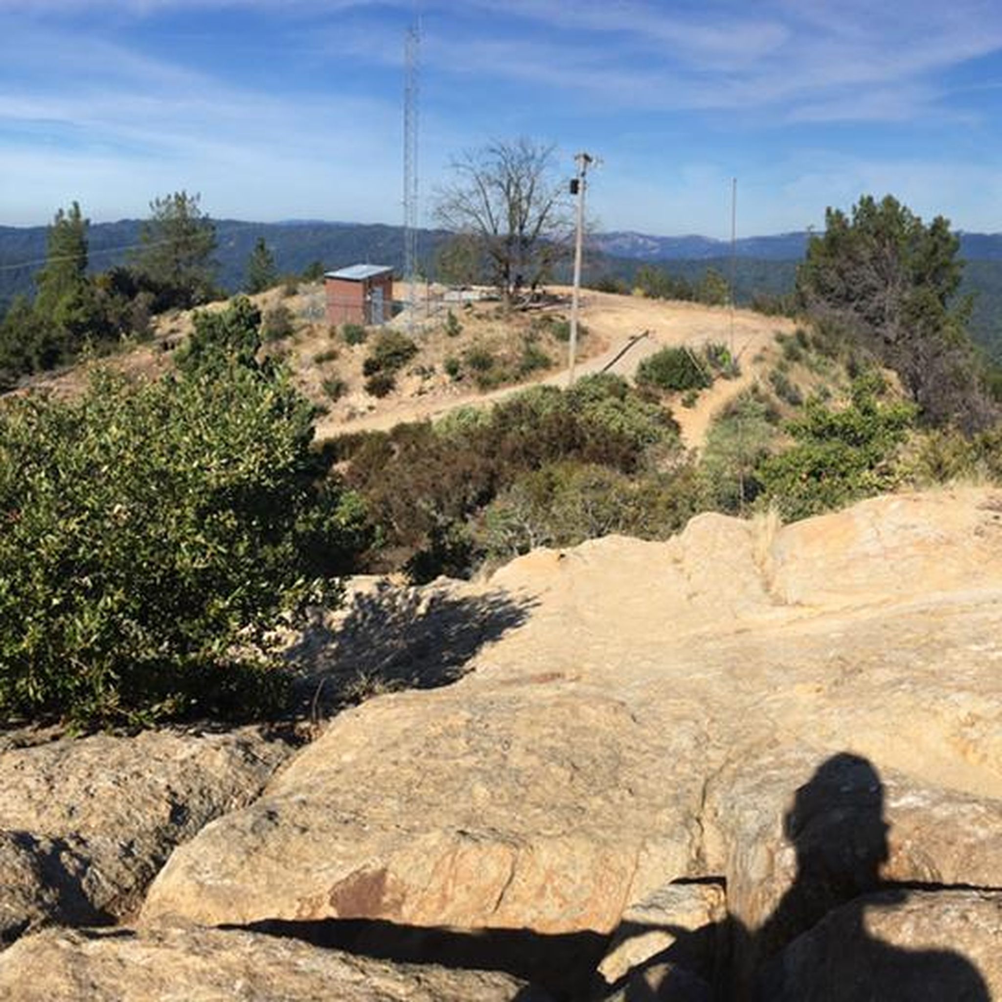
The Peak is a 3,005-foot mountain in Santa Clara County. The high point is marked by a large mossy rock, a short distance away from the end of the trail. This is a great, challenging summit for any mountain biker.
1
0

The Pipeline route is authorised for cycling and runs through the whole park diagonally. To visit the deep parts go hiking.
0
0
This State Park allows to enjoy the original wilderness as before. Be careful on the steep hills and use authorised routes for cycling or hiking only
0
0

Felton Covered Bridge Park is a small city park and home to the Felton Covered Bridge, which is the tallest covered bridge in the United States. The bridge is a California Historical Landmark and is listed on the National Register of Historic Places. Additionally, the park offers a playground, sand volleyball court, picnic area, and access to the San Lorenzo River.
0
0
Boulder Creek sits just below the Santa Cruz Mountains and is the gateway to Big Basin Redwoods State Park. The downtown area offers bars and restaurants that occupy buildings dating back to the early 1900s.
0
0
Frequently Asked Questions
What is the general difficulty level of touring cycling in the San Lorenzo Valley Water District?
The touring cycling routes in the San Lorenzo Valley Water District range from moderate to difficult. You'll find 5 moderate routes and 9 difficult routes, often featuring significant elevation changes, some exceeding 3,000 feet, making them suitable for riders with good to very good fitness.
Are there any circular touring cycling routes in the San Lorenzo Valley Water District?
Yes, many touring cycling routes in the San Lorenzo Valley Water District are designed as loops. For example, you can explore the Saratoga Gap Trailhead – Skyline Boulevard Views loop from Boulder Creek, which offers extensive views, or the Chuck Beebe Scenic Bench – U-Con Trail loop from Mount Hermon, leading through forested hills.
What kind of landscapes can I expect to see while touring cycling in the San Lorenzo Valley?
Touring cycling in the San Lorenzo Valley offers a diverse range of landscapes. You'll ride through majestic redwood forests, experience varied mountainous terrain with scenic canyons, and often follow the picturesque San Lorenzo River. Some routes, like the Bonny Doon Beach – Natural Bridges State Beach loop from Mount Hermon, even connect to coastal areas, blending redwood scenery with ocean vistas.
Are there family-friendly touring cycling options in the San Lorenzo Valley Water District?
While many routes are moderate to difficult, the region offers areas like Henry Cowell Redwoods State Park and Felton Covered Bridge Community Park which have more accessible paths. For specific family-friendly touring cycling routes, it's best to check individual route details on komoot for terrain and distance suitable for all ages.
Can I bring my dog on touring cycling routes in the San Lorenzo Valley Water District?
Dog policies vary by park and trail. While some areas within the San Lorenzo Valley, like certain county parks, may allow dogs on leash, state parks often have restrictions on where dogs are permitted, especially on trails. Always check the specific regulations for the park or trail you plan to visit before bringing your dog.
Where can I find parking for touring cycling routes in the San Lorenzo Valley Water District?
Parking is generally available at trailheads and within the various state and county parks throughout the San Lorenzo Valley. For instance, areas near Henry Cowell Redwoods State Park, Big Basin Redwoods State Park (for limited day use), and community parks in towns like Felton, Ben Lomond, and Boulder Creek often provide parking facilities. It's advisable to check specific starting points for routes on komoot for detailed parking information.
Are there public transport options to access touring cycling routes in the San Lorenzo Valley?
Public transport options in the San Lorenzo Valley are limited, but local bus services may connect some of the towns like Felton, Ben Lomond, and Boulder Creek. However, direct access to many trailheads via public transport might be challenging. Cyclists typically rely on personal vehicles to reach starting points for touring routes.
Are there places to eat or stay near the touring cycling routes?
Yes, the charming villages within the San Lorenzo Valley, such as Felton, Ben Lomond, and Boulder Creek, offer various amenities. You'll find cafes, pubs, and accommodation options in these towns, providing convenient spots for breaks, refreshments, and overnight stays during your touring cycling adventure.
What is the best time of year to go touring cycling in the San Lorenzo Valley?
The San Lorenzo Valley offers pleasant touring cycling conditions for much of the year. Spring and fall generally provide mild temperatures and beautiful scenery. Summer can be warm but the redwood forests offer shade. Winter can bring rain, but clear days are excellent for riding. Always check local weather forecasts before heading out.
What do other touring cyclists enjoy the most about touring cycling in San Lorenzo Valley Water District?
The touring cycling experience in San Lorenzo Valley Water District is highly rated by the komoot community, with an average score of 4.75 stars. Reviewers often praise the diverse terrain, the majestic redwood forests, and the challenging yet rewarding climbs and descents. The scenic views along routes like the Bike loop from Big Basin Way & Hilton Drive are frequently highlighted.
Are there less crowded touring cycling routes in the San Lorenzo Valley Water District?
While popular routes can see more traffic, exploring some of the less-traveled county parks or routes during off-peak hours (weekdays, early mornings) can offer a more serene experience. Routes like the Glenwood Open Space Preserve – Granite Creek Road loop from Mount Hermon might offer a quieter ride through forested areas.
How many touring cycling routes are available in the San Lorenzo Valley Water District?
There are 14 touring cycling routes available in the San Lorenzo Valley Water District, offering a variety of distances and difficulty levels to explore the region's diverse landscapes.
Most popular routes in San Lorenzo Valley Water District

Get inspired with the komoot mobile app


Explore more
Browse the best Cycling routes in other regions.
