The best cycling routes in K'Ómoks Royston Lands
4.4
(9)
191
riders
24
rides
Touring cycling in K'Ómoks Royston Lands offers routes through varied landscapes, characterized by coastal stretches, natural reserves, and areas near local towns. The region provides a mix of terrain suitable for different cycling preferences. These routes often feature views of the surrounding waters and access to local points of interest.
Best touring cycling routes in K'Ómoks Royston Lands
- The most popular touring cycling route is Shingle Spit – Ford's Cove Marina loop from South Island Highway at Kingfisher Resort (NB)…
Last updated: July 8, 2026
9
riders
Hard bike ride. Very good fitness required. Mostly paved surfaces. Suitable for all skill levels.
5.0
(1)
15
riders
17.1km
01:06
90m
90m
Easy bike ride. Great for any fitness level. Mostly paved surfaces. Suitable for all skill levels.

Sign up for free
3
riders
19.4km
01:51
190m
190m
Hard bike ride. Good fitness required. You may need to push your bike for some segments of this route.
3
riders
Hard bike ride. Good fitness required. You may need to push your bike for some segments of this route.
10
riders
15.4km
00:57
90m
90m
Easy bike ride. Great for any fitness level. Mostly paved surfaces. Suitable for all skill levels.
Get access to more routes and recommendations from other explorers.
Sign up for free
Already have an account?
Our route recommendations are based on thousands of hikes, rides, and runs completed by other people on komoot.
Start today with a free account
Your next adventure awaits.
Login or Signup

Tips from the Community

There are a bunch of seaplanes and other small aircraft that are usually parked along the fence opposite the Riverway Path. You can check them out as you pass by.
0
0
This path takes you through Courtenay's urban area, partially sheltered on either side by strips of greenery, between downtown and the riverfront. You share the path with cyclists, but the trail is paved and divided to ease multi-use traffic.
0
0
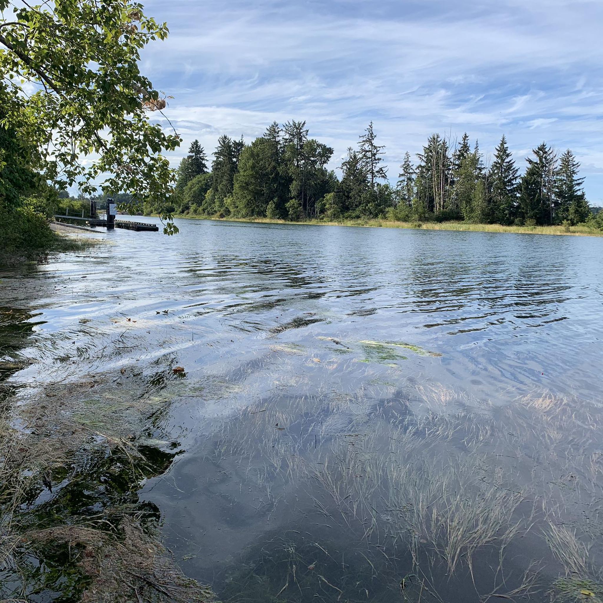
Totem poles by the K’ómoks First Nation have been installed in Courtenay over the past decade to bring greater recognition to indigenous culture. This one overlooks the salt marsh and the banks of the Courtenay River.
0
0

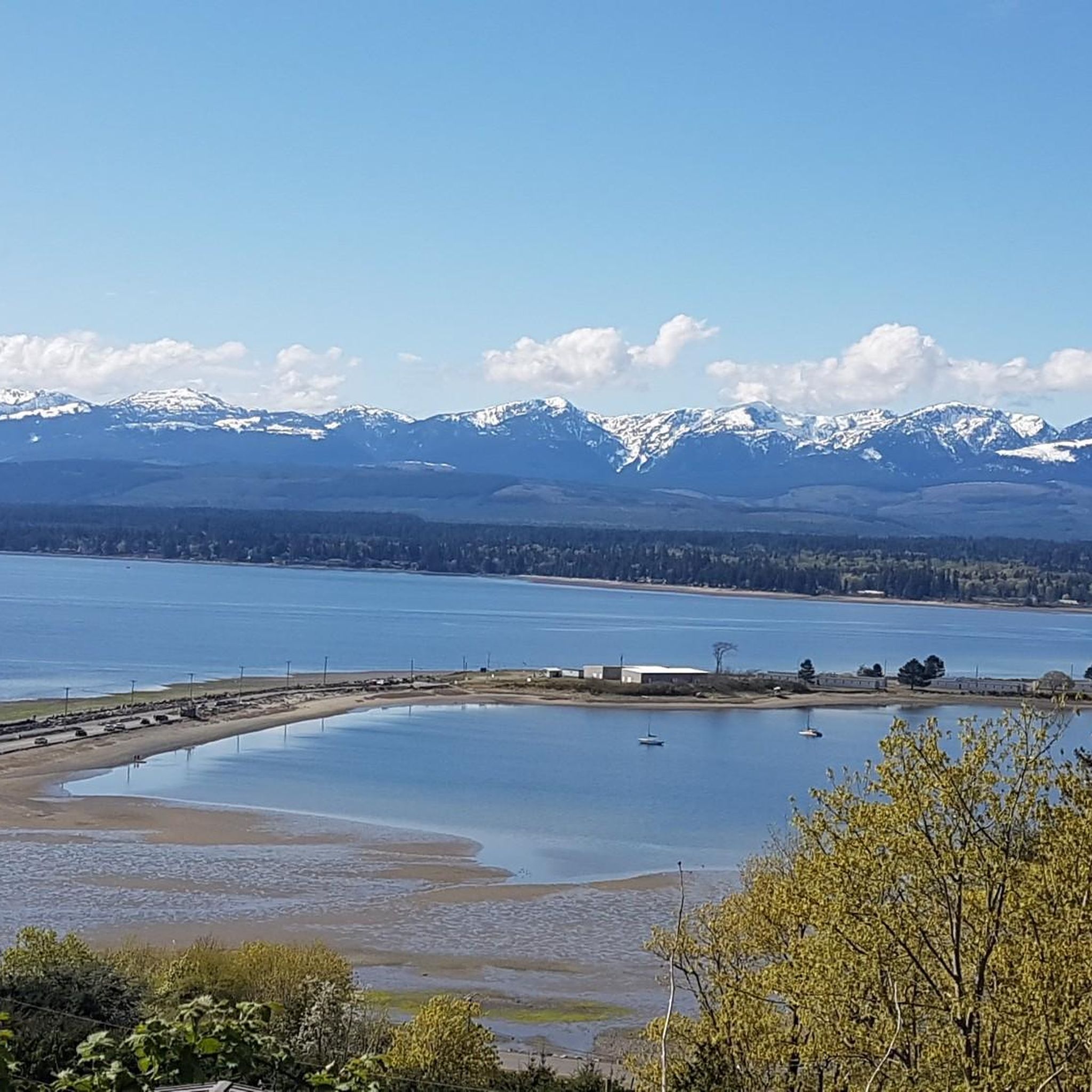
Comox Harbour is a sheltered inlet on the east coast of Vancouver Island, opening into the Strait of Georgia. The water is generally calm, shaped by tides that expose mudflats and sandbars along the shoreline. Backed by distant mountains and coastal communities, it forms a wide, open marine landscape that changes noticeably throughout the day.
0
0
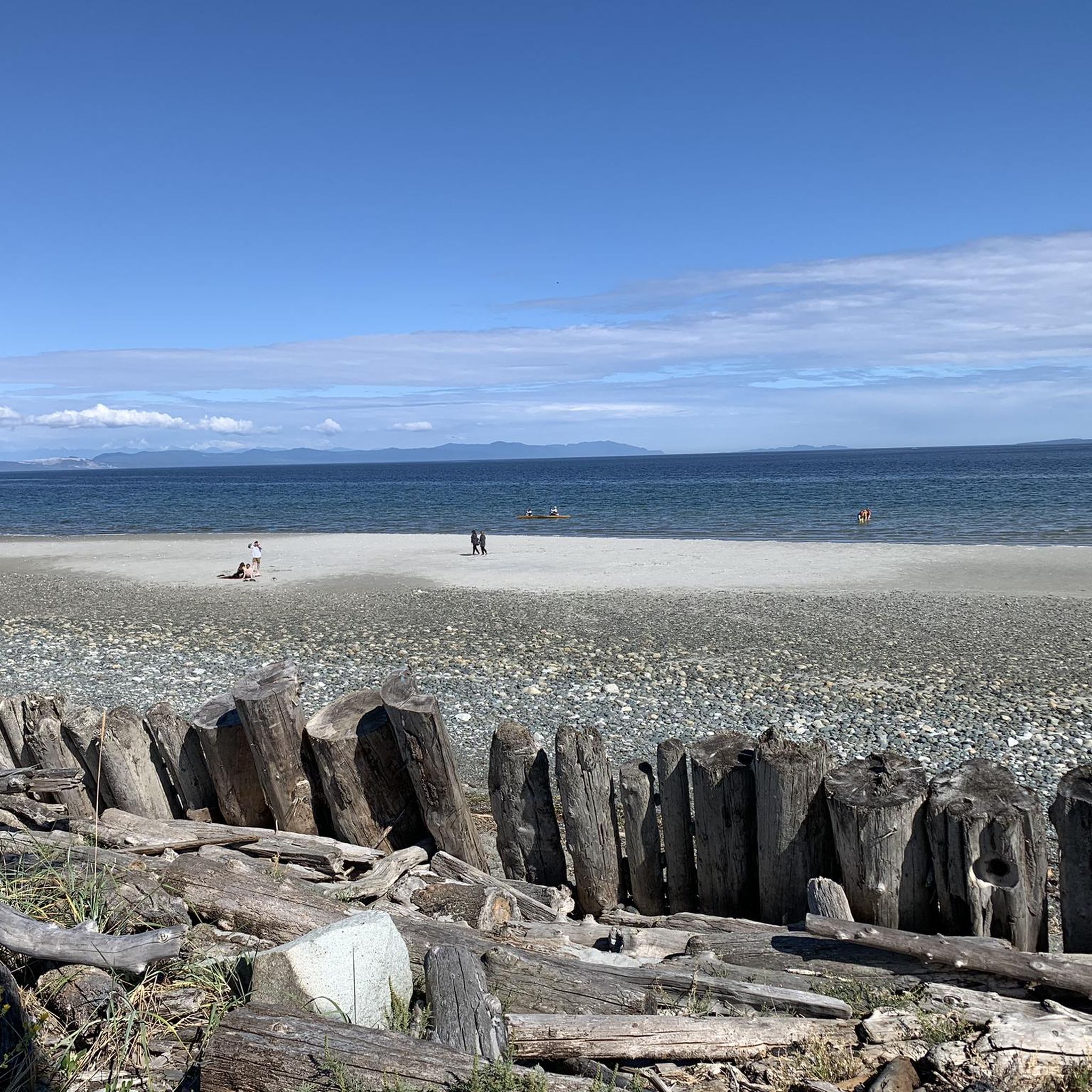
Royston Seaside Trail follows the shoreline of Comox Harbour, and is a flat, gravel path between the water and a narrow strip of coastal vegetation. The trail is short, with driftwood, tidal flats, and small beaches lining the edge of the harbour. With constant ocean views and minimal elevation change, it's a great route for a quick scenic stroll along the waterfront.
0
0
Shingle Spit is a pebbly gravel-bar beach and Hornby Island’s main ferry landing for visitors. The spit is a year‑round wildlife haven, where you’ll likely see plenty of seals, sea lions, cormorants, and dozens of bald eagles during the herring spawn. Just steps from the ferry dock sits Thatch Pub and Restaurant, the island’s only full-service pub with a waterfront deck, making it the perfect lunch spot to enjoy some local fare and take in the scenery during a day of hiking in this beautiful area.
0
0
The Ford Cove to Shingle Spit Trail winds through forested terrain from Ford Cove to the ferry-landing area at Shingle Spit, following the coastline and staying mostly level, making it suitable for hiking or casual cycling. Along the way, you pass wooded hillsides, small bridges over gullies and streams, and near the halfway point, a seasonal waterfall. There are plenty of breathtaking views of the channel and surrounding islands, making this path the perfect mix of forest and coastal scenery.
0
0
Ford's Cove Marina is a small, sheltered harbour on Hornby Island’s southwest shore, beside a sandstone-and-gravel beach, popular for swimming, tide-pool exploring, and watching winter storms, sunsets, and passing wildlife such as sea lions, orcas, and seabirds. It’s a community hub and a gateway for boaters, with restrooms, picnic tables and a general store that also serves fish and chips, making it a perfect scenic lunch spot. The dock pilings are a nesting habitat for purple martins, so keep an eye out for them while you’re here.
0
0
Frequently Asked Questions
What are the general characteristics of touring cycling routes in K'Ómoks Royston Lands?
Touring cycling in K'Ómoks Royston Lands features a diverse landscape, including coastal stretches, natural reserves, and paths connecting local communities. You can expect routes with views of the surrounding waters and access to various local points of interest.
How many touring cycling routes are available in K'Ómoks Royston Lands?
There are over 20 touring cycling routes in K'Ómoks Royston Lands, catering to various skill levels from easy to difficult. The komoot community has highly rated these routes, with an average score of 4.8 stars.
Are there any easy touring cycling routes suitable for beginners or a relaxed ride?
Yes, K'Ómoks Royston Lands offers several easy routes. An excellent option is the Ace Brewing Company – Courtenay Airpark loop from HMCS Gatineau, which is 10.6 miles (17.1 km) long and connects local attractions like an airpark and a brewery.
What kind of challenging touring cycling routes can I find in the region?
For those seeking a challenge, routes like the Shingle Spit – Ford's Cove Marina loop from South Island Highway at Kingfisher Resort (NB) offer a more demanding experience. This route is 46.9 miles (75.4 km) long, features significant elevation changes, and provides extensive coastal views.
Are there any touring cycling routes that pass through natural reserves?
Yes, you can explore natural reserves on two wheels. The Crown Land Reserve loop from South Island Highway at Gartley Road (NB) is a 12.0 miles (19.4 km) trail that takes you through a protected natural area.
What are some points of interest or landmarks I might see along the touring cycling routes?
Many routes connect local points of interest. For example, the Ace Brewing Company – Courtenay Airpark loop from HMCS Gatineau passes by the Courtenay Airpark and Ace Brewing Company. Another route, Shingle Spit – Ford's Cove Marina loop from South Island Highway at Kingfisher Resort (NB), offers views of Ford's Cove Marina.
Are there any circular touring cycling routes in K'Ómoks Royston Lands?
Yes, many routes are designed as loops, allowing you to start and end at the same point. Examples include the Courtenay Airpark – The Canteen loop from HMCS Gatineau and the Cumberland Brewing Co. – Cumberland Village Bakery loop from HMCS Gatineau.
What do other touring cyclists enjoy most about the routes in K'Ómoks Royston Lands?
The komoot community rates the routes highly, with an average of 4.8 stars. Cyclists often praise the varied terrain, which includes scenic coastal paths and routes through natural reserves, as well as the convenience of connecting to local communities and points of interest.
Are there any routes that offer a mix of urban and natural scenery?
Yes, several routes blend urban and natural environments. The Cumberland Brewing Co. – Cumberland Village Bakery loop from HMCS Gatineau, for instance, takes you through areas that combine natural landscapes with access to local establishments like breweries and bakeries.
Where are common starting points or trailheads for these touring cycling routes?
Many routes originate from accessible locations. Common starting points mentioned in the routes include areas near HMCS Gatineau, South Island Highway at Kingfisher Resort (NB), and South Island Highway at Gartley Road (NB). These locations often provide convenient access to the trails.
Most popular routes in K'Ómoks Royston Lands

Get inspired with the komoot mobile app


Explore more
Browse the best Cycling routes in other regions.
