The best walks and hikes in Banagher Forest
4.4
(31)
218
hikers
17
hikes
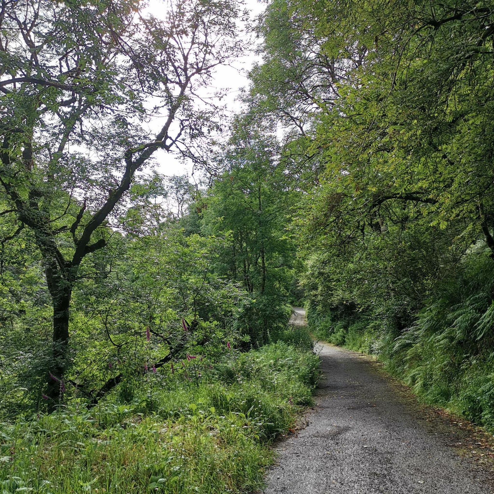
Hikes in Banagher Forest explore one of Northern Ireland's largest ancient oak woodlands, located within the Sperrin Mountains. The landscape is characterized by steep, wooded glens, forest roads, and the large Altnaheglish Reservoir. Routes often follow the Owenrigh River before climbing to viewpoints over the surrounding hills, offering a mix of sheltered paths and open scenery.
Best hiking trails in Banagher Forest
- The most popular hiking route is Altnaheglish Reservoir from Moneyneany Road — Sperrins, a 8.6 mile (13.9 km) trail that takes around 3 hours 50 minutes to complete. The route follows paths around the reservoir, a significant feature in the area.
- Another top favourite among local hiking enthusiasts is Banagher Glen Forest Trail — Sperrins, a moderate 8.2 mile (13.3 km) path. This trail leads through the ancient woodland of Banagher Glen, involving a steady incline.
- Local hiking enthusiasts also love the Spelhoagh – Craigagh Hill loop from Feeny, a 8.6 mile (13.9 km) trail leading through open hill terrain, often completed in about 4 hours 30 minutes.
- Hiking in Banagher Forest is defined by ancient woodlands, large reservoirs, and ascents into the Sperrin Mountains. The network of forest roads and hill paths provides options for both moderate and more demanding hikes.
- The routes in Banagher Forest are highly rated by the komoot community with an average score of 4.6 stars from more than 20 reviews. More than 200 hikers have used komoot to explore Banagher Forest's varied terrain.
Last updated: June 23, 2026
1
hikers
13.9km
03:53
280m
280m
Embark on the Banagher Glen - Forest Trail, a moderate hike that leads you through one of Ireland's most ancient oak woodlands. You will follow the winding Banagher Stream, which guides you towards the tranquil Altnaheglish Reservoir and the impressive Banagher Dam, offering expansive views across the water. This route covers 8.6 miles (13.9 km) and involves a steady climb of 904 feet (276 metres), typically taking around 3 hours and 53 minutes to complete. Keep an eye out for a beautiful waterfall, especially after a good rain, and enjoy the panoramic vistas as you gain elevation.
When planning your visit, be aware that certain sections around the Altnaheglish Reservoir can become flooded following heavy rainfall, so check conditions beforehand. While the trail offers well-worn paths, some areas within the forest lack clear signage, making a map or navigation tool a helpful companion. You might also find mobile phone reception to be intermittent in parts of the glen, so download your route in advance. This trail is best enjoyed when you have some hiking experience and a reasonable level of fitness.
This route is notable for immersing you in a rare ancient oak woodland ecosystem, home to diverse wildlife. In spring, the forest floor transforms with a carpet of bluebells, adding a vibrant splash of color to your journey. You might also spot red squirrels darting among the trees or hear various bird species singing. The trail's path along the Banagher Stream and past the reservoir highlights the natural beauty and historical significance of this protected area.
4
hikers
11.8km
03:56
550m
550m
Moderate hike. Good fitness required. Easily-accessible paths. Suitable for all skill levels.

Sign up for free
4.6
(9)
57
hikers
13.3km
03:45
280m
280m
Embark on the Banagher Glen Forest Trail, a moderate hike that spans 8.2 miles (13.3 km) with an elevation gain of 923 feet (281 metres). This route guides you through one of Ireland's oldest ancient oak woodlands, following the soothing Banagher Stream. You will eventually reach the impressive Altnaheglish Reservoir and Banagher Dam, offering panoramic views of the Sperrin Mountains from higher points. Expect to spend around 3 hours and 44 minutes exploring this diverse landscape. The trail features varied terrain, including surfaced roads and forest tracks, with some very steep sections leading to the dam. Sturdy footwear is highly recommended due to rocky and uneven paths you may encounter. While specific parking details are not provided, the trailhead is accessible for you to begin your adventure. This trail is notable for its rich natural environment, as it is a designated Special Area of Conservation. The steep glens are home to mature trees like oak and ash, along with an understory of rowan, hazel, and holly. You can also catch glimpses of Donegal in the distance from certain vantage points, adding to the scenic appeal of the area.
4.3
(4)
27
hikers
6.63km
02:03
260m
260m
Embark on the Eagle Rock Trail via Moydamlaght Forest, a moderate hike spanning 4.1 miles (6.6 km) with an elevation gain of 851 feet (259 metres), typically taking around 2 hours and 2 minutes to complete. You will follow gravel forest paths through both conifer and native woodlands, encountering rolling hills and continuous uphill sections, some of which can be steep. The highlight is reaching Eagle Rock, also known as Craig-na-shoke, an impressive basalt escarpment that rewards you with spectacular, expansive views over County Londonderry and the surrounding Sperrins hills.
While generally accessible, be prepared for varied terrain; some paths can be narrow, wet, and boggy, with uneven surfaces, exposed roots, and boulders, especially after rain. Sure-footedness is recommended due to potentially slippery conditions. The trail is well-suited for regular hikers with good fitness, offering a rewarding experience through diverse forest environments and open areas.
This route is notable for being part of the International Appalachian Trail (IAT) Ulster-Ireland, highlighting its significance as a segment of a longer international walking route. As you traverse the varied landscape, which includes emerald green farmland and undulating terrain, keep an eye out for local wildlife, including birds of prey. Depending on your chosen path, you might also catch glimpses of the Altnaheglish Reservoir and the River Roe.
6
hikers
6.75km
02:05
260m
260m
Moderate hike. Good fitness required. Easily-accessible paths. Suitable for all skill levels.
Get access to more routes and recommendations from other explorers.
Sign up for free
Already have an account?
Our route recommendations are based on thousands of hikes, rides, and runs completed by other people on komoot.
Start today with a free account
Your next adventure awaits.
Login or Signup
Popular around Banagher Forest
Tips from the Community

Enjoy some peace and serenity as you jog along the shores of the beautiful and calm Altnaheglish Reservoir, situated in the Sperring Area of Natural Beauty. The reservoir is located in the Banagher Forest, which is home to some of the oldest ancient oak woodlands in Ireland. It's a true place of beauty!
1
0
Banagher Forest is a large coniferous woodland featuring beautiful sitka spruce and peat covered slopes. It is one of the oldest ancient woodlands in the whole of Ireland and a real hidden gem.
2
0
Eagle Rock, also known as Craig-na-shoke, is an impressive rock face located in Moydamlaght Forest in the eastern edge of the Sperrins in Northern Ireland. The walk to the rock winds through beautiful conifer and native woodland, with opportunities to enjoy spectacular views over County Londonderry on the way.
1
0
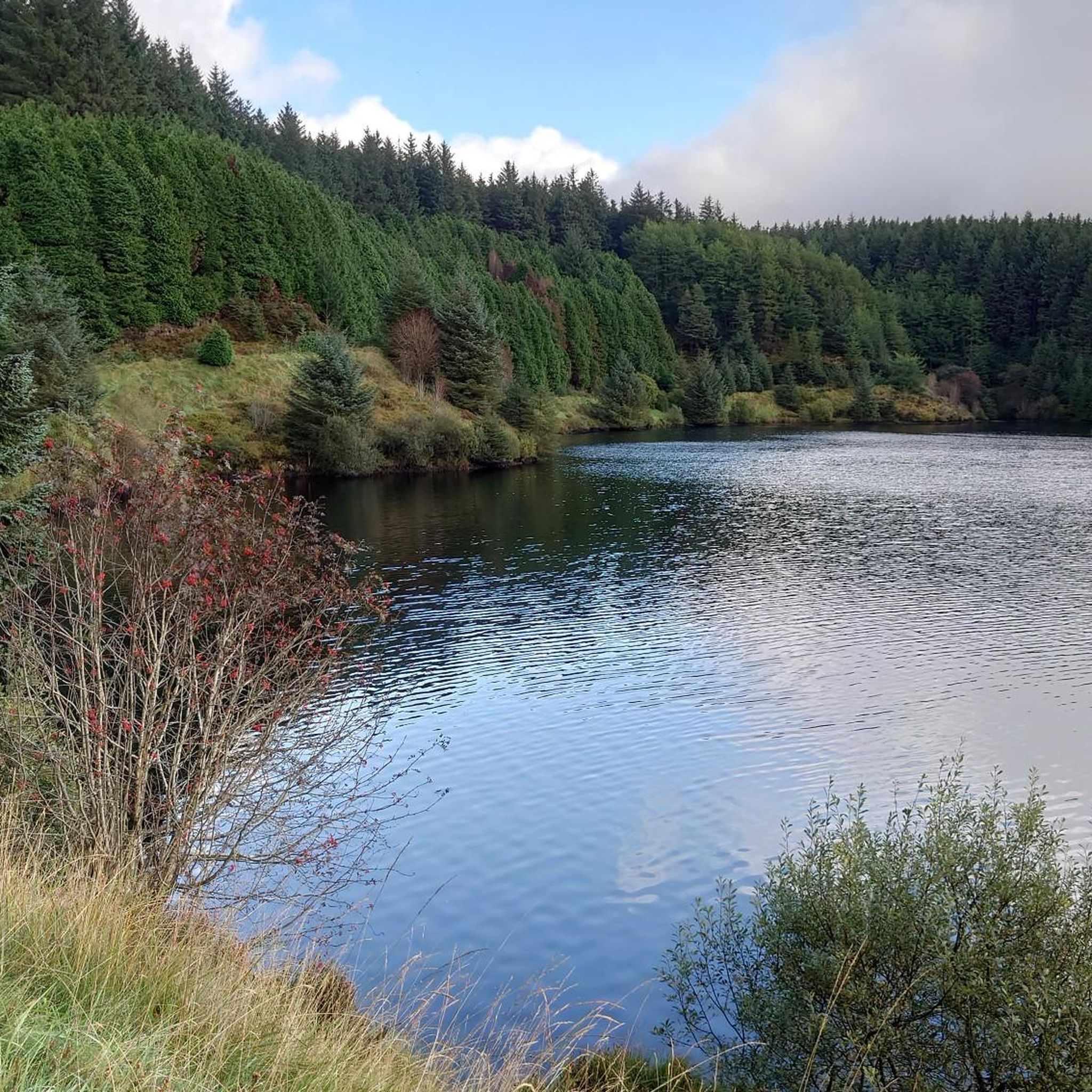
Enjoy tremendous views across Altnaheglish Reservoir from the Banagher Dam wall.
2
0
Enjoy some peace and serenity as you walk along the shores of the beautiful and calm Altnaheglish Reservoir, situated in the Sperring Area of Natural Beauty. The reservoir is located in the Banagher Forest, which is home to some of the oldest ancient oak woodlands in Ireland. It's a true place of beauty!
2
0

Banagher Dam was built in the 1930's, is 42m high and spans a gap of 110m. It is NI's highest dam with a capacity of 2270 million litres of water! On the banks of the reservoir sits some of Irelands most ancient oak woodland with plenty of footpaths to explore it.
1
0

superb view over Moneyneany
1
0
Frequently Asked Questions
Are dogs allowed in Banagher Forest?
Yes, dogs are generally welcome in Banagher Forest, but they must be kept on a lead and under control at all times. This is particularly important as the area is a National Nature Reserve and home to sensitive wildlife and grazing livestock.
Is there parking available at Banagher Forest?
Yes, there is a car park at the entrance to Banagher Glen. However, it can fill up quickly, especially on weekends and during holidays. It's recommended to arrive early to secure a spot. The main trails, including the path to the Altnaheglish Reservoir, start from here.
Are there any easy, family-friendly walks in the area?
While many trails in Banagher Forest involve a steady incline, the initial walk along the forest road through Banagher Glen can be suitable for families. The path is wide, though it is a continuous uphill walk to the dam. It's best to gauge your family's ability and turn back when needed. The scenery within the ancient woodland is rewarding even on a shorter walk.
What are the opening times for Banagher Glen?
Banagher Glen is accessible to the public at all times. However, as there is no lighting on the trails, it is strongly advised to plan your hike during daylight hours and allow plenty of time to return to the car park before dusk.
How long do the hikes in Banagher Forest typically take?
Hike durations vary depending on the route. A popular option is the 8.2-mile (13.3 km) Banagher Glen Forest Trail — Sperrins, which takes most people just over 3.5 hours. Shorter walks are possible by simply turning back at any point, while more challenging routes can take longer.
What is there to see besides the woodland?
A major highlight is the Altnaheglish Reservoir and Dam, the tallest dam in Northern Ireland. The trails leading up to and around it offer fantastic views. The steep-sided Banagher Glen itself is one of Ireland's largest ancient oak woodlands, and the Owenrigh River flows through it, adding to the scenic beauty.
Are there any challenging hikes in the area?
For a more strenuous hike, consider the Spelhoagh – Craigagh Hill loop from Feeny. This 8.6-mile (13.9 km) route involves over 570 meters of ascent, taking you into the open terrain of the Sperrin Mountains and rewarding you with panoramic views.
What kind of wildlife might I see in Banagher Forest?
The forest is a Special Area of Conservation with rich biodiversity. Keep an eye out for bird species like buzzards and sparrowhawks. If you're patient and quiet, you might spot red squirrels. In spring, the woodland floor is famous for its carpet of bluebells.
Are the trails well-marked?
There are no officially waymarked routes within Banagher Forest. Most hikers follow the main forest roads and paths. It is highly recommended to use a navigation app like komoot and download your route map for offline use before you go, as mobile signal can be unreliable in the glens.
Can I get to Banagher Forest using public transport?
Reaching the main car park for Banagher Forest via public transport is very difficult due to its rural location. The nearest town is Dungiven, a few miles away, but there is no direct bus service to the forest entrance. Arriving by car is the most practical option.
What are the trail conditions like?
The main path from the car park to the dam is a tarmac and gravel forest road with a steady incline. Other paths can be uneven, muddy, and slippery, especially after rain. Proper waterproof hiking boots with good grip are essential for exploring beyond the main track.
Are there any circular walks available?
Yes, there are several loop trails. For a shorter but scenic loop with great views, the Eagle Rock (Craig-na-shoke) loop from Draperstown is a great option. It's a moderate 4.2-mile (6.7 km) hike that takes around 2 hours to complete.

Get inspired with the komoot mobile app


Explore more
Browse the best Hikes in other regions.
