The best road cycling routes in Perimetro Florestal Do Rio Mau
5.0
(3)
432
riders
37
rides
Road cycling routes in Perimetro Florestal Do Rio Mau traverse a region characterized by varied terrain, including riverine landscapes along the Rio Mau and forested areas. The area offers a mix of flat sections and routes with significant elevation gain, providing diverse challenges for road cyclists. This environment supports both accessible paths and more demanding climbs, making it suitable for different skill levels.
Best road cycling routes in Perimetro Florestal Do Rio Mau
- The most popular road cycling route is…
Last updated: July 11, 2026
5.0
(1)
20
riders
64.9km
03:16
1,010m
1,010m
Hard road ride. Very good fitness required. Mostly well-paved surfaces and easy to ride.
15
riders
Hard road ride. Very good fitness required. Some segments of this route may be unpaved and difficult to ride.

Sign up for free
5
riders
81.0km
04:22
1,540m
1,540m
Hard road ride. Very good fitness required. Mostly well-paved surfaces and easy to ride.
3
riders
84.9km
04:21
1,380m
1,380m
Hard road ride. Very good fitness required. Mostly well-paved surfaces and easy to ride.
42
riders
101km
04:14
490m
490m
Moderate road ride. Good fitness required. Some segments of this route may be unpaved and difficult to ride.
Get access to more routes and recommendations from other explorers.
Sign up for free
Already have an account?
Our route recommendations are based on thousands of hikes, rides, and runs completed by other people on komoot.
Start today with a free account
Your next adventure awaits.
Login or Signup
Popular around Perimetro Florestal Do Rio Mau
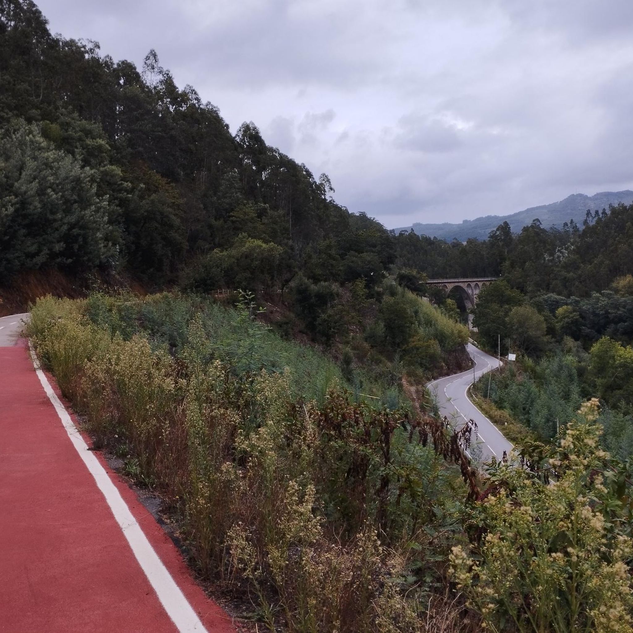
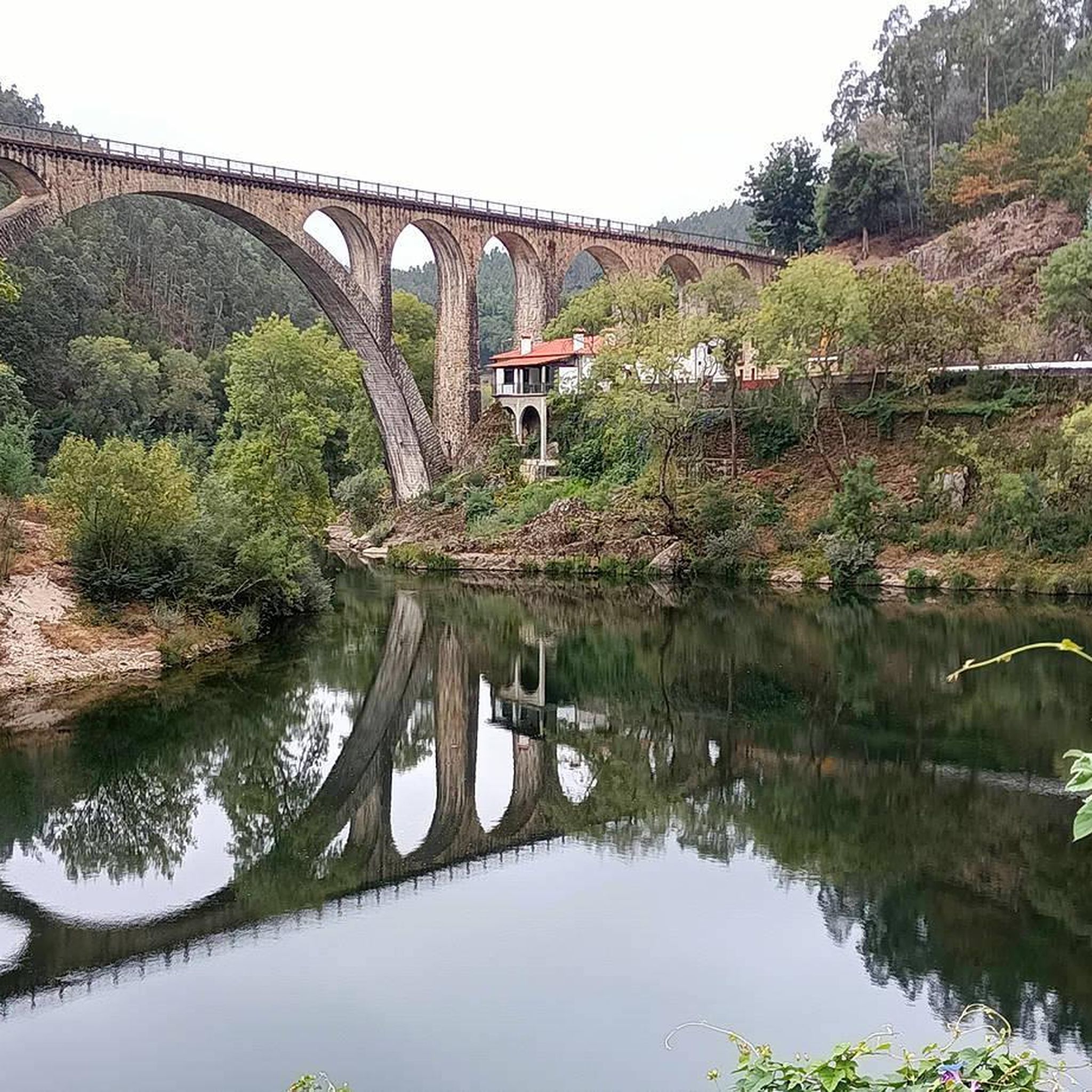

Tips from the Community

Very beautiful place. To rest a little.
1
0
Spectacular view over the river.
1
0

In the past, this bridge was used to be used to ask for the hand of the beloved (engagement bridge).
4
0

Salt mining in the Aveiro region dates back to a time before the Ria de Aveiro itself existed, with the first written document about Aveiro salt production dating back to before the founding of the nation. Over the centuries, the instability of the inlet (isolation from the sea) was a decisive factor in the variation in the number and production of salt pans. This resulted in periods of decline interspersed with periods of great favorability for production. This occurred in 1572, when, given the favorable condition of the inlet and the high and progressive commercial and maritime index, Aveiro became one of the best ports in Portugal, with a significant increase in salt trade and cod fishing. In 1808, the new inlet (an artificial system that allows seawater to enter) was finally opened, a fact of exceptional importance for the future of Aveiro and the entire region. (Source: Wikipedia) (Source: Wikipedia)⁶
13
0
The Palheiros da Costa Nova, or the colorful little houses of Costa Nova, are the old fishermen's warehouses. In other words, these are where they stored their nets, boats, and fishing gear at the end of the day. But what makes the palheiros da Costa Nova so special, and why everyone wants to see them, is their picturesque and colorful appearance. The striped facades leave no one indifferent. And the fact that they are located in a seaside setting attracts even more visitors. Besides the palheiros, Costa Nova offers other must-see attractions for visitors. We're talking about extensive golden sand beaches, ideal for sunbathing or enjoying water sports like surfing and windsurfing. (Source: loveitportugal.com)
13
0
Allows you to cross the Aveiro estuary
11
0
Located on the São Roque canal, the Carcavelos Bridge was built in 1953 to replace the original bridge, which collapsed 11 years earlier. It was a mandatory crossing point for workers on the Sal River. It is one of the oldest and most emblematic bridges in Aveiro. It was built over the São Roque canal. Yellow, adorned with balusters and the city's coat of arms (the eagle represents the symbol of Aveiro), the Carcavelos Bridge can be visited during a stroll through the typical Beira-Mar neighborhood or on one of the many boat tours along the estuary. (www.turismo.portugal.com)
10
0

The most beautiful of the bridges.
2
0
Frequently Asked Questions
How many road cycling routes are available in Perimetro Florestal Do Rio Mau?
There are over 40 road cycling routes in Perimetro Florestal Do Rio Mau, offering a wide range of options for different skill levels and preferences.
Are there road cycling routes suitable for beginners or families in Perimetro Florestal Do Rio Mau?
Yes, the region offers several easier routes. For instance, the Famalicão–Póvoa de Varzim cycle path, though not directly listed in the guide, is known for being largely flat and suitable for families, utilizing an old railway line. Within the komoot selection, there are 4 easy routes and 23 moderate routes, providing accessible options for those new to road cycling or looking for a more relaxed ride.
What kind of terrain can I expect on road cycling routes in Perimetro Florestal Do Rio Mau?
The terrain in Perimetro Florestal Do Rio Mau is quite varied. You'll find riverine landscapes along the Rio Mau, forested sections, and routes with significant elevation changes. This mix provides both accessible flat sections and more demanding climbs, catering to diverse cycling experiences.
Are there any long-distance road cycling routes for experienced cyclists?
Absolutely. For experienced cyclists seeking a challenge, routes like the Ponte do Poço de S. Tiago – Striped Houses of Costa Nova loop from Estação Ferroviária de Paradela (desactivada) offer an extensive 79.0-mile (127.1 km) journey, connecting inland areas with the coastal charm of Costa Nova. There are 13 difficult routes in total for those looking for significant elevation gain and longer distances.
What are some notable natural attractions or viewpoints along the road cycling routes?
The region around Rio Mau is rich in natural beauty. You can expect riverine scenery along the Rio Mau itself, leading to spots like the Poço Negro viewpoint and a natural waterfall. The Baloiço da Boneca (Doll's Swing) in Sebolido also offers spectacular views of the Douro River and the Serra da Boneca, providing stunning natural vistas during your ride.
Are there any circular road cycling routes available?
Yes, many routes in Perimetro Florestal Do Rio Mau are designed as loops. For example, the Paradela Railway Station – Oliveira de Frades loop from Estação Ferroviária de Paradela (desactivada) is a popular 40.3-mile (64.8 km) circular trail. Another option is the Paradela Station – Paradela Railway Station loop from Estação Ferroviária de Paradela (desactivada), which is a moderate 40.5-kilometer (25.2 miles) loop.
What is the best time of year to go road cycling in Perimetro Florestal Do Rio Mau?
While specific seasonal data isn't provided, regions with varied terrain like Perimetro Florestal Do Rio Mau generally offer pleasant cycling conditions during spring and autumn when temperatures are milder. Summer can be enjoyable, especially in shaded forested areas or along riverbanks, but it's always advisable to check local weather forecasts before heading out.
What do other road cyclists enjoy most about the routes in Perimetro Florestal Do Rio Mau?
The routes in Perimetro Florestal Do Rio Mau are highly rated by the komoot community, with an average score of 5.0 stars. Reviewers often praise the diverse terrain, which includes scenic riverine sections and challenging climbs, making it suitable for various skill levels and offering a rewarding cycling experience.
Are there any historical or cultural landmarks to see while cycling?
Beyond natural beauty, the broader region offers cultural points of interest. While not directly on every route, historical sites like the Castelo Vila do Conde (a historic fort) and charming old windmills, such as those near Moinho da Praia de Aguçadoura, add a cultural dimension to the landscape that you might encounter or detour to explore.
Where can I find parking for road cycling routes in Perimetro Florestal Do Rio Mau?
Many routes, particularly those starting from former railway stations or leisure parks, often have designated parking areas. For example, routes like the Paradela Railway Station – Oliveira de Frades loop begin from the Estação Ferroviária de Paradela (desactivada), which typically offers parking facilities. It's always recommended to check the specific route details on komoot for parking information at the starting point.
Are there any cafes or places to stop for refreshments along the routes?
The development of ecotrails and leisure parks, such as the Rio Mau Leisure Park, often includes amenities like cafes or picnic areas. Additionally, the Famalicão–Póvoa de Varzim cycle path is noted for having approximately 12 rest areas, some of which may include cafes. For specific routes, checking the komoot tour details or local maps can help identify refreshment stops.
Most popular routes in Perimetro Florestal Do Rio Mau

Get inspired with the komoot mobile app


Explore more
Browse the best Road cycling routes in other regions.
