The best running trails in Scott State Forrest
12
runners
10
runs
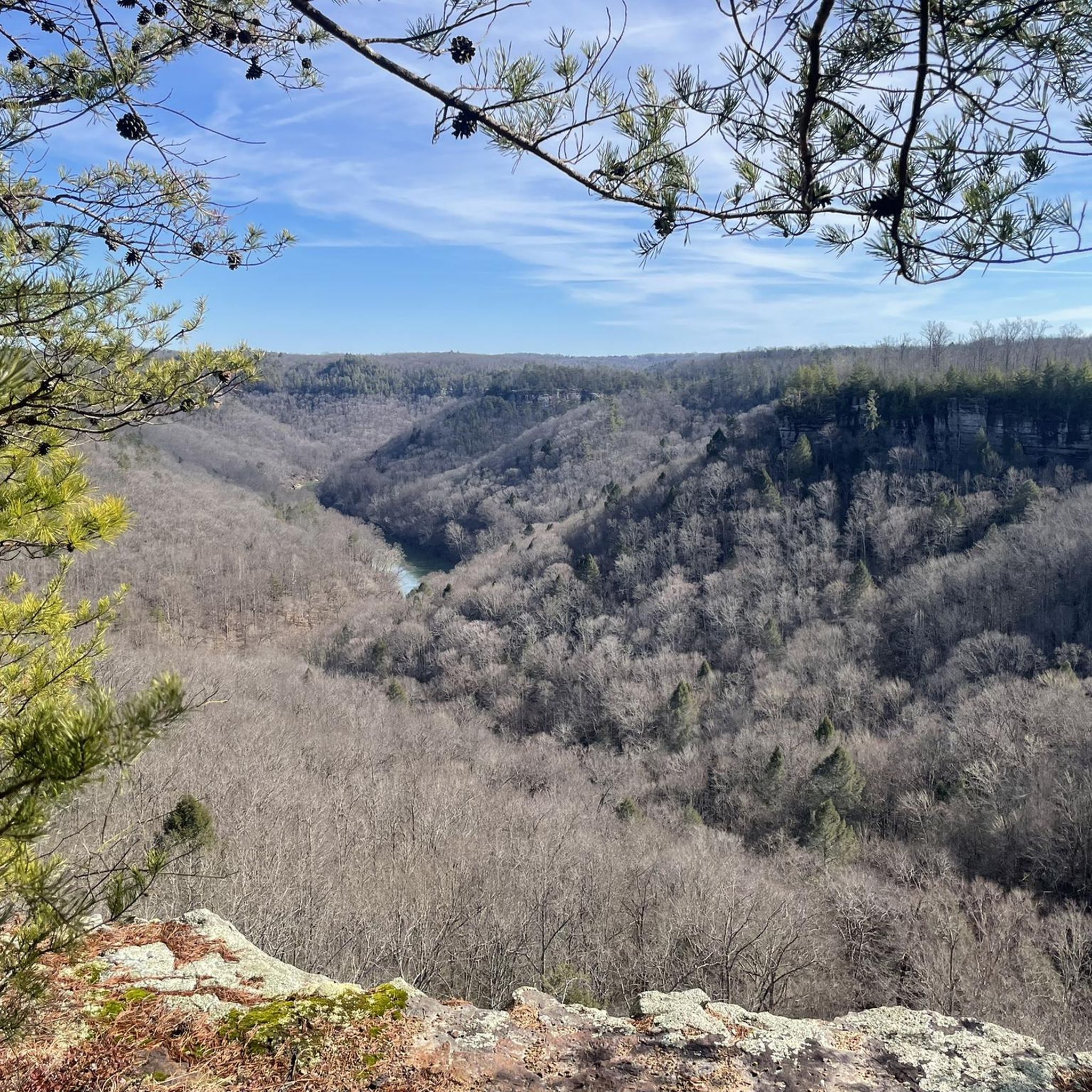
Jogging routes in Scott State Forrest traverse a rugged landscape characterized by hardwood stands, sandstone cliffs, and deep gorges. This region, nestled within the Big South Fork National River and Recreation Area in northeastern Tennessee, offers diverse trails suitable for various fitness levels. Runners can find multi-use paths and old logging roads that provide more even ground, alongside designated hiking trails. The area's natural features include impressive rock formations and tranquil forest environments.
Best jogging routes in Scott State Forrest
…Last updated: August 15, 2026
4
runners
25.0km
03:04
420m
420m
This difficult 15.6-mile jogging loop in Big South Fork National River & Recreation Area offers dramatic gorge views and river overlooks.
4.90km
00:41
170m
160m
Jog the moderate 3.0-mile Leatherwood Loop Trail in Big South Fork National River & Recreation Area, gaining 562 feet with river views.

Sign up for free
6.42km
00:41
80m
80m
Jog the moderate 4.0-mile Angel Falls Trail in Big South Fork National River & Recreation Area, featuring river views and rapids.
5
runners
Hard run. Very good fitness required. Mostly paved surfaces. Suitable for all skill levels.
4.12km
00:30
30m
30m
Jog the easy 2.6-mile Sunset Overlook Trail in Big South Fork National River & Recreation Area for stunning gorge views.
Get access to more routes and recommendations from other explorers.
Sign up for free
Already have an account?
Our route recommendations are based on thousands of hikes, rides, and runs completed by other people on komoot.
Start today with a free account
Your next adventure awaits.
Login or Signup
Popular around Scott State Forrest

Tips from the Community

The John Muir Trail runs flat along the Cumberland River here between Leatherwood Ford and the Grand Gap. There is a dispersed camping site along the middle of the segment.
0
0
This rocky outcropping is warmed by the sun during the day and makes for a fantastic picnic spot with spectacular views over the Cumberland River and Angel Falls. You get more great views of the river as you descend the John Muir Trail just below the overlook.
0
0

The main campground in the Big South Fork National River and Recreation Area acts as a parking area and trailhead for a bunch of different trails and forest roads. The trail signage in Big South Fork is great, and it's easy to find your way back if you decide to deviate from your planned route. Some trails are rougher than others, but they are marked accordingly and intersect each other frequently.
0
0
Walk north a couple feet from the trailhead to see the ruins of an old rail bridge that stretches across the ford. You can walk on part of the bridge quite safely, though most of the middle is washed away. From here you can explore south along the river via the John Muir Trail and Leatherwood Trails, or head north to Angel Falls.
0
0
The trail is easy and well maintained, and you get fantastic views of the Cumberland River. This spot is often fairly secluded and is quite peaceful at sunset.
0
0
The "falls" is a section of the river where the rocky bank closes in and forms a short cascade of white water rapids. This makes for a great picnic area and turn-around point on the trail.
0
0
The trail is a wide, easy, forested route along the riverside with beautiful views across the water.
0
0
The main campground in the Big South Fork National River and Recreation Area acts as a parking area and trailhead for a bunch of different trails and forest roads. The trail signage in Big South Fork is great, and it's easy to find your way back if you decide to deviate from your planned ride. Some trails are rougher than others, but they are marked accordingly and intersect each other frequently.
1
0
Frequently Asked Questions
How many running routes are available in Scott State Forest, and what are their difficulty levels?
Scott State Forest offers a variety of running routes, with over 10 options available. These trails cater to different fitness levels, including 1 easy route, 5 moderate routes, and 4 difficult routes, ensuring there's something for every runner.
Are there any running routes in Scott State Forest suitable for families or beginners?
Yes, for families or those new to running, the forest provides easier options. The Sunset Overlook Trail — Big South Fork National River & Recreation Area is an easy 2.6-mile (4.1 km) path with minimal elevation change, perfect for a relaxing jog. The Bandy Creek Loop Trail, mentioned in regional research, is also known for its relatively flat terrain, making it ideal for a gentle run.
Can I bring my dog on the running trails in Scott State Forest?
While the region is generally dog-friendly, it's always best to check specific regulations for the Big South Fork National River and Recreation Area, which surrounds Scott State Forest. When running with your dog, ensure they are on a leash and that you clean up after them to protect the natural environment and wildlife.
Are there any circular running routes in Scott State Forest?
Yes, several routes offer a circular experience. For a challenging loop, consider the Bandy Creek & Leatherwood Ford loop — Big South Fork National River & Recreation Area, a difficult 15.5-mile (25.0 km) trail. Another option is the John Muir Trail and Leatherwood loop — Big South Fork National River & Recreation Area, a moderate 3.0-mile (4.9 km) path.
What kind of terrain and natural features can I expect while running in Scott State Forest?
Runners in Scott State Forest will encounter a rugged landscape characterized by dense hardwood stands, dramatic sandstone cliffs, and deep gorges. The area, part of the Big South Fork National River and Recreation Area, features impressive natural arches and varied terrain, from multi-use paths and old logging roads to more technical hiking trails.
Are there any scenic viewpoints or landmarks along the running trails?
Absolutely. The region is known for its stunning natural beauty. While specific viewpoints aren't listed for every route, the surrounding Big South Fork area offers scenic vistas, sandstone cliffs, and impressive natural arches. The Angel Falls Trail — Big South Fork National River & Recreation Area, for instance, leads through forested areas and along the river, offering picturesque views.
What is the best time of year to go running in Scott State Forest?
The diverse climate of northeastern Tennessee means running conditions can vary seasonally. Spring and fall generally offer pleasant temperatures and vibrant scenery, with wildflowers in spring and colorful foliage in autumn. Summer can be warm and humid, while winter may bring colder temperatures and potential for icy conditions on trails. Always check local weather forecasts before heading out.
What are some longer, more challenging running routes in the area?
For experienced runners seeking a challenge, the Bandy Creek & Leatherwood Ford loop — Big South Fork National River & Recreation Area is a difficult 15.5-mile (25.0 km) route with significant elevation changes. Another demanding option is the Angel Falls overlook – Bandy Creek Campground loop from Scott State Forest, spanning 16.9 miles (27.2 km) with considerable elevation gain.
Is there wildlife I should be aware of while jogging in Scott State Forest?
Yes, Scott State Forest and the surrounding Big South Fork National River and Recreation Area are home to diverse wildlife. You might encounter whitetail deer, wild turkey, and various bird species. While generally harmless, it's always wise to be aware of your surroundings, especially during dawn and dusk, and maintain a respectful distance from any animals you encounter.
Are there any facilities or accommodations near the running trails?
While specific cafes or pubs aren't detailed, the region is part of the Big South Fork National River and Recreation Area, which includes facilities like the Bandy Creek Campground. This area often serves as a base for outdoor activities, and nearby towns like Oneida, Helenwood, or Huntsville may offer additional services and lodging options.
What is the typical elevation profile for running routes in Scott State Forest?
The running routes in Scott State Forest are characterized by a rugged landscape, meaning elevation profiles can vary significantly. While some paths like the Sunset Overlook Trail have minimal elevation changes, many routes, especially the moderate to difficult ones, feature considerable ascents and descents, such as the Bandy Creek & Leatherwood Ford loop with over 1,300 feet (400 meters) of elevation gain.
Most popular routes in Scott State Forrest

Get inspired with the komoot mobile app


Explore more
Browse the best Running Trails & Routes in other regions.
