The 20 Most Amazing Peaks around Grünhain-Beierfeld
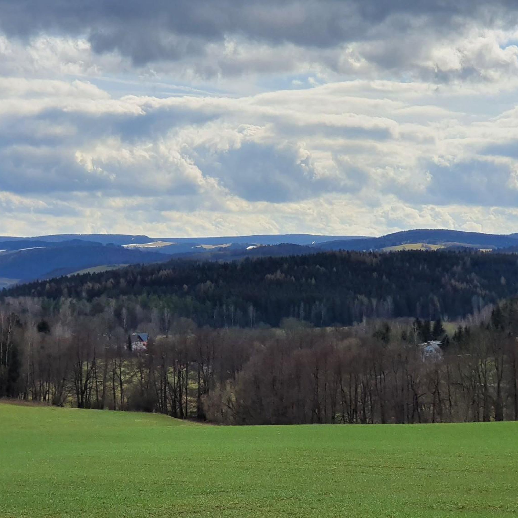
Best mountain peaks around Grünhain-Beierfeld are situated in the scenic Ore Mountains (Erzgebirge) of Saxony, Germany. This region offers access to several notable mountain peaks that provide panoramic views and recreational opportunities. The landscape is characterized by its natural beauty and historical significance, making it a destination for outdoor enthusiasts.
Best mountain peaks around Grünhain-Beierfeld
- The most popular mountain peaks is Katzenstein Triangulation Point, a man-made monument that serves as a measuring point of the Royal Saxon Triangulation. It…
Last updated: August 30, 2026
König Albert Tower (Spiegelwald)
Highlight • Viewpoint
Translated by Google •
Tip by

Scheibenberg Observation Tower and Mountain Inn
Highlight • Viewpoint
Translated by Google •
Tip by

Sign up now to discover places like this
Get recommendations on the best single tracks, peaks, & plenty of other exciting outdoor places.
Sign up for free
Schatzenstein
Highlight • Monument
Translated by Google •
Tip by

Katzenstein Triangulation Point
Highlight • Monument
Translated by Google •
Tip by

Hoher Hahn
Highlight • Summit
sonnenhotels.de/unsere-hotels/sonnenhotel-hoher-hahn
Hotel details
Surrounded by meadows, moors and forests, this historic …
Translated by Google •
Tip by
Sign up for free to discover even more peaks around Grünhain-Beierfeld.
Sign up for free
Already have an account?
Start today with a free account
Your next adventure awaits.
Login or Signup


Other adventures around Grünhain-Beierfeld

Tips from the Community

As guests of the Sonnenhotel, we chose this as our starting point. Don't be confused by the various trail markings along the way, Bremsgrüner Rundgang, W@nderbarer Silberberg, Panoramaweg. Always follow the white, yellow, white marking.
0
0

At Schatzenstein you will find Nagel's Column, Station 127 of the Saxon State Survey of 1864, and the memorial plaque for Max Schreyer, the composer of the "Vuglbärbaam" song. A large rest area with a shelter offers space for a relaxing break.
3
0

"The Royal Saxon Triangulation (here with its historical proper name) is a national survey carried out between 1862 and 1890 on the territory of the Kingdom of Saxony, with the simultaneous creation of a trigonometric network. The goal was to record the national territory with scientific and geodetic precision and, by establishing permanently marked reference points, to create the basis for the production of accurate maps." - https://de.wikipedia.org/wiki/K%C3%B6niglich-S%C3%A4chsische_Triangulirung The triangulation network created by August Nagel was considered one of the most accurate surveying networks in the world at the time. The Nagel columns are preserved today as technical monuments. From the Katzenstein station, the stations of Pfaffenberg (near Hohenstein-Ernstthal), Steinkamm, Schatzenstein, Hirschenstein, and Reinsdorf were surveyed. All of these mountains can still be seen today, along with many more. On a clear day, you can enjoy a fabulous panoramic view of the Ore Mountains, Vogtland, Fichtel Mountains, and the Ore Mountains foothills around Zwickau and Chemnitz.
2
0
The Royal Saxon Triangulation (here with its historical proper name) is a state survey carried out in the years 1862 to 1890 on the territory of the Kingdom of Saxony, with the simultaneous creation of a trigonometric network. The aim was to capture the state territory with scientific-geodetic accuracy and to create the basis for the production of accurate map works by establishing permanently marked fixed points. The triangulation network created by August Nagel was considered one of the most accurate survey networks in the world at its time. The Nagel's columns are preserved today as technical monuments. From Schatzenstein, the stations Greifenstein, Scheibenberg, Fichtelberg, Hirschensprung, Auersberg, Hirschenstein, and Katzenstein were sighted. Unfortunately, this panoramic view is no longer available.
2
0

The Schatzenstein is a 760.4 m high mountain in the Ore Mountains. The Schatzenstein lies directly northwest of the town of Elterlein, on the municipal borders with Zwönitz and Grünhain-Beierfeld in the Grünhain Forest. The Schatzenstein area is a popular hiking destination with several phyllite cliffs, some reaching up to ten meters in height. However, due to the dense forest, there are hardly any distant views. At the highest point of the Schatzenstein stands a pillar of the Royal Saxon Triangulation, and a memorial plaque for the dialect poet Max Schreyer, commemorating the 100th anniversary of the creation of his well-known song "Dar Vuglbärbaam," is embedded in the rock. Max Schreyer was the head forester of this district between 1887 and 1893.
1
0

The "König-Albert-Turm" on the 728 m high Spiegelwald is a worthwhile destination at any time of the year. 180 steps lead up to the viewing platform, which can also be reached quickly and easily by lift (suitable for wheelchair users). Located between Grünhain-Beierfeld and Bernsbach, the tower is the only barrier-free viewing tower in the Ore Mountains. On the 1st floor, the "Multimedia Cultural Landscape" invites you on an informative, virtual journey of discovery on 200 square meters. The restaurant next to the observation tower takes care of your physical well-being. https://www.erzgebirge-tourismus.de/
4
0

Measuring point of the Royal Saxon Triangulation!
3
0

Guesthouse on the summit of the Scheibenberg, price-performance ratio completely okay, a worthwhile excursion destination
11
0
Frequently Asked Questions
What are some popular mountain peaks to visit around Grünhain-Beierfeld?
The region offers several notable peaks. The Spiegelwald, with its König-Albert-Turm, is a popular excursion destination. Another prominent peak is the Scheibenberg, known for its distinct basalt formations and observation tower. Additionally, the Katzenstein Triangulation Point is highly rated for its idyllic setting and great views.
Which mountain peaks offer the best panoramic views?
For spectacular panoramic views, the Spiegelwald is an excellent choice. From its König-Albert-Turm, you can see a large portion of the Ore Mountains crest, including the Fichtelberg, and even the Leipzig skyline on clear days. The Scheibenberg Observation Tower also provides impressive vistas, including the Cranzahl dam, Fichtelberg, and Klínovec in the Czech Republic.
Are there any historical sites or monuments on the mountain peaks?
Yes, several peaks have historical significance. The Spiegelwald was a strategic outpost around 1200. You'll also find triangulation points like the Schatzenstein Triangulation Pillar, which marks the site of the Royal Saxon Triangulation of 1864, and the Katzenstein Triangulation Point, a measuring point of the Royal Saxon Triangulation.
Are there family-friendly mountain peaks or activities in the area?
Absolutely. The König-Albert-Turm on the Spiegelwald is wheelchair-friendly, with an elevator to its observation platform, making it accessible for families with strollers or those with mobility challenges. The Dr. Köhler Tower and Glöckner Inn on the Gleesberg is also considered family-friendly. Additionally, Hoher Hahn offers a playground and mini-golf, making it a great stop for families.
What kind of hiking trails can I find near these mountain peaks?
The region offers a variety of hiking trails suitable for different skill levels. For easier walks, you can explore routes like the 'View of König-Albert-Turm – Bärenrundweg Bernsbach loop' or the 'Bernsbach Observation Tower – König Albert Tower (Spiegelwald) loop'. You can find more options and detailed routes in the Easy hikes around Grünhain-Beierfeld guide.
Are there cycling opportunities around the mountain peaks?
Yes, the area is well-suited for cycling. You can find routes for touring bicycles, such as the 'View of Fichtelberg – Eisenweg Trail loop', or explore gravel biking trails like the 'View of the Valley – View of Spiegelwald Tower loop'. Discover more routes in the Cycling around Grünhain-Beierfeld and Gravel biking around Grünhain-Beierfeld guides.
Are there places to eat or stay near the mountain peaks?
Many peaks offer amenities. The Spiegelwald has the Spiegelwaldbaude, a mountain inn with a beer garden. On the Scheibenberg, you'll find a biker-friendly mountain inn. The Dr. Köhler Tower is accompanied by the Glöckner Inn. For a more comprehensive stay, Hoher Hahn features a hotel with a restaurant, spa, and various recreational facilities.
When is the best time to visit the mountain peaks in Grünhain-Beierfeld?
The Ore Mountains are beautiful year-round. For clear panoramic views, spring and autumn often provide crisp air and good visibility. Autumn also brings vibrant foliage, making hikes particularly scenic. Summer is ideal for longer outdoor activities, while winter offers opportunities for snow-covered landscapes, though some facilities might have reduced hours.
What unique natural features can I observe on these peaks?
The Scheibenberg is particularly notable for its distinct basalt formations, with an old quarry visible on its northern side. The preservation of its natural landscape is partly due to a ban on basalt mining enacted in 1928. Many peaks also offer dense forest environments, such as the Schatzenstein.
What do visitors particularly enjoy about the mountain peaks in Grünhain-Beierfeld?
Visitors frequently praise the rewarding views and the combination of natural beauty with historical elements. Many appreciate the well-maintained trails and the amenities available at the summits, such as mountain inns and observation towers. The accessibility of some towers, like the König-Albert-Turm on the Spiegelwald, is also a highlight for many.
Can I find information about the local area at the mountain peaks?
Yes, the König-Albert-Turm on the Spiegelwald houses a tourist information center, 'Multimediale Kulturlandschaft,' which offers a multimedia exhibition about the Ore Mountains. Similarly, the Dr. Köhler Tower includes a tower museum with local information, though it typically has limited opening hours.
Most popular routes around Grünhain-Beierfeld
Most popular attractions around Grünhain-Beierfeld

Get inspired with the komoot mobile app


Explore more
See even more amazing summits around Grünhain-Beierfeld with these guides:
