The best walks and hikes in Jellore State Forest
4.6
(10)
78
hikers
8
hikes
Hiking in Jellore State Forest offers routes through rugged sandstone landscapes, deep river valleys, and extensive eucalypt forests. The terrain features dramatic escarpments and undulating hills, with Hawkesbury Sandstone dominating higher elevations. This area, part of the Greater Blue Mountains World Heritage Area, provides diverse natural features for outdoor exploration. Trails often provide views of the Nattai River as it flows through a remote sandstone gorge.
Best hiking trails in Jellore State Forest
- The most popular hiking route is Box…
Last updated: July 4, 2026
4.7
(3)
23
hikers
Moderate hike. Good fitness required. Easily-accessible paths. Suitable for all skill levels.
4.5
(2)
11
hikers
6.81km
02:01
140m
140m
Hard hike. Good fitness required. Sure-footedness, sturdy shoes and alpine experience required.

Sign up for free
5.0
(1)
3
hikers
Hard hike. Good fitness required. Sure-footedness, sturdy shoes and alpine experience required.
4.0
(1)
9
hikers
6.79km
02:03
110m
110m
Hard hike. Good fitness required. Sure-footedness, sturdy shoes and alpine experience required.
6
hikers
12.3km
04:37
490m
490m
Moderate hike. Good fitness required. Mostly accessible paths. Sure-footedness required.
Get access to more routes and recommendations from other explorers.
Sign up for free
Already have an account?
Our route recommendations are based on thousands of hikes, rides, and runs completed by other people on komoot.
Start today with a free account
Your next adventure awaits.
Login or Signup
Popular around Jellore State Forest
Tips from the Community

From here you get a great view of Forty Foot Falls, and the trail officially ends. There is a large cave behind the falls, and several deep creek pools you can explore from this point if you feel comfortable with it, but be careful and take extra precautions around slippery sections of rock.
0
0
This track runs for about 3.5 kilometres, eventually leading you to a very nice viewpoint of Forty Foot Falls. It is a well-maintained trail that has some sections of raised wooden walkway, as well as some packed dirt sections through forest. Overall, it is an approachable trail, but there is a little bit of climbing, looser footing, and bushwhacking near the falls, so stay aware in that section.
0
0
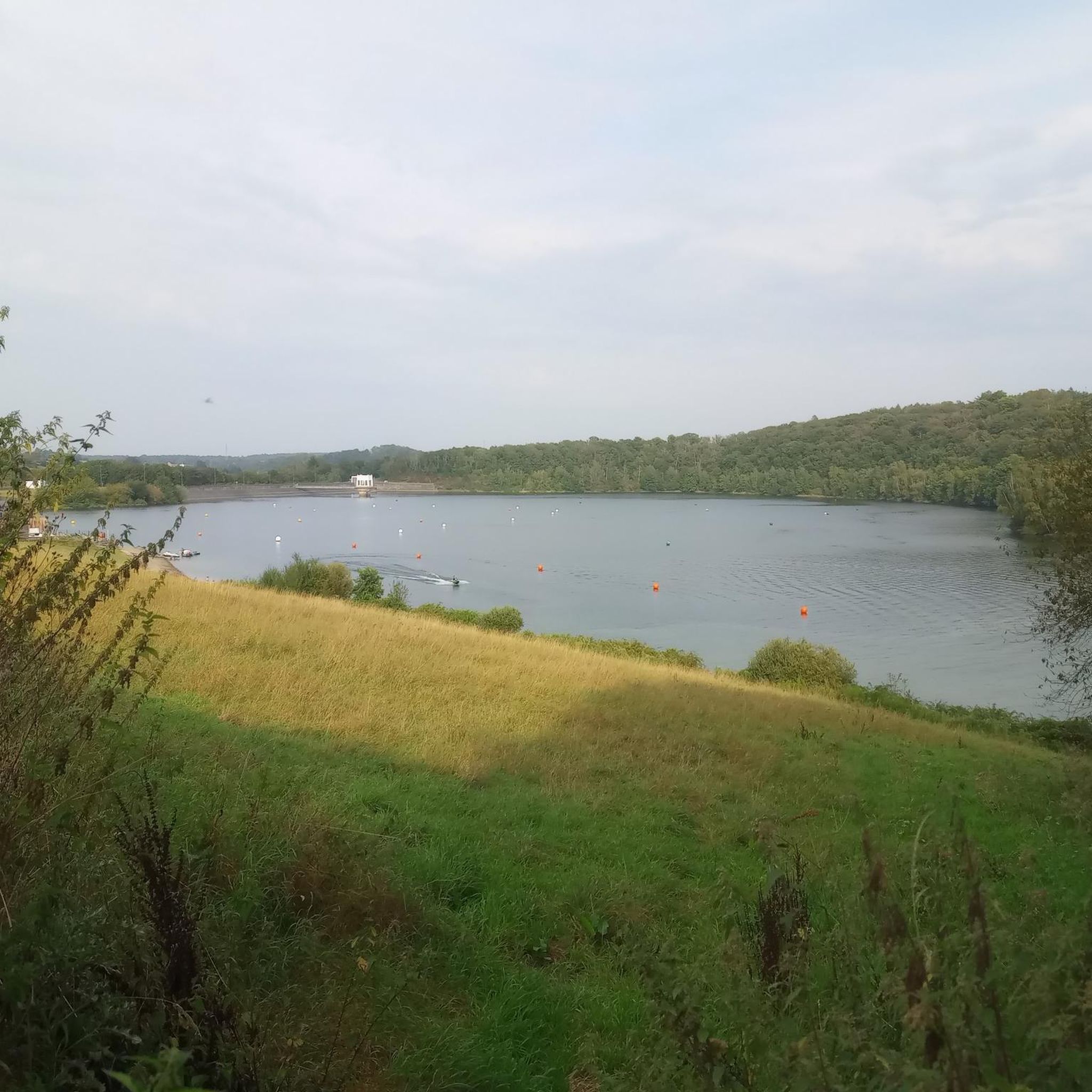
This calm, lakeside recreation area is a great spot to relax and watch the ducks, have a picnic, or to take a walk around the loop trail around the lake. There is also access to several nearby trails that connect to the area, like the walking track to Forty Foot Falls and Mount Alexandra.
0
0

Nattai National Park is a vast wilderness area southwest of Sydney, known for its deep river valleys, sandstone escarpments, and expansive eucalypt forests. With limited road access and few facilities, it retains a remote, undeveloped character that appeals to experienced walkers and nature enthusiasts. The park protects important water catchments and forms part of the Greater Blue Mountains World Heritage Area, highlighting both its ecological and scenic significance.
0
0
Starlights Trail is a remote bushwalk in Nattai National Park that forms part of a larger walking network between Mittagong and Katoomba, passing through untouched wilderness. The track descends into the Nattai Valley, offering sweeping views of the Nattai River, surrounding cliffs, and lookouts, with eucalyptus and pockets of blue-leaved stringybark lining sections of the route. Popular with experienced hikers, it offers a rugged and immersive journey through one of the most secluded landscapes in the Greater Blue Mountains region.
0
0
This viewpoint looks out over the Nattai River as it winds through a remote sandstone gorge within Nattai National Park. From here, it’s only a few metres down to reach the river’s banks, offering a closer perspective of the clear water and surrounding bushland. The river ultimately joins the Wollondilly River and forms part of the Warragamba Dam catchment, underscoring its environmental importance as well as its scenic appeal.
0
0

Steep decline to Nattai River. Was historically part of the supply line for Box Vale Colliery.
0
0
Frequently Asked Questions
What kind of landscapes can I expect to see while hiking in Jellore State Forest?
Jellore State Forest offers a diverse and rugged landscape, characterized by extensive sandstone formations, deep river valleys, and dramatic escarpments. You'll hike through sprawling eucalypt forests and encounter undulating rises and rolling hills. Many trails provide sweeping vistas of the Nattai River as it carves its way through a remote sandstone gorge.
Are there any waterfalls in Jellore State Forest?
Yes, Jellore State Forest is home to notable water features. The Forty Foot Falls loop from Boxvale Tramway Walking Track Carpark is a popular difficult trail specifically leading to a prominent waterfall, traversing varied bushland.
What is the general difficulty level of hiking trails in Jellore State Forest?
The trails in Jellore State Forest range from moderate to difficult, requiring a good level of fitness. Out of the six available routes, two are classified as moderate and four are difficult. Hikers should be prepared for steep descents into creek valleys followed by challenging ascents.
Are there any circular walks available in Jellore State Forest?
Yes, several trails in Jellore State Forest are designed as loops. For example, the Box Vale Incline Cable Route loop from Boxvale Tramway Walking Track Carpark is a moderate 8.1 km circular route, and the Box Vale Incline Cable Route – Forty Foot Falls loop from Boxvale Tramway Walking Track Carpark offers a longer, more challenging 11.1 km loop.
What kind of wildlife might I encounter in Jellore State Forest?
Jellore Flora Reserve is a haven for biodiversity. It's crucial for koala conservation, with documented populations, and provides habitat for other threatened species such as greater gliders, powerful owls, and gang-gang cockatoos. The diverse flora also supports a rich array of native birds and insects.
Is there a notable landmark or viewpoint in the area?
Mount Jellore is a significant landmark within the reserve, known for being home to Australia's first trig station. The summit, which sits on a basalt cap from ancient volcanic activity, offers expansive views of the surrounding landscape and sometimes even the distant Blue Mountains.
How long do hikes in Jellore State Forest typically take?
Hikes in Jellore State Forest vary in length and duration depending on the trail and your pace. For instance, the moderate Box Vale Incline Cable Route loop typically takes around 2 hours 10 minutes, while the more challenging Box Vale Incline Cable Route – Forty Foot Falls loop can take approximately 3 hours 33 minutes.
What do other hikers enjoy most about Jellore State Forest?
The komoot community highly rates Jellore State Forest, with an average score of 4.6 stars from 7 reviews. Hikers often praise the area's rugged and immersive wilderness character, the dramatic sandstone landscapes, and the rewarding views of the Nattai River.
Are there any historical points of interest along the trails?
Yes, some trails offer glimpses into the area's history. The Box Vale Incline Cable Route loop, for example, explores historical railway features as it winds through forest paths, providing a unique blend of nature and heritage.
What is the best time of year to go hiking in Jellore State Forest?
Jellore State Forest can be enjoyed year-round, but spring and autumn generally offer the most pleasant hiking conditions with milder temperatures and less extreme weather. Summer can be hot, and some sections may be steep and slippery in wet conditions, especially after rain.
What should I know about the remote character of Jellore State Forest?
Jellore State Forest maintains a remote and undeveloped character, making it ideal for those seeking an immersive journey through secluded landscapes. Its intact vegetation and remoteness contribute significantly to its high biodiversity and wilderness values. Hikers should be prepared for self-sufficiency and aware that mobile reception may be limited in some areas.
Where can I find more information about the conservation efforts in Jellore State Forest?
Jellore Flora Reserve is managed by NSW National Parks and Wildlife Service, playing a vital role in conservation, particularly for koalas and other threatened species. For more detailed information on conservation and heritage, you can visit the official NSW National Parks website: nationalparks.nsw.gov.au.
Most popular routes in Jellore State Forest

Get inspired with the komoot mobile app


Explore more
Browse the best Hikes in other regions.
