The best walks and hikes around Grad Mali Lošinj
4.5
(777)
3,377
hikers
60
hikes
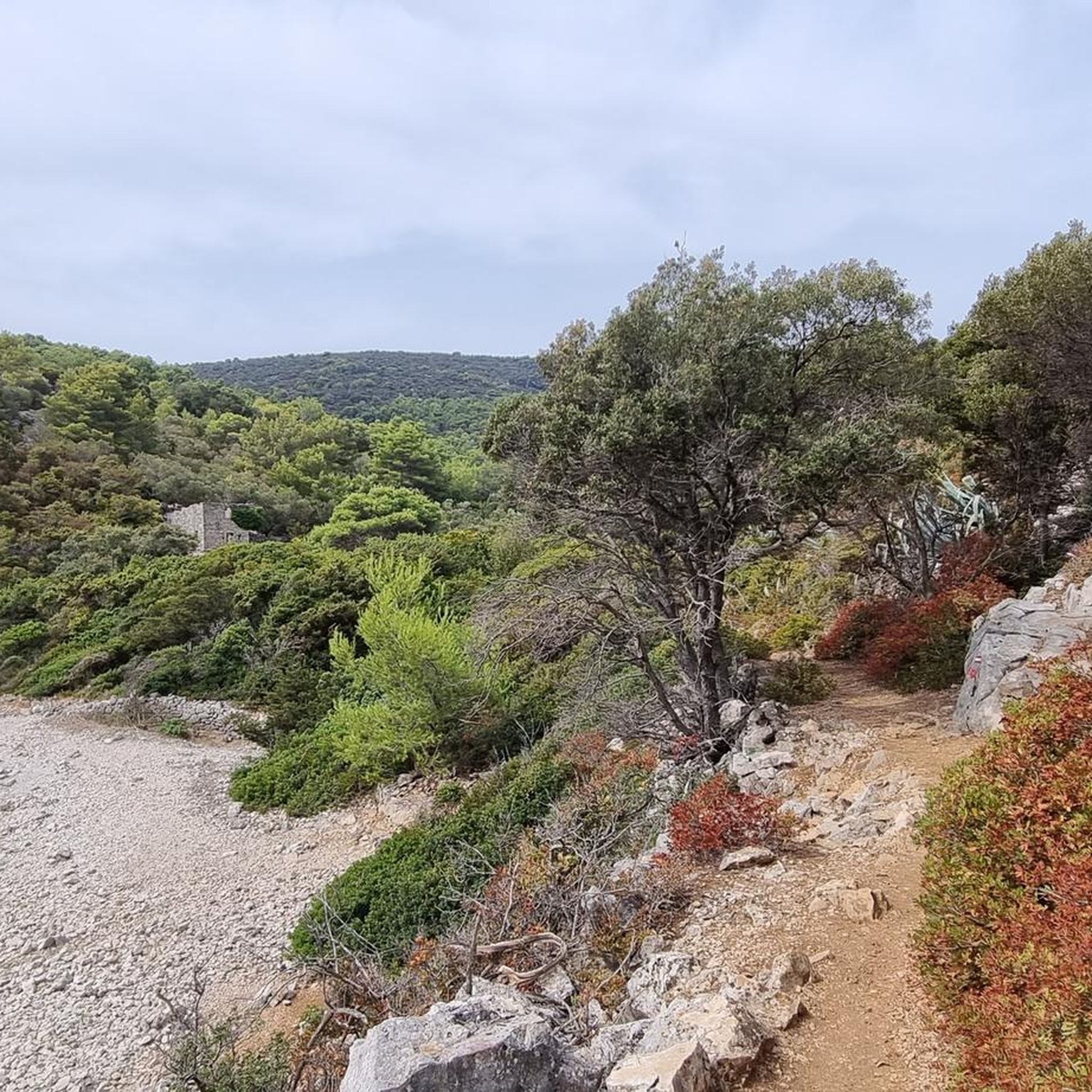
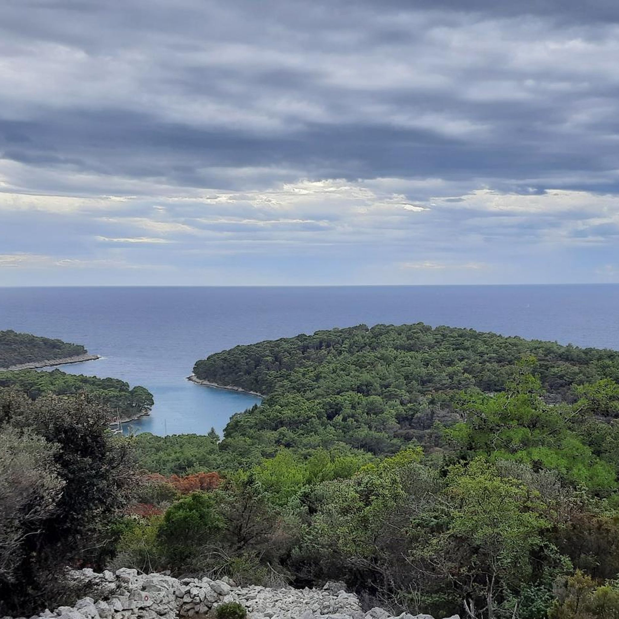
Hiking around Grad Mali Lošinj offers diverse terrain, ranging from gentle coastal paths to more challenging hill trails and fragrant pine forests. The region is characterized by its Mediterranean flora, providing a unique sensory experience along its numerous footpaths. Elevated points across the island offer panoramic views of the surrounding sea and islands. This varied landscape ensures suitable routes for different hiking preferences.
Best hiking trails around Grad Mali Lošinj
- The most popular hiking route is Mali Lošinj Harbor – Coastal Path on Lošinj Island loop from Mali Lošinj, a 5.8 miles (9.3 km) moderate trail that takes about 2 hours 27 minutes to complete, offering views of the harbor and coastline.
- Another top favourite among local hikers is View of Veli Lošinj – View of Veli Lošinj Harbour loop from Mali Lošinj, a moderate 8.9 miles (14.3 km) path. This route provides expansive views of Veli Lošinj Harbour and the surrounding area.
- Local hikers also love the St. Mikul Chapel (Sv. Mikul) – Televrina Summit loop from Nerezine, a 8.7 miles (14.0 km) trail leading through varied terrain to the Televrina Summit, often completed in about 5 hours 42 minutes.
- Hiking around Grad Mali Lošinj is defined by diverse topography, coastal promenades, and fragrant pine forests. The network of trails offers options for different ability levels, from easy strolls to more demanding ascents.
- The routes in Grad Mali Lošinj are highly rated by the komoot community with an average score of 4.5 stars from over 500 reviews. More than 2,400 hikers have used komoot to explore Grad Mali Lošinj's varied terrain.
Last updated: July 1, 2026
4.8
(132)
533
hikers
Moderate hike. Good fitness required. Easily-accessible paths. Suitable for all skill levels.
4.8
(93)
429
hikers
Moderate hike. Good fitness required. Easily-accessible paths. Suitable for all skill levels.

Sign up for free
4.7
(49)
134
hikers
14.1km
04:09
310m
320m
Moderate hike. Good fitness required. Mostly accessible paths. Sure-footedness required.
4.7
(37)
121
hikers
16.8km
04:58
440m
440m
Moderate hike. Good fitness required. Mostly accessible paths. Sure-footedness required.
4.6
(19)
178
hikers
7.59km
02:01
80m
80m
Moderate hike. Good fitness required. Easily-accessible paths. Suitable for all skill levels.
4.6
(34)
93
hikers
8.58km
02:41
210m
210m
Moderate hike. Good fitness required. Mostly accessible paths. Sure-footedness required.
4.7
(19)
66
hikers
24.6km
06:50
420m
420m
Hard hike. Very good fitness required. Easily-accessible paths. Suitable for all skill levels.
4.4
(22)
61
hikers
6.71km
02:07
150m
150m
Moderate hike. Good fitness required. Mostly accessible paths. Sure-footedness required.
4.9
(7)
71
hikers
6.57km
01:41
20m
20m
Easy hike. Great for any fitness level. Easily-accessible paths. Suitable for all skill levels.
4.4
(7)
24
hikers
14.0km
05:43
680m
680m
Hard hike. Very good fitness required. Mostly accessible paths. Sure-footedness required.
Get access to more routes and recommendations from other explorers.
Sign up for free
Already have an account?
Our route recommendations are based on thousands of hikes, rides, and runs completed by other people on komoot.
Start today with a free account
Your next adventure awaits.
Login or Signup

Tips from the Community

We found this tour as a larger round on Komoot. It was described with 14 km and 5 hours 42 minutes. The values given here are pure walking time. We were on the road for a total of 10 hours!!! / 17 km, due to time pressure with few breaks. The round is very difficult to walk, as you are mainly on coarse gravel. Uphill it's not a problem, but downhill. The positive is that the tour is actually excellently marked. There is a marking every 5-10 m. However, you sometimes have to look for them, so you also lose time. Since we still had 3 hours of walking left at 4:30 PM to complete the entire round, we decided to take the 40 minutes according to the signpost directly back up to the transmitter, return to Sv. Nikola and take the same way back downhill. However, it was not indicated that the 40 minutes up to the transmitter is a via ferrata. After 7 hours of walking, we just managed it. We are fit, sporty 60+ and managed to complete this tour via the shortcut just before sunset. In summary: The round is very difficult, good fitness is a prerequisite, start early in the morning so you can complete it calmly without stress and incorporate enough breaks for the beautiful views. And definitely pay attention to the weather forecast, because walking on wet gravel downhill is even more strenuous. Breathtakingly beautiful, but very strenuous!
0
0

Great view, BUT: at the end of June, the path there was overgrown with giant cross spiders in their webs, waiting there for the millions of fluttering moths. Mostly the spiders hang quite high, but you should still be careful if you don't want to have contact. At the summit, hundreds of wasps also awaited us, which simply stung. Biting horseflies were also present. Rather mediocre experience.
1
0

Free parking available, several eateries nearby.
0
0

Beautiful bay for swimming with some shady spots. The restaurant in the next bay is only 10 minutes away by bike.
0
0
Beautiful viewpoint with benches. Religion around.
0
0
The renovation of the water and sewage pipes is now almost complete and the historic cobblestones are back in place.
0
0
At night the lighthouse on Susak dazzles😜
0
0
Frequently Asked Questions
How many hiking trails are there in Grad Mali Lošinj?
Grad Mali Lošinj offers a comprehensive network of over 250 kilometers of footpaths. On komoot, you'll find more than 60 hiking routes, catering to various skill levels and preferences, allowing you to explore the island's diverse landscapes.
What kind of landscapes can I expect to see while hiking in Grad Mali Lošinj?
Hiking in Grad Mali Lošinj provides a rich variety of landscapes. You can expect to traverse gentle coastal paths, explore lush Mediterranean pine forests, and ascend to elevated points offering breathtaking panoramic views of the surrounding islands and the vast turquoise sea. The island is also known as the 'island of scents' due to its abundant fragrant flora.
Are there any challenging hikes for experienced trekkers in Grad Mali Lošinj?
Yes, for more experienced trekkers, Grad Mali Lošinj offers several challenging routes. For instance, the St. Mikul Chapel (Sv. Mikul) – Televrina Summit loop from Nerezine is a difficult 14 km trail leading to the Televrina Summit, the highest peak of the Osoršćica mountain transversal. Another demanding option is the View of Veli Lošinj Harbour – Javorna Bay loop from Koludarc, a difficult 24.6 km route with significant elevation changes.
Are there easy hiking options suitable for families or beginners?
Absolutely. Grad Mali Lošinj has numerous easy trails perfect for families and beginners. Many coastal promenades (lungomares) offer gentle walks with stunning sea views. An example is the Nerezine Harbour – Nerezine Marina loop from Osor, an easy 6.5 km route. These paths often lead to secluded beaches and coves, ideal for a relaxing break.
What are some notable viewpoints or landmarks I can discover on a hike?
Many trails in Grad Mali Lošinj lead to spectacular viewpoints and interesting landmarks. You can hike to Mount Sveti Ivan (St. Ivan's Peak) for unparalleled views of the archipelago, or explore the Osoršćica mountain transversal which includes the St. Gaudens cave and the chapel of St. Michael. Coastal paths like the Promenade of Vitality and the Sunset Promenade also offer scenic vistas. Don't miss the Osor Swing Bridge or the bustling Mali Lošinj Harbor.
Are there any circular hiking routes available?
Yes, many of the hiking routes in Grad Mali Lošinj are circular, allowing you to start and end at the same point. For example, the Mali Lošinj Harbor – Coastal Path on Lošinj Island loop from Mali Lošinj is a popular moderate circular trail. Another option is the Ruins of Veli Tržič – Osor Old Town loop from Osor, which is a moderate 8.5 km circular route.
What do other hikers enjoy most about hiking in Grad Mali Lošinj?
The hiking trails in Grad Mali Lošinj are highly rated by the komoot community, with an average score of 4.5 stars from over 500 reviews. Hikers frequently praise the diverse topography, the fragrant pine forests, and the stunning coastal promenades. The panoramic views from elevated points and the opportunity to discover hidden coves are also often highlighted as favorite aspects.
Is Grad Mali Lošinj suitable for dog-friendly hikes?
While specific dog-friendly regulations can vary, the natural environment of Grad Mali Lošinj with its numerous footpaths and open spaces generally welcomes dogs. Many coastal and forest trails provide ample opportunities for walks with your canine companion. Always ensure your dog is on a leash and respect local signage regarding pet access, especially in protected areas or crowded beaches.
What is the best time of year to go hiking in Grad Mali Lošinj?
Grad Mali Lošinj benefits from a mild climate, making it suitable for hiking year-round. Spring and autumn offer particularly pleasant temperatures for longer excursions, with blooming flora and vibrant autumn colors. Summer is ideal for combining hikes with refreshing dips in the sea, while winter provides a quieter experience with crisp air and fewer crowds.
Are there any historical or cultural sites along the hiking trails?
Yes, hiking trails in Grad Mali Lošinj often weave through areas rich in history and culture. You might encounter centuries-old stone walls, secluded chapels, traditional shepherds' dwellings, and remnants of old military fortifications. These elements add a fascinating cultural dimension to the natural exploration of the island.
Are there any specific safety considerations for hiking in Grad Mali Lošinj?
A reassuring aspect for hikers in Grad Mali Lošinj is the reported absence of poisonous snakes on the archipelago, which can alleviate a common concern for outdoor enthusiasts. However, as with any hiking, it's always advisable to wear appropriate footwear, carry enough water, and be aware of weather conditions, especially during warmer months. Stick to marked trails for your safety.
Can I find hikes that lead to secluded beaches or coves?
Many coastal trails in Grad Mali Lošinj are designed to lead to picturesque hidden coves and secluded beaches. These spots are perfect for a refreshing break, a swim, or simply enjoying the tranquility of nature away from the crowds. The Promenade of Vitality, for example, passes through Valdirke and Vale Škura coves, offering beautiful coastal access.
Most popular routes around Grad Mali Lošinj
Most popular attractions around Grad Mali Lošinj

Get inspired with the komoot mobile app


Explore more
Browse the best Hikes in other regions.
