Attractions and Places To See around gmina Nowe Miasteczko - Top 20
Best attractions and places to see around gmina Nowe Miasteczko, located in western Poland's Lubusz Voivodeship, offer a blend of historical landmarks, cultural sites, and opportunities for outdoor recreation. The region is characterized by a rich local heritage and a distinctive community identity, with a historical urban and landscape complex. Situated on the Biała Woda River, the area also features various forms of nature protection, including landscape parks and Natura 2000 areas. Visitors can explore a range of historical structures…
Last updated: July 1, 2026
Velo Sprotavia Cycling Route
Highlight (Segment) • Cycleway
Translated by Google •
Tip by

Chotków Church
Highlight • Religious Site
Showing Translation
Tip by

Sign up now to discover places like this
Get recommendations on the best single tracks, peaks, & plenty of other exciting outdoor places.
Sign up for free
Church of the Virgin Mary, Kożuchów
Highlight • Religious Site
Translated by Google •
Tip by

Portowy Drawbridge in Nowa Sól
Highlight • Bridge
Translated by Google •
Tip by

Bridge over the Biała Woda
Highlight • Bridge
Translated by Google •
Tip by

Sign up for free to discover even more attractions around gmina Nowe Miasteczko.
Sign up for free
Already have an account?
Start today with a free account
Your next adventure awaits.
Login or Signup

Tips from the Community

The temple was erected at the end of the 13th century from erratic boulders, in the early Gothic style. The first written information about it dates back to 1376. In the 15th century, the church was extended, and in the 16th century, a tower was added, somewhat unusually, from the south side. During the Baroque period, a sacristy was added and the window openings were given a new form (the outline of pointed arch window openings can still be seen on the outer walls). The beautiful 13th-century entrance portal on the south side deserves special attention. It was made of sandstone, is pointed-arched, with profiled offsets, and has columns in the corners. The whole is surrounded by a brick fence, probably from the 15th century.
0
0
The temple was erected at the end of the 13th century from erratic boulders, in the early Gothic style. The first written information about it dates back to 1376. In the 15th century, the church was extended, and in the 16th century, a tower was added, somewhat unusually, from the south side. In the Baroque period, the sacristy was added and the window openings were given a new form (the outlines of pointed-arch window openings can still be seen on the outer walls). The beautiful 13th-century entrance portal on the south side is particularly noteworthy. It was made of sandstone, is pointed-arched, with profiled ledges, and has columns in the corners. The whole is surrounded by a brick fence, probably from the 15th century.
0
0

Unfortunately, this cycle path is not completely finished. The final layer of asphalt over the concrete slabs is missing. The cycle path is apparently rarely cleared and cleaned, which means that you have to cycle very slowly in some sections. The connection to the cycle path at the former Stypułów train station leads along an unpaved gravel road.
0
0
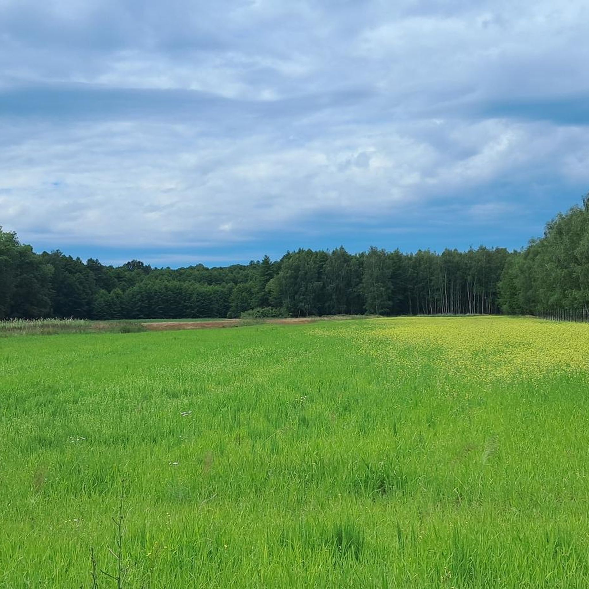
VELO SPROTAVIA is a strategic cycling path in the southern Lubusz Voivodeship. It runs vertically through the Szprotawa commune, from the town of Szprotawa to the village of Stypułów. At the former railway station in Stypułów, it connects with the regional RAILWAY TO BIKE path, which runs to Kożuchów, Nowa Sól, Otyń, Konotop, and the border with the Wielkopolska Voivodeship. The total length of VELO SPROTAVIA is 16 km. The route follows the former Szprotawa-Zielona Góra railway line (1911-1955), along the Szprotawa-Kartowice-Witków-Siecieborzyce-Stypułów section. Initially, the path runs parallel to the district road towards Kartowice, a short distance away. We ascend a gentle hill (141 m above sea level), offering a panoramic view of the surrounding area. Under favorable conditions, we can see the Karkonosze and Jizera Mountains from here. The agricultural landscape is only interrupted by a strip of trees growing along the path, with a significant proportion of fruit trees. According to legend, former passengers of the Zielona Góra railway, by throwing fruit pits out of the train windows, contributed to the creation of a linear orchard of plums, apples, pears, and cherries. From the hill, we descend pleasantly all the way to Kartowice itself, where, near the ruins of the village railway station, a cyclist service area (MOR) has been built, complete with a shelter, table, benches, parking spaces, and a bicycle repair module. No one will likely object if we pitch a tent near the shelter if necessary. It's a very atmospheric place. Near the shelter, we'll see a monument to the residents of Kartowice (Kortnitz in German) who died on the front lines of World War I. After a rest in Kartowice, we head further north, towards Witków. Soon, the agricultural landscape will transform into forest. This preservation owes its historical preservation to the fact that since the Middle Ages, this has been an inviolable border between the duchies of Głogów and Żagań. The forest preserves fragments of the famous Silesian Ramparts, built in the 15th/16th centuries, a kind of border barrier. All the preserved sections of the Silesian Ramparts constitute the longest archaeological site in Poland. The Szprotawa Land Museum holds a unique boundary marker from this forest. Nearby, by the district road, we come across a 19th-century stone signpost pointing the way towards Borowina (orig. "nach Hartau"). Old maps show peculiar enclaves in this area, such as Wilczy zaułek (Wilczy Lane), Krowie Bagno (Ciche Hill).
0
0
The bridge is closed to car traffic
0
0

The stylish bridge over the White Water will replace the traditional improvisation of the crossing with beams, planks and rubber. But I have already met cyclists who, admiring the new bridge, nostalgically recall the old days, when they were accompanied by a hint of uncertainty - whether they will succeed or not with dry feet on the other side.
0
0

A very pleasant bike path
0
0

Edit: The beautiful new bridge is now open to traffic! The new bridge is scheduled to open in May 2025 👌💪🫶 as part of the new asphalt section from Kiełcz to the Prussian Route.
0
0
Frequently Asked Questions
What historical sites can I explore in and around gmina Nowe Miasteczko?
The region is rich in history. You can visit the Church of St. Mary Magdalene, a 14th-century parish church with Baroque interiors, and the Renaissance Town Hall, built between 1664 and 1665 in Nowe Miasteczko. Another significant religious building is the Church of the Virgin Mary, Kożuchów, a Gothic parish church dating back to the end of the 13th century. Don't miss the Bytom Odrzański Market Square, known for its impressive Renaissance Town Hall and historic tenement houses.
Are there good cycling opportunities in gmina Nowe Miasteczko?
Yes, gmina Nowe Miasteczko is excellent for cycling. The Velo Sprotavia Cycling Route is a strategic path running through the Szprotawa commune, offering picturesque journeys along a former railway line. It's 16 km long and connects to the regional RAILWAY TO BIKE path. You can find more routes in the Road Cycling Routes around gmina Nowe Miasteczko guide.
What natural features can I discover in the area?
The gmina features various forms of nature protection, including landscape parks and Natura 2000 areas, offering opportunities for nature observation. The town itself is located on the Biała Woda River, and a newly replaced Bridge over the Biała Woda is part of an asphalt section connecting Kiełcz to the Prussian Route, making it accessible for cyclists and walkers.
Are there any family-friendly attractions or activities?
Absolutely! The Velo Sprotavia Cycling Route is considered family-friendly, offering a pleasant and mostly flat path for all ages. Additionally, the Bytom Odrzański Market Square provides an open, historical space that families can explore together, with views of the Odra River.
Where can I go hiking or walking near gmina Nowe Miasteczko?
The region offers beautiful routes suitable for hiking and walking. The Dziadosze Trail (Szlak Dziadoszan) is a regional trail designed to showcase the natural and cultural heritage of the Dalkowskie Hills. For more detailed routes, explore the Hiking around gmina Nowe Miasteczko guide, which includes options like the 'Dalkowskie Wzgórza loop from Gostyń'.
What is the Portowy Drawbridge in Nowa Sól?
The Portowy Drawbridge in Nowa Sól is a unique technical monument. It's the only movable bridge in Poland with a lifting span, built in 1927. Located over the port canal, it represents significant engineering from the early 20th century and is a valuable historical structure.
What do visitors enjoy most about the attractions in gmina Nowe Miasteczko?
Visitors appreciate the blend of historical charm and outdoor recreation. The Velo Sprotavia Cycling Route is praised for being a very pleasant bike path, offering scenic views and a connection to other regional routes. The historical sites, like the Bytom Odrzański Market Square, are noted for their atmospheric beauty and impressive architecture.
Are there any running trails available?
Yes, if you enjoy running, you'll find several options. The Running Trails around gmina Nowe Miasteczko guide lists various routes, including a 'Running loop from Nowe Miasteczko' that covers nearly 7 km, offering a moderate challenge.
What is the significance of the Urban and Landscape Complex in Nowe Miasteczko?
The Urban and Landscape Complex in Nowe Miasteczko signifies a preserved town layout and aesthetic that reflects its rich past. It offers a glimpse into the historical development and architectural heritage of the gmina, showcasing how the town has maintained its distinctive character over centuries.
Can I find any remnants of old city fortifications?
While the city walls of Nowe Miasteczko ceased to exist in the early 19th century, fragments of them may still be present. The town's historical origins trace back to the 13th century, and remnants of a former castle, located within the city's fortifications, can also be explored for those interested in its defensive past.
What is the Church of Divine Providence?
The Church of Divine Providence (Kościół Opatrzności Bożej) is a classical-style building constructed between 1784 and 1785. It formerly served as an evangelical church and stands as another notable historical structure within the gmina, showcasing different architectural periods.
Are there any easy hiking trails for beginners?
Yes, for those looking for easier walks, the Hiking around gmina Nowe Miasteczko guide includes options like the 'Dalkowskie Wzgórza loop from Gostyń', which is rated as easy and covers approximately 4.4 km, perfect for a leisurely stroll.
Most popular routes around gmina Nowe Miasteczko
Most popular attractions around gmina Nowe Miasteczko

Get inspired with the komoot mobile app


Explore more
Still not found the Highlight you’re looking for? See guides of the top attractions in other regions:
