The best walks and hikes around Bandeiras
4.3
(1153)
6,677
hikers
112
hikes
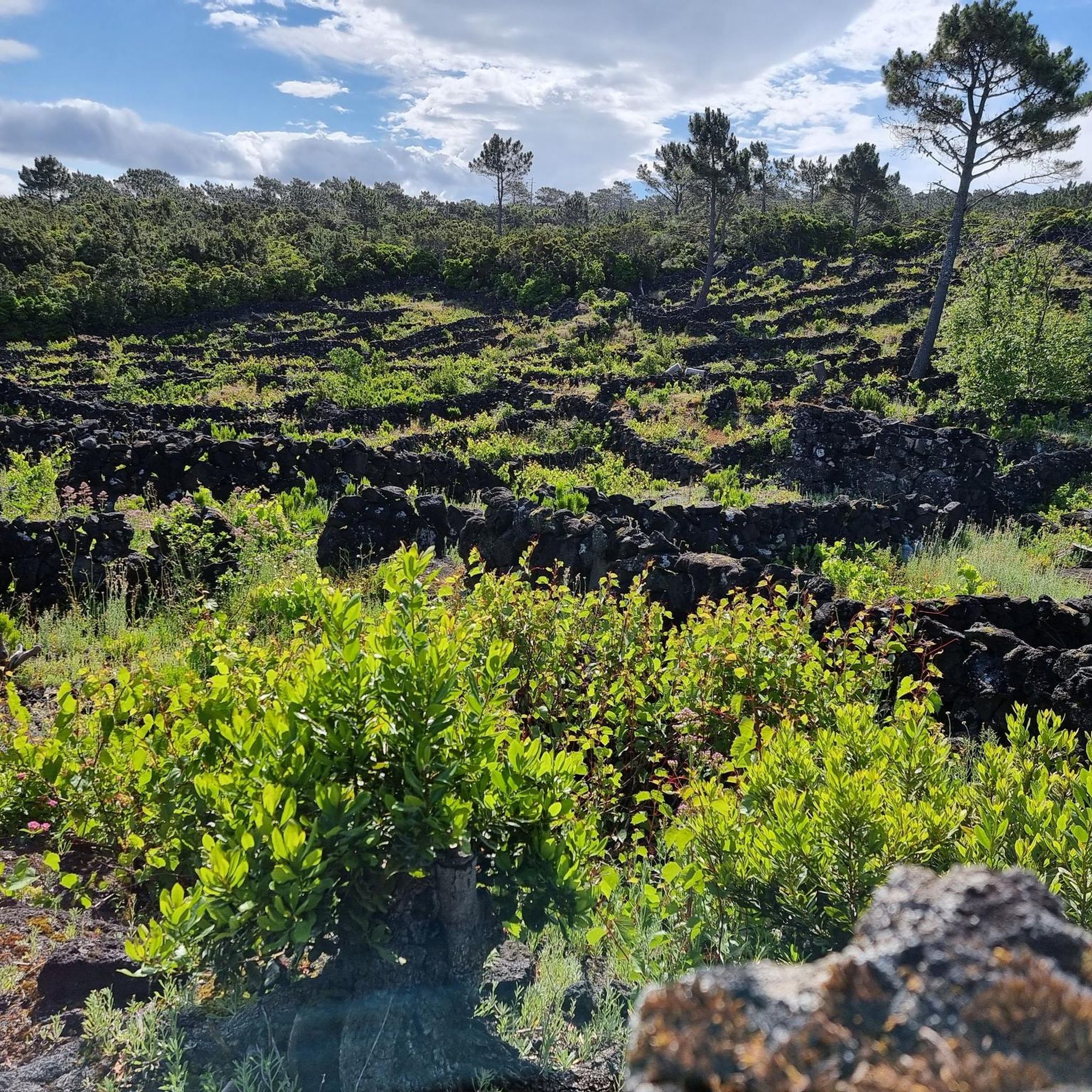
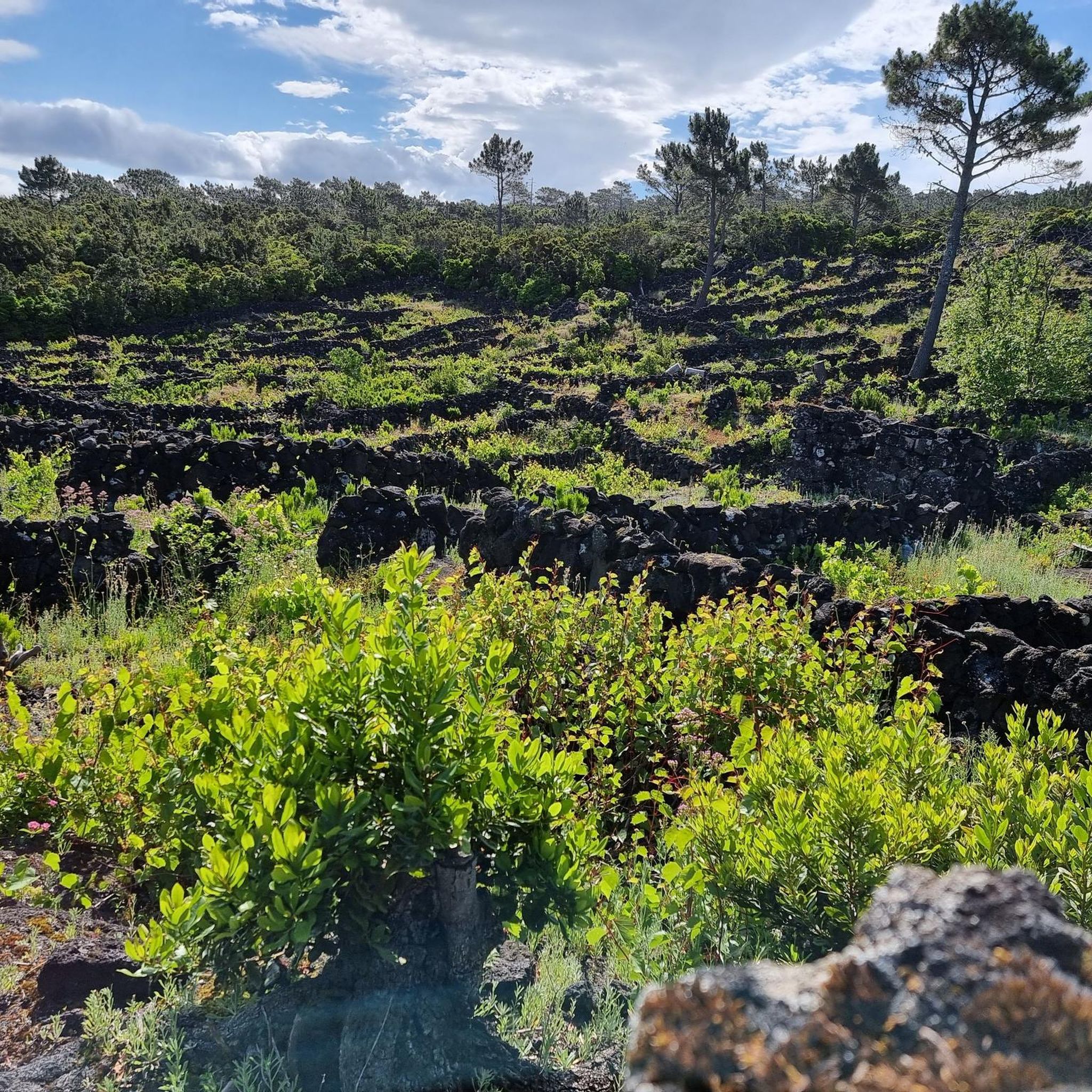
Hiking trails around Bandeiras, located on Pico Island in the Azores, are characterized by volcanic landscapes and coastal paths. The region features the prominent Pico Mountain, Portugal's highest peak, alongside diverse terrain including vineyards and traditional villages. The trails offer varied elevations, from sea-level walks to challenging ascents.
Best hiking trails around Bandeiras
- The most popular hiking route is Ascent of Pico Mountain — route on Pico Island, a 4.7 miles (7.6 km) difficult trail that takes about 6…
Last updated: June 24, 2026
4.8
(365)
2,783
hikers
7.55km
05:58
1,020m
1,020m
Hard hike. Very good fitness required. Sure-footedness, sturdy shoes and alpine experience required.
4.5
(13)
98
hikers
11.1km
03:11
270m
260m
Moderate hike. Good fitness required. Easily-accessible paths. Suitable for all skill levels.

Sign up for free
4.7
(6)
46
hikers
14.2km
03:55
240m
240m
Moderate hike. Good fitness required. Easily-accessible paths. Suitable for all skill levels.
4.6
(35)
140
hikers
5.78km
01:38
130m
130m
Easy hike. Great for any fitness level. Easily-accessible paths. Suitable for all skill levels.
4.6
(33)
139
hikers
5.66km
01:36
130m
130m
Easy hike. Great for any fitness level. Easily-accessible paths. Suitable for all skill levels.
Get access to more routes and recommendations from other explorers.
Sign up for free
Already have an account?
Our route recommendations are based on thousands of hikes, rides, and runs completed by other people on komoot.
Start today with a free account
Your next adventure awaits.
Login or Signup
Tips from the Community

The route runs the other way around, so at the end it goes along the sea.
0
0

Cold and hot drinks! Ice cream! Enjoy!
0
0
It is the highest mountain in Portugal, the third highest mountain in the Atlantic, and on top of that, you can experience the heat emanating from a virtually extinct volcano at the summit!
1
0

Permission for the climb is necessary and can be applied for online, costs 25€ per person.
3
1

For those who are going to venture up Pico Mountain, Casa da Montanha is a mandatory stop. Its function is to register and control those who decide to venture towards the summit. A prior authorization request must be made. For those who just come to cycle, it is possible to find something to eat.
0
0
Mandatory stop before starting the climb to the top of Pico Mountain. Its function is to register and control those who decide to venture towards the peak. A prior authorization request must be made. There are educational panels on site and you can find something to eat as a snack.
1
0
One of the striking features of the Azores are the trails marked by the constant passage of ox carts, which were once the predominant means of transporting supplies. This excerpt highlights the activity.
0
0

From here the climb up to the Pico summit begins... Buy your ticket and enjoy the view as you climb
1
1
Frequently Asked Questions
How many hiking trails are available around Bandeiras?
There are over 110 hiking trails around Bandeiras, offering a wide variety of options for different skill levels. This includes 51 easy routes, 55 moderate routes, and 7 difficult trails, ensuring there's something for everyone.
What do other hikers enjoy most about hiking in Bandeiras?
The hiking trails around Bandeiras are highly rated by the komoot community, with an average score of 4.3 stars from over 1000 reviews. Hikers frequently praise the unique volcanic landscapes, the stunning coastal views, and the traditional vineyard scenery that defines the region.
Are there easy hiking trails suitable for beginners in Bandeiras?
Yes, Bandeiras offers a good selection of easy trails perfect for beginners or those looking for a relaxed walk. For example, the Hiking loop from Aeroporto da Ilha do Pico is an easy 5.8 km route, and the Hiking loop from Santa Luzia is another accessible 5.7 km option.
Are there any circular hiking routes around Bandeiras?
Yes, there are several circular routes. A popular moderate option is the Caminhos de Santa Luzia — circular route on the Island of Pico (PR 1 PIC), which is 11.1 km long and explores the island's interior, passing through varied vegetation and rural areas.
Can I hike with my dog on trails around Bandeiras?
While many trails on Pico Island are generally accessible, it's always recommended to check specific trail regulations for dog access, especially within protected natural areas or private land. Keep your dog on a leash and be mindful of local wildlife and other hikers.
Are there family-friendly hiking options in Bandeiras?
Yes, many of the easier routes around Bandeiras are suitable for families. Trails with less elevation gain and shorter distances, such as the loops starting from Aeroporto da Ilha do Pico or Santa Luzia, provide enjoyable experiences for all ages. These trails often offer scenic views without being overly strenuous.
What kind of landscapes or natural attractions can I expect to see on hikes near Bandeiras?
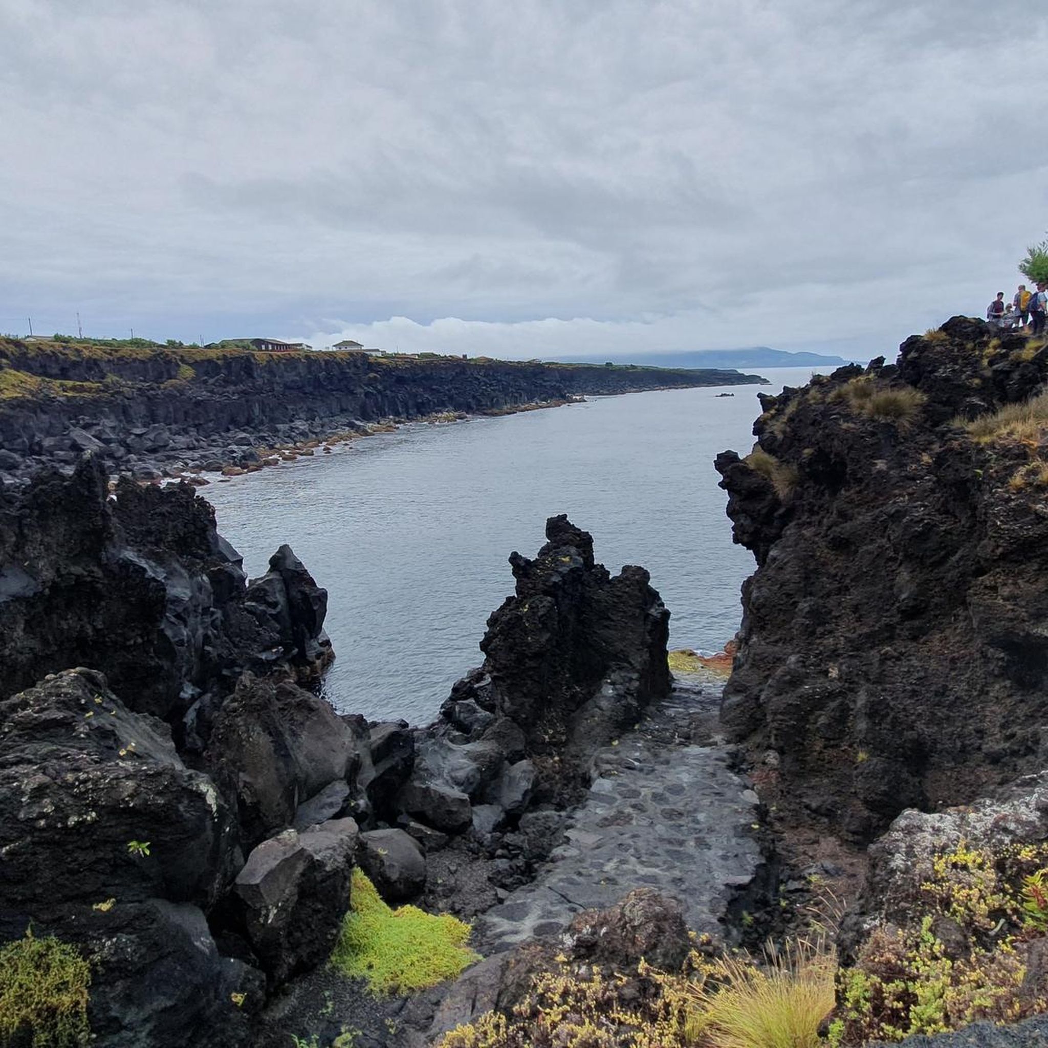
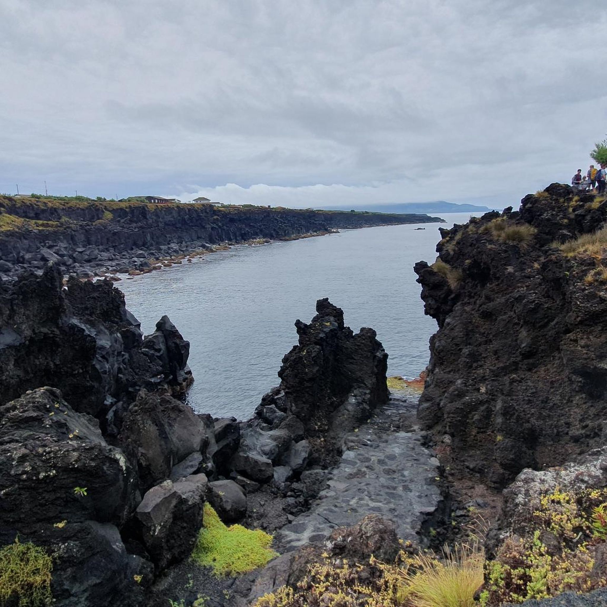
Hiking around Bandeiras offers diverse landscapes, from volcanic terrain and coastal paths to traditional vineyard culture. You can explore unique geological formations, including caves like Furna de Frei Matias and Gruta das Torres. The region also features beautiful natural monuments such as Captain's Lagoon.
Do I need a permit to hike Pico Mountain?
Yes, climbing Pico Mountain requires a permit, which must be booked in advance. This helps manage the number of hikers on the mountain and ensures safety. You can obtain permits through the official Pico Mountain House website or local tour operators.
What is the best time of year to go hiking in Bandeiras?
The best time for hiking in Bandeiras, and Pico Island in general, is typically during the warmer and drier months, from late spring to early autumn (May to October). During this period, the weather is more stable, offering clearer views and more comfortable hiking conditions. However, weather on Pico Mountain can change rapidly at any time of year.
Is public transport available to reach hiking trailheads in Bandeiras?
Public transport options on Pico Island can be limited, especially to more remote trailheads. While there are some bus services connecting main towns, for direct access to many hiking starting points, renting a car or arranging a taxi is often the most convenient option. Some guided tours may also include transport.
Where can I park my car when hiking around Bandeiras?
Parking availability varies by trailhead. For popular routes like the ascent of Pico Mountain, there is designated parking near the Mountain House (Pico Mountain House). For other trails, you can often find roadside parking in nearby villages or designated areas. Always ensure you park legally and do not obstruct local access.
What are some notable viewpoints or landmarks to look out for on the trails?
Beyond the summit of Pico Mountain itself, which offers expansive panoramic views, hikers can enjoy sights like the unique vineyard landscapes, particularly along the From Lajido to Cultura de Vinha — route on Pico Island (PR 10 PIC). The various coastal paths also provide stunning ocean vistas and opportunities to observe the island's volcanic coastline.
Most popular attractions around Bandeiras

Get inspired with the komoot mobile app


Explore more
Browse the best Hikes in other regions.
