The best walks and hikes around Balugães
4.3
(15)
49
hikers
3
hikes
Hiking trails around Balugães, Portugal, traverse a rural landscape featuring green fields, lush forests, and vineyards. The region's terrain includes dirt tracks and cobbled paths, with the Neiva River flowing nearby and Monte do Castro forming part of the local topography. These routes provide opportunities to explore the natural beauty and historical elements of this area.
Best hiking trails around Balugães
- The most popular hiking route is Fonte Verde – Detour halfway to Facho loop from Oliveira, a 6.7…
Last updated: July 4, 2026
4.6
(5)
16
hikers
10.8km
03:14
340m
350m
Moderate hike. Good fitness required. Easily-accessible paths. Suitable for all skill levels.
3.0
(1)
7
hikers
9.82km
02:52
260m
250m
Moderate hike. Good fitness required. Easily-accessible paths. Suitable for all skill levels.

Sign up for free
4.2
(5)
10
hikers
Moderate hike. Good fitness required. Easily-accessible paths. Suitable for all skill levels.
5.0
(1)
4
hikers
8.35km
02:22
190m
190m
Moderate hike. Good fitness required. Easily-accessible paths. Suitable for all skill levels.
4.0
(1)
3
hikers
8.47km
02:17
110m
110m
Moderate hike. Good fitness required. Easily-accessible paths. Suitable for all skill levels.
Our route recommendations are based on thousands of hikes, rides, and runs completed by other people on komoot.
Start today with a free account
Your next adventure awaits.
Login or Signup
Tips from the Community

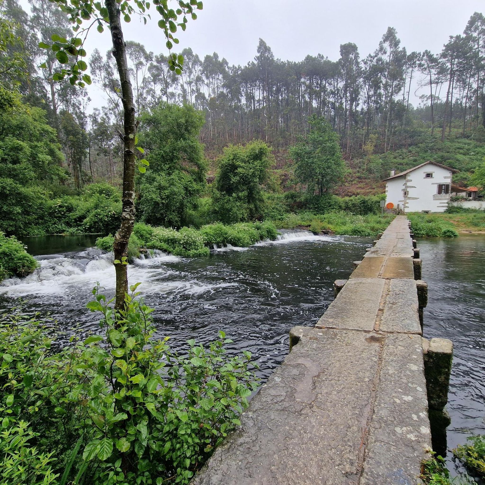
The Ponte das Tábuas de Balugães (Bridge of the Tábuas of Balugães) is a discreet jewel on the Portuguese Way to Santiago. It spans the serene Neiva River with an elegant trestle arch and boasts a wealth of history: it was mentioned in documents dating back to 1135, likely still made of wood, as the name suggests. The current stone structure is believed to have emerged around the 16th century. Nearby, a small river beach welcomes locals and travelers from around the world, all with the same goal: to dive in, cool off, and let themselves be carried away by the calm rhythm of the Neiva River's waters.
2
0

An interesting climb with several alternative paths, dirt or paved.
0
0

Ancient Roman road 14 AD
2
0


A real city for pilgrims, colourful, interesting and lively. The heraldic animal, the rooster, can be seen on all corners.
2
1

A beautiful example of a Camino pilgrimage route
3
0
Frequently Asked Questions
How many hiking trails are available around Balugães?
There are 5 hiking routes detailed in this guide for the Balugães area. All of them are rated as moderate difficulty, offering varied experiences through the local countryside.
What kind of terrain can I expect on the hiking trails in Balugães?
The trails around Balugães feature a mix of picturesque rural environments, including green fields, lush forests, and vineyards. You'll traverse dirt tracks and cobbled paths, with the Neiva River often nearby and routes winding around the slopes of Monte do Castro.
Are there any circular walks in Balugães?
Yes, all the routes listed in this guide are circular walks. For example, you can explore the Fonte Verde – Detour halfway to Facho loop from Oliveira or the Old Mill with Pond – Ponte das Tábuas de Balugães loop from Balugães, both offering a complete loop back to your starting point.
What historical landmarks can I see while hiking in Balugães?
Many trails incorporate historical elements. The Old Mill with Pond – Ponte das Tábuas de Balugães loop from Balugães passes by an old mill and the 12th-century Ponte das Tábuas de Balugães bridge over the Neiva River. The region is also part of the Portuguese Way of the Camino de Santiago, meaning you'll encounter numerous roadside shrines and chapels, such as the Santa Cruz Chapel and the Chapel of Saint Clement of the Rocks.
Are there any trails with waterfalls near Balugães?
Yes, the Idyllic Small Waterfalls – Square After Steep Climb loop from Vilar do Monte is an 8.2 km route that specifically leads through areas featuring small waterfalls, offering a refreshing natural highlight.
What is the best time of year to hike in Balugães?
Spring is a particularly beautiful time to visit Balugães, with calla lilies blooming along the roadsides and gardens in full color. The lush green fields and forests are vibrant, and the eucalyptus trees add a distinct aroma, especially after rain, enhancing the sensory experience of the trails.
What do other hikers say about the trails in Balugães?
The hiking routes in Balugães are highly rated by the komoot community, with an average score of 4.3 stars from over 10 reviews. Hikers often praise the varied terrain, the natural beauty of the green fields and forests, and the historical points of interest encountered along the way.
Are there any viewpoints or scenic spots on the trails?
Many routes offer scenic views of the rural landscape. The Viewpoint loop from Mujães is specifically designed to take you to elevated spots. Additionally, the Santuário de Nossa Senhora Aparecida, located on the slopes of Monte do Castro, offers admirable views of the village and surrounding area.
What is the typical difficulty level of hikes in Balugães?
All the routes highlighted in this guide are rated as moderate difficulty. They involve varied terrain, including some climbs, but are generally accessible for hikers with a reasonable fitness level.
Are there any attractions near the trails that are worth exploring?
Beyond the trails themselves, you can explore the charming historic center of Balugães with its cobbled streets and traditional stone houses. The Santuário de Nossa Senhora Aparecida, Igreja de Balugães, and Chapel of San Bento are significant historical and architectural sites. For a different kind of exploration, a cycle path to Ponte de Lima also exists, which can be hiked.
What are the typical lengths and durations of hikes in Balugães?
The hikes in Balugães generally range from about 8 km to 10.8 km in length. You can expect to spend between 2 hours 17 minutes and 3 hours 13 minutes on the trails, depending on the specific route and your pace.
Most popular routes around Balugães
Most popular attractions around Balugães

Get inspired with the komoot mobile app


Explore more
Browse the best Hikes in other regions.
