The best MTB trails around Vilaça e Fradelos e Fradelos e Fradelos
4.2
(81)
746
riders
66
rides
Mountain bike trails around Vilaça e Fradelos e Fradelos e Fradelos offer a network of routes through a landscape characterized by significant elevation changes and varied terrain. The region features numerous hills and elevated points, providing extensive views and challenging climbs. Riders can expect routes that traverse open areas, passing historical landmarks and natural features. The area's topography supports a range of mountain biking experiences, from moderate to difficult.
Best mountain bike trails around Vilaça e Fradelos e Fradelos e…
Last updated: July 4, 2026
1.0
(1)
17
riders
55.4km
03:25
650m
650m
Moderate mountain bike ride. Good fitness required. Suitable for all skill levels.
14
riders
49.9km
04:14
1,120m
1,120m
Hard mountain bike ride. Very good fitness required. Suitable for all skill levels.

Sign up for free
16
riders
40.5km
03:35
880m
880m
Hard mountain bike ride. Good fitness required. Advanced riding skills necessary. Some portions of the route may require you to push your bike.
8
riders
82.2km
05:43
1,360m
1,360m
Hard mountain bike ride. Very good fitness required. Suitable for all skill levels.
6
riders
Moderate mountain bike ride. Good fitness required. Suitable for all skill levels.
Get access to more routes and recommendations from other explorers.
Sign up for free
Already have an account?
Our route recommendations are based on thousands of hikes, rides, and runs completed by other people on komoot.
Start today with a free account
Your next adventure awaits.
Login or Signup
Popular around Vilaça e Fradelos e Fradelos e Fradelos


Tips from the Community

Thanks for sharing the photos and route.👍🥾🚲
1
0

The Metal Bridge of Fão (Esposende) Location: It crosses the Cávado River, on National Road 13 (EN13), in the parish of Fão, in Esposende. Alternative Name: It is frequently referred to as the D. Luís Filipe Bridge. History: It is a significant example of iron architecture in Portugal, inaugurated on August 7, 1892. Characteristics: The bridge, which is a Property of Public Interest, has an extensive metal structure and has recently been rehabilitated.
2
0
In Esposende, the main historical bridge that crosses the Cávado River is the Ponte Metálica de Fão, also known locally as Ponte D. Luís Filipe.
2
0

The Estádio 1º de Maio is located in Parque da Ponte, in the parish of Braga (São José de São Lázaro and São João do Souto), in Braga, Portugal, and until 1974 was called Estádio 28 de Maio. It has been classified as a Monument of Public Interest since 2012, being included in the special protection zone that encompasses the entire Parque da Ponte. With a capacity of 28,000 spectators, it was used by SC Braga B and the SC Braga women's football team until February 11, 2025, when the Amélia Morais mini-stadium, built in the SC Braga Sports City, was inaugurated.
0
0


Floating bridge over the CÁVADO river, exclusive to the 5 summits
0
0

A highlight that should not be missed on any visit to the region!
1
0
Frequently Asked Questions
How many mountain bike trails are available in Vilaça e Fradelos e Fradelos e Fradelos?
There are over 70 mountain bike trails in Vilaça e Fradelos e Fradelos e Fradelos, offering a wide range of options for different skill levels. This includes 3 easy, 42 moderate, and 25 difficult routes.
Are there easy mountain bike trails suitable for beginners or families?
While the region is known for its challenging terrain, there are a few easier options. For a less demanding ride, consider one of the 3 easy trails available. These are generally shorter and have less elevation gain, making them suitable for those new to mountain biking or families.
What is the typical length and duration of mountain bike trails in the area?
The trails in Vilaça e Fradelos e Fradelos e Fradelos vary significantly in length and duration. For example, the Penedo das Letras – View of Braga loop from Tadim is 48 km and takes around 4 hours 32 minutes, while the Sequeira Windmill – Castelo da Póvoa de Lanhoso loop from Aveleda is 66.7 km and can be completed in about 4 hours 20 minutes. Most routes range from moderate to difficult, often covering distances between 40 to 60 km.
Where can I find challenging mountain bike routes in Vilaça e Fradelos e Fradelos e Fradelos?
For experienced riders seeking a challenge, the region offers 25 difficult routes with significant elevation changes. A notable option is the A Maluca – Penedo das Letras loop from Oliveira (São Pedro), which is 54.5 km long with over 1700 meters of elevation gain, featuring demanding ascents and notable rock formations. Another challenging route is the Airó Geodesic Marker – Monte Airo loop from Mazagão, spanning 49.8 km with over 1100 meters of climbing.
Are there any circular mountain bike trails in the region?
Yes, many of the mountain bike trails in Vilaça e Fradelos e Fradelos e Fradelos are designed as loops, allowing you to start and finish at the same point. Examples include the Penedo das Letras – View of Braga loop from Tadim and the Monte da Garrafa – A Maluca loop from Aveleda.
What is the best time of year for mountain biking in Vilaça e Fradelos e Fradelos e Fradelos?
The best time for mountain biking in this region is typically during spring (April to June) and autumn (September to October). During these seasons, the weather is generally milder, with pleasant temperatures and less rainfall, making for more comfortable riding conditions. Summers can be hot, and winters may bring colder, wetter weather.
What kind of views or natural features can I expect along the trails?
The region is characterized by hilly terrain and elevated points, offering extensive panoramic views. Many routes provide vistas of Braga and the surrounding landscapes. You'll encounter varied terrain, including open areas and natural features shaped by the topography.
Are there any interesting landmarks or attractions near the mountain bike trails?
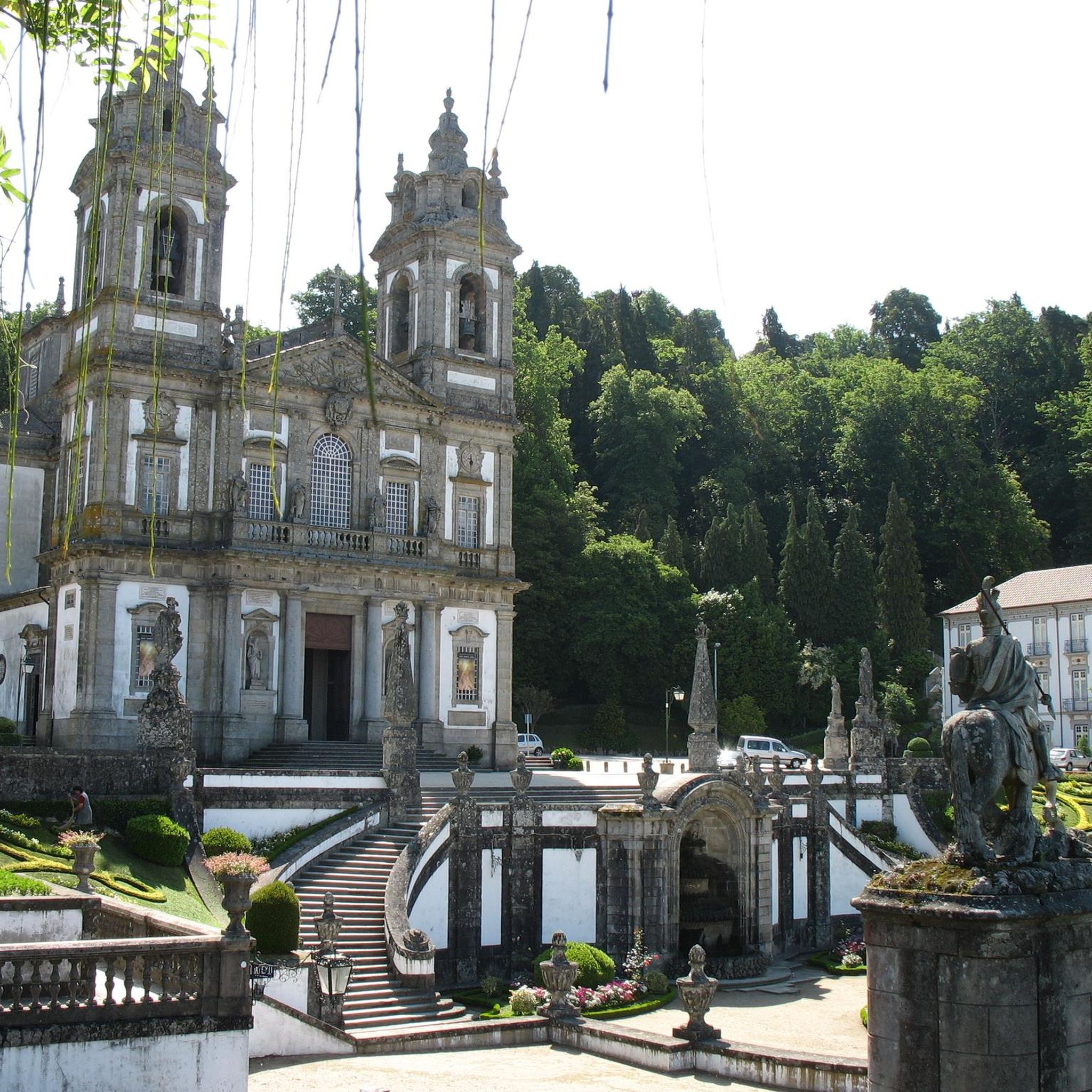
Yes, the region is rich in historical and religious landmarks. You can explore attractions such as the impressive Sanctuary of Bom Jesus do Monte, the historic Raio Palace, and the significant Braga Cathedral (Sé de Braga). Some trails, like the Sequeira Windmill – Castelo da Póvoa de Lanhoso loop from Aveleda, lead directly through areas with historical points of interest.
What do other mountain bikers enjoy most about mountain biking in Vilaça e Fradelos e Fradelos e Fradelos?
The area is highly rated by the komoot community, with an average score of 4.4 stars from over 70 reviews. Reviewers often praise the challenging nature of the trails, the extensive panoramic views, and the opportunity to explore historical landmarks while riding.
Is parking generally available near the trailheads?
While specific parking information for each trailhead is not detailed, most trail networks in regions like Vilaça e Fradelos e Fradelos e Fradelos typically have designated parking areas or roadside spots available in nearby villages or at popular starting points. It's advisable to check the specific route details on komoot for more precise parking suggestions.
Are there any cafes or places to refuel along the mountain bike routes?
Given the length of many routes, it's common to find small cafes or local establishments in the villages that the trails pass through or near. Planning your route in advance and checking for towns or hamlets along the way can help you identify potential spots for refreshments and supplies.
What are the typical weather conditions for mountain biking in the region?
The region experiences a Mediterranean climate, with warm, dry summers and mild, wet winters. During summer, temperatures can be high, making early morning or late afternoon rides preferable. Winters can bring rain, which might make some trails muddy or slippery. Always check the local weather forecast before heading out.
Most popular routes around Vilaça e Fradelos e Fradelos e Fradelos
Most popular attractions around Vilaça e Fradelos e Fradelos e Fradelos

Get inspired with the komoot mobile app


Explore more
Browse the best MTB trails in other regions.
