The best road cycling routes around Codeçoso
5.0
(13)
674
riders
27
rides
Road cycling around Codeçoso is characterized by lush green hills and serene rivers, providing a picturesque backdrop for outdoor pursuits. The region's landscape integrates robust granite constructions and offers access to broader natural attractions like the Serra do Marão mountain range. A significant feature for cyclists is the Tâmega Line Ecotrail, a repurposed former railway line offering scenic views and good surfacing. This area provides varied terrain suitable for road cycling.
Best road cycling routes around Codeçoso
- The most popular…
Last updated: July 2, 2026
5.0
(1)
104
riders
103km
05:53
2,140m
2,140m
Hard road ride. Very good fitness required. Mostly well-paved surfaces and easy to ride.
5.0
(2)
87
riders
47.2km
02:38
710m
710m
Moderate road ride. Good fitness required. Mostly well-paved surfaces and easy to ride.

Sign up for free
61
riders
119km
07:14
2,920m
2,920m
Hard road ride. Very good fitness required. Mostly well-paved surfaces and easy to ride.
5.0
(2)
60
riders
81.7km
04:53
1,700m
1,700m
Hard road ride. Very good fitness required. Mostly well-paved surfaces and easy to ride.
32
riders
99.4km
05:47
2,220m
2,220m
Hard road ride. Very good fitness required. Mostly well-paved surfaces and easy to ride.
Get access to more routes and recommendations from other explorers.
Sign up for free
Already have an account?
Our route recommendations are based on thousands of hikes, rides, and runs completed by other people on komoot.
Start today with a free account
Your next adventure awaits.
Login or Signup


Tips from the Community

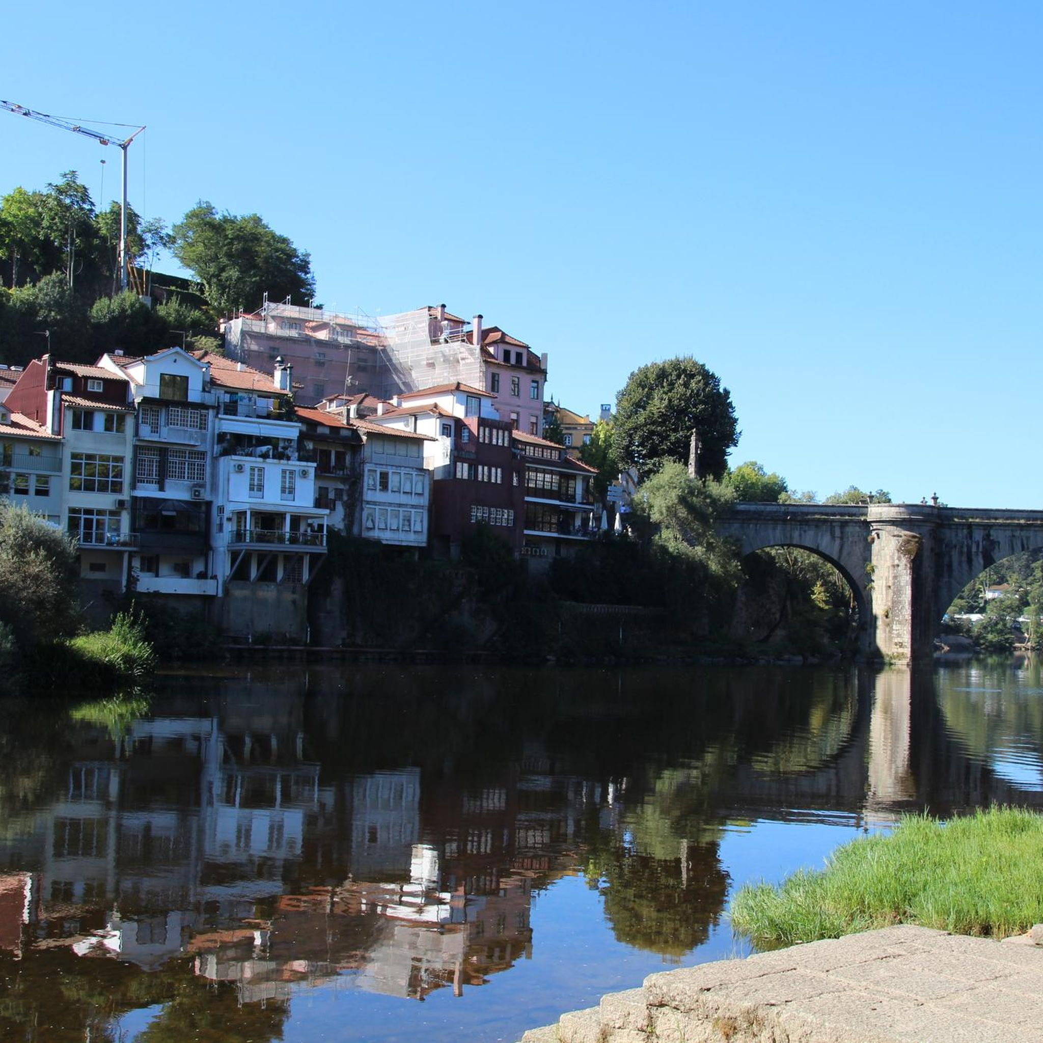
A bridge with a horizontal deck over three unequal round arches, the central one being the largest. The pillars have triangular buttresses upstream and downstream. The parapet protecting the bridge deck rests on a carved tubular cornice. Crowning the buttresses, four semicircular balconies with stone benches open onto the deck. At each end, the bridge boasts two pairs of faceted Baroque spires resting on small spheres.
2
0

Approach to Monte Farinha in Mondim de Basto
0
0


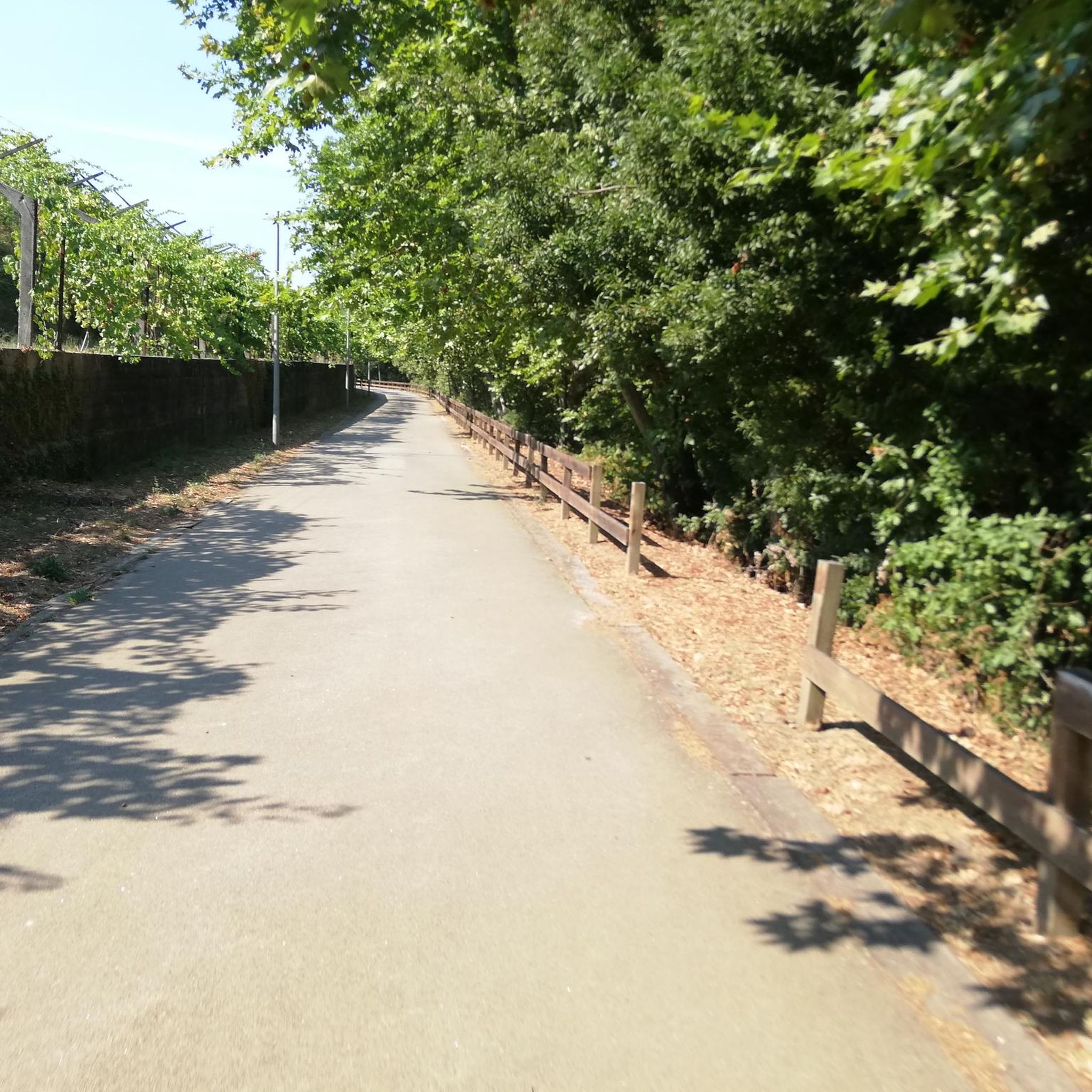
Nice bike path, nice asphalt. Fairly wide, but only in a few spots is the vegetation recovering. Recommended 👍
1
0
Nice climb, steady and great for pushing. Nice view at the top, and there's a fountain halfway up/down.
0
0

Small narrow streets to discover in the not so small village
2
2

Mondim de Basto, on the banks of the Tâmega, holds memories of many peoples. Although it was only founded in the 12th century, during the reign of D. Sancho I, its roots are much older.
1
0

This church is actually a monastery, a Dominican monastery. It is dedicated to Blessed Gonçalo, who is also the patron saint of this town. The monastery was built in the 16th century, and parts of it now serve as the town hall and a museum. It's very sustainable.
5
2
Frequently Asked Questions
How many road cycling routes are available around Codeçoso?
There are over 25 road cycling routes around Codeçoso, offering a variety of options for different skill levels. The komoot community has contributed to and explored these routes extensively.
What kind of terrain can I expect on road cycling routes near Codeçoso?
The region around Codeçoso is characterized by lush green hills and serene rivers, providing a picturesque backdrop. You can expect varied terrain, including robust granite constructions and access to broader natural attractions like the Serra do Marão mountain range. Some routes, like those following the Tâmega Line Ecotrail, offer smoother rides on repurposed railway lines, while others involve significant elevation gain through demanding landscapes.
Are there road cycling routes suitable for different skill levels in Codeçoso?
Yes, Codeçoso offers routes for various abilities. While there are 7 moderate routes, the majority, 21 routes, are classified as difficult, featuring significant elevation gain and challenging landscapes. For example, the Tâmega Line Greenway loop from Amarante is a moderate option, whereas the Church of Saint Mary of Gondar – Montagne Tunnel loop from Amarante is a difficult trail.
What natural features or landmarks can I see while road cycling in the Codeçoso area?
You can encounter several natural features and landmarks. The routes often pass through lush green hills and along serene rivers like the Tâmega. The Tâmega Line Ecotrail itself is a significant feature, offering scenic views. You might also catch glimpses of the Serra do Marão mountain range, known for its stunning natural vistas. The Azenhas Trail along the Tâmega River is another notable natural attraction.
Are there any historical points of interest along the cycling routes?
Yes, the area around Codeçoso is rich in historical and cultural attractions. You can cycle past the iconic St. Gonçalo Bridge in Amarante, known for its unique architecture. The Church and Bridge of São Gonçalo also offer historical interest. The Tâmega Line Greenway, a repurposed railway line, provides a historical context to your ride.
Are there any circular road bike routes around Codeçoso?
Many of the road cycling routes around Codeçoso are designed as loops, allowing you to start and end in the same location. Examples include the Tâmega Line Greenway loop from Amarante and the Ermelo Village loop from Celorico de Basto, providing convenient circular journeys.
Can I find routes that follow the Tâmega Line Ecotrail?
Absolutely. The Tâmega Line Ecotrail is a significant draw for cyclists in the region. Routes like the Tâmega Line Greenway loop from Amarante and the Tâmega Line Greenway – View of Ponte de São Gonçalo loop from Amarante specifically incorporate this scenic former railway line, offering great views and good surfacing.
What do other road cyclists enjoy most about the routes in Codeçoso?
The road cycling routes in Codeçoso are highly rated by the komoot community, with an average score of 5.0 stars from more than 10 reviews. Cyclists often praise the picturesque backdrop of lush green hills and serene rivers, the varied terrain, and the unique experience of riding along the repurposed Tâmega Line Ecotrail.
What is the best time of year for road cycling in Codeçoso?
While specific seasonal weather details are not provided, the region's lush green landscape suggests that spring and early autumn would offer pleasant temperatures and vibrant scenery, ideal for road cycling. Summers can be warm, and winters might bring cooler, wetter conditions, so checking local forecasts is always recommended.
Are there cafes or places to stop for refreshments along the routes?
The region around Codeçoso, including towns like Amarante and Celorico de Basto, offers various amenities. While specific cafes directly on every route are not detailed, these towns and villages along the routes are likely to have options for refreshments and meals, allowing for convenient stops during your ride.
Where can I find parking near the road cycling trailheads in Codeçoso?
For routes starting in larger towns like Amarante or Celorico de Basto, you can typically find public parking facilities. For routes originating closer to Codeçoso, it's advisable to check local maps or resources from the Celorico de Basto Tourism Center for designated parking areas near trailheads.
Is public transport available to reach road cycling routes around Codeçoso?
Public transport options to reach the starting points of road cycling routes will primarily depend on the larger towns in the vicinity, such as Amarante or Celorico de Basto. From these hubs, local bus services might connect to smaller villages or areas closer to the trailheads. It's recommended to consult local transport schedules for the most accurate information.
Most popular routes around Codeçoso
Most popular attractions around Codeçoso

Get inspired with the komoot mobile app


Explore more
Browse the best Road cycling routes in other regions.
