The best road cycling routes around Marrancos
4.8
(31)
569
riders
23
rides
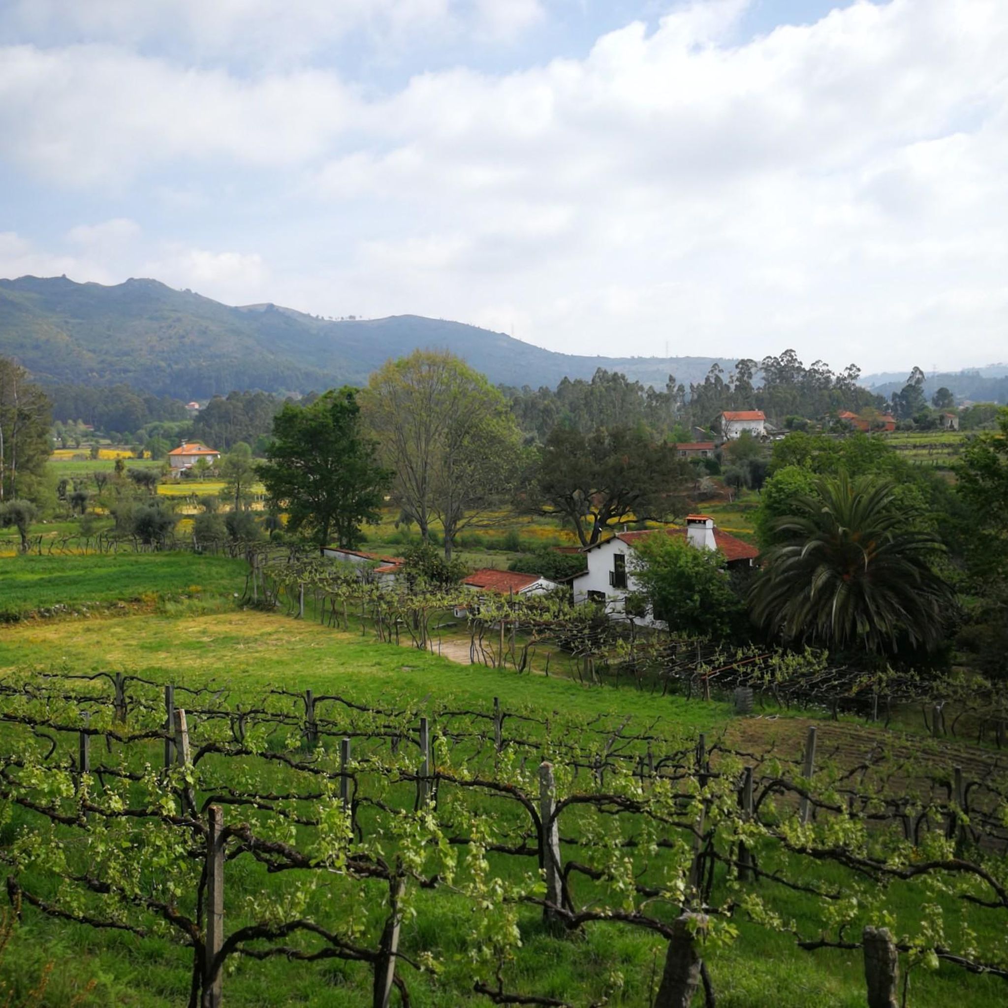
Road cycling routes around Marrancos, a parish within Vila Verde, traverse a region known for its varied terrain in northern Portugal. The area features river valleys, offering flatter sections or gentle inclines, alongside rolling hills that provide both challenging climbs and enjoyable descents. Cyclists can experience the rural charm of northern Portugal, passing through agricultural fields and peaceful villages. This landscape provides diverse options for road cyclists.
Best road cycling routes around Marrancos
- The most popular road cycling route is…
Last updated: July 4, 2026
4.6
(7)
84
riders
60.8km
03:01
850m
860m
Moderate road ride. Good fitness required. Mostly well-paved surfaces and easy to ride.
40
riders
75.3km
03:55
1,320m
1,320m
Hard road ride. Very good fitness required. Mostly well-paved surfaces and easy to ride.

Sign up for free
18
riders
65.4km
03:06
750m
750m
Moderate road ride. Good fitness required. Some segments of this route may be unpaved and difficult to ride.
4.3
(11)
11
riders
28.3km
01:19
320m
320m
Moderate road ride. Good fitness required. Mostly well-paved surfaces and easy to ride.
14
riders
80.0km
04:07
1,340m
1,340m
Hard road ride. Very good fitness required. Mostly well-paved surfaces and easy to ride.
Get access to more routes and recommendations from other explorers.
Sign up for free
Already have an account?
Our route recommendations are based on thousands of hikes, rides, and runs completed by other people on komoot.
Start today with a free account
Your next adventure awaits.
Login or Signup
Tips from the Community


Historical Context Origin of the name: The town of Ponte de Lima, the oldest in Portugal, derives its name from the bridge that crosses it. Way of St. James: The bridge is an important crossing point on the Portuguese Way of St. James. Legend: The legend of the Lima River, which runs under the bridge, tells that the Romans believed it to be the river of forgetfulness, which would have given rise to the myth that people who crossed it would forget their past lives.
2
0
The bridge that gives the Lima Bridge its name is actually a combination of two structures: a Roman section, built in the 1st century, and a medieval section, expanded in the 14th century. It crosses the Lima River and is one of the town's most emblematic monuments. Characteristics of the bridge Roman section: The remaining Roman section consists of five arches, and its construction is linked to the military road that connected the cities of Braga and Astorga. Medieval section: The medieval portion of the bridge is larger and was built to connect to the Roman section, extending the structure over the river. Material: The bridge is built of granite, using the Roman technique of "quadratum" and "vittatum" masonry.
2
0

A city bathed by the Lima River, with walking trails in the area and good food.👍🥾🇵🇹
1
0

Inside is the tourist office.
2
1

The Ponte das Tábuas de Balugães (Bridge of the Tábuas of Balugães) is a discreet jewel on the Portuguese Way to Santiago. It spans the serene Neiva River with an elegant trestle arch and boasts a wealth of history: it was mentioned in documents dating back to 1135, likely still made of wood, as the name suggests. The current stone structure is believed to have emerged around the 16th century. Nearby, a small river beach welcomes locals and travelers from around the world, all with the same goal: to dive in, cool off, and let themselves be carried away by the calm rhythm of the Neiva River's waters.
2
0

The Tower of Cadeia Velha, converted into a prison in the 16th century (reign of Manuel I), now houses the Loja do Turismo (Tourism Shop) and many temporary art exhibitions.
4
1
Both towers are classified as buildings of "public interest," as is the wall connecting them, the Tower of Cadeia Velha and the Tower of S. Paulo (once also known as the Tower of S. Paulo). They are the most prominent witnesses to what remains of the old wall of Ponte de Lima, which, in addition to the walled structure, consisted of towers and doors, a group of buildings built during the reign of Pedro I in the 14th century.
4
1
Frequently Asked Questions
How many road cycling routes are available around Marrancos?
There are over 25 road cycling routes around Marrancos, offering a variety of options for different skill levels and preferences.
What kind of terrain can I expect when road cycling in Marrancos?
Road cycling in Marrancos, located within the Vila Verde region, offers diverse terrain. You'll find routes that follow river valleys with flatter sections or gentle inclines, as well as rolling hills that provide both challenging climbs and enjoyable descents. The region is known for its beautiful countryside and rural charm.
Are there options for different skill levels, from easy to challenging?
Yes, Marrancos caters to various skill levels. While there is 1 easy route, you'll find 13 moderate routes, such as the Igreja de Torre – Chapel of Senhor dos Aflitos loop from Loureira, and 12 difficult routes, like the demanding Covide – Chapel of Senhor dos Aflitos loop from Loureira, which features significant elevation gain.
What is the best time of year for road cycling in Marrancos?
The Minho Province, where Marrancos is located, generally experiences mild winters and warm summers. Spring and autumn typically offer the most pleasant temperatures for road cycling, with less extreme heat than summer and lower chances of heavy rain than winter. Always check local weather forecasts before heading out.
Are there any interesting landmarks or cultural sites to see along the road cycling routes in Marrancos?
Yes, many routes pass through rural landscapes and past historic churches and other points of interest. For example, you might encounter the Pilgrim Altar or the Azulejo Shrine of Saint James the Greater. The Turiz Church – Igreja de Lage loop from Lage specifically leads through rural landscapes and past historic churches.
Can I find scenic viewpoints on the road cycling routes around Marrancos?
Absolutely. The rolling hills and varied topography of the Vila Verde region offer numerous opportunities for panoramic views. Routes like the Oleiros Wall – View of the Valley loop from Loureira are specifically designed to include scenic vistas, allowing cyclists to enjoy the beautiful countryside of northern Portugal.
Are there any circular road cycling routes in Marrancos?
Many of the road cycling routes around Marrancos are designed as loops, allowing you to start and end at the same point. Examples include the Igreja de Torre – Chapel of Senhor dos Aflitos loop from Loureira and the Chapel of Senhor dos Aflitos – Igreja de Lage loop from Lage.
What are the parking options for road cyclists in Marrancos?
While specific designated cycling parking areas in Marrancos are not widely publicized, you can typically find parking in or near the villages where routes often begin, such as Loureira or Lage. Look for public parking spaces in these areas.
Are there family-friendly road cycling routes in Marrancos?
For families, it's best to look for routes with less elevation gain and shorter distances. There is 1 easy route available, and some of the moderate routes, particularly those following river valleys, might be suitable for families seeking a gentler ride. Always check the route details for distance and elevation before setting out with children.
Can I find cafes or places to stop for refreshments along the road cycling routes?
Cycling through the rural villages of Marrancos and the wider Vila Verde area often provides opportunities to stop for refreshments. Many routes pass through or near small towns where local cafes and eateries can be found. Planning your route to include these villages will ensure you have places to refuel.
What makes road cycling in Marrancos unique or highly rated?
Road cycling in Marrancos is highly rated by the komoot community, with an average score of 4.8 stars from over 30 reviews. Cyclists often praise the varied terrain, which includes both river valleys and rolling hills, and the opportunity to experience the serene rural charm of northern Portugal while passing through peaceful villages and past historic sites.
Are there any particularly challenging climbs for experienced road cyclists?
Yes, for experienced road cyclists seeking a challenge, Marrancos and the surrounding Vila Verde region offer routes with significant elevation gain. There are 12 difficult routes available, such as the Covide – Chapel of Senhor dos Aflitos loop from Loureira, which features over 1300 meters of ascent, providing a demanding ride through the region's varied topography.
Most popular routes around Marrancos
Most popular attractions around Marrancos

Get inspired with the komoot mobile app


Explore more
Browse the best Road cycling routes in other regions.
