The best road cycling routes around Cardanha
30
riders
8
rides
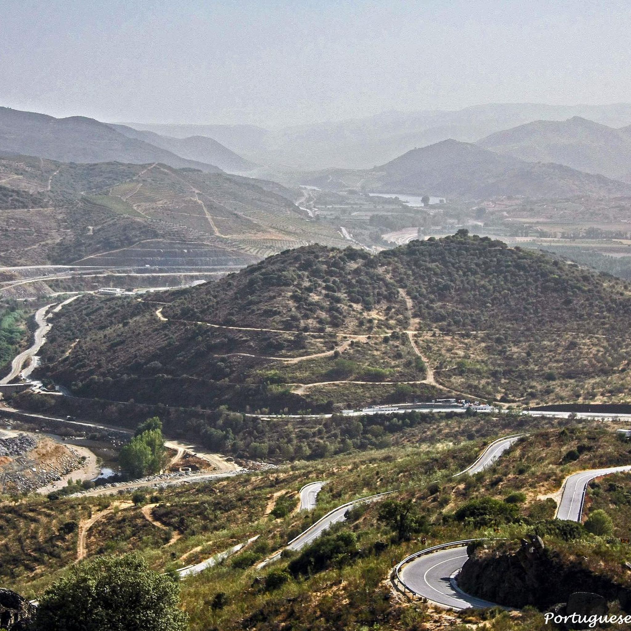
Road cycling routes around Cardanha traverse a landscape characterized by diverse terrain, including river valleys and hills. The region features impressive natural beauty, with notable viewpoints and varied elevations. Cyclists can expect routes that navigate through areas with scenic vistas, such as those overlooking the Sabor River valley. The network of roads and trails caters to different preferences, from more gentle rides to challenging ascents and descents.
Best road cycling routes around Cardanha
- The most popular road cycling route is…
Last updated: July 11, 2026
3
riders
Moderate road ride. Good fitness required. Mostly well-paved surfaces and easy to ride.
4
riders
50.4km
02:49
1,140m
1,140m
Hard road ride. Very good fitness required. Mostly well-paved surfaces and easy to ride.

Sign up for free
3
riders
26.5km
01:25
480m
480m
Moderate road ride. Good fitness required. Mostly well-paved surfaces and easy to ride.
9
riders
44.2km
02:14
570m
570m
Moderate road ride. Good fitness required. Mostly well-paved surfaces and easy to ride.
4
riders
67.5km
03:34
1,230m
1,230m
Hard road ride. Very good fitness required. Some segments of this route may be unpaved and difficult to ride.
Get access to more routes and recommendations from other explorers.
Sign up for free
Already have an account?
Our route recommendations are based on thousands of hikes, rides, and runs completed by other people on komoot.
Start today with a free account
Your next adventure awaits.
Login or Signup
Popular around Cardanha
Tips from the Community

The Pocinho Road-Railway Bridge, also known as the Pocinho Bridge, is a road-rail infrastructure of the Linha do Sabor, which crosses the Douro River in the Municipality of Vila Nova de Foz Côa, in Portugal; it is closed to service, for both types of traffic. The construction of a bridge at this location, with two superimposed decks, was foreseen by the Plan of the Complementary Network North of Mondego, dated February 15, 1900.
0
0

Nice road, which leaves us at the entrance to Urros, on a hilly and winding road, good for riding.
0
0
At this fork of the Douro River, which is called the Ribera do Arroio, this road appears that reaches the two towns that are above the river terrace of the same river, Açoreira and Peredo Dos Castelhanos.
0
0
Nice bridge that helps cross this stretch of the Sabor River on a big, tall bridge. Good views of the valley and the surrounding hills.
1
0
Impressive viewpoint on this descent/ascent where these two viewpoints are located, the one at this point and one further north, called the Miradouro do Vale do Sabor.
1
0
Descent that comes from the town of Trindade and that takes us towards the center of Santa Comba de Vilariça. The road follows the valley with the riverbank coming from Albufeira da Burga, which is located near Vale Bom.
0
0
Just north of Albufeira de Santa Justa and this land of olive trees with small hills appears this beautiful town called Vilarelhos.
1
0

The train ride to Pocinho is definitely worth it. The place and the bridge can safely be left out.
6
1
Frequently Asked Questions
What kind of terrain can I expect on road cycling routes around Cardanha?
Road cycling routes in Cardanha feature diverse terrain, characterized by scenic river valleys and varied hills. You'll encounter routes that navigate through areas with impressive natural beauty, including vistas overlooking the Sabor River valley and ascents to viewpoints like the São Gregório Viewpoint. The region offers a mix of challenging climbs and descents.
How many road cycling routes are available in the Cardanha region?
There are 7 road cycling routes detailed in this guide for the Cardanha region. These routes cater to different skill levels, with options ranging from moderate to difficult.
Are there challenging road cycling routes in Cardanha?
Yes, Cardanha offers several challenging road cycling routes. For instance, the Rio Duero along the Ribera do Arroio and city of Urros — circular from Torre de Moncorvo is a difficult 50.4 km route with significant elevation gain. Another demanding option is the Vilarelhos loop from Quinta do Barracão da Vilariça, which covers 67.4 km.
What scenic viewpoints can I find along road cycling routes in Cardanha?
Many routes offer stunning views. The Moncorvo, Miradouro de São Gregório e Lagos do Sabor — circular pela Barragem do Baixo Sabor route, for example, provides panoramic vistas from the São Gregório Viewpoint. You can also expect impressive views of river valleys, such as those near the Portela Bridge over the Sabor River.
Are there any notable landmarks or attractions to see while road cycling in Cardanha?
Yes, several routes pass by interesting landmarks. You might encounter the Portela Bridge over the Sabor River, offering great views of the valley. The São Gregório Viewpoint is another significant natural attraction. Additionally, some routes, like the Moncorvo, Miradouro de São Gregório e Lagos do Sabor, pass by the Lagos do Sabor.
Are there circular road cycling routes available in Cardanha?
Yes, many of the road cycling routes in Cardanha are circular, allowing you to start and finish at the same point. Examples include the Rio Duero along the Ribera do Arroio and city of Urros — circular from Torre de Moncorvo and the Moncorvo, Miradouro de São Gregório e Lagos do Sabor — circular pela Barragem do Baixo Sabor.
What are the typical distances of road cycling routes in Cardanha?
The road cycling routes in Cardanha vary in length. You can find routes ranging from approximately 34.5 km, like the Moncorvo, Miradouro de São Gregório e Lagos do Sabor, up to longer rides such as the 67.4 km Vilarelhos loop from Quinta do Barracão da Vilariça.
Is parking available for cyclists near the routes in Cardanha?
While specific parking areas for each route are not detailed, many routes start or pass through towns like Torre de Moncorvo, which typically offer public parking facilities. It's advisable to check local parking options in the starting towns of your chosen route.
When is the best time of year for road cycling in Cardanha?
Cardanha's diverse landscapes suggest that spring and autumn would likely be ideal for road cycling, offering pleasant temperatures and vibrant scenery. Summers can be warm, especially in river valleys, while winters might bring cooler conditions. Always check local weather forecasts before your ride.
Are there places to stop for food or accommodation near the road cycling routes?
Yes, towns like Torre de Moncorvo, which serves as a starting or ending point for several routes, offer services including food and accommodation. This makes it convenient to refuel and rest during or after your rides in the Cardanha region.
Are there any easier road cycling options for beginners in Cardanha?
While there are no routes explicitly classified as 'easy' in this guide, several routes are rated as 'moderate'. These include the Moncorvo, Miradouro de São Gregório e Lagos do Sabor (34.5 km) and the Pocinho Station loop from Ribeira da Vilariça (44.1 km). These moderate routes might be suitable for beginners with a reasonable level of fitness.
Can I reach road cycling routes in Cardanha using public transport?
The region's connectivity via public transport can vary. While specific public transport links to trailheads are not detailed, major towns like Torre de Moncorvo might have bus services. For routes starting from more remote locations, personal transport is often more convenient. It's recommended to research local bus schedules if you plan to rely on public transport.
Most popular routes around Cardanha
Most popular attractions around Cardanha

Get inspired with the komoot mobile app


Explore more
Browse the best Road cycling routes in other regions.
