The best road cycling routes around Santo André Das Tojeiras
5.0
(2)
34
riders
11
rides
Road cycling routes around Santo André Das Tojeiras traverse a varied landscape, influenced by the Alentejo coast and the foothills of the Grândola Mountains. The region features rolling hills, open plains, and stretches of low-traffic asphalt roads. Cyclists can expect diverse terrain, including areas near the Natural Reserve of the Lagoons of Santo André and Sancha, which offers a mix of fresh and brackish waters and dune ridges. The topography provides both coastal views and inland challenges, making bikes with…
Last updated: July 11, 2026
6
riders
Hard road ride. Very good fitness required. Some segments of this route may be unpaved and difficult to ride.
5.0
(2)
5
riders
109km
05:17
1,540m
1,540m
Hard road ride. Very good fitness required. Mostly well-paved surfaces and easy to ride.

Sign up for free
6
riders
38.3km
02:04
740m
740m
Moderate road ride. Good fitness required. Mostly well-paved surfaces and easy to ride.
5
riders
116km
05:33
1,190m
1,190m
Hard road ride. Very good fitness required. Mostly well-paved surfaces and easy to ride.
4
riders
32.9km
02:12
910m
910m
Hard road ride. Very good fitness required. Mostly well-paved surfaces and easy to ride.
Get access to more routes and recommendations from other explorers.
Sign up for free
Already have an account?
Our route recommendations are based on thousands of hikes, rides, and runs completed by other people on komoot.
Start today with a free account
Your next adventure awaits.
Login or Signup
Popular around Santo André Das Tojeiras
Tips from the Community

Far in the northeast of Alentejo lies Castelo de Vide, just a few kilometers from the border with Spain. The town is often called Cidade branca (white city), which is primarily due to the pretty whitewashed houses of the town. The highlight of the town (besides its great location in the Parque Natural da Serra de São Mamede) is the 14th-century Castelo de São Roque. From the castle, you have a fantastic view of the old town. Other sights in Castelo de Vide include the old Jewish quarter with the oldest synagogue in Portugal and the numerous churches and chapels of the town.
1
0

From the viewpoint you can see: The historic center of Castelo Branco, The São Águeda Reservoir (Marateca), The southern foothills of the Serra da Gardunha, The Serra da Estrela and Monte de São Martinho, On clear days, even the border with Spain (“a Raia”).
4
0
The Miradouro de São Gens, in Castelo Branco, Portugal, is a panoramic viewpoint that stands out for both its location and its history: It is located on Rua da Piscina, near Castelo Branco Castle, just 100–120 meters from the Church of Santa Maria do Castelo. Inaugurated in 1941, its structure was originally designed to conceal water tanks, and was later restored as part of the Polis program. Surrounded by flower gardens, benches, and shaded areas, it encourages rest and contemplation.
4
0

Stop on the bridge to absorb the grandeur of this unique geological feature. And look for the vultures in the sky!
0
0
Imposing building in which the Centro de Dia senior center is located
2
0

Located in the Cadeia Nova building, next to the Porta de Montalvão, this museum showcases the typical embroidery and candelabras of Nisa, as well as other objects from the region. The central core consists of a space for long-term exhibitions and an area dedicated to temporary exhibitions. Closing day(s): Mondays Visiting hours: Summer: from 10:00 to 12:30 and from 14:00 to 18:00Winter: from 10:00 to 12:30 and from 14:00 to 17:30 (Source: www.lifecooler.com)
15
0

Beirã is a small, quiet town surrounded by rolling countryside, with cork oak forests, olive groves and a rural, peaceful atmosphere typical of the Alto Alentejo. This village is often associated with its historic train station, once an important hub on the line between Lisbon and Madrid, which still retains some of its old-world charm. Beirã is an ideal base for exploring the surrounding nature and the area's rich historical sites, such as the nearby, well-preserved medieval village of Marvão, perched on a hill, or the Roman city of Ammaia.
1
0

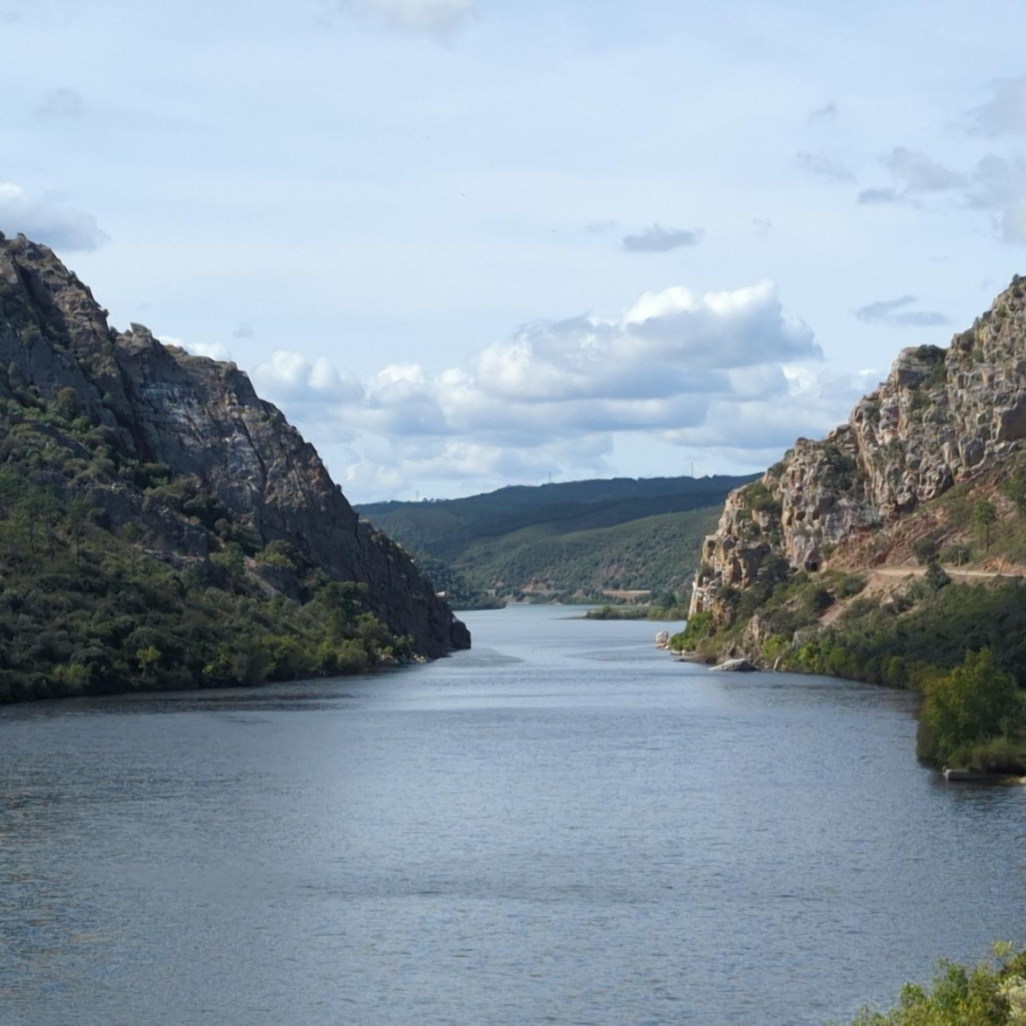
The Portas de Ródão are a geological formation located near Vila Velha de Ródão, resulting from the intersection of the hard quartzite relief of the Serra das Talhadas with the course of the River Tagus. At this location, there is a narrowing of the valley, which runs between two steep walls, which reach about 170 m in height, resembling two "gates", one to the north in the District of Castelo Branco, Beira Baixa, and another to the south in the Municipality of Nisa, District of Portalegre, Alto Alentejo.[1][2][3] The embedding of the Tagus began by upward erosion, about 2.6 million years ago, taking advantage of tectonic accidents associated with the Pônsul fault, and occurred in several stages, reflected in river terraces and platforms embedded by erosion, most visible on the right bank upstream of the Portas. The large lake and the great depths immediately downstream from Portas bear witness to the grandeur of the waterfall that must have existed here before the current equilibrium phase was reached.
0
0
Frequently Asked Questions
What kind of terrain can I expect on road cycling routes around Santo André Das Tojeiras?
Road cycling routes in Santo André Das Tojeiras feature a varied landscape, influenced by the Alentejo coast and the foothills of the Grândola Mountains. You can expect a mix of rolling hills, open plains, and stretches of low-traffic asphalt roads. The topography provides both coastal views and inland challenges, so bikes with sufficient gears are advisable.
How many road cycling routes are available in Santo André Das Tojeiras?
There are 12 road cycling routes available around Santo André Das Tojeiras. These include 7 moderate and 5 difficult routes, offering options for various skill levels.
Are there any circular road cycling routes in the area?
Yes, many routes in Santo André Das Tojeiras are designed as loops. For example, you can explore the Roadbike loop from A Catraia, a moderate 38.3 km path, or the more challenging Ponte do Alvito – CTTS Bicycle Dismount Point loop from Praia Fluvial da Couca - Cerejeira, which covers 77.1 km.
What are the best times of year for road cycling in Santo André Das Tojeiras?
The most favorable weather conditions for road cycling in Santo André Das Tojeiras are typically during May and August. These months generally offer pleasant temperatures for exploring the region's diverse routes.
What natural features or landmarks can I see along the road cycling routes?
The region is rich in natural beauty. Many routes traverse areas near the Natural Reserve of the Lagoons of Santo André and Sancha, offering views of the largest lagoon on the Alentejo coastline, diverse ecosystems, and dune ridges. You might also encounter scenic vistas of the Alentejo coast and the foothills of the Grândola Mountains.
Are there any beginner-friendly road cycling routes?
While there are no routes specifically classified as 'easy,' Santo André Das Tojeiras offers 7 moderate routes that are suitable for cyclists looking for a balanced ride without extreme difficulty. An example is the Ponte do Alvito loop from A Catraia, a 37.9 km trail through the Alentejo countryside.
What do other road cyclists think about the routes in Santo André Das Tojeiras?
The road cycling routes in Santo André Das Tojeiras are highly rated by the komoot community, with an average score of 5.0 stars. Cyclists often praise the incredible visual scenery, the varied terrain, and the low-traffic asphalt roads that cut through natural landscapes.
Are there any longer, more challenging road cycling routes for experienced riders?
Yes, for experienced riders seeking a challenge, there are 5 difficult routes. A notable option is the Fonte do Rei loop from Alvito da Beira, a 54.9 km route with significant elevation gain, offering a demanding yet rewarding experience.
What kind of views can I expect while cycling in this region?
Cyclists can expect incredible visual scenery, traversing fields, plains, and rolling hills. The coastal influence means you'll find routes with coastal views, while inland sections offer glimpses of the Alentejo countryside and the foothills of the Grândola Mountains.
Are there any routes that pass by river beaches or other water bodies?
The region is known for its natural water features. Some routes, like the Roadbike loop from Zona de Lazer da Praia Fluvial da Fróia, start near river beaches, and many routes are influenced by the nearby Natural Reserve of the Lagoons of Santo André and Sancha, offering views of its fresh and brackish waters.
What is the typical duration for road cycling routes in Santo André Das Tojeiras?
The duration of routes varies depending on their length and difficulty. Moderate routes, such as the 38.3 km Roadbike loop from A Catraia, typically take around 2 hours. Longer, more difficult routes, like the 77.1 km Ponte do Alvito – CTTS Bicycle Dismount Point loop from Praia Fluvial da Couca - Cerejeira, can take close to 4 hours.
Most popular routes around Santo André Das Tojeiras

Get inspired with the komoot mobile app


Explore more
Browse the best Road cycling routes in other regions.
