The best walks and hikes around Unhais Da Serra
4.3
(771)
2,946
hikers
45
hikes
Hiking around Unhais Da Serra offers exploration of a glacial valley at the foot of the southwestern slopes of Serra da Estrela. The region is characterized by impressive glacial valleys and dramatic granite formations, providing a gateway to Portugal's largest protected natural park. Hikers will find diverse landscapes including high mountains, numerous crystal-clear springs, rivers, and around 25 lagoons. The area's geology showcases glacial morphology with steep walls and moraine deposits.
Best hiking trails around Unhais Da Serra
- The most…
Last updated: July 4, 2026
4.3
(31)
147
hikers
10.4km
03:43
590m
590m
Hike the Serra da Estrela — Central Massif Route (PR 5), a moderate 6.4-mile trail with stunning glacial valleys and granite landscapes.
4.5
(26)
82
hikers
8.89km
02:41
300m
300m
Moderate hike. Good fitness required. Easily-accessible paths. Suitable for all skill levels.

Sign up for free
4.4
(27)
65
hikers
5.07km
01:34
180m
180m
Easy hike. Great for any fitness level. Easily-accessible paths. Suitable for all skill levels.
4.4
(10)
44
hikers
Moderate hike. Good fitness required. Mostly accessible paths. Sure-footedness required.
4.5
(14)
69
hikers
Moderate hike. Good fitness required. Easily-accessible paths. Suitable for all skill levels.
Get access to more routes and recommendations from other explorers.
Sign up for free
Already have an account?
Our route recommendations are based on thousands of hikes, rides, and runs completed by other people on komoot.
Start today with a free account
Your next adventure awaits.
Login or Signup

Tips from the Community

The Torre is the highest point of Continental Portugal, at 1,993 meters above sea level. It is located in the heart of the Serra da Estrela Natural Park and serves as the dividing line between the municipalities of Seia, Manteigas, and Covilhã. To reach the round 2,000 meters, King D. João VI had a stone monument built at the top of the plateau in the early 19th century.👍🥾
0
0

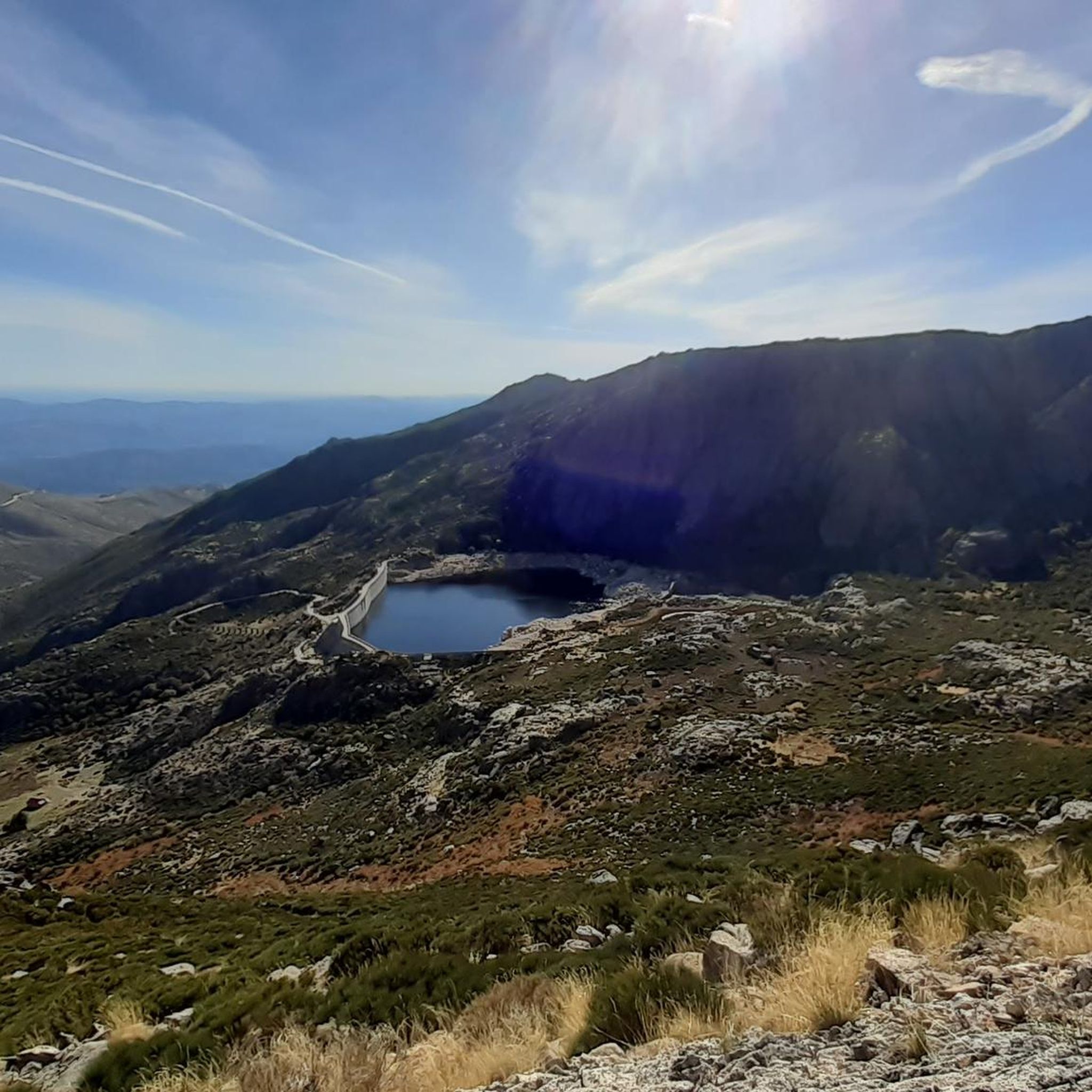
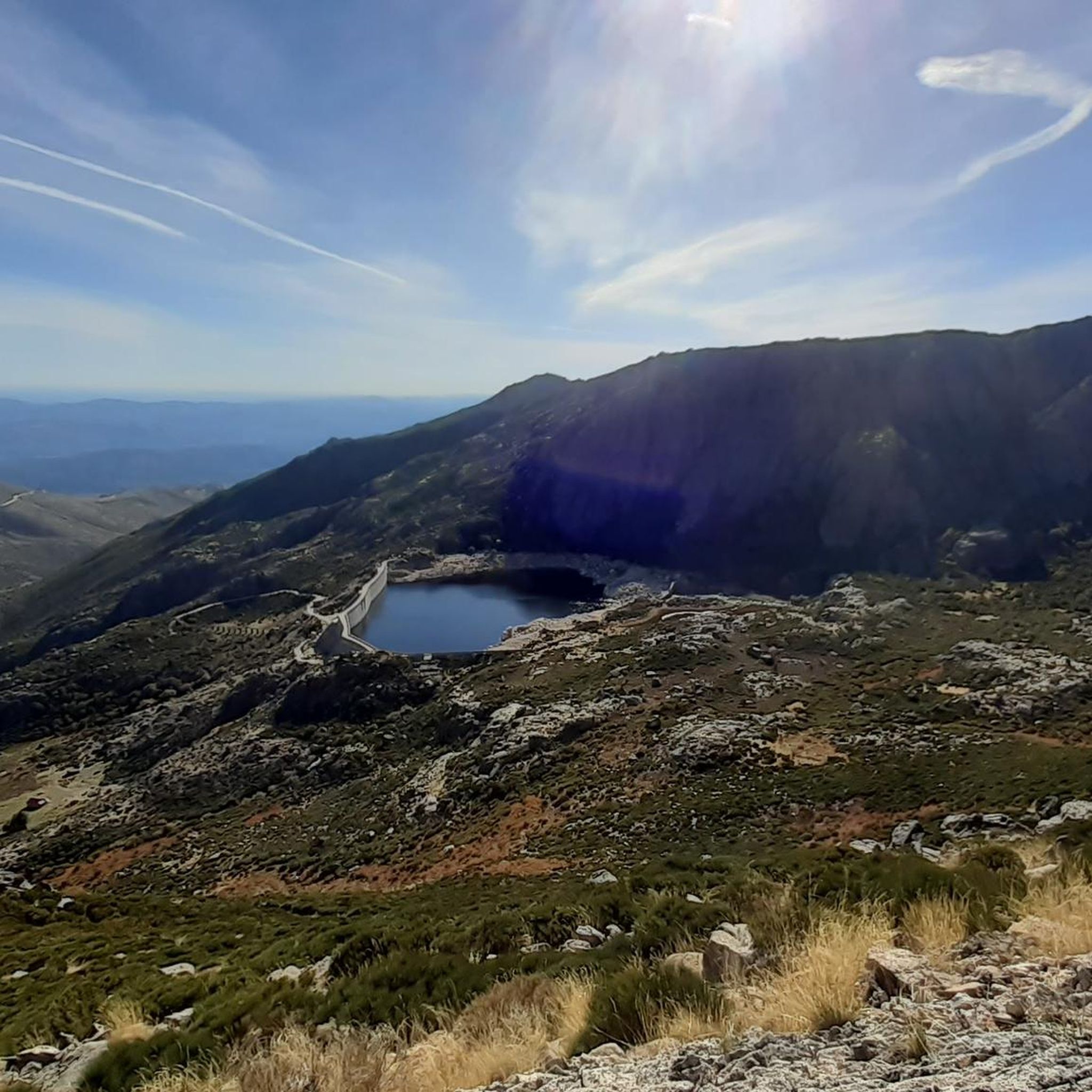
Next to the Nave de Santo António, the Covão do Ferro or Padre Alfredo dam, inaugurated in 1956, uses a glacial cirque and collects water from the Alforfa stream. It was commissioned by Father Alfredo to supply electricity to the wool industry in Unhais da Serra. Unhais da Serra can be seen in the background.
2
0

The Serra da Estrela Natural Park is something truly special. This 1,000-square-kilometer park, spread across six municipalities, was the first and currently the largest protected natural park in Portugal. It is home to the highest point on the Portuguese mainland, the country's only ski slope, the source of two important rivers, and a fascinating, alpine-like landscape formed by glaciers.
5
1
At exactly 1993 meters above sea level, Torre is the highest point in mainland Portugal, where the only ski resort is located. The landscape on the upper plateau of the Serra da Estrela is like a sprinkling of granite rocks over low scrub and patches of snow and ice, which the sun threatens to melt soon in the summer and which always returns the following winter. In winter, it sometimes becomes inaccessible.
6
0

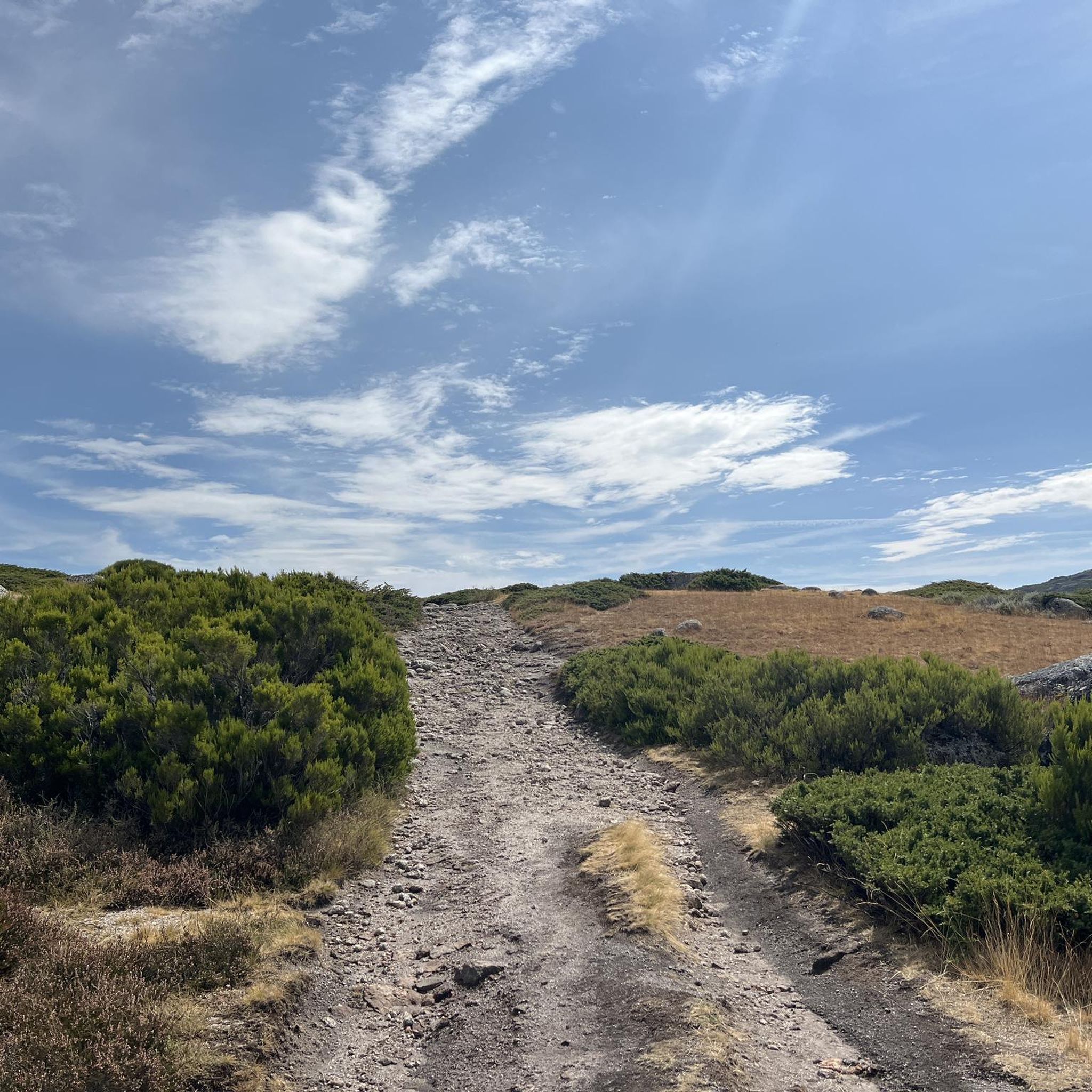
Caminho dos Poios with views of the Vale Glaciar do Zêzere The Caminho dos Poios, or the "Poios" (agricultural terraces) Trail, offers spectacular views of the vast and imposing Vale Glaciar do Zêzere, a masterpiece of nature sculpted by ancient glaciers. This trail winds along the sides of the mountain, offering panoramic views that embrace the entire "U" valley, highlighting its grandeur and the singularity of the landscape. The route allows you to appreciate not only the glacial morphology with its steep walls and moraine deposits, but also the human ingenuity in adapting the territory, as evidenced by the terraces that characterize the landscape in some areas. It is an immersion in the wild beauty of the Serra da Estrela, with the opportunity to contemplate one of its most significant geological treasures.
2
0

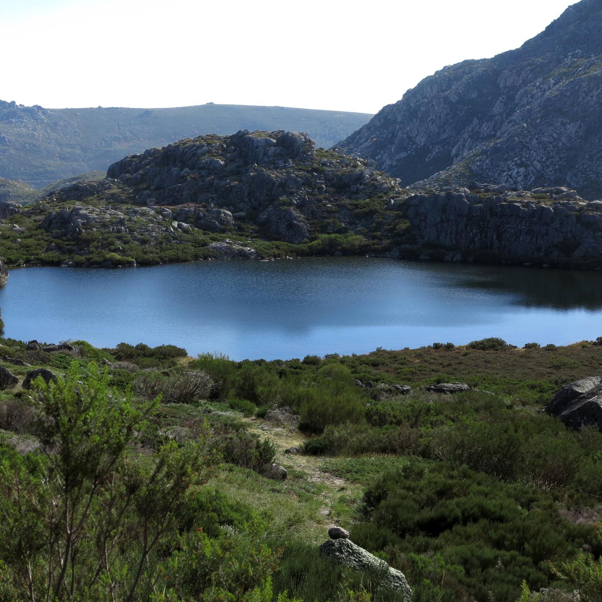
As the name suggests, this is a large hollow, an amphitheater sculpted by nature, where a lagoon lies that, on hot summer days, can disappear completely. Even so, the landscape remains stunning, imposing and filled with the overwhelming silence of the mountain.
1
1
The Lagoa do Peixão, sculpted by ice from ancient times, has an almost mystical aura. In spring, the spectacle becomes even more mesmerizing, with thousands of dragonflies dancing on the water, while tree frogs croak on the edge of the lake, composing a perfect natural symphony. The view from here is breathtaking. The imposing rocky peaks of Fragão do Poio dos Cães and Cântaro Gordo emerge on the horizon, reminding you of the ancient glaciers that once shaped this stunning landscape.
4
0

Superb route done in snow. Not a very interesting start on the road, but once you're on the trails, it's magnificent all the way to the summit!
2
1
Frequently Asked Questions
How many hiking trails are available around Unhais Da Serra?
There are over 40 hiking trails around Unhais Da Serra, offering a diverse range of experiences. You'll find options for all skill levels, including 13 easy routes, 25 moderate trails, and 7 more challenging hikes.
What kind of landscapes can I expect to see while hiking around Unhais Da Serra?
Hiking around Unhais Da Serra offers stunning natural landscapes shaped by ancient glaciers. You can expect to see impressive U-shaped glacial valleys, dramatic granite formations, and privileged views of the high mountains of Serra da Estrela, including Torre, the highest point in mainland Portugal. The region also features numerous crystal-clear springs, river beaches, and around 25 lagoons.
Are there any easy hiking trails suitable for beginners or families in Unhais Da Serra?
Yes, Unhais Da Serra offers several easy trails perfect for beginners or families. One such option is the Covão do Curral Dam – Covão do Ferro Lake loop from Serra da Estrela, an easy 3.2-mile (5.1 km) trail that takes about 1 hour 34 minutes to complete, leading through a scenic landscape featuring the dam and lake.
Are there any challenging hikes for experienced trekkers in the area?
For experienced trekkers, Unhais Da Serra provides challenging ascents that explore the higher altitudes of Serra da Estrela. While not listed in the guide data, the region research mentions the PR16 CVL – Unhais Canadas Route, which connects Unhais da Serra to the Torre plateau, offering a demanding experience through glacial cirques.
Are there any circular hiking routes around Unhais Da Serra?
Yes, many trails in the region are circular, allowing you to start and end at the same point. A popular choice is the Circular do Planalto Superior — circular route in Serra da Estrela, a moderate 5.5-mile (8.9 km) path that explores the high plateau, offering expansive views.
Can I find trails with waterfalls or lakes near Unhais Da Serra?
Absolutely! The region is rich in water features. You can discover various waterfalls, such as the majestic Vale das Vacas Waterfall and the famous Poço do Inferno. For lakes, the area boasts around 25 lagoons, including Lagoa do Peixão and Covão do Curral Dam – Covão do Ferro Lake. The Hidden cascade at Poço do Inferno is a notable highlight.
What are some interesting landmarks or viewpoints to see along the trails?
Hikers can enjoy numerous viewpoints offering panoramic vistas of the valleys and mountains. Notable examples include Poios Brancos Viewpoint and Miradouro da Varanda dos Carqueijais. You might also encounter unique features like the Covão dos Conchos Trail, a fascinating man-made funnel in a lagoon, or the Rock Passage in the Serra da Estrela Natural Park.
What do other hikers enjoy most about hiking in Unhais Da Serra?
The hiking trails around Unhais Da Serra are highly rated by the komoot community, with an average score of 4.3 stars from over 600 reviews. Hikers often praise the stunning glacial valleys, dramatic granite formations, and the diverse range of trails that cater to various fitness levels, from easy strolls to challenging ascents.
Is Unhais Da Serra accessible by public transport for hikers?
While Unhais Da Serra is a popular destination, public transport options directly to trailheads can be limited. It's advisable to check local bus schedules or consider private transport for more flexibility in reaching specific starting points for your hikes. For general information on the region, you might find resources on visitcovilha.com.
Are there specific trails that offer great views of the Serra da Estrela mountains?
Many trails provide excellent views of the Serra da Estrela mountains. The Central Massif Route (PR5) is particularly known for its stunning views of glacial valleys and granite landscapes, offering a true sense of the region's grandeur. Additionally, the Torre Summit, Serra da Estrela – View of Cântaro Gordo loop from Serra da Estrela provides direct access to the highest point in mainland Portugal with breathtaking panoramic vistas.
What is the best season for hiking in Unhais Da Serra?
The best season for hiking in Unhais Da Serra generally depends on your preference. Spring (April-June) offers vibrant flora and pleasant temperatures, with lagoons like Lagoa do Peixão coming alive with insect life. Summer (July-August) is warm and sunny, ideal for higher altitude trails. Autumn (September-October) brings beautiful fall colors. Winter (November-March) can be cold with snow at higher elevations, offering a different, more challenging experience for those equipped for it.
Are there any trails that explore the unique geology of the region?
Yes, the entire region is a testament to glacial morphology. Trails often traverse impressive glacial valleys, showcase dramatic granite formations, and reveal features like glacial cirques and moraine deposits. The Central Massif Route (PR5) is an excellent example, offering stunning views of these geological wonders.
Where can I find parking for hiking trails in Unhais Da Serra?
Parking availability varies by trailhead. In Unhais Da Serra itself, you can often find parking near the village center or specific points of interest. For trails leading into the Serra da Estrela Natural Park, designated parking areas are usually available at popular starting points or viewpoints. It's recommended to check specific route details on komoot for parking suggestions related to your chosen hike.
Most popular routes around Unhais Da Serra
Most popular attractions around Unhais Da Serra

Get inspired with the komoot mobile app


Explore more
Browse the best Hikes in other regions.
