The best road cycling routes around São Vicente Do Pigeiro
3.0
(2)
158
riders
9
rides
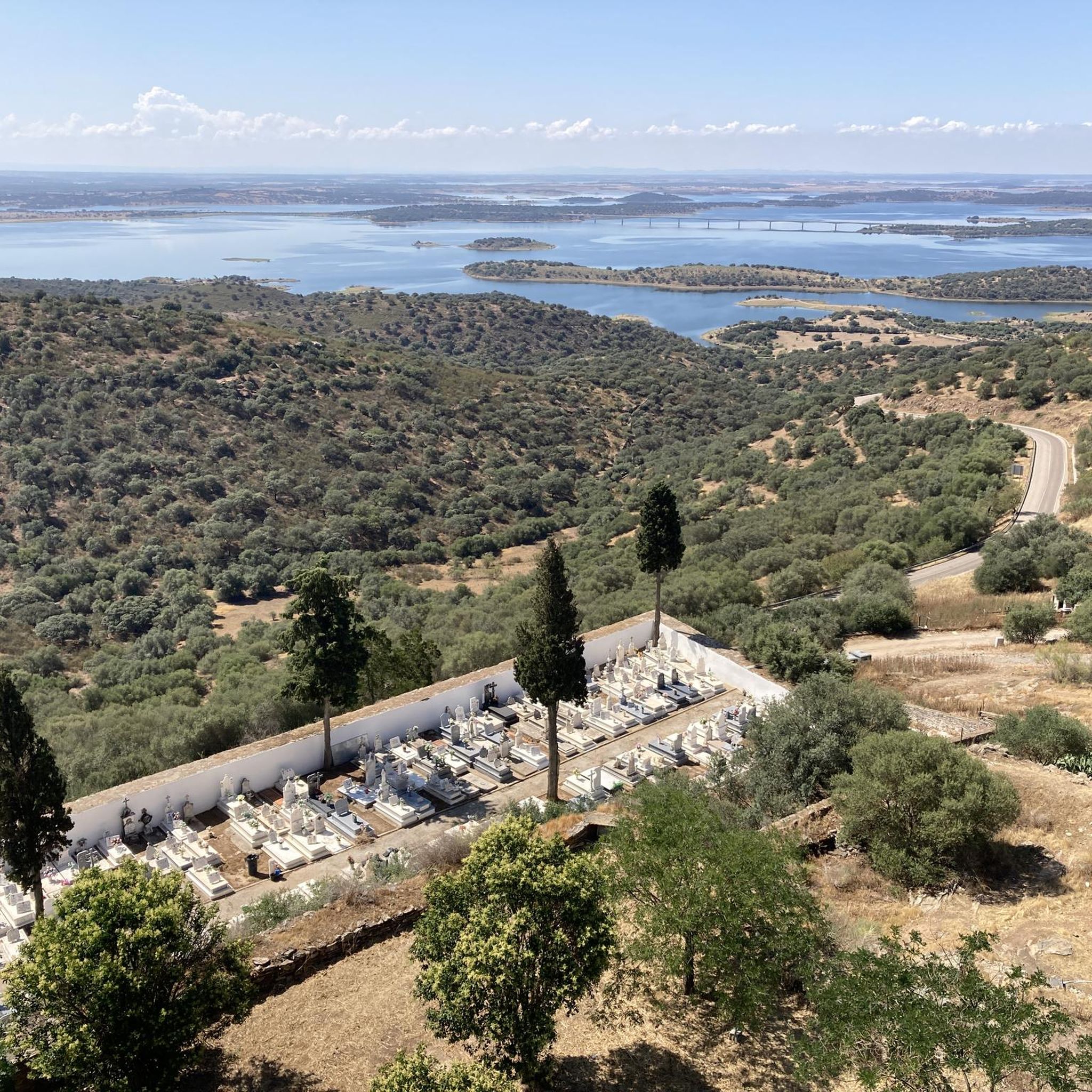
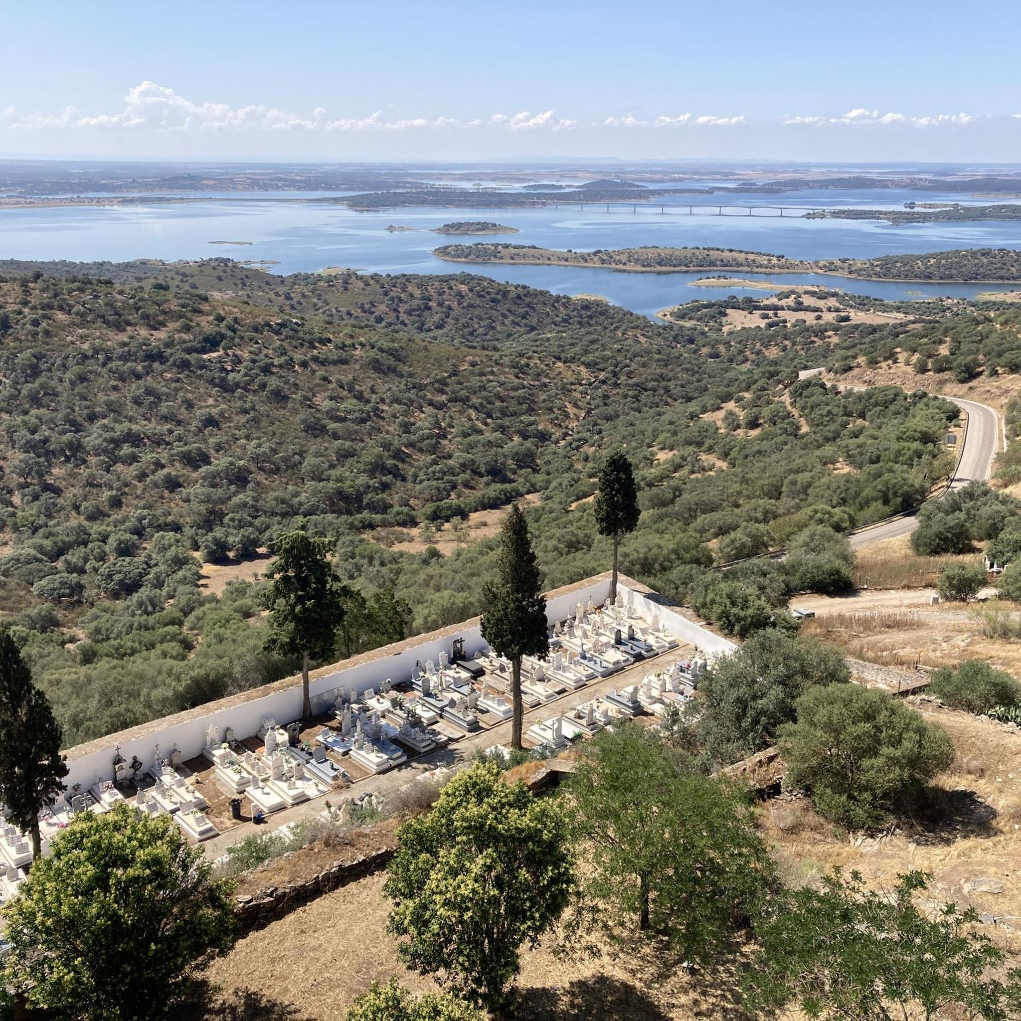
Road cycling routes around São Vicente do Pigeiro traverse the Alto Alentejo region, characterized by rolling hills, open plains, and extensive cork oak forests. The terrain offers a mix of undulating sections and flatter roads, suitable for various cycling abilities. Cyclists can expect smooth, well-maintained, and quiet roads, providing an environment for both steady rides and more challenging routes. The area's landscape includes vineyards and historic towns, adding cultural points of interest to the natural scenery.
Best road cycling routes around São Vicente do Pigeiro
- The most popular road cycling route is Castle of Mourão – View of Alqueva Reservoir loop from Reguengos de Monsaraz, a 60.3 miles (97.0 km) trail that takes 4 hours 18 minutes to complete. This route offers views of the Alqueva Reservoir and passes by historic sites.
- Another top favourite among local road cyclists is Checkpoint 3, Évora – Évora City Walls loop from Reguengos de Monsaraz, a moderate 66.8 miles (107.6 km) path. This route explores the surroundings of Évora, including its historic city walls.
- Local road cyclists also love the Cromlech of Xerez – Castelo de Monsaraz loop from Corval, a 25.8 miles (41.6 km) trail leading through open plains and past historic landmarks, often completed in about 1 hour 50 minutes.
- Road cycling around São Vicente do Pigeiro is defined by rolling hills, cork oak forests, and quiet roads. The network offers options for different ability levels, from moderate rides to more challenging routes.
- The routes in São Vicente do Pigeiro are highly rated by the komoot community with an average score of 3.0 stars from a few reviews. More than 150 road cyclists have used komoot to explore São Vicente do Pigeiro's varied terrain.
Last updated: July 18, 2026
3.0
(1)
47
riders
Moderate road ride. Good fitness required. Mostly well-paved surfaces and easy to ride.
32
riders
Moderate road ride. Good fitness required. Some segments of this route may be unpaved and difficult to ride.

Sign up for free
32
riders
41.6km
01:50
310m
310m
Moderate road ride. Good fitness required. Some segments of this route may be unpaved and difficult to ride.
3.0
(1)
24
riders
53.3km
02:15
350m
350m
Moderate road ride. Good fitness required. Mostly well-paved surfaces and easy to ride.
9
riders
Moderate road ride. Good fitness required. Mostly well-paved surfaces and easy to ride.
Get access to more routes and recommendations from other explorers.
Sign up for free
Already have an account?
Our route recommendations are based on thousands of hikes, rides, and runs completed by other people on komoot.
Start today with a free account
Your next adventure awaits.
Login or Signup
Popular around São Vicente Do Pigeiro
Tips from the Community


bridge, observation point of the Alqueva waters.👍
0
0
Roundabout connecting Aespenha and the interior of Extremadura Alentejo with a beautiful miniature castle.👍
0
0

It's a beautiful, narrow bridge with the unique feature of allowing you to sit quietly and admire the spectacular scenery in which you find yourself.
1
0

The restaurant serves at any time. You can have lunch at 5 p.m. or 6 p.m. if you wish.
11
0
Bridge with benches. So when you cross the narrow bridge, you can rest on one of these stone benches.
11
0
This restaurant serves until very late. I was served at 4 p.m. Impeccable service, very friendly staff. Excellent food.
11
0
The dam takes its name from the nearby village of Alqueva. This dam was a project dating back to the time of dictator Salazar. It was completed 50 years later. The dam was primarily built to promote agriculture rather than electricity production. Indeed, the region was severely lacking the water needed for agricultural production. The result was the largest artificial lake in Europe in an extremely dry region. The village of Luz was submerged and rebuilt identically.
11
0
Frequently Asked Questions
How many road cycling routes are available around São Vicente do Pigeiro?
There are 9 road cycling routes available around São Vicente do Pigeiro. These routes cater to various skill levels, including 1 easy, 6 moderate, and 2 difficult options.
What kind of terrain can I expect when road cycling near São Vicente do Pigeiro?
The region offers a diverse landscape characterized by rolling hills, open plains, and extensive cork oak forests. You'll find a mix of undulating sections and flatter, well-maintained roads, providing a varied and picturesque cycling experience. The roads are generally quiet, enhancing the tranquility of your ride.
What is the best time of year for road cycling in the São Vicente do Pigeiro region?
The Alto Alentejo region, where São Vicente do Pigeiro is located, generally offers pleasant conditions for road cycling during spring and autumn. These seasons provide milder temperatures, making longer rides more comfortable. Summers can be hot, while winters are typically mild but may have more rainfall.
Are there road cycling routes suitable for beginners or families in São Vicente do Pigeiro?
Yes, there is at least one easy road cycling route available. The overall network includes options for different ability levels, ensuring that less experienced cyclists or families can find suitable paths to enjoy the scenic Alentejo landscape.
Are there challenging road cycling routes for experienced cyclists?
For experienced cyclists seeking a challenge, there are 2 difficult road cycling routes available. The broader Alentejo region, particularly areas like the Serra de São Mamede Natural Park, offers tougher climbs and more demanding terrain for those looking for a rigorous ride.
What landmarks or points of interest can I see along road cycling routes?
Road cycling routes in the area often pass by historic sites and scenic viewpoints. You might encounter the Tower of Herdade do Esporão, the historic Castelo de Valongo, or cycle near the Évora Bike Path. The region is rich in medieval heritage and charming towns.
Are there circular road cycling routes available?
Yes, many of the road cycling routes around São Vicente do Pigeiro are designed as loops. For example, the Castle of Mourão – View of Alqueva Reservoir loop from Reguengos de Monsaraz offers a scenic circular journey, and the Checkpoint 3, Évora – Évora City Walls loop from Reguengos de Monsaraz explores the historic surroundings of Évora.
What are the options for long-distance road cycling routes?
The region offers several long-distance routes. The Checkpoint 3, Évora – Évora City Walls loop from Reguengos de Monsaraz covers 66.8 miles (107.6 km), while the Igreja Matriz de Corval – View of Alqueva Reservoir loop from Corval is an even longer option at 123.5 km (76.7 miles), providing extensive exploration of the Alentejo landscape.
Is parking available at the start of road cycling routes?
While specific parking details for each trailhead are not always listed, the towns and villages that serve as starting points for these routes, such as Reguengos de Monsaraz or Corval, typically offer public parking options. It's advisable to check local parking availability upon arrival.
Can I reach road cycling routes using public transport?
Public transport options in the Alto Alentejo region, particularly to smaller villages like São Vicente do Pigeiro, might be limited. For routes starting in larger towns like Évora or Reguengos de Monsaraz, there may be more public transport connections, but bringing your bike on buses or trains can vary. Planning ahead is recommended.
Are there places to stop for refreshments or cafes along the routes?
Many routes pass through or near charming towns and villages in the Alentejo, such as Corval or Reguengos de Monsaraz. These locations often have local cafes, restaurants, and wineries where you can stop for refreshments and experience the region's renowned gastronomy. The Igreja Matriz de Corval – Jardim do Montoito loop from Corval, for instance, starts and ends in a village likely to offer such amenities.
What do other cyclists say about road cycling in São Vicente do Pigeiro?
The road cycling routes around São Vicente do Pigeiro are highly rated by the komoot community, with an average score of 3.0 stars from over 150 road cyclists. Reviewers often praise the quiet roads, varied terrain, and the opportunity to cycle through cork oak forests and past historic landmarks like those found on the Cromlech of Xerez – Castelo de Monsaraz loop from Corval.
Most popular routes around São Vicente Do Pigeiro
Most popular attractions around São Vicente Do Pigeiro

Get inspired with the komoot mobile app


Explore more
Browse the best Road cycling routes in other regions.
