The best road cycling routes around Conceição
4.4
(179)
5,438
riders
269
rides
Road cycling around Conceição, Portugal, offers diverse landscapes ranging from coastal areas to undulating countryside. The region features pine forests, such as Mata da Conceição, and is situated near the Ria Formosa Natural Park. Cyclists can find routes with varying elevation gains, from minimal to over 3,000 feet, catering to different fitness levels. The area provides a mix of well-paved surfaces and scenic pathways through natural settings.
Best road cycling routes around Conceição
- The most popular road cycling route is…
Last updated: July 1, 2026
4.0
(2)
43
riders
80.4km
03:27
560m
550m
Moderate road ride. Good fitness required. Mostly well-paved surfaces and easy to ride.
4.3
(6)
35
riders
74.0km
03:06
440m
440m
This moderate 46.0-mile (74.0 km) road cycling route from Faro to Tavira offers diverse scenery through the Ria Formosa Natural Park.

Sign up for free
4.6
(5)
44
riders
47.8km
02:04
280m
280m
This moderate 29.7-mile (47.8 km) circular road cycling route from Faro to Fuseta offers scenic views of the Ria Formosa Natural Park.
3
riders
155km
07:42
2,220m
2,220m
This difficult 96.2-mile (154.7 km) circular road cycling route from Faro to Alto do Malhão offers panoramic views and a challenging climb.
4.0
(1)
89
riders
121km
04:59
670m
670m
Moderate road ride. Good fitness required. Some segments of this route may be unpaved and difficult to ride.
Get access to more routes and recommendations from other explorers.
Sign up for free
Already have an account?
Our route recommendations are based on thousands of hikes, rides, and runs completed by other people on komoot.
Start today with a free account
Your next adventure awaits.
Login or Signup
Tips from the Community

Historic bridge over the Rio Gilhão in the center of Tavira
0
0

The current bridge, contrary to its name, has nothing to do with the Romans. It was only built in the 20th century. The original Roman bridge no longer exists, but it was present here.
0
0

Vila Real de Santo António is located on the Gulf of Cádiz, which is part of the Atlantic Ocean, and on the right bank of the Guadiana River, whose lower reaches form the border between Portugal and Spain. The town offers several attractions, charming restaurants, bars, and cafés! A ferry ⛴️ provides convenient hourly service to the Spanish town of Ayamonte.
3
0
Vila Real de Santo António is a municipality and town in the Faro District of Portugal. It lies on the Gulf of Cádiz, which is part of the Atlantic Ocean, and on the right bank of the Guadiana River, whose lower reaches form the border between Portugal and Spain. Ayamonte, in Spain, lies on the opposite bank of the Guadiana River.
4
0
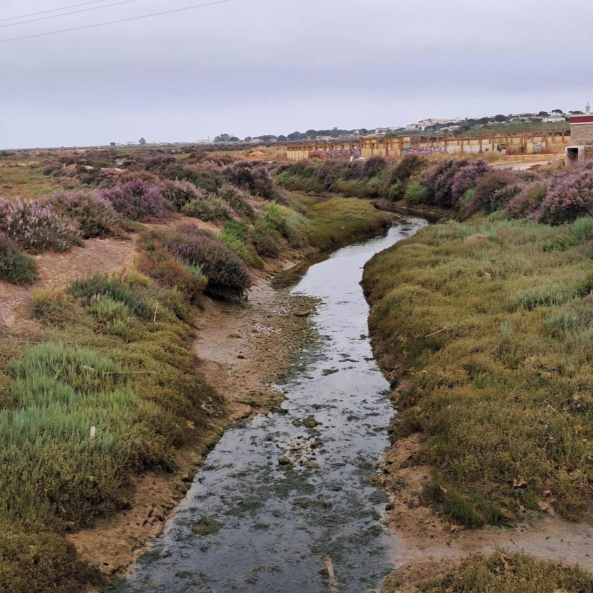
A very well-developed cycle path with the following destinations: Olhão is a city in Portugal with 14,206 inhabitants (as of April 19, 2021). Olhão is located in the so-called Sand Algarve, the Sotavento. This is the name given to the region that stretches between Faro Airport and the Spanish border in eastern Portugal. Among the numerous architectural monuments are a number of historic public buildings, various social housing blocks from the Estado Novo regime, the 17th-century fortress, and two Baroque parish churches. The historic town center as a whole is also a protected monument, and a tidal mill can be visited just outside the city. The Ria Formosa Natural Park is a nature park surrounding a lagoon in the southern Portuguese Algarve. With a protected area of 170 km², the lagoon is one of the largest lagoonal nature reserves in Europe. The lagoon itself covers 83.5 km². Fuseta, also known as Fuzeta, is a town and former municipality on the Algarve coast in southern Portugal. The German author Holger Karsten Schmidt, writing under the pseudonym Gil Ribeiro, created a crime series set here.
4
0

Saltworks where salt is extracted using traditional methods. The saltworks are located in the Sapal Natural Park.
12
0
Statue overlooking the landscapes of Sapal Natural Park. There's a good cycle path right next to it.
12
0

In the heart of the Algarve, perched on a hill on the right bank of the Guadiana River, Castro Marim Castle holds centuries of history and battles. Although human presence in the region dates back to prehistoric times, it was here that Romans and Muslims found a strategically valuable vantage point, taking advantage of its privileged position. The imposing fortification you can visit today (for a small fee) was built in the 13th century by order of King Dinis, serving as a defensive bastion against invasions and as a watchful sentinel on the border with Spain. At the top, the reward is a breathtaking panoramic view: the town of Castro Marim at your feet, the shimmering salt flats, the bridge connecting Portugal and Spain, and, in the distance, neighboring Ayamonte.
3
0
Frequently Asked Questions
How many road cycling routes are available around Conceição?
There are over 280 road cycling routes available around Conceição, Portugal. These routes cater to various fitness levels, with options ranging from easy to challenging.
What kind of terrain can I expect when road cycling in Conceição?
Road cycling in Conceição offers diverse terrain, from coastal paths along the Ria Formosa to inland routes winding through picturesque orange groves and the tranquil Mata Nacional de Conceição. Most surfaces are well-paved, but some segments might be unpaved and more challenging.
What are the elevation challenges like for road cycling in Conceição?
The region provides varied elevation gains, catering to different fitness levels. You can find gentle rides with minimal climbing, as well as more demanding routes with significant ascents, some exceeding 1,000 meters (over 3,000 feet).
What do other cyclists say about road cycling in Conceição?
The komoot community highly rates road cycling in Conceição, with an average score of 4.4 stars from over 150 reviews. Cyclists often praise the diverse landscapes, from coastal views to the undulating countryside and pine forests, as well as the variety of routes suitable for different abilities.
Are there any scenic viewpoints or landmarks to see along the road cycling routes?
Yes, many routes offer stunning views and pass by notable landmarks. You can cycle alongside the extensive wetlands of Ria Formosa Natural Park, explore charming villages like Cacela Velha with its Moorish history, or discover historical sites. The region also features scenic orange groves and coastal vistas.
Are there any circular road cycling routes in Conceição?
Yes, Conceição offers numerous circular road cycling routes. An example is the From Faro to Albufeira — circular route by the Ecovia do Litoral, which is a moderate 80.4 km trail offering coastal views. Another popular loop is the Palace of Estoi – Moncarapacho Town Square loop from Caliços, an easier 40.2 km option.
What is the best time of year for road cycling in Conceição?
The Algarve region, where Conceição is located, generally offers pleasant cycling conditions for much of the year. Spring and autumn are particularly ideal, with milder temperatures and less crowded routes. Summers can be hot, especially inland, while winters are typically mild and suitable for cycling, though occasional rain may occur.
Are there any family-friendly road cycling routes in Conceição?
Yes, there are 49 easy road cycling routes around Conceição that are suitable for families or beginners. These routes typically feature less elevation gain and are shorter in distance, allowing for a more relaxed cycling experience through the countryside.
Where can I find challenging road cycling routes with significant climbs?
For cyclists seeking a challenge, there are 67 difficult road cycling routes around Conceição. These routes often feature significant elevation gains, sometimes exceeding 1,000 meters, and can take you through more undulating inland areas of the Algarve countryside. An example is the Palace of Estoi – Caldeirão Pond loop from Caliços, which includes over 570 meters of ascent.
Are there opportunities to combine road cycling with other activities or attractions?
Absolutely. Many road cycling routes pass by areas rich in birdlife, especially near the Ancão Estuary within the Ria Formosa Natural Park. You can also visit local markets, enjoy regional cuisine in charming villages, or explore historical sites along your ride.
What are some of the longer road cycling routes available?
For longer rides, consider routes like the From Faro to Albufeira — circular route by the Ecovia do Litoral, which spans 80.4 km. Another option is the Palace of Estoi – Loulé loop from Caliços, covering 61.1 km through the Algarve countryside.
Are there any specific routes that highlight the natural beauty of the region?
Many routes showcase the natural beauty of Conceição. Those that follow the Ecovia do Litoral offer stunning coastal scenery, while inland routes wind through areas like the Mata Nacional de Conceição and past extensive orange groves, providing a blend of natural landscapes. The Ecovía do litoral 🚴 Fuseta - Olhão is a great example of a scenic cycleway.
Most popular attractions around Conceição

Get inspired with the komoot mobile app


Explore more
Browse the best Road cycling routes in other regions.
