The best road cycling routes around Manteigas (São Pedro)
4.8
(43)
1,890
riders
66
rides
Road cycling around Manteigas (São Pedro) offers routes through the mountainous terrain of the Serra da Estrela, Portugal's highest mountain range. The landscape is characterized by significant elevation changes, winding mountain roads, and views of granite formations and valleys. Road cyclists can expect challenging climbs and descents, with routes often traversing through natural parks and past notable peaks. The region provides a diverse environment for road cycling, from high mountain passes to forested sections.
Best road cycling routes around Manteigas…
Last updated: July 7, 2026
5.0
(3)
223
riders
70.7km
04:35
1,910m
1,910m
Hard road ride. Very good fitness required. Mostly well-paved surfaces and easy to ride.
20
riders
83.7km
04:54
1,970m
1,970m
This difficult 52.0-mile road cycling loop from Manteigas in Serra da Estrela offers challenging climbs and stunning mountain views.

Sign up for free
35
riders
20.1km
01:28
620m
620m
Moderate road ride. Good fitness required. Mostly well-paved surfaces and easy to ride.
36
riders
63.3km
03:36
1,370m
1,370m
Hard road ride. Very good fitness required. Mostly well-paved surfaces and easy to ride.
42
riders
Hard road ride. Very good fitness required. Some segments of this route may be unpaved and difficult to ride.
Get access to more routes and recommendations from other explorers.
Sign up for free
Already have an account?
Our route recommendations are based on thousands of hikes, rides, and runs completed by other people on komoot.
Start today with a free account
Your next adventure awaits.
Login or Signup
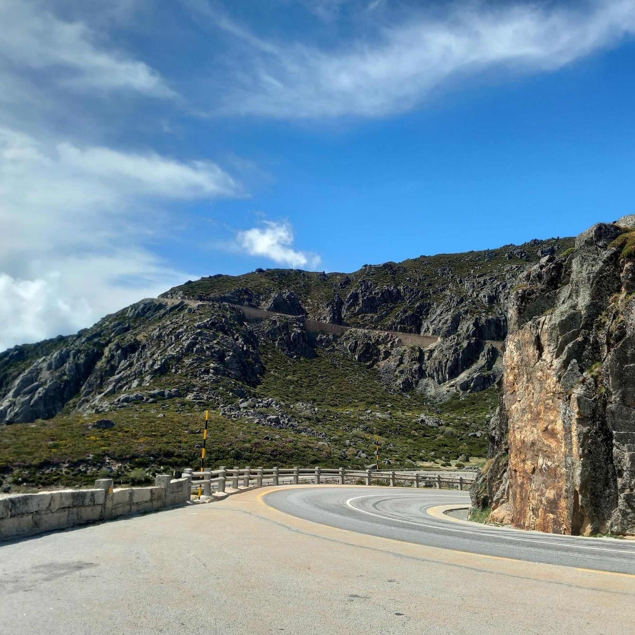

Tips from the Community

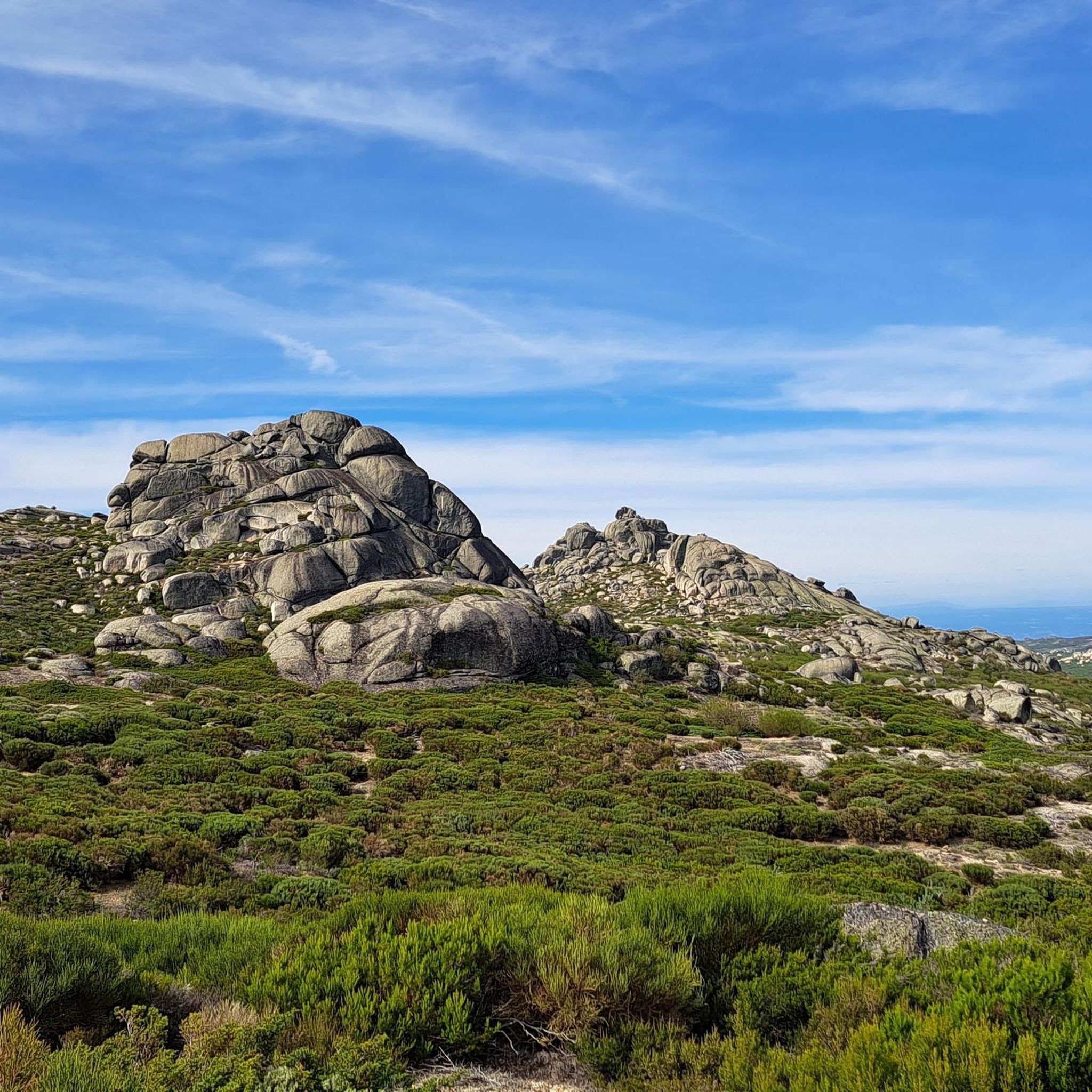
Cântaro Magro is one of the "commonplaces" of the Serra da Estrela mountain range, whose summit rises to 1928 m altitude, deserving a visit at any time of year. Viewed from west to east, its silhouette resembles a pitcher. In summer, its rocky face is interrupted by small terraces of soil, where some of the rarest botanical jewels of the mountain range grow. In winter, it is covered in snow and ice which, as they melt, form ephemeral waterfalls. These recall the overflowing liquid from the pitchers carried on the heads of women when, in the past, they went to the fountains. #CISE #VisitSeia #ParqueNaturaldaSerradaEstrela
0
0

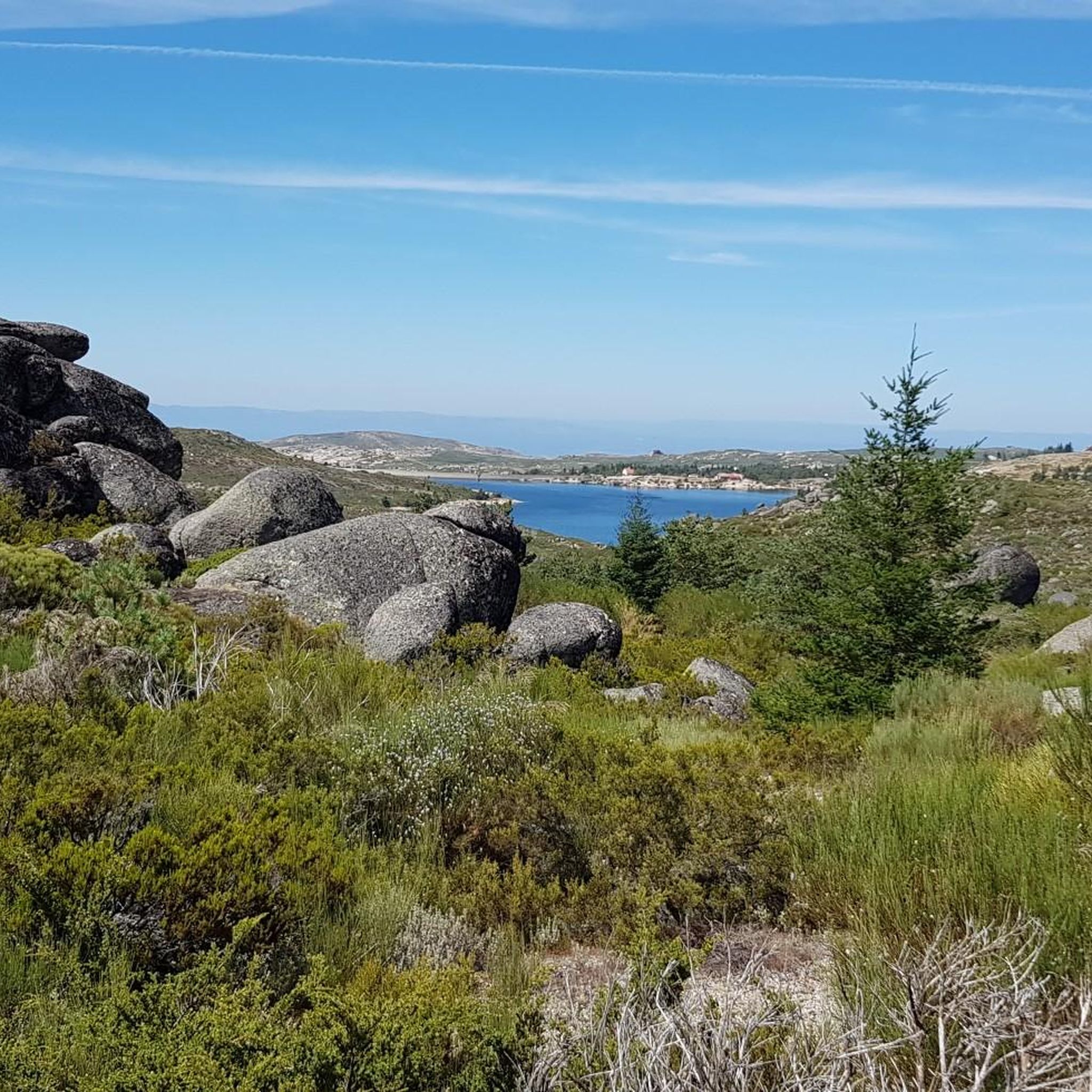
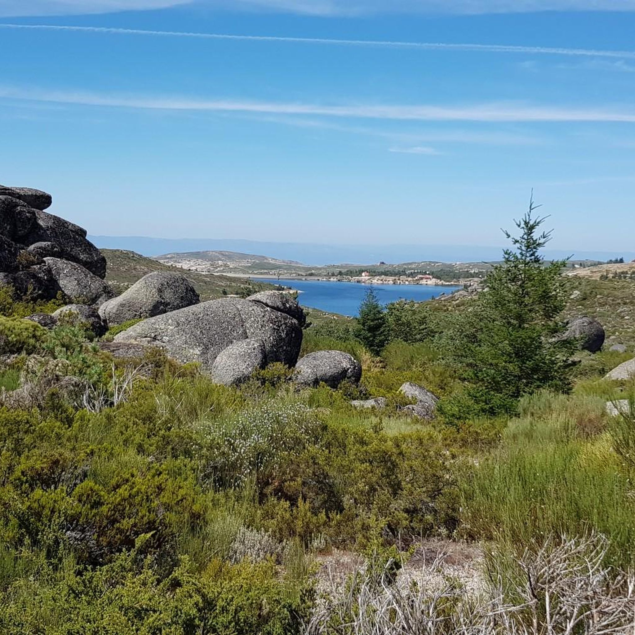
Located within the Planalto Superior biogenetic reserve, the Rossim Valley is a unique location of great scientific, environmental, and scenic value that deserves to be protected and enhanced. Although it is an artificial lake, over time, conditions have been created that have transformed this area into an excellent leisure and recreation area that attracts countless tourists. The Vale do Rossim recreation center is located at an average altitude of 1,437 meters. Before the dam was built, it was one of the best high-altitude pastures in the municipality of Gouveia. The area has almost always been frequented by transhumance herds, flocks that gathered here from São João to the Sr. do Calvário festivities in August.
3
0


At over 1,400 meters above sea level, the Rossim Valley Reservoir is a haven of granite, pine trees, and crystal-clear waters in the heart of the Serra da Estrela Mountains. It's the perfect setting for strolls, summer swims, and admiring nature in all its splendor, one of Portugal's highest jewels.
3
0

The Serra da Estrela Natural Park is something truly special. This 1,000-square-kilometer park, spread across six municipalities, was the first and currently the largest protected natural park in Portugal. It is home to the highest point on the Portuguese mainland, the country's only ski slope, the source of two important rivers, and a fascinating, alpine-like landscape formed by glaciers.
5
1
At exactly 1993 meters above sea level, Torre is the highest point in mainland Portugal, where the only ski resort is located. The landscape on the upper plateau of the Serra da Estrela is like a sprinkling of granite rocks over low scrub and patches of snow and ice, which the sun threatens to melt soon in the summer and which always returns the following winter. In winter, it sometimes becomes inaccessible.
6
0

This place offers a typical mountain landscape, with open views and the feeling of being at a high point where directions cross. It is an area characterized by the wild beauty of the mountain range, ideal for hiking and appreciating the vastness of the panorama. Its location makes it a natural crossroads to explore the surrounding valleys and other attractions of the Serra da Estrela, offering an immersive experience in mountainous nature.
1
0
Frequently Asked Questions
How many road cycling routes are available in Manteigas (São Pedro)?
There are over 60 road cycling routes available around Manteigas (São Pedro), offering a diverse range of options for different skill levels.
What kind of terrain can I expect on road cycling routes in Manteigas (São Pedro)?
The region is characterized by the mountainous terrain of the Serra da Estrela, Portugal's highest mountain range. You can expect significant elevation changes, winding mountain roads, and views of granite formations and valleys, with challenging climbs and descents.
Are there easy road cycling routes in Manteigas (São Pedro)?
While many routes are challenging, there is at least one easy road cycling route available. The network offers options for easy, moderate, and difficult ability levels.
What are some of the most challenging road cycling routes around Manteigas (São Pedro)?
Many routes in the region are considered difficult due to significant elevation gain. Examples include the Loop tour from Manteigas in the Serra da Estrela, a 43.9-mile (70.7 km) route with over 1,900 meters of elevation gain, and the Serra da Estrela Loop from Manteigas, which is 52.0 miles (83.7 km) long with nearly 2,000 meters of ascent.
Can I find loop road cycling routes in Manteigas (São Pedro)?
Yes, many road cycling routes in the area are loops. For instance, the Cântaro Magro – Serra da Estrela loop from Serra da Estrela is a popular 19.2-mile (30.8 km) loop that takes you through dramatic rock formations.
What is the typical elevation gain on road cycling routes in this region?
Road cycling in Manteigas (São Pedro) is known for significant elevation changes. Difficult routes often feature over 1,900 meters of ascent, while moderate routes can still involve hundreds of meters of climbing, such as the Cântaro Magro – Serra da Estrela loop from Penhas da Saúde with over 650 meters of elevation gain.
What natural attractions can I see while road cycling around Manteigas (São Pedro)?
While cycling, you can encounter several natural monuments and scenic spots. Notable attractions include the Covão dos Conchos Trail, Long Lake, and the Torre (Serra da Estrela Summit), which is the highest point in mainland Portugal. You might also pass by the Lapa dos Dinheiros River Beach.
What is the best time of year for road cycling in Manteigas (São Pedro)?
The mountainous terrain means that spring, summer, and early autumn generally offer the most favorable conditions for road cycling, with milder temperatures and less chance of snow or ice on higher passes.
What are the road cycling conditions like in Manteigas (São Pedro) during winter?
During winter, especially at higher elevations in the Serra da Estrela, road conditions can be challenging due to snow and ice. Some mountain passes may be closed, and temperatures can drop significantly. It's advisable to check local weather and road reports before planning a winter ride.
Are there road cycling routes with parking available?
Many routes in the region start from towns like Manteigas, where parking facilities are typically available. For example, routes like the O Berenxido Bar & Sandwiches – Gouveia loop from Manteigas (Santa Maria) would likely have parking options near the starting point in Manteigas.
What do other road cyclists say about the routes in Manteigas (São Pedro)?
The road cycling routes in Manteigas (São Pedro) are highly rated by the komoot community, with an average score of 4.8 stars from over 40 reviews. Cyclists often praise the extensive mountain scenery and challenging climbs typical of the region's high-altitude roads.
Are there less crowded road cycling routes in Manteigas (São Pedro)?
While popular routes attract many cyclists, the region offers over 60 routes. Exploring some of the less-trafficked roads, especially those not directly leading to the highest peaks, may provide a more solitary experience. Consulting komoot's route planner can help identify less-frequented paths.
Most popular routes around Manteigas (São Pedro)
Most popular attractions around Manteigas (São Pedro)

Get inspired with the komoot mobile app


Explore more
Browse the best Road cycling routes in other regions.
