The best walks and hikes around Sazes Da Beira
4.5
(608)
2,337
hikers
20
hikes
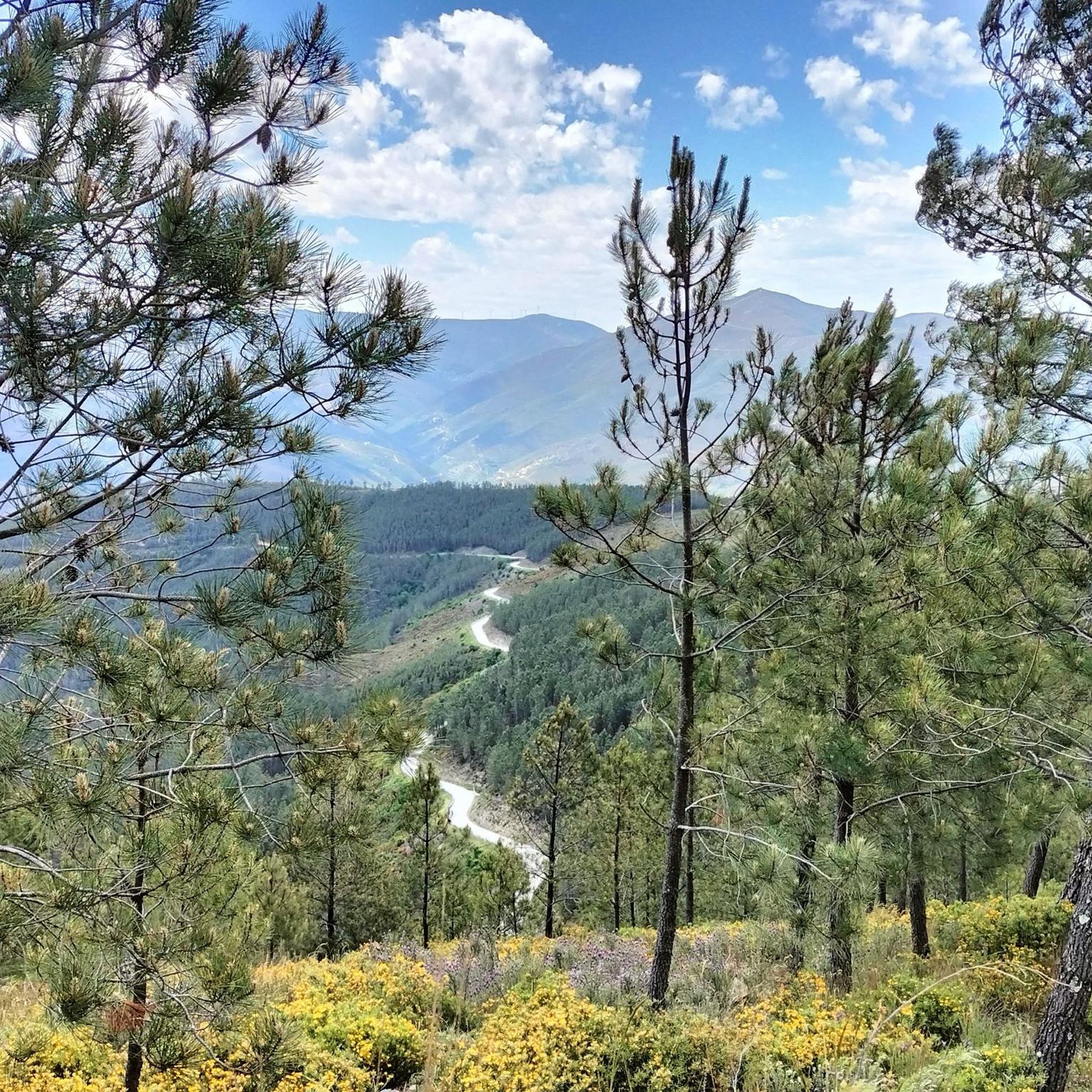
Hiking around Sazes Da Beira offers access to the diverse landscapes of the Serra da Estrela mountain range, Portugal's highest. The region is characterized by granite plateaus, deep U-shaped glacial valleys, and pristine rivers, providing varied terrain for outdoor activities. Many trails follow ancient irrigation channels (levadas) and trace paths alongside rivers. This area provides a network of hiking trails suitable for various fitness levels.
Best hiking trails around Sazes Da Beira
- The most popular hiking route is Tour of…
Last updated: August 18, 2026
4.5
(26)
98
hikers
14.8km
04:31
490m
490m
Hike the moderate Ribeira de Loriga Route, a 9.2-mile (14.8 km) trail through a unique valley in Serra da Estrela Natural Park.
3.6
(7)
23
hikers
3.26km
01:05
160m
160m
Easy hike. Great for any fitness level. Easily-accessible paths. Suitable for all skill levels.

Sign up for free
5.0
(7)
30
hikers
9.22km
03:36
1,090m
10m
The Garganta de Loriga Route is a difficult 5.7-mile hike in Serra da Estrela, featuring glacial valleys and significant elevation gain.
5.0
(6)
25
hikers
11.1km
04:15
1,250m
10m
Hike the challenging Garganta de Loriga Trail in Serra da Estrela Natural Park, a 6.9-mile route with 4117 feet of elevation gain.
4.8
(23)
71
hikers
Moderate hike. Good fitness required. Easily-accessible paths. Suitable for all skill levels.
Get access to more routes and recommendations from other explorers.
Sign up for free
Already have an account?
Our route recommendations are based on thousands of hikes, rides, and runs completed by other people on komoot.
Start today with a free account
Your next adventure awaits.
Login or Signup
Other adventures around Sazes Da Beira

Tips from the Community

The Loriga Glacial Valley is an impressive geological formation of glacial origin, approximately 6.5 kilometers long, located in the municipality of Seia, right in the Serra da Estrela Natural Park. Shaped during the last ice age, this "U"-shaped valley stands out for its steep granite slopes, staircase-like cirques, and the famous village of Loriga, often nicknamed the "Portuguese Switzerland" due to its mountainous surroundings.👍🥾
0
0

The Devil's Horns are a prominent granite rock formation with two horn-like points, located in the Serra da Estrela mountain range, near Lapa dos Dinheiros and Senhora do Desterro (not in Gerês, but in Seia, Portugal). They are the highlight of a famous circular hiking trail that follows a water channel and the Caniça stream, offering stunning landscapes, lagoons, and waterfalls. 👍🥾
0
0

The Lapa dos Dinheiros river beach is in perfect harmony with nature. Located in the parish of Lapa dos Dinheiros, on the Caniça River, a right-bank tributary of the Alva River, this bathing area is nestled in a mountainous landscape dominated by the Lapa Souto (south of Lapa) and imposing granite outcrops. With clear water, very appealing for swimming, the beach boasts the award for accessible beach and has lifeguards and a bar available to visitors. The rugged terrain of the valley causes the river to form a succession of small waterfalls nearby. The Lapa Souto, in addition to its valuable collection of centuries-old chestnut trees, is also home to a high level of biodiversity. From the bridge, a pedestrian path leads to the Moura Hole and a viewpoint over the Caniça Waterfalls. The Buraco da Moura is a natural cave system created by the sliding and accumulation of large granite blocks, which formed a complex system of rooms and galleries. How to get there? Once in Seia, follow the EN231 to S. Romão. From there, continue uphill for about 5 km, toward Loriga/Lapa, until you find the sign for Lapa dos Dinheiros on the left. Once inside the town, simply follow the beach signs. Coordinates: 40º 23′ 07.0″ N / 7º 41′ 50.1″ W
1
0

The Sanctuary of Our Lady of Desterro stands on the banks of the Alva River as an authentic path of faith, marked by ten chapels built over more than two centuries, between 1650 and 1892. Near the village, nature itself left its masterpiece: a curious rock, sculpted by time, that resembles the head of an old woman watching over the mountains.
0
0
Caution: collapsed path (also aqueduct) 2.5 km from the start. Possible but dangerous passage.
3
0
Among the terraces, chestnut groves and pine forests, a rural heritage that is as authentic as it is surprising is hidden. Like this house, for example, which seems to have grown out of the rock itself: embedded in a huge boulder, in a perfect symbiosis between popular architecture and raw nature. It is as if it had been sculpted by the mountain.
2
0
As the name suggests, this is a large hollow, an amphitheater sculpted by nature, where a lagoon lies that, on hot summer days, can disappear completely. Even so, the landscape remains stunning, imposing and filled with the overwhelming silence of the mountain.
1
1
Frequently Asked Questions
How many hiking trails are available in Sazes Da Beira?
Sazes Da Beira offers a diverse network of over 20 hiking trails. These include 7 easy routes, 8 moderate trails, and 5 more challenging options, catering to various fitness levels within the Serra da Estrela region.
Are there any easy hiking trails suitable for beginners or families?
Yes, Sazes Da Beira has several easy trails perfect for beginners or families. One excellent option is the Tour da Eira (PR 4) — circular route in Serra da Estrela, which is just over 3 km long and can be completed in about an hour. This circular route is suitable for all fitness levels.
Are there any circular hiking routes in Sazes Da Beira?
Many trails in Sazes Da Beira are circular, offering convenient starting and ending points. A popular moderate circular route is the Tour of the Levada (Cabeça–Loriga) — circular route in Serra da Estrela, which spans nearly 15 km and takes around 4.5 hours to complete.
Can I find hikes with waterfalls or natural pools in the area?
Absolutely. The region around Sazes Da Beira is known for its beautiful waterfalls and natural pools. You can explore areas like Lapa dos Dinheiros River Beach, which often features idyllic bathing spots. Other notable waterfalls include Poço da Broca de Serapitel and Poço Fundeiro Waterfall.
What kind of landscapes can I expect to see while hiking around Sazes Da Beira?
Hiking around Sazes Da Beira offers diverse landscapes characteristic of the Serra da Estrela. You'll encounter dramatic granite plateaus, deep U-shaped glacial valleys like the Zêzere, and pristine river paths. Many trails follow ancient irrigation channels (levadas) and provide stunning panoramic views from higher altitudes.
Are there any challenging hikes for experienced trekkers?
Yes, for experienced trekkers, there are several demanding trails. The Tour of the Loriga Gorge (PR 5) — Serra da Estrela is a challenging 9.2 km hike with significant elevation changes. Another hard option is the Ascent to Serra da Estrela starting from Loriga (PR 5.1) — Serra da Estrela, an 11.1 km route that takes you to higher elevations.
What do other hikers say about the trails in Sazes Da Beira?
The hiking routes in Sazes Da Beira are highly rated by the komoot community, with an average score of 4.5 stars from nearly 500 reviews. Hikers often praise the well-defined paths, the stunning natural beauty of the Serra da Estrela, and the variety of trails available for different skill levels.
What are some notable natural attractions or landmarks to look out for?
Beyond the trails themselves, the region boasts several natural landmarks. You can visit the unique Covão dos Conchos Trail, explore the serene Long Lake, or even reach the highest point of mainland Portugal at Torre (Serra da Estrela Summit).
Is public transport available to reach hiking trailheads?
While some villages near trailheads might have limited bus services, access to many hiking routes in the Serra da Estrela region is often easier by car. It's advisable to check local transport schedules in advance, as services can be infrequent, especially to more remote starting points.
What is the best time of year to go hiking in Sazes Da Beira?
The best time for hiking in Sazes Da Beira is generally from spring to autumn (April to October). During these months, the weather is milder and more stable. Summer offers warm temperatures, while spring and autumn provide pleasant conditions with vibrant flora or changing foliage. Be aware that at altitudes over 1000m, weather can change rapidly, so always be prepared.
Are there any hikes that follow ancient irrigation channels (levadas)?
Yes, many trails in the Sazes Da Beira area, particularly within the Serra da Estrela, follow ancient irrigation channels known as levadas. These paths often offer relatively flat walking surfaces and lead through shaded, scenic areas alongside rivers, providing a unique hiking experience. The Tour of the Levada (Cabeça–Loriga) is a prime example.
What should I know about the altitude when planning a hike?
Many hikes in the Serra da Estrela region around Sazes Da Beira are at altitudes exceeding 1000m. This means you can expect cooler temperatures and stunning vistas. However, it also means that weather conditions can change quickly and unexpectedly. Always carry appropriate layers, waterproof gear, and be prepared for varying conditions, even on sunny days.
Most popular attractions around Sazes Da Beira

Get inspired with the komoot mobile app


Explore more
Browse the best Hikes in other regions.
