The best walks and hikes around Chão De Couce
4.6
(50)
215
hikers
9
hikes
Hiking around Chão De Couce offers trails through a landscape characterized by rolling hills and dense woodlands, primarily composed of pine and eucalyptus forests. The region features numerous streams and small river valleys, contributing to varied terrain. Elevations are generally moderate, with no peaks exceeding 200m, making most ascents gradual.
Best hiking trails around Chão De Couce
- The most popular hiking route is Casal de São Simão loop from Aguda, an easy 3.4 miles (5.5 km) trail that takes 1 hour 35 minutes to complete. This route features varied terrain and passes through local villages.
- Another top favourite among local hikers is Casal de São Simão loop from Aguda, an easy 1.9 miles (3.1 km) path. It offers a shorter option through similar landscapes, suitable for a quick outing.
- Local hikers also love the Olho de Tordo – Olho do Tordo Spring loop from Aldeia do Bofinho, a 2.5 miles (4.1 km) trail leading through natural springs and local countryside, often completed in about 1 hour 8 minutes.
- Hiking around Chão De Couce is defined by rolling hills, dense woodlands, and tranquil river valleys. The network offers options for both easy and moderate ability levels.
- The routes in Chão De Couce are highly rated by the komoot community with an average score of 4.7 stars from over 40 reviews. More than 200 hikers have used komoot to explore Chão De Couce's varied terrain.
Last updated: June 24, 2026
4.7
(30)
101
hikers
5.49km
01:36
140m
140m
Easy hike. Great for any fitness level. Easily-accessible paths. Suitable for all skill levels.
4.8
(4)
25
hikers
3.10km
00:57
110m
110m
Easy hike. Great for any fitness level. Easily-accessible paths. Suitable for all skill levels.

Sign up for free
4.7
(3)
4
hikers
4.08km
01:08
80m
80m
Easy hike. Great for any fitness level. Easily-accessible paths. Suitable for all skill levels.
8
hikers
1.17km
00:23
50m
50m
Easy hike. Great for any fitness level. Easily-accessible paths. Suitable for all skill levels.
5.0
(1)
6
hikers
9.95km
02:53
250m
250m
Moderate hike. Good fitness required. Easily-accessible paths. Suitable for all skill levels.
Get access to more routes and recommendations from other explorers.
Sign up for free
Already have an account?
Our route recommendations are based on thousands of hikes, rides, and runs completed by other people on komoot.
Start today with a free account
Your next adventure awaits.
Login or Signup
Tips from the Community

Las Pasarelas Fragas de São Simão (in Portuguese, Pasarelas Fragas de São Simão) is a path of approximately 2 kilometers that connects the town of Casal de São Simão with the Fragas de São Simão viewpoint, offering impressive landscapes. Full of contrasts. A few minutes from the route you will find the Playa Fluvial de las Fragas de São Simão, located near the town of Casal de São Simão. It's a charming place to explore! 😊
1
0

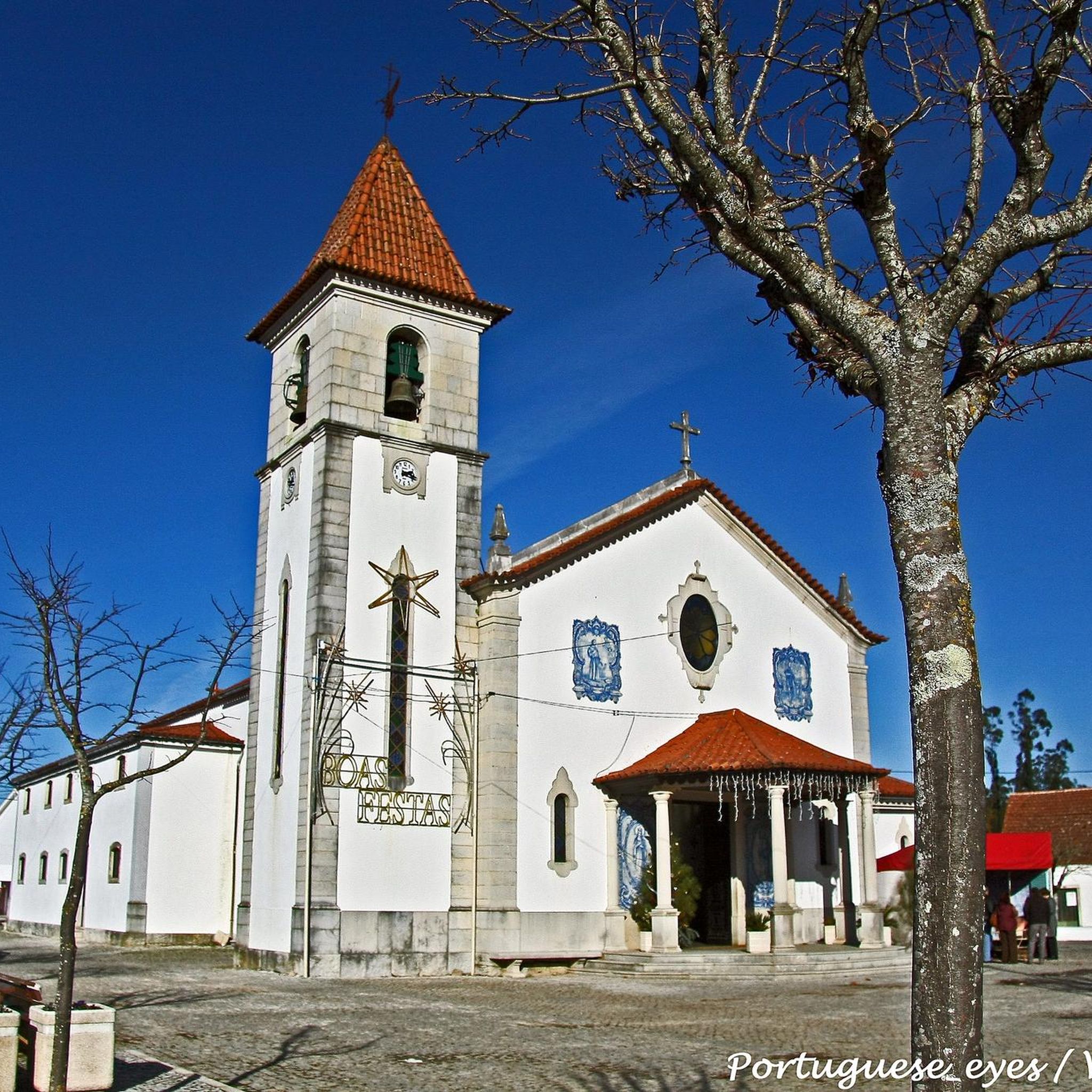
The Parish Church of Alvaiázere is a temple dedicated to Saint Mary Magdalene. This religious building was likely built in the second half of the 16th century and underwent extensive remodeling in subsequent centuries, modifying part of its 16th-century structure. [https://www.outdooractive.pt/mobile/pt/poi/alvaiazere/igreja-matriz-de-alvaiazere/805548327/](https://www.outdooractive.pt/mobile/pt/poi/alvaiazere/igreja-matriz-de-alvaiazere/805548327/)
1
0

The Eye of the Thrush is a mysterious spring that gushes from the bowels of the earth, forming a stream that sleeps in the summer. Among ancient mills and vestiges of bygone eras, the water resurfaces from a deep grotto, a natural spectacle of rare beauty.
1
0
The Mother Church of Alvaiázere, officially known as the Parish Church of Santa Maria Madalena, is one of the main religious monuments in the municipality of Alvaiázere. It was built in the second half of the 16th century, although it has undergone significant renovations in subsequent centuries.
9
0

The Mother Church of Alvaiázere, also known as Igreja Matriz de Alvaiázere, is an important religious building located in the heart of the village of the same name in Portugal. It is a church whose construction dates back to the 15th century, although it was later influenced by Renaissance architecture and, in particular, Baroque (it is also referred to as the 18th century due to some of its characteristics).
1
0
The "Olho de Tordo" route offers an experience rich in landscapes and historical heritage.
7
0
If you decide to explore this route, you will be surrounded by nature, history and breathtaking views. Enjoy your hike! 🏞️🚶♂️🥾🚵🌞
8
0
The Fragas de São Simão River Beach is a charming place located near the village of Casal de São Simão, in Portugal. This river beach is located in the Ribeira de Alge gorge, and is part of the Fragas de São Simão Walkways route. Here you can enjoy crystal clear waters surrounded by impressive natural landscapes. It is a perfect destination to relax and enjoy nature! 😊🌿🏞️
15
0
Frequently Asked Questions
How many hiking trails are available around Chão De Couce?
Chão De Couce offers a selection of over 9 hiking routes, catering to various preferences. The majority of these are easy, with a few moderate options for those seeking a bit more challenge.
Are there easy hiking trails suitable for beginners in Chão De Couce?
Yes, Chão De Couce is well-suited for beginners, with 7 easy hiking trails. An excellent option is the Olho de Tordo – Olho do Tordo Spring loop from Aldeia do Bofinho, which is 2.5 miles (4.1 km) long and takes about 1 hour 8 minutes to complete, leading through natural springs and local countryside.
Are there any moderate difficulty hikes around Chão De Couce?
For those looking for a bit more challenge, there are 2 moderate hiking trails available. One such route is the Igreja de Alvaiázere loop from Alvaiázere, which covers 6.2 miles (9.9 km) with an elevation gain of approximately 250 meters.
What are the typical lengths and durations of hikes in Chão De Couce?
Hikes in Chão De Couce vary, but many are designed for shorter outings. For example, the Casal de São Simão loop from Aguda is 3.4 miles (5.5 km) and takes about 1 hour 35 minutes, while the Hiking loop from Aguda is a shorter 0.6 miles (1 km) route.
Are there any circular walks available in the region?
Yes, many of the trails in Chão De Couce are circular, offering convenient starting and ending points. Popular circular options include the Casal de São Simão loop from Aguda and the Olho de Tordo – Olho do Tordo Spring loop from Aldeia do Bofinho.
What kind of landscapes can I expect to see while hiking in Chão De Couce?
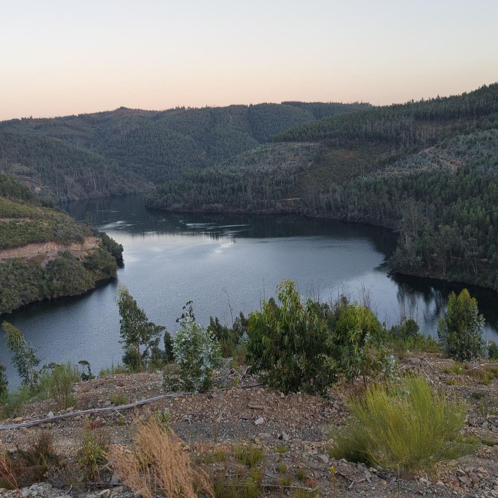
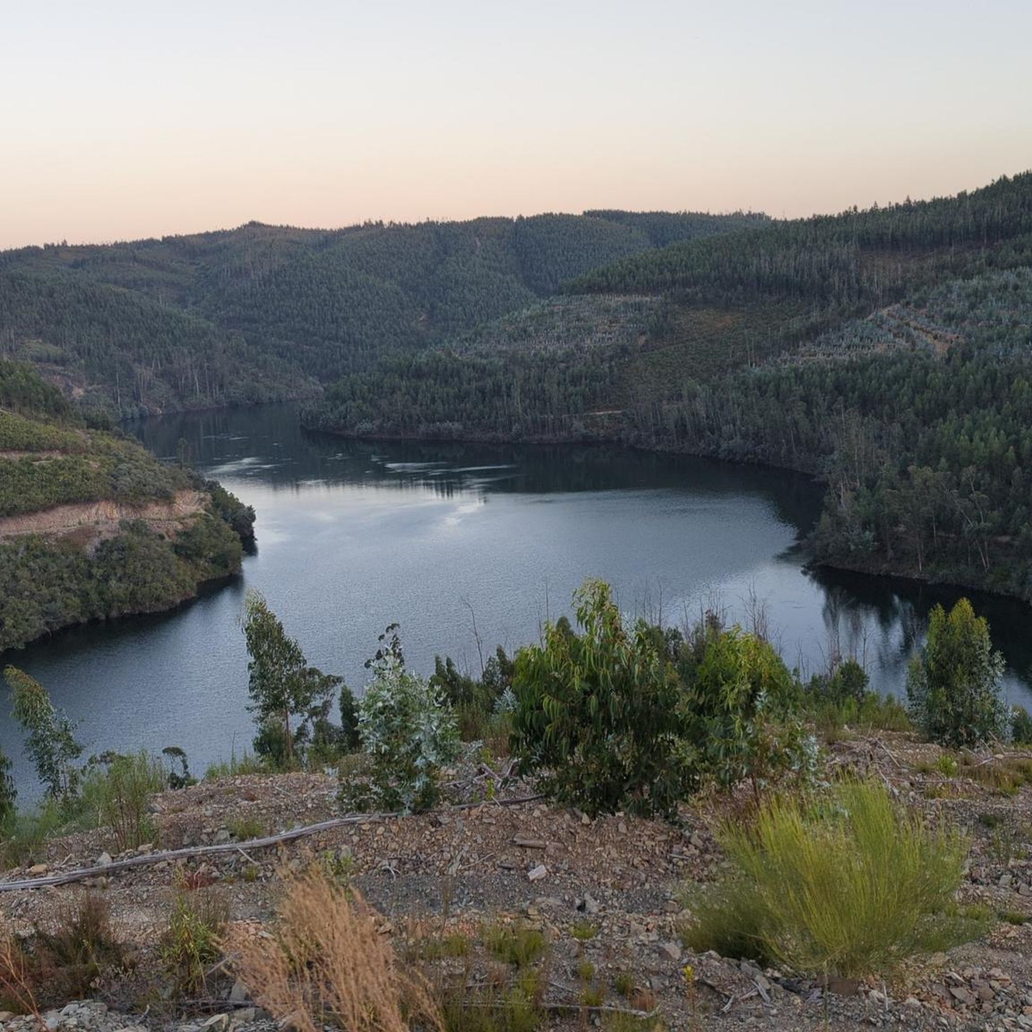
The landscape around Chão De Couce is characterized by rolling hills and dense woodlands, primarily composed of pine and eucalyptus forests. You'll also encounter numerous streams and small river valleys, contributing to varied terrain and tranquil natural settings.
Are there any interesting landmarks or attractions to see near the hiking trails?
Yes, the region offers several points of interest. You can visit the historic Igreja de Alvaiázere, enjoy the natural beauty of Fragas de São Simão River Beach, or explore the scenic Passadiços das Fragas de São Simão. There's also a scenic viewpoint at Monte da Ovelha offering panoramic views.
What do other hikers enjoy most about hiking in Chão De Couce?
The area is highly rated by the komoot community, with an average score of 4.7 stars from over 40 reviews. Reviewers often praise the tranquil river valleys, dense woodlands, and the variety of options for both easy and moderate ability levels.
Is Chão De Couce a good destination for family-friendly walks?
Yes, with a significant number of easy trails and moderate elevations, Chão De Couce is suitable for family outings. The shorter, less strenuous routes like the Casal de São Simão loop from Aguda (1.9 miles / 3.1 km) are ideal for families with children.
Are there hiking trails with good viewpoints in Chão De Couce?
While the region is characterized by rolling hills rather than high peaks, you can find scenic spots. The scenic viewpoint at Monte da Ovelha is a notable highlight where you can enjoy expansive views of the surrounding landscape.
Is there parking available near the hiking trails in Chão De Couce?
Many trailheads in the region, especially those near villages like Aguda or Aldeia do Bofinho, typically offer local parking options. It's advisable to check specific route details on komoot for precise parking information before you go.
What is the best time of year for hiking in Chão De Couce?
The region's climate makes it enjoyable for hiking during most of the year. Spring and autumn offer pleasant temperatures and lush scenery, while winter can provide cooler, crisp conditions. Summers can be warm, so early morning or late afternoon hikes are recommended during peak heat.
Most popular attractions around Chão De Couce

Get inspired with the komoot mobile app


Explore more
Browse the best Hikes in other regions.
