The best walks and hikes around Caia E São Pedro
4.5
(104)
1,117
hikers
99
hikes
Hiking around Caia E São Pedro, part of the municipality of Elvas, Portugal, offers a diverse landscape characterized by historical fortifications, serene Alentejo plains, and varied natural environments. The region features extensive military architecture, including star-shaped bastions and outlying forts, alongside rolling hills and riverine paths. This area, near the Portuguese-Spanish border, provides a blend of cultural heritage and natural beauty for outdoor exploration.
Best hiking trails around Caia E São Pedro
- The most popular hiking route is Praça da…
Last updated: October 11, 2026
4.4
(9)
25
hikers
5.03km
01:26
110m
110m
Easy hike. Great for any fitness level. Easily-accessible paths. Suitable for all skill levels.
4.5
(4)
30
hikers
4.94km
01:15
10m
10m
Easy hike. Great for any fitness level. Easily-accessible paths. Suitable for all skill levels.

5.0
(1)
20
hikers
Easy hike. Great for any fitness level. Easily-accessible paths. Suitable for all skill levels.
4.3
(3)
15
hikers
7.54km
01:54
10m
10m
Easy hike. Great for any fitness level. Easily-accessible paths. Suitable for all skill levels.
5.0
(1)
12
hikers
5.24km
01:27
90m
90m
Easy hike. Great for any fitness level. Easily-accessible paths. Suitable for all skill levels.
Get access to more routes and recommendations from other explorers.
Already have an account?
Our route recommendations are based on thousands of hikes, rides, and runs completed by other people on komoot.
Start today with a free account
Your next adventure awaits.


Tips from the Community


The modern cable-stayed bridge is 452 meters long and has a striking, approximately 81-meter-high A-shaped pylon. From it, 28 steel cables support the roadway and give the bridge its characteristic appearance. It got its name because the Spanish royal couple laid the foundation stone for its construction in 1992.
4
1


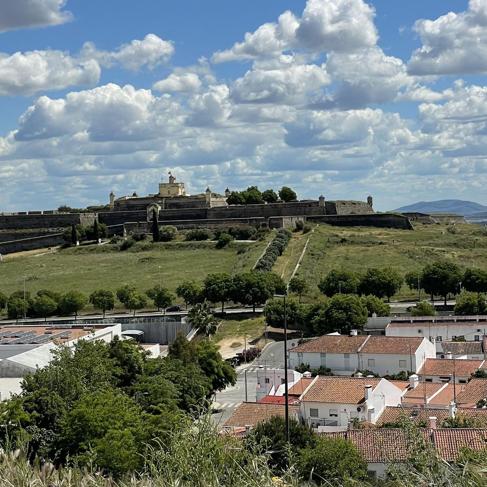
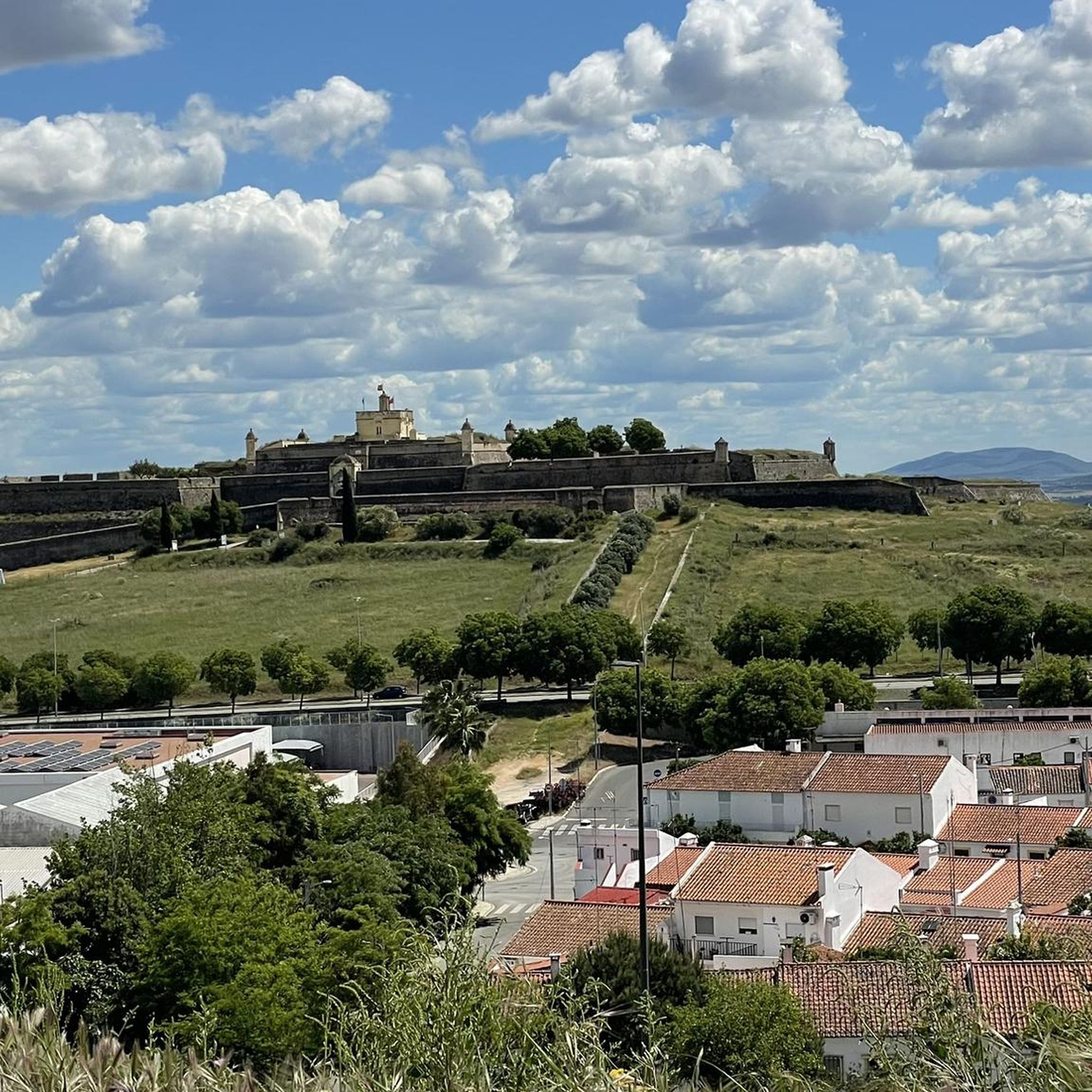
This castle differs significantly from other castles in Portugal, as it is more of a fortress than a royal residence. It is located to the north of the city, with very thick and high castle walls. Due to its strategic location at the highest point in the city, the top of the castle and its ramparts offer magnificent panoramic views of the surrounding landscape.
3
0
It connects the town of Amoreira to the city of Elvas. With a length of 8.5 kilometres, 843 arches with more than five arcades and towers that rise to 31 metres in height, it is considered the largest aqueduct in the Iberian Peninsula. It has been classified as a National Monument since 1910 and is part of the site called the Border and Garrison Town of Elvas and its Fortifications, classified by UNESCO as a World Heritage Site since 2012. (Source: Wikipedia)
15
1

All of the pictures here (except for the last ones with the Pelourinho) show not the Dominican Church, but the old Sé, the city's parish church, the Igreja de Nossa Senhora da Assunção (antiga Sé). The Dominican Church is also not located on the Plaza de la República (City Square), but on the Largo Primero de Decembro, behind the old cathedral, opposite the Arch of Santa Clara.
2
0

Forte da Graça (Graça Fort), also known as Forte Conde de Lippe, is located on the mountain with the same name, one of the highest ones and very important in the defensive strategy of the region. Only one kilometre to the north of the city of Elvas.
5
0
Frequently Asked Questions
How many hiking trails are there in Caia E São Pedro, and what are their difficulty levels?
The Caia E São Pedro area offers a wide selection of hiking trails, with over 80 routes available. These cater to various fitness levels, including 41 easy trails perfect for a relaxed stroll, 43 moderate routes for those seeking a bit more challenge, and a couple of difficult trails for experienced hikers.
What historical landmarks or natural features can I explore while hiking in Caia E São Pedro?
Hiking in Caia E São Pedro provides a unique opportunity to explore a rich historical landscape. You can walk along the magnificent Amoreira Aqueduct, a four-tiered architectural marvel. The region is also famous for its extensive military architecture, including the impressive Fort of Graça and Forte de Santa Luzia, which offer panoramic views. Don't miss the medieval Castle of Elvas, located on the highest elevation, providing sweeping views over the Alentejo plains.
Are there family-friendly hiking trails suitable for children in Caia E São Pedro?
Yes, Caia E São Pedro offers several easy trails that are suitable for families with children. Many routes incorporate historical sites or gentle paths through the Alentejo plains. For example, the Praça da República, Elvas – Castle of Elvas loop from Elvas is an easy 3.0-mile trail that explores the historic castle area, making it a great option for a family outing.
Can I bring my dog on the hiking trails around Caia E São Pedro?
While specific regulations for every trail can vary, the natural and open landscapes of Caia E São Pedro, particularly the Alentejo plains and riverside paths, are generally welcoming for dogs. It's always recommended to keep your dog on a leash, especially near historical sites or in areas with livestock, and to carry waste bags. Many local hikers enjoy these routes with their canine companions.
Are there many circular hiking routes available in the Caia E São Pedro area?
Yes, circular routes are a popular option in Caia E São Pedro, allowing hikers to start and end at the same point without retracing their steps. Many of the trails, such as the Santa Clara Arch loop from Elvas, are designed as loops, making planning easier and offering varied scenery throughout your journey.
What is the best time of year to go hiking in Caia E São Pedro?
The best time to hike in Caia E São Pedro is typically during the spring (March to May) and autumn (September to November). During these seasons, the weather is milder and more pleasant, avoiding the intense heat of summer and the cooler, potentially wetter days of winter. Spring brings blooming wildflowers, while autumn offers comfortable temperatures and beautiful light across the Alentejo plains.
How accessible are the hiking trails in Caia E São Pedro by public transport?
Elvas, the main town in the municipality, is reasonably well-connected by public transport, including bus services. Some trailheads, especially those closer to the city center like the starting point for the Praça da República, Elvas – Castle of Elvas loop from Elvas, are often accessible by local transport. For trails further afield, particularly those in more rural settings or within the Serra de São Mamede Natural Park, a car might be more convenient.
Is parking readily available near the trailheads in Caia E São Pedro?
In and around Elvas, parking is generally available, especially near popular historical sites or town centers which often serve as starting points for trails. For routes that venture into more rural areas or natural parks, designated parking spots might be less frequent, but local information or maps often indicate suitable areas. For example, trails starting from areas like Estadio Nuevo Vivero often have nearby parking options.
What kind of terrain and elevation changes can I expect on hikes in Caia E São Pedro?
The terrain in Caia E São Pedro is quite varied. You can expect gentle paths across the serene Alentejo plains, offering minimal elevation changes, such as the Guadiana River loop from Universidad de Extremadura. However, routes around the historical fortifications like the Forte de Nossa Senhora da Graça and Forte de Santa Luzia involve steeper inclines to reach their elevated positions, rewarding hikers with panoramic views. The broader Serra de São Mamede Natural Park also offers more rolling hills and diverse landscapes.
What do other hikers enjoy most about the trails in Caia E São Pedro?
The trails in Caia E São Pedro are highly rated by the komoot community, with an average score of 4.7 stars from over 60 reviews. Hikers frequently praise the unique blend of historical exploration and natural beauty, particularly the well-preserved fortifications and the peaceful Alentejo atmosphere. The diverse range of routes, from easy strolls to more challenging paths, also contributes to its popularity.
Are there any options for longer distance or multi-day hikes in the region?
While many routes in the immediate Caia E São Pedro area are suitable for day hikes, the broader region, particularly the nearby Serra de São Mamede Natural Park, offers opportunities for longer excursions. This natural park provides diverse terrain and stunning views, making it ideal for those looking for more extensive hiking experiences beyond the immediate vicinity of Elvas. For more information on the Alentejo region's trails, you can visit visitalentejo.pt.
Are there any riverside trails in Caia E São Pedro?
Yes, the region offers pleasant riverside trails, particularly along the Guadiana River. These routes provide a different natural setting compared to the historical fortifications and plains. An example is the Guadiana River loop from Universidad de Extremadura, which allows hikers to enjoy the tranquil riverine landscapes.
Most popular attractions around Caia E São Pedro

Get inspired with the komoot mobile app


Explore more
Browse the best Hikes in other regions.
