The best road cycling routes around Carneiro
4.9
(8)
354
riders
6
rides
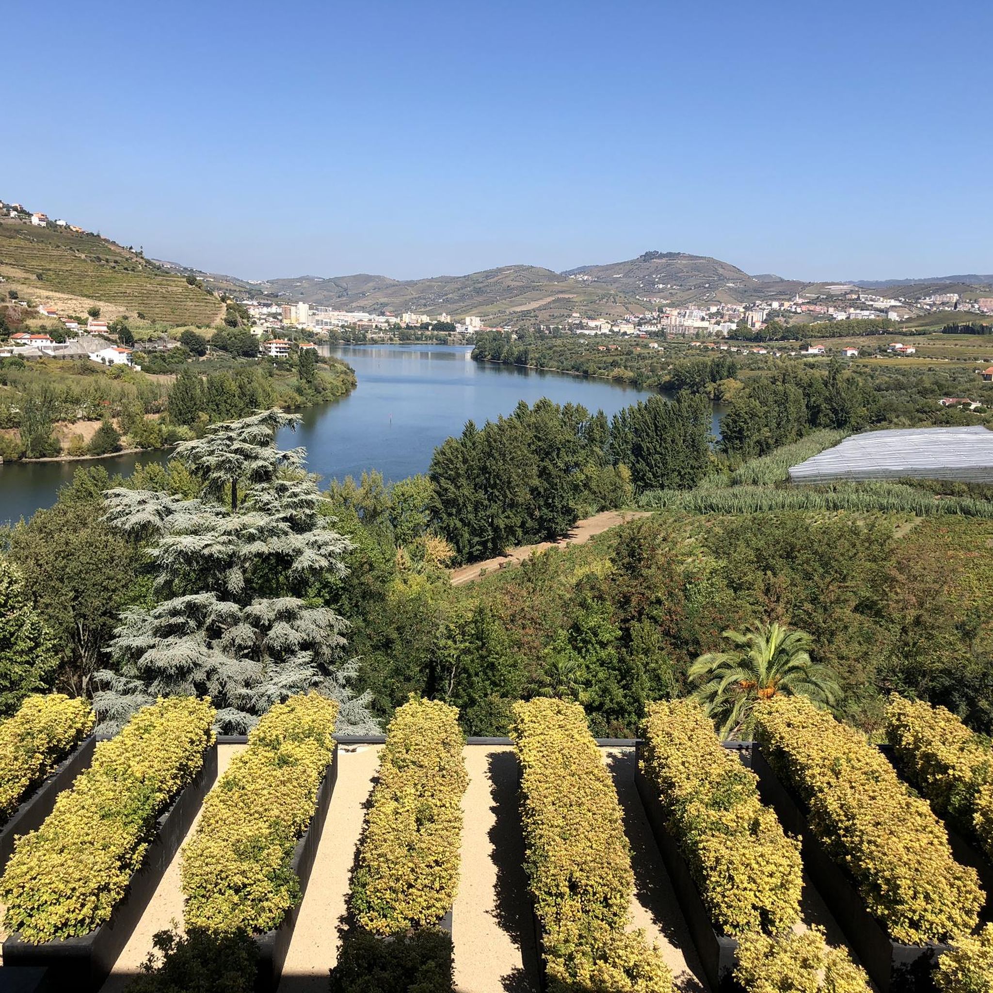
Road cycling routes around Carneiro are situated within the Douro River region of Portugal, characterized by dramatic, green, and hilly landscapes. The area features terraced vineyards and the Douro Valley, a UNESCO World Heritage site, offering varied terrain for road cyclists. Routes often follow the river, passing picturesque bridges and traditional villages, with significant elevation changes.
Best road cycling routes around Carneiro
- The most popular road cycling route is Régua Pedestrian Bridge – Pinhão Metal Bridge loop from Barqueiros,…
Last updated: July 9, 2026
5.0
(1)
100
riders
104km
05:25
1,710m
1,710m
Hard road ride. Very good fitness required. Some segments of this route may be unpaved and difficult to ride.
5.0
(1)
67
riders
83.6km
04:45
1,790m
1,790m
Hard road ride. Very good fitness required. Some segments of this route may be unpaved and difficult to ride.

Sign up for free
5.0
(1)
15
riders
54.0km
03:01
1,170m
1,170m
Hard road ride. Very good fitness required. Mostly well-paved surfaces and easy to ride.
13
riders
54.7km
02:55
1,070m
1,070m
Hard road ride. Very good fitness required. Mostly well-paved surfaces and easy to ride.
5.0
(1)
8
riders
70.9km
03:55
1,500m
1,500m
Hard road ride. Very good fitness required. Mostly well-paved surfaces and easy to ride.
Our route recommendations are based on thousands of hikes, rides, and runs completed by other people on komoot.
Start today with a free account
Your next adventure awaits.
Login or Signup



Tips from the Community

The parking area for motorhomes directly on the Douro River
1
0

A worthwhile museum, which scores points despite/or because of its very minimalist presentation of the subject matter. At the end, enjoy a port wine on the terrace of the museum's café.
1
0
The bridge is really well-made. The view from the bridge is beautiful, even though there's still a lot that could be done with the buildings at the end.
2
0

The regional motifs are simply beautiful. You should take some time to enjoy them.
7
0
Great station with its azulejos. If you're staying at a hotel on the hill, it's best to book a taxi in advance. Otherwise, it can be difficult during peak season.
6
0
The Duero rises in the Picos de Urbión Mountains in the northern Spanish province of Soria at an altitude of 2,080 meters. It flows through the autonomous community of Castile and León, passing through the cities of Soria, Almazán, Aranda de Duero, Tordesillas, and Zamora. For 112 km, it forms the Spanish-Portuguese border, with the river landscape on both sides located in protected natural parks: Arribes del Duero and Douro Internacional. From here, it flows 213 km into Portugal, passing through the cities of Miranda do Douro, Pinhão, and Peso da Régua, as well as the Alto Douro wine region. The Duero flows into the Atlantic near Porto and Vila Nova de Gaia.
3
0

The slopes of the Douro are truly spectacular. Stunning landscapes. 👍🥾
1
0
Thank you for sharing the spectacular photos.👍
0
0
Frequently Asked Questions
How many road cycling routes are available around Carneiro?
There are 6 road cycling routes around Carneiro, offering diverse experiences within the Douro River region. Most of these routes are considered difficult, with one moderate option.
What is the typical terrain and elevation like for road cycling in Carneiro?
Road cycling in Carneiro is characterized by dramatic, green, and hilly landscapes, featuring terraced vineyards and riverside paths along the Douro Valley. Routes often involve significant elevation changes, with climbs ranging from approximately 1000 to 1700 meters.
Are there any easy or beginner-friendly road cycling routes in Carneiro?
The road cycling routes around Carneiro are generally challenging, with 5 out of 6 routes rated as difficult. There is one moderate route, but no easy routes are currently listed, indicating the area is best suited for cyclists comfortable with significant elevation gain.
What kind of landmarks or points of interest can I expect to see along the road cycling routes?
While cycling, you'll encounter picturesque bridges and traditional villages along the Douro River. Nearby attractions include the historic St. Gonçalo Bridge and the Church and Bridge of São Gonçalo in Amarante. You might also spot the Mural of the Facades and enjoy views from the View of Ponte de São Gonçalo.
What do other road cyclists enjoy most about road cycling in Carneiro?
The area is highly rated by the komoot community, with an average score of 4.8 stars from over 7 reviews. Cyclists often praise the extensive views of the Douro River, the dramatic hilly terrain, and the immersive experience of cycling through terraced vineyards and traditional villages.
Are there any circular road cycling routes available?
Yes, several routes are loops. For example, the Régua Pedestrian Bridge – Pinhão Metal Bridge loop from Barqueiros and the Régua Road Bridge – Régua Pedestrian Bridge loop from Loivos do Monte are popular circular options that offer extensive river views and vineyard scenery.
What is the longest road cycling route in Carneiro?
The longest road cycling route available is the Régua Pedestrian Bridge – Pinhão Metal Bridge loop from Barqueiros, which spans 63.9 miles (102.8 km) and typically takes around 5 hours and 21 minutes to complete.
Which route offers the most significant elevation gain?
The Régua Road Bridge – Régua Pedestrian Bridge loop from Loivos do Monte features one of the most significant elevation gains, with approximately 1763 meters of ascent, offering a challenging ride through the region's hilly terrain.
Can I find routes that pass through wine country?
Absolutely. The Douro River region is famous for its terraced vineyards. Routes like the Douro Valley Wine Route – View of the Douro Valley loop from Ermida are specifically designed to showcase these iconic landscapes, offering panoramic views of the vineyards and the river.
Are there any routes that incorporate a ferry crossing?
Yes, the Caldas de Aregos Ferry loop from Ermida is a route that includes a ferry crossing, adding a unique element to your road cycling adventure through the Douro Valley.
What is the shortest difficult road cycling route in the area?
Among the difficult routes, the Baião loop from Rede is the shortest, covering 33.6 miles (54.0 km) and typically completed in about 3 hours and 1 minute, while still offering challenging green, hilly terrain.
Most popular routes around Carneiro
Most popular attractions around Carneiro

Get inspired with the komoot mobile app


Explore more
Browse the best Road cycling routes in other regions.
