The best road cycling routes around Duas Igrejas
4.4
(54)
2,089
riders
96
rides
Road cycling around Duas Igrejas offers varied terrain within the municipality of Miranda do Douro, Portugal. The region is characterized by dramatic topography, including deep river valleys and steep cliffs shaped by the Douro River. Cyclists encounter well-paved roads that wind through extensive olive groves and natural park landscapes. The area provides routes with challenging climbs and exhilarating descents, often featuring views of the Douro River and its canyons.
Best road cycling routes around Duas Igrejas
- The most popular road…
Last updated: October 18, 2026
36
riders
42.6km
02:06
630m
620m
Moderate road ride. Good fitness required. Mostly well-paved surfaces and easy to ride.
12
riders
49.0km
02:25
720m
720m
Moderate road ride. Good fitness required. Mostly well-paved surfaces and easy to ride.

19
riders
Moderate road ride. Good fitness required. Mostly well-paved surfaces and easy to ride.
10
riders
85.0km
04:18
1,210m
1,210m
Hard road ride. Very good fitness required. Some segments of this route may be unpaved and difficult to ride.
9
riders
87.9km
04:37
1,550m
1,550m
Hard road ride. Very good fitness required. Mostly well-paved surfaces and easy to ride.
Get access to more routes and recommendations from other explorers.
Already have an account?
Our route recommendations are based on thousands of hikes, rides, and runs completed by other people on komoot.
Start today with a free account
Your next adventure awaits.

Tips from the Community

The Dom Zameiro Bridge crosses the Ave River in a bucolic setting of vineyards and fields, connecting the parishes of Bagunte and Macieira da Maia. Although reminiscent of Roman architecture, its origins date back to the 12th or 13th centuries. Part of the old Via Veteriz, the medieval road that connected Porto to Barcelos and Esposende, it continues to welcome pilgrims today, with a small resting place. Windmills and a rural house complete the serene picture of a place where time seems to slow down.
1
0


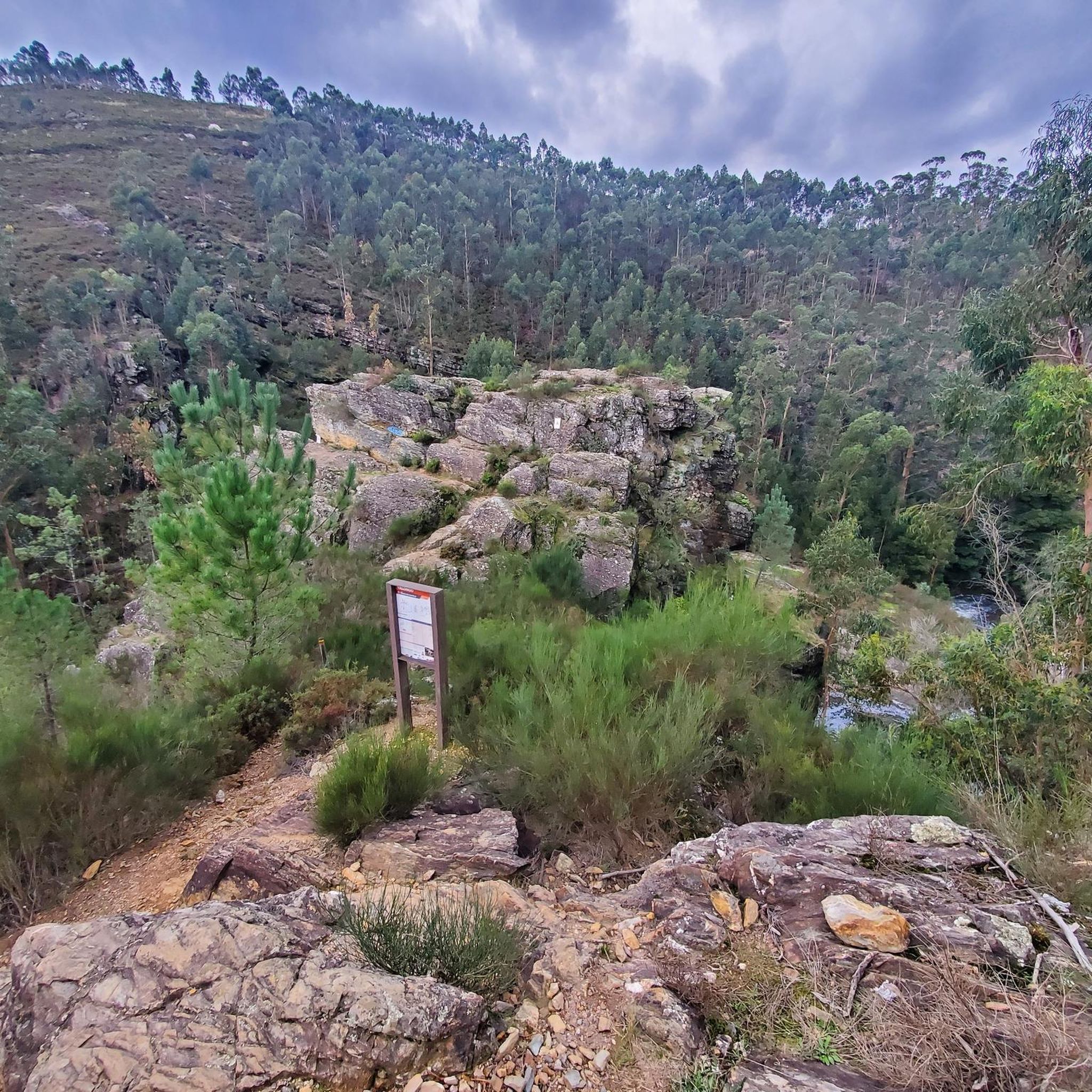
This is perhaps one of the most popular places in the municipality of Paredes. This landscaped area of rare beauty is nestled between high mountains through which the Sousa River flows. This place is home to the so-called “Boca do Inferno”, with its unique geological characteristics and imbued with great mysticism. The Senhora do Salto site offers moments of tranquility and freshness, and its cliffs are ideal for abseiling, climbing, mountain biking or hiking. Despite the existence of a valley with steep slopes, it is possible to enjoy long-distance views if you climb the slopes of the Santa Iria mountain range. This area is part of the Natura 2000 Network, which protects the habitats and species of flora and fauna, and it is possible to observe the peregrine falcon and the rock swallow, among others. The Salto site is shrouded in a legend, according to which a knight escaped death by invoking the protection of Our Lady after an inadvertent jump into the abyss. As a sign of gratitude for the miracle, the knight ordered the construction of the small chapel of Nossa Senhora do Salto.
0
0

An imposing C14 fortified manor house stands at the end of the village and shares a wall with a contemporary building. It has been impressively restored inside with wooden stairs and floors. There's also a art mini gallery, with pictures and sculptures created by local artists. There's a Tourist Information Centre next to the tower but it looks closed for good. A kind lady from the house on the right of the entrance gate opened the Torre for me and showed me around. Obrigado :) https://www.rotadoromanico.com/en/Monuments/tower-of-the-alcoforados/
0
0
This quadrangular tower, with a stunning 360° view to the Sousa River valley and surrounding hills, is all that remains of a castle built around C9 as a part of the Kingdom of Asturias' defensive network. It was besieged in 995 by Almanzor, the famous military leader from the Caliphate of Córdoba. The castle was a seat of various territorial units between C11 and C13, stretching all the way from Porto to Penafiel. It was abandoned at the end of C13. To reach the tower you have climb a steep stone path but after the initial brutal ramp it eases off and the path turns to concrete. It's well worth the effort :) https://www.rotadoromanico.com/en/Monuments/tower-of-the-castle-of-aguiar-de-sousa/
0
0


The schist village of Quintadona is very well preserved. Its emblematic canastros are worth a visit.
0
0

Beautiful bridge overlooking the watermills.
0
0
Frequently Asked Questions
How many road cycling routes are available around Duas Igrejas?
There are over 100 road cycling routes around Duas Igrejas, offering a wide range of options for different skill levels. This includes 2 easy routes, 65 moderate routes, and 34 difficult routes.
What is the best time of year for road cycling in Duas Igrejas?
The region is particularly picturesque during the almond blossom season in February and March, when the almond trees are in full bloom. Generally, spring and autumn offer pleasant temperatures for cycling, while summer can be warm but still enjoyable with early morning rides.
Are there any circular road cycling routes in Duas Igrejas?
Yes, many routes in Duas Igrejas are designed as loops. For example, the moderate Church of Saint Thomas – Stone Towers in Park loop from Vilela is a popular 42.6 km circular route, and the more challenging Torre dos Alcoforados – Along the Leça River loop from Rebordosa covers 83.6 km.
What kind of terrain can I expect on road cycling routes in Duas Igrejas?
Road cycling in Duas Igrejas features varied and often dramatic terrain. You'll encounter well-paved roads winding through deep river valleys, alongside steep cliffs, and past extensive olive groves. Routes often include challenging climbs and exhilarating descents, with constant views of the Douro River and its canyons.
What do other road cyclists enjoy most about the routes in Duas Igrejas?
The road cycling routes in Duas Igrejas are highly rated by the komoot community, with an average score of 4.6 stars from over 40 reviews. Cyclists frequently praise the breathtaking scenic views, the challenging yet rewarding climbs, and the opportunity to explore the natural beauty of the Douro International Natural Park.
Are there any beginner-friendly road cycling routes in the area?
While many routes feature significant elevation changes, there are options suitable for beginners. For instance, the Monte Alto – Ponte dos Arcos de Campo loop from Rebordosa is a moderate 23.4 km route with a manageable elevation gain, offering a good introduction to the region's cycling.
What attractions can I see along the road cycling routes in Duas Igrejas?
Many routes pass by interesting landmarks and natural features. You might encounter the Ponte dos Arcos de Campo, or enjoy panoramic vistas from viewpoints like the View of Fragas do Castelo. The region is also known for its charming historic villages and the dramatic Douro cliffs.
Are there any waterfalls or bridges to see on the routes?
Yes, some routes offer views of impressive natural and man-made structures. You can find highlights such as the Leça River Waterfalls and the Suspended Bridge at Parque das Serras do Porto, which add to the scenic appeal of the rides.
What are some of the more challenging road cycling routes in Duas Igrejas?
For experienced cyclists seeking a challenge, routes like the Torre dos Alcoforados – Along the Leça River loop from Rebordosa offer significant elevation gains and longer distances. This particular route is 83.6 km long with over 1180 meters of climbing, providing a demanding yet rewarding experience.
Can I find routes that pass through historic villages?
Absolutely. The road cycling routes in Duas Igrejas frequently lead through charming, historic villages that preserve their medieval character. The Aldeia de Quintandona – Museu da Broa loop from Rebordosa is an excellent example, traversing picturesque villages and offering a glimpse into the region's rich heritage.
Are there routes with good viewpoints of the Douro River?
Many routes in Duas Igrejas offer spectacular views of the Douro River and its canyons. The region is dotted with numerous panoramic viewpoints, and the winding roads often provide continuous vistas of the dramatic river landscape, especially within the Douro International Natural Park.
What is the average distance and elevation gain for road cycling routes in Duas Igrejas?
The routes vary significantly, but moderate options often range from 40 to 60 km with elevation gains between 600 and 900 meters. More difficult routes can extend over 80 km with more than 1000 meters of climbing, while shorter, easier routes are also available.
Most popular routes around Duas Igrejas
Most popular attractions around Duas Igrejas

Get inspired with the komoot mobile app


Explore more
Browse the best Road cycling routes in other regions.
