The best cycling routes around Godim
3.8
(68)
4,603
riders
14
rides
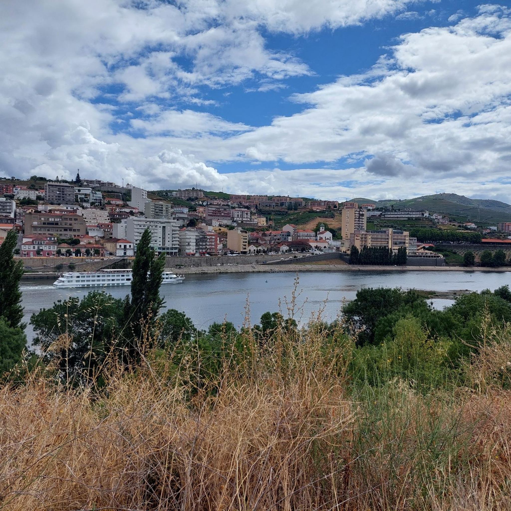
Touring cycling routes around Godim are primarily situated within the Douro Valley, a region defined by the Douro River and its surrounding terraced hillsides. The landscape features significant elevation changes, with routes traversing both riverside paths and climbs through vineyards and rural areas. This area offers varied terrain, from gentler sections along the river to more challenging ascents into the higher elevations of the valley.
Best touring cycling routes around Godim
- The most popular touring cycling route is Douro Valley…
Last updated: October 12, 2026
4.4
(24)
4,171
riders
41.6km
02:36
430m
430m
Moderate bike ride. Good fitness required. Mostly paved surfaces. Suitable for all skill levels.
3.0
(4)
79
riders
11.8km
00:46
130m
130m
Easy bike ride. Great for any fitness level. Mostly paved surfaces. Suitable for all skill levels.

4.5
(4)
37
riders
57.7km
03:59
1,000m
1,000m
Hard bike ride. Very good fitness required. Mostly paved surfaces. Suitable for all skill levels.
29
riders
106km
07:34
2,170m
2,180m
Hard bike ride. Very good fitness required. Mostly paved surfaces. Suitable for all skill levels.
4.0
(2)
19
riders
51.2km
03:39
820m
820m
Hard bike ride. Very good fitness required. Mostly paved surfaces. Suitable for all skill levels.
Get access to more routes and recommendations from other explorers.
Already have an account?
Our route recommendations are based on thousands of hikes, rides, and runs completed by other people on komoot.
Start today with a free account
Your next adventure awaits.


Tips from the Community

The parking area for motorhomes directly on the Douro River
1
0

The station is so run-down that it's almost in working order again. Old railway vehicles (burned-out steam locomotives and old wagons) are scattered around the large grounds. There are also many disused tracks, including turntables. At the end of the station, the former storage sheds have been converted into wine shops and restaurants.
2
0
A worthwhile museum, which scores points despite/or because of its very minimalist presentation of the subject matter. At the end, enjoy a port wine on the terrace of the museum's café.
1
0
The bridge is really well-made. The view from the bridge is beautiful, even though there's still a lot that could be done with the buildings at the end.
2
0
The Duero rises in the Picos de Urbión Mountains in the northern Spanish province of Soria at an altitude of 2,080 meters. It flows through the autonomous community of Castile and León, passing through the cities of Soria, Almazán, Aranda de Duero, Tordesillas, and Zamora. For 112 km, it forms the Spanish-Portuguese border, with the river landscape on both sides located in protected natural parks: Arribes del Duero and Douro Internacional. From here, it flows 213 km into Portugal, passing through the cities of Miranda do Douro, Pinhão, and Peso da Régua, as well as the Alto Douro wine region. The Duero flows into the Atlantic near Porto and Vila Nova de Gaia.
3
0

The slopes of the Douro are truly spectacular. Stunning landscapes. 👍🥾
1
0
Thank you for sharing the spectacular photos.👍
0
0

This is the southern part of Ecopista do corgo, the former railroad track between Chaves and Peso da Régua. The view of the valley and all the wine yards is spectacular, but expect a rather rough and uneven surface. MTB is definitely recommended here.
0
0
Frequently Asked Questions
How many touring cycling routes are available around Godim?
There are over 15 touring cycling routes available around Godim, primarily situated within the Douro Valley. These routes offer varied terrain, from gentler sections along the river to more challenging ascents through vineyards.
What is the general terrain like for touring cycling in the Godim area?
The terrain around Godim, located within the Douro Valley, is characterized by the Douro River and its surrounding terraced hillsides. Cyclists can expect significant elevation changes, with routes traversing both riverside paths and climbs through vineyards and rural areas. The landscape offers a mix of easy riverside loops and challenging ascents.
What do other cyclists say about the touring routes in Godim?
The touring cycling routes around Godim are highly rated by the komoot community, with an average score of 4.1 stars from over 50 reviews. More than 3800 touring cyclists have used komoot to explore the varied terrain, often praising the scenic views of the Douro River and the unique experience of cycling through the wine region.
Are there easy touring cycling routes suitable for beginners in Godim?
Yes, there are easy touring cycling routes available. For instance, the Régua Pedestrian Bridge – Douro Valley loop from Régua is an easy 7.3 miles (11.7 km) path that provides an accessible option for exploring the riverside scenery without significant climbs.
What are some of the more challenging touring cycling routes around Godim?
For experienced cyclists seeking a challenge, routes like the Douro Valley – Régua Pedestrian Bridge loop from Godim offer a demanding experience. This difficult trail spans 64.6 miles (103.9 km) with over 2,100 meters of elevation gain, leading through the expansive Douro Valley.
Are there any circular touring cycling routes available?
Yes, many routes in the area are designed as loops. Examples include the Douro Valley – Régua Pedestrian Bridge loop from Régua, a 31.3-mile route, and the Régua Railway Station – Régua Pedestrian Bridge loop from Régua, which covers 56.6 km with significant elevation changes.
What natural features or landmarks can I expect to see along the touring cycling routes?
Along the touring cycling routes, you'll primarily encounter the stunning Douro River and its terraced vineyards. Notable features include the Régua Pedestrian Bridge and the general beauty of Régua and the Douro River itself. The region is famous for its wine-growing landscapes.
Are there any historical or cultural attractions accessible from the cycling routes?
Yes, the region offers several cultural points of interest. You might consider visiting Casa do Douro (House of the Douro), which is significant to the region's wine history. Further afield, Lamego Castle offers a glimpse into the area's past.
What is the best time of year for touring cycling in the Douro Valley region?
The best time for touring cycling in the Douro Valley is typically during the spring (April to June) and autumn (September to October). During these months, the weather is generally mild and pleasant, avoiding the intense heat of summer and the cooler, wetter conditions of winter. Spring brings blooming landscapes, while autumn offers the vibrant colors of the harvest season.
Can I combine cycling with other activities like river cruises?
Absolutely. The Douro River is central to the region's tourism. You can find a Douro River cruise dock in Peso da Régua, allowing you to combine a scenic bike ride with a relaxing boat tour to experience the valley from a different perspective.
Are there routes that offer scenic viewpoints?
Many routes in the Douro Valley offer breathtaking panoramic views. For example, the Viewpoint on the Train Line loop from Régua is a 50.6 km route specifically designed to showcase scenic vistas, often overlooking the river and terraced vineyards.
What are the typical distances and elevations for touring cycling routes in this area?
Touring cycling routes around Godim vary significantly. Distances can range from shorter, easy loops of around 7 miles (11 km) with about 120 meters of elevation gain, to challenging multi-hour rides exceeding 60 miles (100 km) with over 2,100 meters of climbing. This variety ensures options for all fitness levels.
Most popular routes around Godim
Most popular attractions around Godim

Get inspired with the komoot mobile app


Explore more
Browse the best Cycling routes in other regions.
