The best cycling routes around Ferreirim
4.7
(23)
105
riders
4
rides
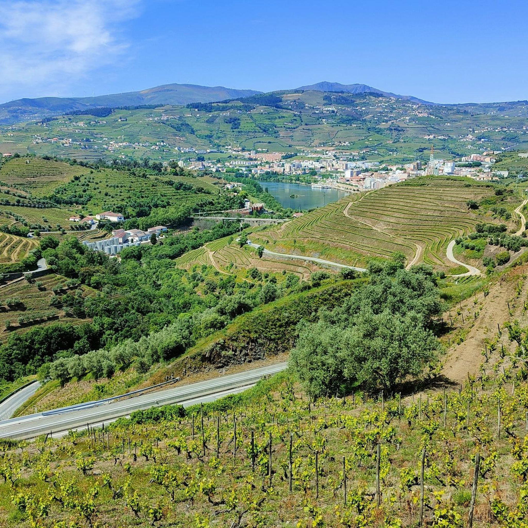
Touring cycling routes around Ferreirim, located in Portugal's Viseu district, navigate a landscape characterized by its proximity to the Douro Valley, a UNESCO World Heritage site. The region features terraced hillsides, schist lanes, and an average altitude of 525.3 meters above sea level. Routes often include views of the Bestança River Valley and the Serra de Montemuro, providing varied terrain for cyclists. This area offers a blend of cultural landmarks and natural features, making it suitable for exploring by bike.
…Last updated: June 26, 2026
4.8
(13)
56
riders
39.9km
02:58
840m
840m
Hard bike ride. Very good fitness required. Mostly paved surfaces. Suitable for all skill levels.
4.5
(10)
36
riders
29.5km
02:20
710m
710m
Hard bike ride. Very good fitness required. Mostly paved surfaces. Suitable for all skill levels.

Sign up for free
9
riders
111km
07:36
1,920m
1,920m
Hard bike ride. Very good fitness required. Mostly paved surfaces. Suitable for all skill levels.
2
riders
24.3km
01:56
690m
690m
Hard bike ride. Very good fitness required. Mostly paved surfaces. Suitable for all skill levels.
2
riders
88.0km
06:11
1,650m
1,650m
Hard bike ride. Very good fitness required. Mostly paved surfaces. Suitable for all skill levels.
Our route recommendations are based on thousands of hikes, rides, and runs completed by other people on komoot.
Start today with a free account
Your next adventure awaits.
Login or Signup


Tips from the Community

The parking area for motorhomes directly on the Douro River
1
0

The station is so run-down that it's almost in working order again. Old railway vehicles (burned-out steam locomotives and old wagons) are scattered around the large grounds. There are also many disused tracks, including turntables. At the end of the station, the former storage sheds have been converted into wine shops and restaurants.
2
0
The bridge is really well-made. The view from the bridge is beautiful, even though there's still a lot that could be done with the buildings at the end.
2
0

A beautiful church, both inside and out. The courtyard is also worth seeing 😃
2
0
The Duero rises in the Picos de Urbión Mountains in the northern Spanish province of Soria at an altitude of 2,080 meters. It flows through the autonomous community of Castile and León, passing through the cities of Soria, Almazán, Aranda de Duero, Tordesillas, and Zamora. For 112 km, it forms the Spanish-Portuguese border, with the river landscape on both sides located in protected natural parks: Arribes del Duero and Douro Internacional. From here, it flows 213 km into Portugal, passing through the cities of Miranda do Douro, Pinhão, and Peso da Régua, as well as the Alto Douro wine region. The Duero flows into the Atlantic near Porto and Vila Nova de Gaia.
3
0

The slopes of the Douro are truly spectacular. Stunning landscapes. 👍🥾
1
0
Thank you for sharing the spectacular photos.👍
0
0

A charming village with a typically medieval feel, the town still consists of a small, romantic line of houses stretching along a narrow path, Rua Principal, Rua Direita, or simply Rua, since it is the only street in the village. Winemaking, particularly elderberry, a strong presence in the village, continues to be the main source of livelihood. The village's two landmarks stand proudly at the entrance to the old Couto de Salzedas. They are the Tower and the Ucanha Bridge, two rare gems of the Douro Heritage. Some scholars suggest that the Ucanha Bridge, a National Monument, was built on an earlier Roman structure, while others suggest that it already existed in the 12th century. In any case, the current structure, in Gothic style, was built in the 15th century. Next to it stands a robust, square-shaped tower, formerly intended not only to guard the entrance to Couto de Salzedas, but also to allow the collection of tolls to which the Monastery was entitled.
1
0
Frequently Asked Questions
What kind of terrain can I expect on touring cycling routes around Ferreirim?
The touring cycling routes around Ferreirim are primarily characterized by their proximity to the Douro Valley, a UNESCO World Heritage site. You'll encounter terraced hillsides, often featuring vineyards, and quiet schist lanes. The region has an average altitude of 525.3 meters above sea level, and routes frequently offer views of the Bestança River Valley and the Serra de Montemuro, providing varied and often challenging terrain.
Are there many touring cycling routes available in Ferreirim?
While Ferreirim serves as a gateway to the broader Douro Valley, the immediate area features several dedicated touring cycling routes. There are currently 4 difficult touring cycling routes listed, offering diverse experiences through the region's unique landscape.
What is the general difficulty level of touring cycling routes near Ferreirim?
The touring cycling routes around Ferreirim are generally considered difficult. They often involve significant elevation changes, with routes like the Douro Valley Wine Route – Régua Pedestrian Bridge loop from Lamego featuring over 790 meters of ascent. Cyclists should be prepared for challenging climbs and descents.
Are there any circular touring cycling routes in the Ferreirim area?
Yes, many of the touring cycling routes around Ferreirim are designed as loops. For instance, the Régua Train Station – Original Douro Hotel loop from Lamego is a popular circular route exploring the area around Lamego, offering both historical sites and scenic views.
What are some notable landmarks or viewpoints I can see while cycling near Ferreirim?
The region offers numerous cultural and scenic highlights. You can cycle past the iconic UNESCO World Heritage vineyards of the Douro Valley. Nearby Lamego boasts historical attractions such as the Lamego Castle, the Lamego Cathedral, and the impressive Sanctuary of Nossa Senhora dos Remédios Staircase. Many routes also provide breathtaking views of the Douro Valley.
What do other touring cyclists say about the routes around Ferreirim?
The touring cycling routes in Ferreirim are highly regarded by the komoot community, holding an impressive average rating of 4.7 stars from over 19 reviews. Cyclists often praise the stunning scenery of the Douro Valley and the immersive experience of cycling through the terraced vineyards.
How long are the touring cycling routes in this region?
The routes vary significantly in length. You can find shorter, challenging loops like the Bike loop from Lamego, which is about 24.5 km (15.2 miles). For a longer adventure, consider the Douro Valley – Douro Riverside Views loop from Armamar, spanning approximately 112 km (69.7 miles).
Is it possible to access these cycling routes using public transport?
While Ferreirim itself is a smaller parish, the nearby city of Lamego, which serves as a common starting point for many routes, has public transport connections. Some routes, like the Régua Train Station – Original Douro Hotel loop from Lamego, specifically mention starting points near transport hubs, making them potentially accessible by train or bus to Lamego or Régua.
What is the best time of year to go touring cycling in Ferreirim and the Douro Valley?
The region is particularly stunning in autumn when the terraced vineyards transform into 'lipstick-red vines,' offering a picturesque cycling backdrop. Spring also provides pleasant temperatures and lush landscapes. Summers can be hot, while winters might be cooler and wetter, though cycling is generally possible year-round, depending on specific weather conditions.
Are there any family-friendly touring cycling options in the Ferreirim area?
Given that most listed touring cycling routes in this area are rated as 'difficult' due to significant elevation changes and distances, they might be challenging for younger children or beginner family cyclists. However, the region offers many scenic, quieter roads that could be adapted for shorter, less strenuous rides if planned carefully, focusing on flatter sections along the river where available.
Can I bring my dog on the touring cycling routes around Ferreirim?
While specific regulations for dogs on cycling routes can vary, generally, dogs are welcome on public paths and roads in Portugal, provided they are kept under control, typically on a leash. It's advisable to ensure your dog is fit for the challenging terrain and distances, and to carry enough water for both yourself and your pet, especially on longer routes or during warmer months.
Where can I park my car when starting a touring cycling route near Ferreirim?
Many touring cycling routes in the region start from larger towns like Lamego or Armamar, where public parking facilities are available. For example, routes originating from Lamego would typically utilize parking within the city, allowing easy access to the starting points. It's recommended to check local parking options in your chosen starting town.
Most popular routes around Ferreirim
Most popular attractions around Ferreirim

Get inspired with the komoot mobile app


Explore more
Browse the best Cycling routes in other regions.
