The 8 Most Amazing Peaks around Lembach im Mühlkreis
Best mountain peaks around Lembach im Mühlkreis are characterized by prominent elevated areas and viewpoints rather than towering alpine summits. The region, located in Upper Austria, offers a hilly landscape with opportunities for panoramic vistas and hiking. Notable natural features include the dramatic Schlögen Loop of the Danube River, which provides significant elevated viewpoints. These areas offer various hiking routes and natural experiences.
Best mountain peaks around Lembach im Mühlkreis
- The most popular mountain peaks is Ameisberg Tower, a…
Last updated: July 1, 2026
Ameisberg Tower
Highlight • Viewpoint
Translated by Google •
Tip by

Cooling stone
Highlight • Viewpoint
A beautiful hike from all sides and a fantastic view
Translated by Google •
Tip by

Sign up now to discover places like this
Get recommendations on the best single tracks, peaks, & plenty of other exciting outdoor places.
Sign up for free
Lutzenkreuz
Highlight • Summit
A popular destination for everyone because it is easy to reach...on foot or by bike. A wonderful place to rest or for a bike ride.
Translated by Google •
Tip by
Summit Cross Kugelberg – Station 12 of Lebensblickeweg
Highlight • Summit
Translated by Google •
Tip by
Kalvarienberg Chapel
Highlight • Religious Site
Translated by Google •
Tip by

Sign up for free to discover even more peaks around Lembach im Mühlkreis.
Sign up for free
Already have an account?
Start today with a free account
Your next adventure awaits.
Login or Signup
Popular around Lembach im Mühlkreis
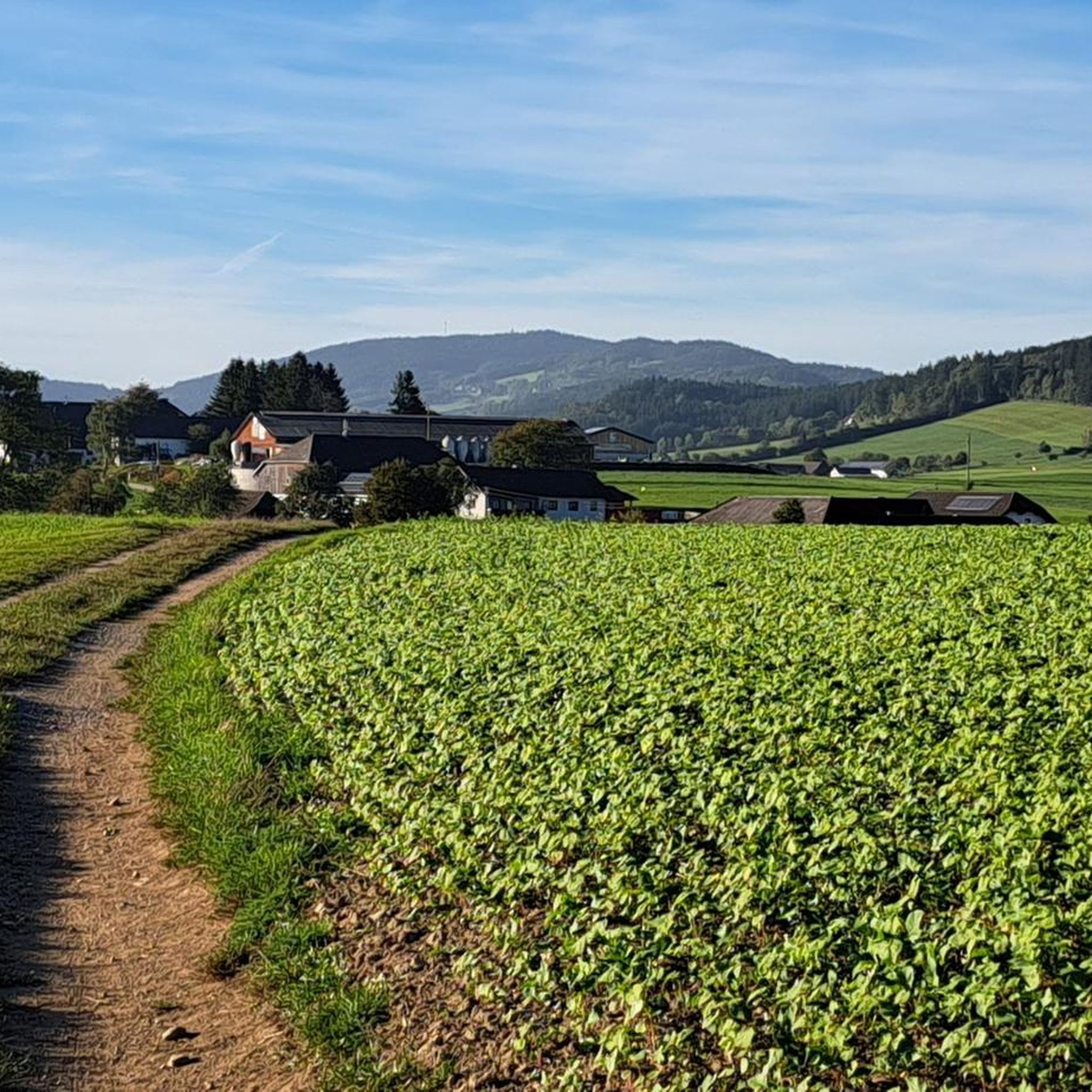

Tips from the Community

The Calvary Hill is the highest elevation in the municipality (562 m) with a chapel.
0
0
Panoramic view across the Danube to Kirchberg ob der Donau.
0
0

The Lutzenkreuz is the highest elevation in the Mühlviertel municipality of Putzleinsdorf and is beautifully situated in the forest with a lovely rest area.
0
1


Unfortunately mostly closed as it is privately owned.
4
0

By the way, not a via ferrata, but shorter sport climbing routes.
3
0
The Kühstein 710m The Kühstein, located between Oberpeilstein and Meisingeröd, has become a beautiful destination. Several hiking trails also meet here. The somewhat grim face on the southeast side doesn't stop climbers from practicing on the rocks. Nevertheless, this rock castle has retained its old historical grandeur. Our prehistoric ancestors used the large bowl on the summit for sacrifice. They also came here to select their bards. Five pines adorn the summit level, they are about 140 years old. To the northeast you have a good view of the small Mühltal valley, and you can also enjoy the sunrise. Two ramparts testify to an early castle around 1300 and around 1600 there was a wooden chapel at the foot of the rock. The Kühstein is energetically connected to the nearby Bründlstein. (https://www.muehlviertel.at/oesterreich-poi/detail/430015314/kuehstein.html)
3
0

The Lutzenkreuz is a popular destination, whether on foot or by bike. It's easy to get to and a beautiful spot for a rest or a bikini.
1
0
Frequently Asked Questions
What are some prominent elevated areas or viewpoints to visit around Lembach im Mühlkreis?
The region around Lembach im Mühlkreis is characterized by picturesque hilly landscapes and offers several notable elevated areas and viewpoints. Key destinations include the Ameisberg Tower, the natural monument known as Cooling stone, and the highest point in Putzleinsdorf, Lutzenkreuz. Additionally, the dramatic Schlögen Loop of the Danube River provides spectacular panoramic vistas.
What makes the Ameisberg Tower a popular destination?
The Ameisberg Tower, situated at the summit of Ameisberg (941 meters), is a 24-meter-high structure offering extensive views of the surrounding landscape. Visitors appreciate the great experience and ambiance, with beautiful mature trees framing the tower. It's a popular spot for its panoramic outlook.
What can I expect when visiting the Cooling stone?
The Cooling stone is a natural monument and viewpoint at 710 meters, offering wide views of the Kleine Mühl valley, the Bohemian Forest, and towards Rohrbach. It's a popular destination for hikers and cyclists, with several trails converging here. Historically, it was an earlier place of sacrifice, and its rock castle has retained its old historical grandeur.
What is special about Lutzenkreuz?
Lutzenkreuz is the highest point in the municipality of Putzleinsdorf at 907 meters. It's a popular and easily accessible destination for everyone, whether on foot or by bike, offering a wonderful place to rest. The summit is known for its flowing trails in all directions.
Are there any themed trails that include mountain peaks or elevated viewpoints?
Yes, the Summit Cross Kugelberg is Station 12 of the Lebensblickeweg. This varied circular route features 12 thematic points, reflecting the everyday life of bygone days with old photos of the Sarleinsbach population. It offers numerous benches and rest stops, including a meditation area with views of the Ameisberg, making for a contemplative and enjoyable hike.
What kind of natural features can I explore near Lembach im Mühlkreis?
Beyond the named peaks, the region is rich in natural beauty. The most iconic feature is the Schlögen Loop (Schlögener Schlinge), where the Danube River makes a dramatic U-turn through forested hills. Viewpoints like Schlögener Blick offer breathtaking panoramas. You'll find dense forests, river valleys, and unique geological formations, such as those around the Cooling stone.
Are there historical or cultural sites associated with the elevated areas?
Yes, several elevated areas have historical or cultural significance. The Ameisberg Tower is a man-made monument. The Cooling stone is a natural monument with archaeological evidence of being an earlier place of sacrifice. Additionally, the Kalvarienberg Chapel, located on the highest elevation in its municipality, is a religious building offering panoramic views.
Are there family-friendly mountain peaks or viewpoints in the area?
Many of the elevated areas around Lembach im Mühlkreis are considered family-friendly. Highlights like the Ameisberg Tower, Cooling stone, and Lutzenkreuz are accessible and suitable for families. The Lebensblickeweg, which includes the Summit Cross Kugelberg, is also designed with varied circular routes and rest stops that can be enjoyed by all ages.
What outdoor activities, like hiking or cycling, can I do near these elevated areas?
The region offers diverse outdoor activities. You can find numerous hiking trails, ranging from easy to difficult, especially around the Schlögen Loop. For cycling, there are routes like the 'Untermühl – Resilacke loop' or the 'Sarleinsbach Town Square – Doppl Bridge loop'. You can explore more options in the Easy hikes around Lembach im Mühlkreis, Mountain Hikes around Lembach im Mühlkreis, and Cycling around Lembach im Mühlkreis guides.
Are there easy hiking trails around Lembach im Mühlkreis?
Yes, there are several easy hiking trails suitable for a relaxed outing. Examples include the 'Chapel in Mühlviertel – Johanniter Cross loop' and the 'Power Plant Model – Büchertor Shelter loop' from Lembach im Mühlkreis. These routes typically range from 4.5 km to 7 km in distance. For more details, refer to the Easy hikes around Lembach im Mühlkreis guide.
What about more challenging mountain hikes in the area?
For those seeking more challenging routes, the area around the Schlögen Loop offers options. For instance, the 'Schlögen Loop – Schlögen Loop loop from Haibach ob der Donau' is a difficult 17.6 km mountaineering route. You can find more challenging trails in the Mountain Hikes around Lembach im Mühlkreis guide.
When is the best time to visit the elevated areas around Lembach im Mühlkreis?
The region's elevated areas and viewpoints are generally enjoyable throughout the warmer months, from spring to autumn, when hiking and cycling conditions are ideal. The 'golden hour' or sunset is particularly recommended for visiting viewpoints like Schlögener Blick for an especially impressive landscape.
Where can I find panoramic views of the Danube River?
For breathtaking panoramic views of the Danube River, the Schlögen Loop (Schlögener Schlinge) is the primary destination. The renowned Schlögener Blick viewpoint offers an iconic perspective of the river's dramatic U-turn. The Kalvarienberg Chapel also provides a panoramic view across the Danube towards Kirchberg ob der Donau.
Most popular routes around Lembach im Mühlkreis
Most popular attractions around Lembach im Mühlkreis

Get inspired with the komoot mobile app


Explore more
See even more amazing summits around Lembach im Mühlkreis with these guides:
