The best walks and hikes in Ansel Adams Wilderness
4.7
(160)
2,715
hikers
197
hikes
Hiking in Ansel Adams Wilderness explores a vast area within California's Sierra Nevada, characterized by its glaciated terrain. The region features granite peaks, deep canyons, and numerous alpine lakes, with elevations ranging from approximately 3,500 feet to over 13,000 feet. This diverse landscape includes meadows and high-altitude rock formations, notably the prominent Ritter Range.
Best hiking trails in Ansel Adams Wilderness
- The most popular hiking route is Thousand Island Lake via Rush Creek Trail, a 7.4 miles (11.9 km) trail that takes 4 hours 15 minutes to complete. This route leads to a large alpine lake set against the backdrop of Banner Peak.
- Another top favourite among local hikers is Shadow Creek and John Muir Trail to Garnet Lake, a difficult 12.2 miles (19.6 km) path. This trail offers views of granite cliffs and alpine scenery.
- Local hikers also love the McCleod Lake Trail, an 1.8 miles (2.9 km) trail leading through forested areas to an alpine lake, often completed in about 53 minutes.
- Hiking in Ansel Adams Wilderness is defined by high-altitude alpine lakes, granite peaks, and sections of the John Muir Trail. The trail network offers options for both moderate day hikes and more difficult multi-day backpacking trips.
- The routes in Ansel Adams Wilderness are highly rated by the komoot community with an average score of 4.7 stars from over 150 reviews. More than 2,400 hikers have used komoot to explore Ansel Adams Wilderness's varied terrain.
Last updated: October 11, 2026
4.3
(4)
38
hikers
2.95km
00:53
100m
90m
The McCleod Lake Trail offers an easy hike through the scenic Inyo National Forest, leading you to the pristine waters of McLeod Lake. This route covers 1.8 miles (2.9 km) with a gentle elevation gain of 318 feet (97 metres), making it a perfect choice for a quick outdoor escape. You can expect to complete the journey in about 53 minutes, enjoying the peaceful atmosphere and the stunning backdrop of the Sierra Nevada mountains. The trail winds through charming wooded areas, providing a refreshing experience in nature before you reach the lake itself.
When planning your visit, be aware of seasonal access restrictions for Lake Mary Road, which leads to the trailhead. This road is typically closed from mid-November to mid-April due to snow. During these winter months, you can still reach McLeod Lake, but it requires an additional 5 miles of travel, often by skiing or snowshoeing. Always check local conditions before heading out, especially if you plan to visit outside of the warmer seasons. Parking is available near the trailhead, but it can fill up quickly during peak times.
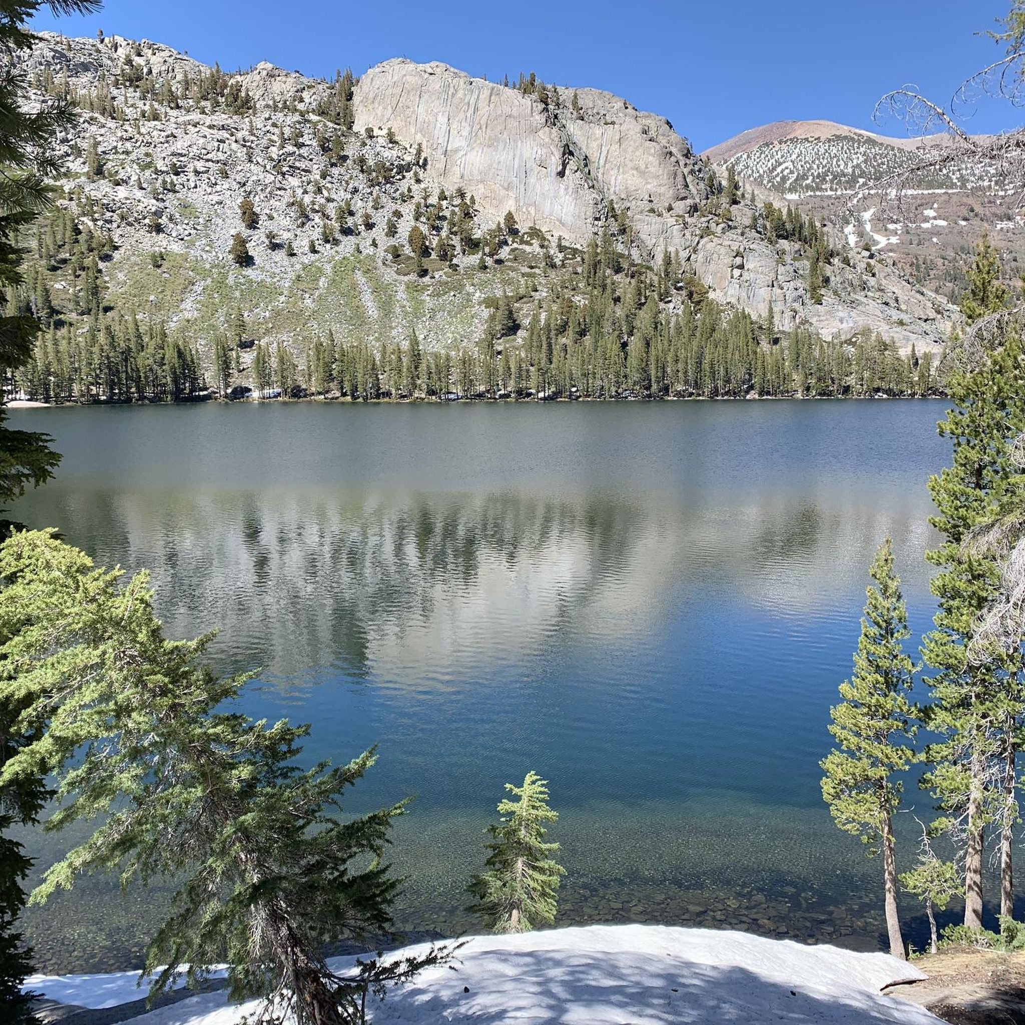
McLeod Lake is a true highlight, known for its crystal-clear water and inviting sandy beaches. The lake is nestled against the dramatic peaks of Mammoth Crest and Mammoth Mountain, creating a picturesque setting for relaxation or a picnic. This trail is particularly notable for its accessibility and the rewarding views it offers for such a short and easy effort. It provides a wonderful opportunity to experience the beauty of the Sierra alpine environment without a strenuous climb.
22
hikers
19.6km
06:12
1,080m
420m
The Shadow Creek and John Muir Trail to Garnet Lake offers a classic High Sierra adventure, leading you through stunning alpine scenery to one of the region's most celebrated lakes. You'll traverse diverse terrain, from the serene beauty of Shadow Creek with its clear waters and a picturesque bridge, to the dramatic, high-altitude landscapes surrounding Garnet Lake. This difficult hike covers 12.2 miles (19.6 km) with a substantial 3532 feet (1077 metres) of elevation gain, typically requiring about 6 hours and 11 minutes to complete.
Planning your trip requires careful consideration, as this route is often part of longer backpacking loops. Permits are essential for any overnight stays, and you must carry a bear canister due to active wildlife. Be prepared for challenging conditions, as snow can persist on sections of the trail until late June or July. It's wise to check current trail conditions and secure any necessary permits well in advance, especially during peak season.
This trail is a highlight of the Ansel Adams Wilderness, renowned for its connection to the iconic John Muir Trail and the breathtaking views of Banner Peak reflected in Garnet Lake. It's a prime example of the rugged beauty of the Ritter Range, making it a top choice for experienced hikers seeking a rewarding and memorable journey into the heart of the Sierra Nevada.

27
hikers
11.9km
04:15
970m
180m
Embark on a difficult hiking adventure to Thousand Island Lake via Rush Creek Trail, covering 7.4 miles (11.9 km) with a significant 3180 feet (969 metres) of elevation gain. This challenging route typically takes 4 hours and 15 minutes to complete, offering continuous scenic views through the Ansel Adams Wilderness. You will pass several alpine lakes, including Agnew Lake and Gem Lake, which provides your first view of the impressive Ritter Range. The highlight is Thousand Island Lake, where Banner Peak stands majestically over the water and its many small islands. Expect wildflowers to line your path during the right season.
This is a difficult hike with substantial elevation gain and rocky sections, so assess your fitness level before you start. If you plan to extend your trip overnight, be aware that backpacking permits are required. These permits can be reserved up to six months in advance, so plan accordingly. Ensure you carry enough water and supplies for the duration of the journey. The trail is best enjoyed during the warmer months when snow has melted and wildflowers are in bloom.
This route offers more than just a day hike; it provides connections to longer, iconic trails. The path intersects with both the Pacific Crest Trail (PCT) and the John Muir Trail (JMT), making it a gateway for extended backpacking adventures. The journey through the Ansel Adams Wilderness ensures a pristine natural experience, showcasing the Sierra Nevada's rugged beauty. This trail is a notable option for experienced hikers seeking a rewarding challenge and stunning alpine scenery.
19
hikers
4.25km
01:10
40m
100m
The Rainbow Falls via Devils Postpile Trail offers a captivating journey through diverse landscapes, from serene meadows and recovering burn scars to the dramatic columnar basalt of Devils Postpile. You'll follow the Middle Fork San Joaquin River, eventually reaching the magnificent 101-foot Rainbow Falls, famous for the vibrant rainbows that frequently appear in its mist. This easy 2.6-mile (4.3 km) hike, with a gentle 133 feet (40 metres) of elevation gain, is a high-reward option for families and takes about 1 hour and 9 minutes to complete.
Accessing the Devils Postpile National Monument, where the trail begins, typically requires using a mandatory shuttle system during peak summer months, so check operating hours before you go. The route can be exposed in sections, so carrying plenty of water and applying sunscreen is essential, especially on warmer days. For the best chance to see the falls in full flow and catch a rainbow, plan your visit for a sunny day in late spring or summer.
This trail is a fantastic way to experience two significant geological wonders: the unique hexagonal columns of Devils Postpile and the powerful Rainbow Falls. It also offers a glimpse into the resilience of nature, passing through areas recovering from the 1992 Rainbow Fire, now blooming with new growth and wildflowers. The trail also connects with the famous John Muir Trail and Pacific Crest Trail, offering a taste of these epic routes.
15
hikers
13.2km
04:46
690m
110m
The Shadow Creek Trail offers a deep dive into the stunning High Sierra landscape, traversing varied alpine singletrack alongside icy streams and the Middle Fork of the San Joaquin River. You'll be treated to sweeping canyon views and a series of pristine glacier-fed lakes, including Shadow Lake, Ediza Lake, and Iceberg Lake, all framed by the dramatic peaks of the Minarets and Mount Ritter. It's a challenging but incredibly rewarding experience for those seeking remote wilderness beauty.
This difficult 8.2-mile (13.2 km) hiking route involves a substantial 2251 feet (686 metres) of elevation gain, typically taking around 4 hours and 46 minutes to complete. Access to the trailhead often requires a mandatory shuttle bus during peak season, and overnight trips necessitate a wilderness permit. Be prepared for steep climbs and potential snow cover well into late summer, especially on the sections leading to Ediza and Iceberg Lakes.
Located in the Ansel Adams Wilderness, the trail provides an intimate experience with the alpine environment and connects with the John Muir Trail for extended adventures. The area is active bear habitat, so bear canisters are required for food storage. This trail is a fantastic option for experienced hikers looking for a strenuous day trip or a starting point for a multi-day backpacking journey.
Get access to more routes and recommendations from other explorers.
Already have an account?
Our route recommendations are based on thousands of hikes, rides, and runs completed by other people on komoot.
Start today with a free account
Your next adventure awaits.
Popular around Ansel Adams Wilderness

John Muir Trail – Along the legendary trail through the magical Sierra Nevada

The Sierra High Route — Solitude in California's alpine country
Running Trails in Ansel Adams Wilderness
MTB Trails in Ansel Adams Wilderness
Road Cycling Routes in Ansel Adams Wilderness
Cycling in Ansel Adams Wilderness

Gravel biking in Ansel Adams Wilderness


Tips from the Community

Devils Postpile National Monument is a United States national monument located near Mammoth Mountain in eastern California. The monument protects Devils Postpile, an unusual rock formation of columnar basalt, "all tightly and perfectly fitted together like a vast mosaic."
0
0

A crystal-clear lake that is surrounded by forest, with the Crystal Crag in the background. It is easily accessible by a short hike, and there is a trail that circumferences it, taking you to the peaceful forest views around the lake.
1
0

Olaine Lake is a beautiful alpine lake. It is surrounded by woods and mountains. The path from the nearest parking lot is not too challenging, so it is definitely worth the effort for the great scenery.
0
0

Thousand Island Lake is one of the most beautiful lakes in the Sierra Nevada. It's name comes from the shimmering stone islands that make up it's unique and a true postcard motif. On its eastern shore, the Pacific Crest and John Muir Trail converge again.
0
0
The Devil's Postpile is a large cliff made of volcanic basalt columns. It is a very popular site, so there is a good possibility there will be others enjoying the site.
0
0
Rainbow Falls is a 101-foot waterfall, which is the largest falls on the San Joaquin River. The falls are located a short distance off the Pacific Crest Trail.
0
0

One of the most easily accessible lakes and one of the most beautiful in Mammoth Lakes.
0
0

One of the most easily accessible and beautiful lakes in Mammoth Lakes.
0
0
Frequently Asked Questions
When is the best time to hike in the Ansel Adams Wilderness?
The prime hiking season is typically from June through October. July is fantastic for wildflower blooms in the alpine meadows, while September often provides clearer weather, fewer crowds, and beautiful autumn colors, especially in areas with aspen groves. Be aware that snow can linger at high elevations well into early summer.
Do I need a permit to hike in the Ansel Adams Wilderness?
For day hiking, you generally do not need a permit. However, for any overnight trips, a wilderness permit is mandatory. These are subject to a strict trailhead quota system from May through October to protect the fragile environment. It's crucial to plan and book these well in advance, especially for popular trailheads.
Are dogs allowed on the trails?
Yes, dogs are generally permitted on trails within the Ansel Adams Wilderness, but they must be under voice control at all times. In some specific areas, particularly within the mandatory shuttle bus zone of the Reds Meadow Valley, dogs may be required to be on a leash. Always be prepared to pack out all waste.
How do I get to the trailheads?
Most trailheads on the eastern side are accessed from the Mammoth Lakes and June Lake areas. Popular starting points like Agnew Meadows and Devils Postpile are located in the Reds Meadow Valley. During the busy summer season, a mandatory shuttle bus service operates in this valley, and private vehicle access is restricted during certain hours.
What are the hiking conditions like?
The terrain is classic high Sierra: expect rocky, uneven trails and significant elevation changes. The wilderness ranges from about 3,500 feet to over 13,000 feet, so altitude can be a factor. Trails are generally well-defined but can be rugged. Weather can change rapidly, so always carry layers, sun protection, and plenty of water.
Are there any good backpacking loops?
The Ansel Adams Wilderness is a premier backpacking destination with many loop options. A classic multi-day trip is the Rush Creek to Agnew Meadows loop, which can include stunning lakes like Thousand Island Lake and Garnet Lake. Another popular option is starting from Agnew Meadows to explore the Ritter Range, creating a loop via the High Trail and River Trail.
What kind of wildlife might I see?
The wilderness is home to a variety of wildlife. You might encounter marmots, pikas, and mule deer. Black bears are also present, so it's essential to store food properly using bear-resistant canisters, which are required for overnight stays in most of the wilderness. Birdwatchers can look for Clark's nutcrackers and mountain chickadees.
What do other hikers think of the trails here?
The region is highly regarded by the komoot community, with an average rating of 4.7 stars. Hikers frequently praise the spectacular high-alpine scenery, the abundance of pristine lakes, and the dramatic granite peaks of the Ritter Range and the Minarets.
How many trails are there in the Ansel Adams Wilderness?
There are over 150 different routes to explore, covering approximately 350 miles of trails. These range from short, accessible day hikes to challenging, multi-day backpacking expeditions through the High Sierra backcountry.
Is fishing allowed in the lakes and rivers?
Yes, fishing is a popular activity in the many lakes and streams of the Ansel Adams Wilderness. The waters hold various species of trout, including golden, rainbow, and brook trout. A valid California state fishing license is required for anyone 16 years of age or older.
What is a challenging day hike I can do?
For a strenuous but rewarding day out, consider the hike to Iceberg Lake — Mammoth Lakes. This 15-mile (24 km) round trip takes you past several other beautiful lakes before reaching the starkly beautiful Iceberg Lake, which sits right below the jagged Minarets.
How does hiking here compare to Yosemite?
While both offer stunning Sierra Nevada landscapes, the Ansel Adams Wilderness generally provides a more remote and less crowded experience than the main valleys of Yosemite National Park. It is renowned for its vast, lake-dotted basins and the dramatic, jagged peaks of the Ritter Range, offering a true wilderness feel.
Most popular routes in Ansel Adams Wilderness
Most popular attractions in Ansel Adams Wilderness

Get inspired with the komoot mobile app


Explore more
Browse the best Hikes in other regions.
