The best MTB trails in Sespe Wilderness
4.7
(9)
23
riders
6
rides
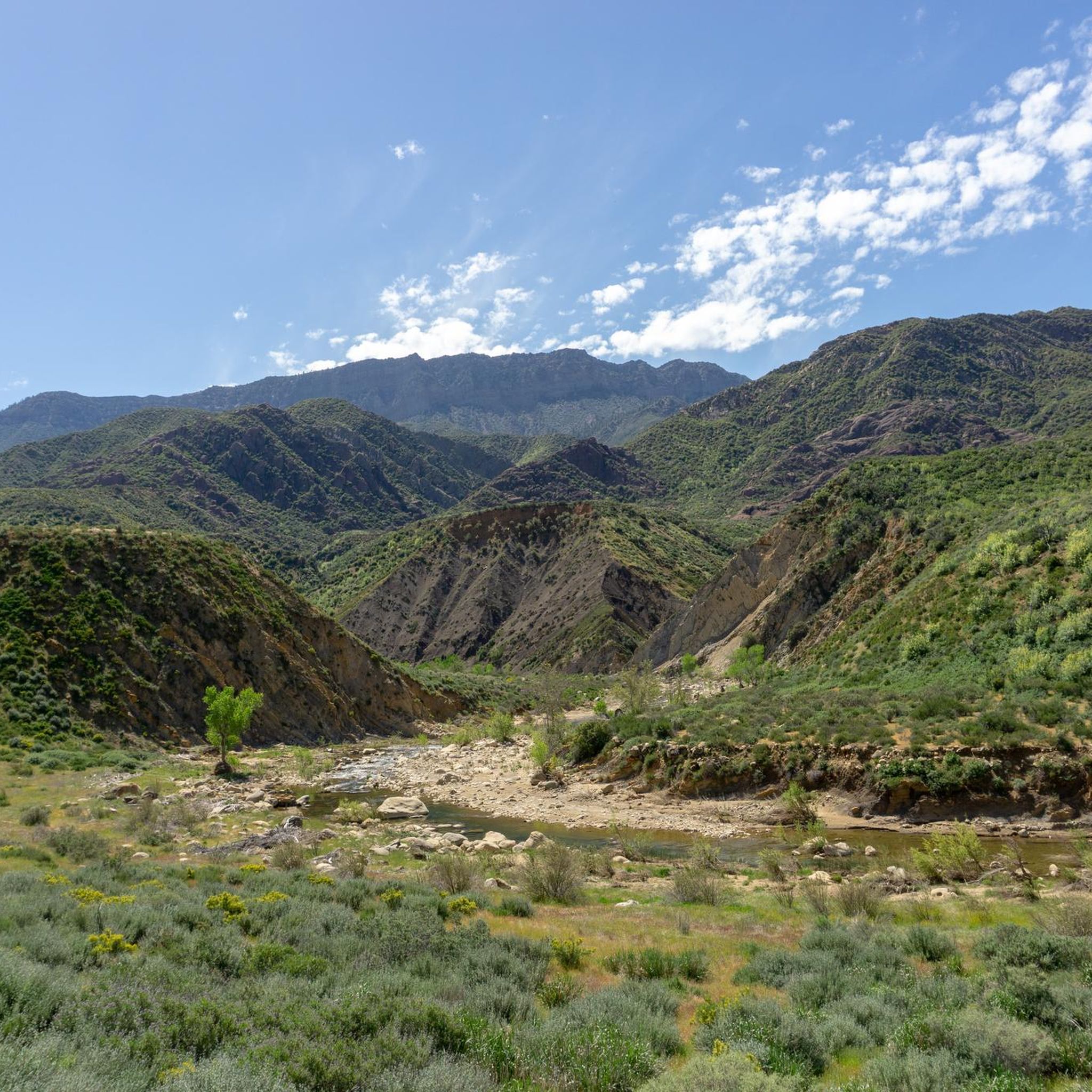
Mountain biking in Sespe Wilderness, located within the Los Padres National Forest, offers extensive and challenging trails outside the designated wilderness area. The region features rugged and diverse terrain, characterized by dramatic geological upthrusts and impressive sandstone cliffs. Riders can expect varied landscapes including chaparral, California oak woodlands, and canyons. The area provides a range of difficulties with significant elevation changes.
Best mountain bike trails in Sespe Wilderness
- The most popular mountain bike trail is Middle Sespe and Howard Creek Trail Loop, a 20.8 miles (33.5 km) trail that takes 3 hours 27 minutes to complete. This difficult route features significant elevation gain through rugged terrain.
- Another top favourite among local mountain bikers is Sisar Canyon and Red Reef Trail Loop, a difficult 17.3 miles (27.9 km) path. This trail navigates through canyons and offers views of unique red rock formations.
- Local mountain bikers also love the Sisar Canyon Road – Sisar Canyon Road loop from Stagecoach Station Upper Ojai Market, an 8.1 miles (13.1 km) trail leading through varied terrain, often completed in about 1 hour 31 minutes.
- Mountain biking in Sespe Wilderness is defined by rugged terrain, sandstone cliffs, and diverse canyon landscapes. The network offers options for different ability levels, from moderate loops to challenging climbs.
- The routes in Sespe Wilderness are highly rated by the komoot community with an average score of 4.7 stars from more than 5 reviews. More than 20 mountain bikers have used komoot to explore Sespe Wilderness's varied terrain.
Last updated: June 29, 2026
33.5km
03:27
960m
960m
This difficult 20.8-mile mountain biking loop in Los Padres National Forest offers a challenging ride with 3148 feet of elevation gain.
4.4
(7)
12
riders
27.9km
03:28
1,120m
1,120m
The Sisar Canyon and Red Reef Trail Loop near Ojai offers a quintessential Southern California mountain biking experience, blending a long, sustained climb with a thrilling singletrack descent. You'll start with a shaded ascent through Sisar Canyon, gradually emerging to breathtaking panoramic views of the Ojai Valley and Topatopa Mountains as you gain elevation. The terrain shifts from a well-maintained fire road to the Red Reef Trail's dynamic singletrack, which transitions from smooth and fast to loose and rocky, providing a varied and engaging ride.
Planning your trip requires considering the trail's challenging nature; it's a difficult route with 3665 feet (1117 metres) of elevation gain over 17.3 miles (27.9 km), typically taking about 3 hours and 28 minutes. Summer heat can be intense on the exposed upper sections, so it's best to avoid midday rides during warmer months or start very early. Ensure you carry ample water, as shade is limited on much of the climb.
What makes this loop stand out is the significant reward of the Red Reef singletrack after the extensive Sisar Canyon climb, embodying the "earn your turns" ethos. The views of the Ojai Valley are a constant companion on the upper sections, making the physical effort worthwhile. It's a top choice for experienced mountain bikers looking for a demanding workout paired with a fun, technical descent in Ventura County.

Sign up for free
5.0
(2)
8
riders
Moderate mountain bike ride. Good fitness required. Suitable for all skill levels.
4
riders
37.7km
04:11
1,350m
1,350m
Hard mountain bike ride. Very good fitness required. Suitable for all skill levels.
27.9km
02:56
690m
690m
Embark on the Yellowjacket and Lockwood Creek OHV Loop for a moderate mountain biking adventure through Los Padres National Forest. This 17.3-mile (27.9 km) route challenges you with 2271 feet (692 metres) of elevation gain, taking approximately 2 hours and 55 minutes to complete. You will encounter a diverse mix of rocky sections, flowing singletrack, and wider four-wheel drive roads. As you climb, you'll pass through pleasant meadows and dense pine forests, with the Lockwood Trail offering spectacular views from its ridge sections. Imagine yourself riding along these ridges, taking in the expansive scenery.
Before you head out, be aware that this is a multi-use trail network, shared by mountain bikers, dirt bikes, horses, and hikers. Always be courteous and prepared to share the path with others. Some parts of the route, especially on the Lockwood Trail, feature challenging steep pitches and rocky terrain, so ensure your skills match the conditions. Plan your visit during daylight hours to comfortably complete the loop before dusk.
This trail provides an excellent opportunity to experience the varied landscapes of Los Padres National Forest. The combination of different trail surfaces and the journey through both open meadows and shaded forests makes it a dynamic ride. It stands out for its ridge sections, which offer some of the most rewarding vistas in the area. This loop is a great choice if you are looking for a comprehensive tour of the local terrain.
Our route recommendations are based on thousands of hikes, rides, and runs completed by other people on komoot.
Start today with a free account
Your next adventure awaits.
Login or Signup
Popular around Sespe Wilderness
Tips from the Community

Sisar Canyon Road delivers an exciting ride through rugged terrain and breathtaking scenery. The trail features a mix of dirt and gravel paths, with challenging climbs and thrilling descents. Along the way, you’ll enjoy views of the valley below and the striking Topatopa Bluff in the background.
1
0

Yellowjacket Trail is mostly used by ATVs or similar vehicles, hence the trail is wide. Nevertheless, it is bouncy, ricky, and enables riders to carry a lot of speed. It also just north of Lockwood Peak, which you can access via and access trail.
0
0
Viewpoint with a panoramic view of Santa Monica Mountains, Upper Ojai, Piedra Blanca, Reyes Peak and Pine Mountain. The access to this trail is closed as of winter 2023, for more information see fs.usda.gov/detail/lpnf/alerts-notices/?cid=stelprdb5309152
0
0
Viewpoint with a panoramic view of Santa Monica Mountains, Upper Ojai, Piedra Blanca, Reyes Peak and Pine Mountain. The access to this trail is closed as of winter 2023, for more information see http://fs.usda.gov/detail/lpnf/alerts-notices/?cid=stelprdb5309152
0
0
Sisar Canyon Road is a well-groomed track road with breathtaking views of the Topatopa Bluff. Be prepared for a steady incline, not much shade, and a few creek crossings.
0
0

This singletrack offers challenging sections for experienced riders. From Nordhoff Ridge Road you shred all the way down through White Ledge Camp and further to Sisar Canyon Road.
0
0
Nordhoff Road is a great gravel road that connects e.g. Sisar Canyon Road with Horn Canyon Trail or Red Reef Trail. Expect awesome views!
0
0
A dirt road climb that offers beautiful views and that leads all the way up to Nordhoff Road.
0
0
Frequently Asked Questions
How many mountain bike trails are available in the Sespe Wilderness area?
There are 6 mountain bike trails available in the broader Sespe Wilderness area, offering a range of experiences from moderate to difficult.
Are mountain bikes allowed within the Sespe Wilderness boundaries?
No, mountain biking is generally prohibited within the designated Sespe Wilderness area itself to protect its pristine nature. However, the surrounding Los Padres National Forest, which encompasses the wilderness, offers extensive and challenging mountain biking trails just outside the wilderness boundary.
What kind of terrain can I expect on mountain bike trails near Sespe Wilderness?
The terrain is rugged and diverse, characterized by dramatic geological upthrusts, impressive sandstone cliffs, and unique sandstone formations. You'll encounter varied landscapes including chaparral, California oak woodlands, and canyons, with significant elevation changes.
Are there any moderate mountain bike trails suitable for intermediate riders?
Yes, there are moderate trails available. For example, the Sisar Canyon Road – Sisar Canyon Road loop from Stagecoach Station Upper Ojai Market is an 8.1-mile trail leading through varied terrain, often completed in about 1 hour 31 minutes. Another moderate option is the Yellowjacket and Lockwood Creek OHV Loop.
What natural features or landmarks can I see while mountain biking near Sespe Wilderness?
While mountain biking, you'll experience dramatic geology and rock formations, including impressive sandstone cliffs. The region is also home to significant natural features like Sespe Creek, the last undammed river in Southern California. You might also encounter highlights such as Topatopa Bluff or Potrero John Falls.
Are there any loop mountain bike trails in the area?
Yes, several trails are loops. The Middle Sespe and Howard Creek Trail Loop is a difficult 20.8-mile route. Another popular loop is the Sisar Canyon and Red Reef Trail Loop, which is 17.3 miles long and navigates through canyons.
What is the best time of year to go mountain biking near Sespe Wilderness?
The region experiences warm, dry summers and mild winters. Spring and fall generally offer the most pleasant temperatures for mountain biking. During spring, visitors can also enjoy arrays of wildflowers. Always check local weather conditions before heading out.
What do other mountain bikers enjoy most about the trails near Sespe Wilderness?
The area is highly rated by the komoot community, with an average score of 4.7 stars. Reviewers often praise the rugged terrain, the dramatic sandstone cliffs, and the diverse canyon landscapes that define the riding experience.
Are there any trails suitable for advanced mountain bikers seeking a challenge?
Yes, the area offers several difficult routes for experienced riders. The View of the Topatopa Mountains – Sisar Canyon Road loop from Thacher School is a challenging 37.7-kilometer trail with significant elevation gain, offering extensive views.
Is parking available at the trailheads?
Trailhead parking is generally available in the Los Padres National Forest. However, it's advisable to consult specific route details or ranger districts for current information on parking availability and any required permits or fees for certain areas.
Can I bring my dog on the mountain bike trails?
Regulations regarding dogs can vary within the Los Padres National Forest. While some trails may permit dogs on a leash, it's crucial to verify specific rules for each trail or consult the local ranger district to ensure compliance and protect wildlife.
Are there any hot springs accessible near the mountain biking routes?
While not directly on mountain biking routes, the Sespe Wilderness is known for its hot springs, including the well-known Sespe Hot Springs and Willett Hot Springs. These are typically accessed via hiking trails within the wilderness area, offering unique resting points for hikers and backpackers.
Most popular routes in Sespe Wilderness
Most popular attractions in Sespe Wilderness

Get inspired with the komoot mobile app


Explore more
Browse the best MTB trails in other regions.
