The best MTB trails in San Rafael Wilderness
4.9
(22)
32
riders
1
ride
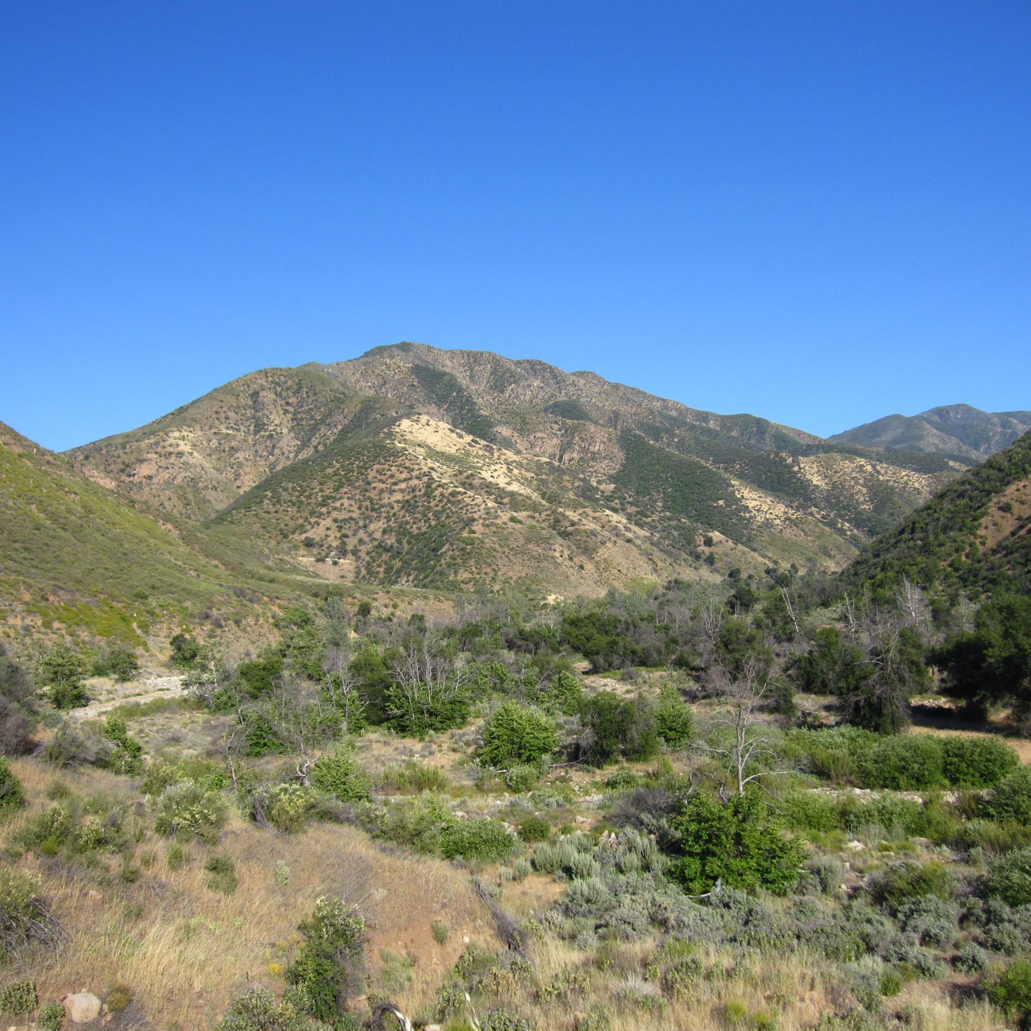
Mountain biking in San Rafael Wilderness offers routes through rugged mountain terrain, dense chaparral, and pine forests within the Los Padres National Forest. The region is characterized by significant elevation changes, with trails often following mountain roads and traversing canyons. Riders can expect varied surfaces, from dirt tracks to more technical sections, providing a challenging experience.
Best mountain bike trails in San Rafael Wilderness
- The most popular mountain bike trail is Figueroa Mountain Road loop, a 21.1 miles (34.0…
Last updated: October 18, 2026
34.0km
03:38
1,280m
1,280m
Hard mountain bike ride. Very good fitness required. Suitable for all skill levels.
4.7
(7)
15
riders
16.9km
02:13
470m
470m
Moderate mountain bike ride. Good fitness required. Advanced riding skills necessary.

5.0
(8)
8
riders
17.1km
02:01
650m
650m
Moderate mountain bike ride. Good fitness required. Suitable for all skill levels.
5.0
(3)
3
riders
31.4km
03:42
1,110m
1,110m
Hard mountain bike ride. Very good fitness required. Advanced riding skills necessary.
5.0
(2)
3
riders
36.0km
03:34
980m
980m
Hard mountain bike ride. Very good fitness required. Suitable for all skill levels.
Our route recommendations are based on thousands of hikes, rides, and runs completed by other people on komoot.
Start today with a free account
Your next adventure awaits.
Popular around San Rafael Wilderness
Tips from the Community

Figueroa Mountain is a spectacular summit, offering panoramic views of the Santa Ynez Valley and the San Rafael Wilderness, dotted with beautiful wildflowers and oak trees. It's a popular recreation area for hiking, camping, and mountain biking, equipped with its own dedicated campground, picnic area, and restrooms. It's well worth the trip to get here, and a great opportunity to capture incredible photos while you take a break during your ride.
0
0

This is an epic road to ride on. By no means an easy one, but the sweeping views of the San Rafael Wilderness Area make up for the effort.
0
0
This trail is a favorite among mountain bikers, offering a fast downhill with a mix of smooth, flowing sections of dirt and shale, along with challenging rock gardens. There are plenty of oak trees for shade, along with some small creek crossings, making for a fun and challenging ride.
0
0
The Camuesa Connector Trail is a fantastic route from Big Pine/Buckhorn Road to Paradise Road along the Santa Ynez River and is a great ride the entire way. After a short descent, the trail levels off before climbing with several switchbacks. While all turns are rideable, it may be best to walk a few, even by intermediate riders. The real fun begins on the descent toward the river, with smooth sections, tight turns, and rocky areas where you’ll reach the riverbed after an exposed rocky section. This crossing varies, but is usually shallow.
0
0
Ranger Peak stands at 1,376 meters and boasts beautiful bright green slopes adorned with wildflowers surrounded by open meadows and scattered oak trees. There is a trail leading to the summit on the south side, accessible from Figueroa Road. If you're seeking an extended adventure, the view of Figueroa Mountain and beyond from the top is truly incredible.
0
0

Devil’s Canyon is a deep and narrow canyon, with a creek flowing in between, which you may need to cross a few times, oak trees are all around, and be aware of poison oak. This is a historic route, originally taken by the workers who built the Gibraltar Dam. This trail can be a good option for those trying to escape the more popular trails in Santa Barbara.
0
0
This is a very enjoyable and not-so-popular trail, surrounded by lush vegetation and with amazing landscape views. The trail is easy to follow and offers views of Blue Canyon, Camuesa Peak, and La Cumbre. There are a few small creek crossings, providing water along the trail, and as the trail is not so popular, wildlife is more often seen.
0
0
Gibraltar Dam is located above the confluence of Devil’s Canyon and Santa Ynez River, in a remote part of Los Padres National Forest. It was built with the purpose of supplying water to the city of Santa Barbara, supplying almost 30% of the city needs.
0
0
Frequently Asked Questions
How many mountain bike trails are available in San Rafael Wilderness?
There are several mountain bike trails in the San Rafael Wilderness, with komoot featuring over 5 routes. These routes traverse rugged mountain terrain, dense chaparral, and pine forests, offering a challenging experience for riders.
Are there any easy mountain bike trails suitable for beginners in San Rafael Wilderness?
The San Rafael Wilderness is known for its challenging terrain. While there are no routes explicitly listed as 'easy' in the provided data, trails like Camuesa Connector Trail loop from Lower Oso Picnic Site and Arroyo Burro Trail loop from Lower Oso Picnic Site are rated as moderate, offering a less strenuous option compared to the difficult routes.
What are some challenging mountain bike trails for advanced riders in San Rafael Wilderness?
Advanced riders seeking a challenge can explore routes like the Figueroa Mountain Road loop, which is 21.1 miles (34.0 km) with extensive climbs and descents. Another difficult option is the Little Pine Mountain loop from Lower Oso Picnic Site, covering 19.5 miles (31.4 km) through mountainous landscapes.
Are there any family-friendly mountain bike trails in San Rafael Wilderness?
Given the rugged nature and significant elevation changes characteristic of the San Rafael Wilderness, most trails are rated moderate to difficult. There are no specific routes highlighted as 'family-friendly' in the data, suggesting that trails may be more suited for experienced riders or families with older, more capable children.
What is the typical length of mountain bike trails in San Rafael Wilderness?
Trail lengths in the San Rafael Wilderness vary, generally ranging from moderate to long distances. For example, the Camuesa Connector Trail loop is about 10.5 miles (16.9 km), while the Figueroa Mountain Road loop extends to 21.1 miles (34.0 km).
Are there loop mountain bike trails available in San Rafael Wilderness?
Yes, many of the mountain bike routes in San Rafael Wilderness are designed as loops. Examples include the Figueroa Mountain Road loop, the Camuesa Connector Trail loop from Lower Oso Picnic Site, and the Arroyo Burro Trail – Matias Potrero Trail loop from Santa Ynez.
What is the best time of year for mountain biking in San Rafael Wilderness?
The San Rafael Wilderness experiences hot, dry summers and mild, wet winters. The best time for mountain biking is typically during the cooler, drier months of spring and fall to avoid extreme heat and potential winter closures or muddy conditions.
What are the typical weather conditions to expect when mountain biking in San Rafael Wilderness?
Riders should prepare for varied conditions. Summers can be very hot and dry, while winters bring cooler temperatures and rain, which can make trails muddy or impassable. Always check the local forecast before heading out, as conditions can change rapidly in mountainous terrain.
Are permits required for mountain biking in San Rafael Wilderness?
As part of the Los Padres National Forest, specific permits may be required for certain activities or for entering designated wilderness areas. It's advisable to check with the local U.S. Forest Service office for the most current information regarding permits and regulations before your ride.
Where can I find parking or trailheads for mountain biking in San Rafael Wilderness?
Many routes, such as the Camuesa Connector Trail loop and Little Pine Mountain loop, start from the Lower Oso Picnic Site, which typically offers parking facilities. For other trails, parking may be available at designated trailheads or along forest roads. Always verify access and parking regulations beforehand.
What do other mountain bikers enjoy most about the San Rafael Wilderness trails?
The San Rafael Wilderness trails are highly rated by the komoot community, with an average score of 4.9 stars from over 20 reviews. Riders often praise the challenging mountain roads, the scenic forested canyons, and the significant elevation gains that provide a rewarding workout and stunning views.
Are there any cafes or amenities near the mountain bike trails in San Rafael Wilderness?
The San Rafael Wilderness is a remote area, and amenities like cafes are generally not found directly along the trails or at trailheads. It's recommended to bring all necessary supplies, including water and snacks, and plan to visit towns outside the wilderness area for food and services.
Are there good viewpoints along the mountain bike trails in San Rafael Wilderness?
Yes, the mountainous landscapes and significant elevation changes in San Rafael Wilderness offer numerous opportunities for scenic viewpoints. Trails like the Figueroa Mountain Road loop and the Little Pine Mountain loop are known for their expansive vistas over the rugged terrain and forests.
Most popular routes in San Rafael Wilderness

Get inspired with the komoot mobile app


Explore more
Browse the best MTB trails in other regions.
