The best running trails in San Mateo Canyon Wilderness
3.0
(1)
50
runners
21
runs
Jogging routes in San Mateo Canyon Wilderness traverse a 37,000-acre expanse within the Santa Ana Mountains and Cleveland National Forest. The region is characterized by mountains cloaked in chaparral and coastal sage, with deep drainages fostering oak woodlands. San Mateo Creek, notable for its rugged canyon, flows through the area, offering varied terrain for runners.
Best jogging routes in San Mateo Canyon Wilderness
- The most popular jogging route is Sitton Peak via Bear Canyon and Bear Ridge Loop, a…
Last updated: October 15, 2026
11
runners
15.9km
02:13
550m
550m
Hard run. Very good fitness required. Mostly accessible paths. Some sure footedness required.
1
runners
13.6km
01:47
330m
330m
Hard run. Very good fitness required. Mostly paved surfaces. Suitable for all skill levels.

4
runners
22.3km
03:18
850m
850m
Hard run. Very good fitness required. Sure-footedness, sturdy shoes and alpine experience required.
3
runners
28.6km
03:55
950m
950m
Hard run. Very good fitness required. Mostly paved surfaces. Suitable for all skill levels.
24.6km
03:47
1,310m
1,310m
Hard run. Very good fitness required. Mostly accessible paths. Some sure footedness required.
Get access to more routes and recommendations from other explorers.
Already have an account?
Our route recommendations are based on thousands of hikes, rides, and runs completed by other people on komoot.
Start today with a free account
Your next adventure awaits.
Popular around San Mateo Canyon Wilderness
Tips from the Community

This is an extremely popular mountain biking trail that doubles as a great run if you get out early or on a weekday when there are fewer riders. Be sure to keep your ears out for bike bells and tires, especially when on the switchbacks.
0
0
Los Pinos Peak is the fourth highest peak in the county, after Santiago, Modjeska, and Trabuco Peak. There are a few different trails you can explore that take you to the summit, though some trailheads in the Trabuco Creek Valley have been closed in recent years so it is best to check the Forest Service website before you go.
0
0
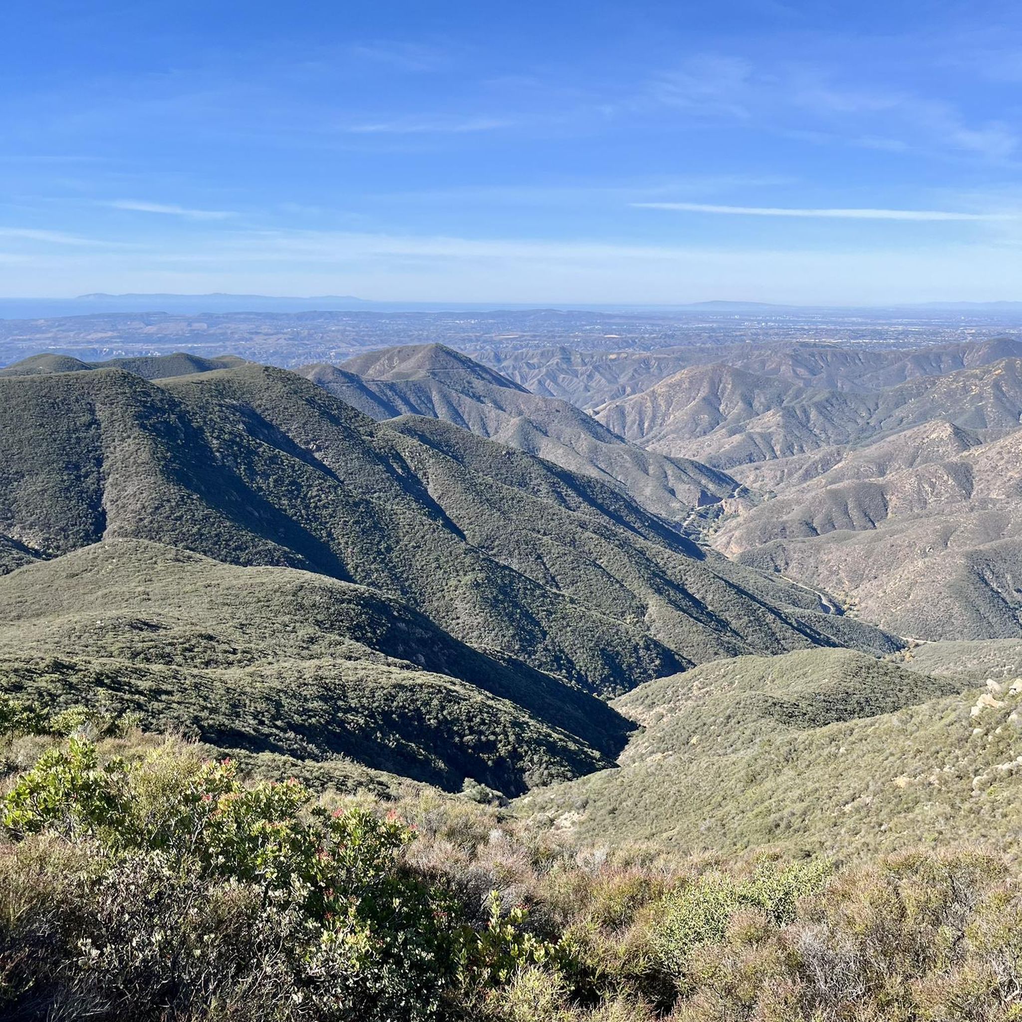
You get fantastic views across the Santa Ana Mountains as you ascend the ridge to Los Pinos Peak. The trail is beautiful but there is no shade as it follows the top of the ridgeline the whole time.
0
0
This is a beautiful trail that grants views of the mountains the whole time. There is little shade and you may want longer clothes for the chaparral and brambles in places, but nothing unusual for the Santa Ana Mountains.
0
0
Like the climb to Sugarloaf, New Sugarloaf has no official trail to the summit but is a fairly easy climb. You get sweeping views of the mountains and can see Catalina if the weather is clear.
0
0
The ascent to Sugarloaf Peak is a little overgrown but not difficult. You get fantastic views of the mountains from the summit.
0
0

Sitton Peak is located in the southern portion of the Santa Ana Mountains. While not as high as some of the neighboring peaks, the views are still worth the effort up. From the summit you will overlook San Diego County to the south, Santa Ana Mountains to the north, and the Santa Ana foothills to the west.
1
0
There is a large parking area across the highway from the trailhead with a general goods store, campground, and bathrooms. From here you can hike up into Bear Canyon and enjoy views of the nearby peaks.
1
0
Frequently Asked Questions
How many running routes are available in San Mateo Canyon Wilderness?
There are over 20 running routes available for exploration in the San Mateo Canyon Wilderness, catering to various fitness levels. You'll find a mix of easy, moderate, and difficult trails to choose from.
What kind of terrain can I expect on the running trails in San Mateo Canyon Wilderness?
Runners in San Mateo Canyon Wilderness will encounter diverse terrain, from mountains cloaked in chaparral and coastal sage to deep drainages with lush oak woodlands. The rugged canyon of San Mateo Creek also offers varied surfaces, and you might find damp, cool sections in the mornings, especially in lower elevations.
Are there any running routes that feature waterfalls?
Yes, the Teneja Falls Trail is a popular option that leads to the scenic Tenaja Falls. This spot is particularly dramatic when water levels are high during winter and spring, surrounded by large boulders and picturesque landscapes.
Can I find challenging running routes with significant elevation gain?
Absolutely. The San Mateo Canyon Wilderness offers several challenging routes. For instance, the Sitton Peak via Bear Canyon and Bear Ridge Loop involves over 550 meters of elevation gain, leading towards one of the area's prominent summits. Another demanding option is the Los Pinos Trail, which features over 1300 meters of ascent.
Are there any loop running trails in the area?
Yes, several routes offer a loop experience. The Sitton Peak via Bear Canyon and Bear Ridge Loop is a notable example, covering nearly 16 km. Another option is the Old and New San Juan Trail Loop, which is a longer, challenging loop spanning over 28 km.
What is the best time of year to go running in San Mateo Canyon Wilderness?
Spring is an excellent time to visit, as the landscape transforms with a wealth of wildflower blooms. While summers are typically hot and dry, mornings can be cool in the canyons. Small pools can often be found in San Mateo Canyon throughout the year. Winter and spring also offer the best views of Tenaja Falls when water levels are high.
What natural features or landmarks can I expect to see while running?
You'll encounter diverse natural beauty, including chaparral-covered mountains, deep drainages, and lush oak woodlands. The rugged canyon of San Mateo Creek, which supports the endangered southern steelhead trout, is a primary feature. Prominent peaks like San Mateo Peak, Sitton Peak, Elsinore Peak, and Miller Peak also define the landscape.
Are there any family-friendly running options?
While many trails offer significant challenges, some sections or shorter trails can be suitable for families. For example, the Tenaja Falls Trail is only 0.7 miles from the trailhead to the falls, making it a relatively short and scenic option for a family outing, though it can be extended for longer runs.
What do other runners enjoy most about jogging in San Mateo Canyon Wilderness?
The area is appreciated by the komoot community, with an average score of 3.0 stars. Runners often praise the comprehensive Southern California running experience, with miles of challenging trails, cool, shady canyons, and sun-drenched hills. The opportunity to encounter diverse wildlife, including numerous bird and mammal species, also adds to the appeal.
Is parking available at the trailheads?
Parking is generally available at various trailheads within the Cleveland National Forest, which encompasses the San Mateo Canyon Wilderness. It's advisable to check specific trailhead information for the route you plan to run to confirm parking availability and any potential fees or permits required.
What wildlife might I see on the running trails?
The San Mateo Canyon Wilderness is home to a rich diversity of wildlife. You might encounter 139 bird species, 37 mammal species, and 46 reptile and amphibian species. Keep an eye out for deer, various birds of prey, and smaller mammals as you run through this natural retreat.
Are there any less crowded running routes for a more solitary experience?
For a more remote and rugged experience, consider the San Mateo Canyon Trail (5W05). This 7.5-mile (one-way) trail follows the heart of the canyon along San Mateo Creek and is considered one of the most rugged and remote in the wilderness, offering a challenging yet rewarding run away from more frequented paths.
Most popular routes in San Mateo Canyon Wilderness

Get inspired with the komoot mobile app


Explore more
Browse the best Running Trails & Routes in other regions.
