The best walks and hikes in Cucamonga Wilderness
4.8
(83)
1,391
hikers
46
hikes
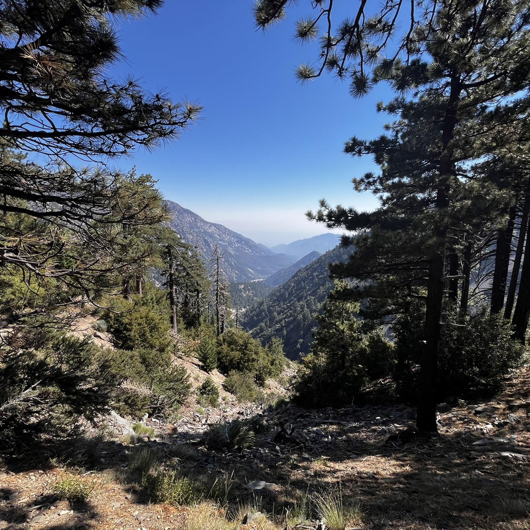
Hiking in Cucamonga Wilderness offers challenging trails through rugged sub-alpine landscapes. The region features elevations ranging from approximately 5,000 feet to nearly 9,000 feet, providing a significant natural retreat. Steep terrain and mixed conifers characterize the environment, with prominent peaks offering extensive panoramic views. Icehouse Canyon, with its perennial stream and historical cabins, is a notable natural feature.
Best hiking trails in Cucamonga Wilderness
- The most popular hiking route is Cucamonga Peak via Icehouse Canyon Trail loop — San Bernardino National Forest, a 14.5 miles (23.3 km) trail that takes 6 hours 37 minutes to complete, ascending to Cucamonga Peak for panoramic views.
- Another top favourite among local hikers is Icehouse Saddle – Cucamonga Peak loop from Icehouse Canyon Trailhead, a difficult 11.7 miles (18.8 km) path. This route leads through Icehouse Saddle to the summit of Cucamonga Peak.
- Local hikers also love the Icehouse Saddle – Icehouse Saddle loop from Icehouse Canyon Trailhead, a 6.8 miles (10.9 km) trail leading through Icehouse Canyon, often completed in about 4 hours 7 minutes.
- Hiking in Cucamonga Wilderness is defined by steep, rugged terrain, sub-alpine forests, and panoramic views from high elevations. The network offers options for moderate to difficult trails, catering to various ability levels.
- The routes in Cucamonga Wilderness are highly rated by the komoot community with an average score of 4.9 stars from over 70 reviews. More than 1300 hikers have used komoot to explore Cucamonga Wilderness's varied terrain.
Last updated: August 16, 2026
3.0
(1)
20
hikers
5.40km
01:47
0m
780m
Embark on an easy hike along the Icehouse Canyon Trail, a gentle 3.4 miles (5.4 km) route that takes about 1 hour and 46 minutes to complete. You'll find yourself in a tranquil, shaded canyon, where the sound of a year-round creek often accompanies your steps. The path is relatively gentle, winding past historic cabin ruins, some still standing as weathered remnants of the past. Lush, shady forests of oak, fir, pine, and cedar trees provide ample cover, with massive boulders scattered along the way. This route offers a peaceful introduction to the scenic Cucamonga Wilderness, with no elevation gain to worry about.
Before you head out, be aware that an Adventure Pass is required for parking at the Icehouse Canyon trailhead. Parking spaces can be quite limited, particularly if you plan to visit on a weekend, so an early start is advisable. Always check for potential wildfire closures and current trail conditions before your trip. If you intend to venture deeper into the Cucamonga Wilderness beyond this initial section, remember that a free wilderness permit is necessary.
This trail serves as a gateway to the broader Cucamonga Wilderness, offering a glimpse into its natural beauty without demanding a strenuous effort. The presence of historic cabin ruins adds a unique layer of human history to the natural landscape, showcasing past resilience against the elements. It's a notable route for its accessibility and the immediate immersion it provides into a shaded, creek-side environment, making it a popular choice for a refreshing outdoor escape.
5.0
(1)
87
hikers
23.3km
06:37
1,410m
1,410m
Hike the challenging Cucamonga Peak via Icehouse Canyon Trail Loop for 14.5 miles, gaining 4620 feet to panoramic views.

Sign up for free
5.0
(3)
104
hikers
18.8km
07:01
1,280m
1,280m
Hard hike. Very good fitness required. Easily-accessible paths. Suitable for all skill levels.
4.8
(5)
42
hikers
19.4km
07:04
1,240m
1,240m
Hard hike. Very good fitness required. Easily-accessible paths. Suitable for all skill levels.
12
hikers
23.9km
08:50
1,600m
1,600m
Hard hike. Very good fitness required. Easily-accessible paths. Suitable for all skill levels.
Get access to more routes and recommendations from other explorers.
Sign up for free
Already have an account?
Our route recommendations are based on thousands of hikes, rides, and runs completed by other people on komoot.
Start today with a free account
Your next adventure awaits.
Login or Signup
Popular around Cucamonga Wilderness

Tips from the Community

At 8,989 feet, Telegraph Peak is one of the highest summits in this part of the Cucamonga Wilderness. The running about 7,000 feet is technical and tough, but the views from the top are worth the power-hiking it takes to reach the summit.
0
0
Bighorn Peak is an 8,441-foot peak in the Cucamonga Wilderness that doesn't see nearly as many visitors as some of the other nearby summits. This is a great peak to go after if you are a fan of power-hiking and solitude.
0
0
Cucamonga Peak rises up to 8,862 feet and is one of the most popular peaks that you can access from the Icehouse Canyon Trail. You get an awesome view of the San Gabriel range from the peak, which you should only attempt to run up in the dry season.
0
0
The Cucamonga Wilderness encompasses over 12,000 acres of mountains, valleys, and rivers in Angeles National Forest and San Bernardino National Forest. Being a wilderness area, some of the trails are more primitive than city trails, but you are surrounded by wildlife and nature as you run through the mountains. Keep in mind that running in the Cucamonga Wilderness requires a free permit.
0
0

Thunder Mountain is at an elevation of 9,414 feet above sea level and is part of the Mt. Baldy ski resort. One of the ski lifts ends at Thunder Mountain.
0
0
Telegraph Peak sits at an elevation of 8,989 feet, and can be reached by the Three Ts Trail. Hikers can get a great view of Telegraph Peak from Devil's Backbone Trail.
0
0

Not many people decide for the strenuous hike to Bighorn Peak. So if you want to leave the crowds behind and enjoy a breathtaking view from the summit at 8,441 feet, this is your hike. Keep in mind that you need a free permit to hike in the Cucamonga Wilderness.
1
0
Reaching the summit of Cucamonga you know you worked hard! But look around and enjoy the majestic views over the San Gabriel mountains from one of the highest peaks within the mountain range. Bring appropriate gear if you hike in winter conditions. If you hike from the Icehouse Canyon Trailhead please obtain your wilderness permit from the Angeles National Forest, Baldy Ranger Station. If you prefer ascending via Middle Fork Trail, you can obtain the permit from the San Bernardino National Forest, Lytle Creek Ranger Station.
1
0
Frequently Asked Questions
What kind of terrain can I expect when hiking in Cucamonga Wilderness?
The Cucamonga Wilderness is known for its steep, rugged terrain and sub-alpine landscapes. Elevations range from approximately 5,000 feet to nearly 9,000 feet, offering challenging but rewarding experiences through mixed conifer forests. You'll encounter significant elevation gains on most trails.
Are there any easy or beginner-friendly hiking trails in Cucamonga Wilderness?
While many trails are challenging, there are a few options suitable for beginners. The komoot community has identified 5 easy routes. For instance, parts of the Icehouse Saddle – Icehouse Saddle loop from Icehouse Canyon Trailhead, though listed as moderate overall, offers sections through Icehouse Canyon that are less strenuous and provide a good introduction to the area's beauty.
What are some notable landmarks or viewpoints I can discover along the trails?
The wilderness offers world-class panoramic views from its higher elevations. Key landmarks include Cucamonga Peak, Telegraph Peak, and Bighorn Peak, all offering spectacular vistas. Icehouse Saddle is a popular junction and resting spot with great mountain views. On clear days, you can see the Santa Ana Mountains, Mt. San Gorgonio, Mt. San Jacinto, and parts of the San Diego Mountains.
What is the best time of year to go hiking in Cucamonga Wilderness?
The best time to hike is typically from late spring through early fall. During winter, conditions can be dangerous due to snow and ice, requiring proper gear and experience. Always check current weather and trail conditions before heading out, especially at higher elevations.
Are permits required for hiking in Cucamonga Wilderness?
Yes, a free wilderness permit is required for day hikes and overnight trips for portions within the San Bernardino National Forest. Additionally, an Adventure Pass may be needed for parking at some trailheads. It's advisable to check with the local forest service for the most up-to-date requirements before your visit.
Can I bring my dog on the hiking trails?
The Cucamonga Wilderness is generally dog-friendly, but specific regulations can vary by trail and season. It's always best to check the latest rules for the particular trail you plan to hike, as some areas may have restrictions, and dogs should always be kept on a leash.
Are there any circular hiking routes available?
Yes, the area features several circular routes. A popular option is the Cucamonga Peak via Icehouse Canyon Trail loop, which is a challenging 14.5-mile (23.3 km) route. Another is the Icehouse Saddle – Cucamonga Peak loop from Icehouse Canyon Trailhead, an 11.7-mile (18.8 km) difficult path.
What kind of wildlife might I encounter in Cucamonga Wilderness?
The wilderness supports a healthy variety of wildlife. Hikers might spot deer, bears, mountain lions, and bighorn sheep. Always maintain a safe distance and store food properly to avoid attracting animals.
What do other hikers enjoy most about the trails in Cucamonga Wilderness?
The trails in Cucamonga Wilderness are highly rated by the komoot community, with an average score of 4.9 stars. Hikers frequently praise the stunning panoramic views from the peaks, the challenging yet rewarding ascents, and the beautiful sub-alpine environment, especially the scenic Icehouse Canyon with its stream and historical cabins.
Are there any trails that lead to multiple peaks for a more challenging experience?
For experienced hikers seeking a significant challenge, it's possible to combine multiple peaks. Avid hikers sometimes aim for a 'five-peak day' by connecting trails to summits like Cucamonga, Ontario, Sugarloaf, Bighorn, and Etiwanda Peaks. A challenging route like the Icehouse Saddle – Telegraph Peak loop from Icehouse Canyon Trailhead offers a strenuous ascent to another prominent summit.
Is public transport available to reach the trailheads?
The Cucamonga Wilderness is primarily accessed by car, and public transport options directly to the main trailheads are limited. Most visitors drive to trailheads like Icehouse Canyon, where parking is available (though an Adventure Pass may be required). It's recommended to plan your transport in advance.
Most popular attractions in Cucamonga Wilderness

Get inspired with the komoot mobile app


Explore more
Browse the best Hikes in other regions.
