The best walks and hikes in Black Ridge Canyons Wilderness
4.7
(38)
615
hikers
38
hikes
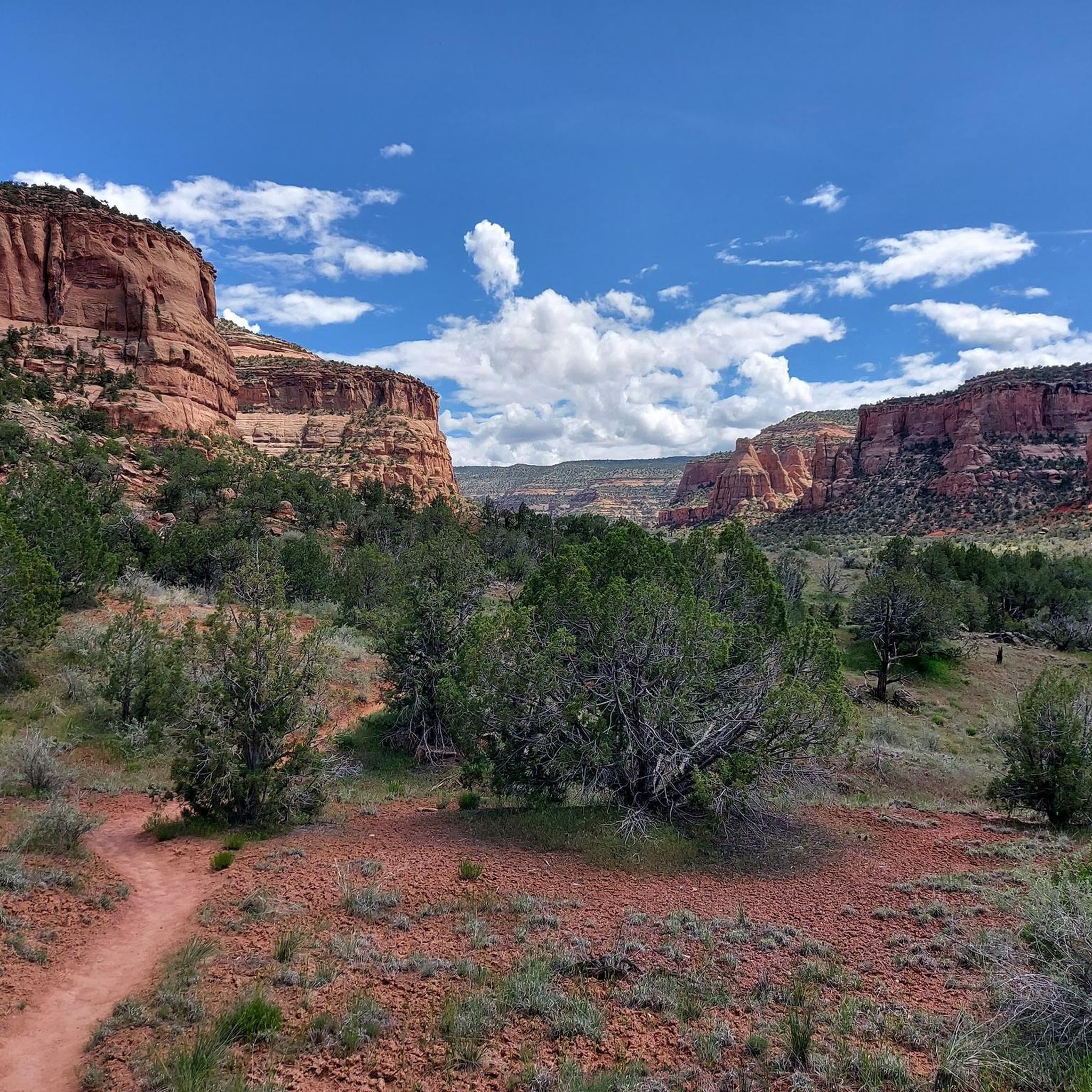
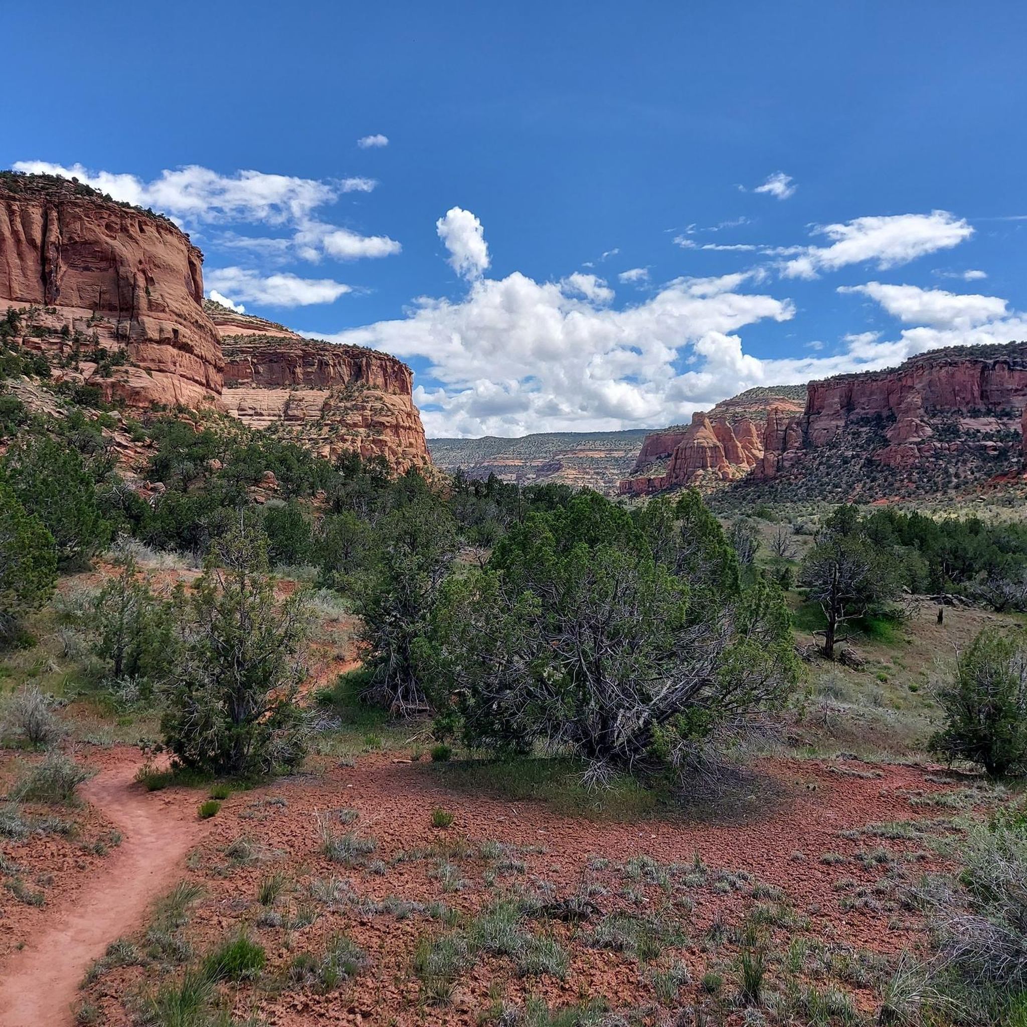
Hikes in Black Ridge Canyons Wilderness explore a semi-arid landscape on the Colorado Plateau, managed by the Bureau of Land Management. The area is defined by its 7 major red rock canyons, which feature natural arches, towering spires, and large sandstone alcoves. The terrain is primarily characterized by pinyon-juniper woodland, with trails winding through canyons and along ridges.
Best hiking trails in Black Ridge Canyons Wilderness
- The most popular hiking route is the Pitchfork Tower – Devil's Canyon Trail loop…
Last updated: October 10, 2026
1
hikers
5.60km
01:35
120m
110m
Easy hike. Great for any fitness level. Easily-accessible paths. Suitable for all skill levels.
5.0
(3)
20
hikers
8.55km
02:26
180m
180m
Moderate hike. Good fitness required. Easily-accessible paths. Suitable for all skill levels.

5.0
(1)
12
hikers
23.8km
06:59
630m
630m
Hard hike. Very good fitness required. Easily-accessible paths. Suitable for all skill levels.
1
hikers
6.38km
01:47
120m
120m
Easy hike. Great for any fitness level. Easily-accessible paths. Suitable for all skill levels.
1
hikers
16.9km
04:40
310m
290m
Moderate hike. Good fitness required. Mostly accessible paths. Sure-footedness required.
Get access to more routes and recommendations from other explorers.
Already have an account?
Our route recommendations are based on thousands of hikes, rides, and runs completed by other people on komoot.
Start today with a free account
Your next adventure awaits.
Tips from the Community

Moore Fun is significantly more technical than many other trails/loops in the area.
2
0
Several fantastic mountain bike loops crisscross the area. These are easily accessible from the trailhead.
2
0

Super technical and rocky—expect tough climbs and fun, tricky descents. Take it slow, pick good lines, and enjoy awesome canyon views. Bring plenty of water and be ready for a real challenge!
2
0

Sieber Canyon is a unique trail where you hike through the canyon and on the walls are pictographs of all kinds including what look to be footprints.
0
0

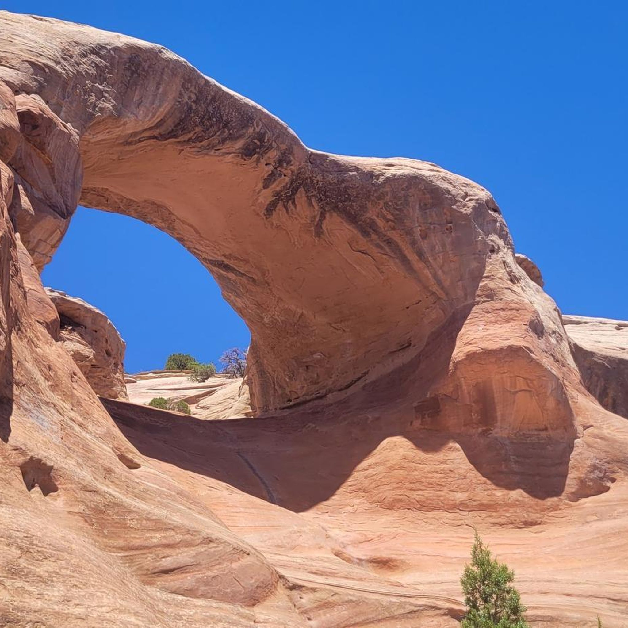
Eye Arch is one of the nine arches in Rattlesnake Canyon. Formed in a layer of Entrada sandstone, it gets it's name from the resemblance to a squinting eye.
0
0
East Rim Arch can sometimes be referred to as Centennial Arch and has a span of 40 feet. It one of the many arches in Rattlesnake Canyon, which is the second largest collection of natural arches in the US.
0
0
Cedar Tree Arch is also referred to as Rainbow Arch. It has a span of almost 80 feet across and 43 feet tall. Formed more than 175 million years ago as sand dunes along an ancient coastline. It is a result of erosion from the dried up sea.
0
0
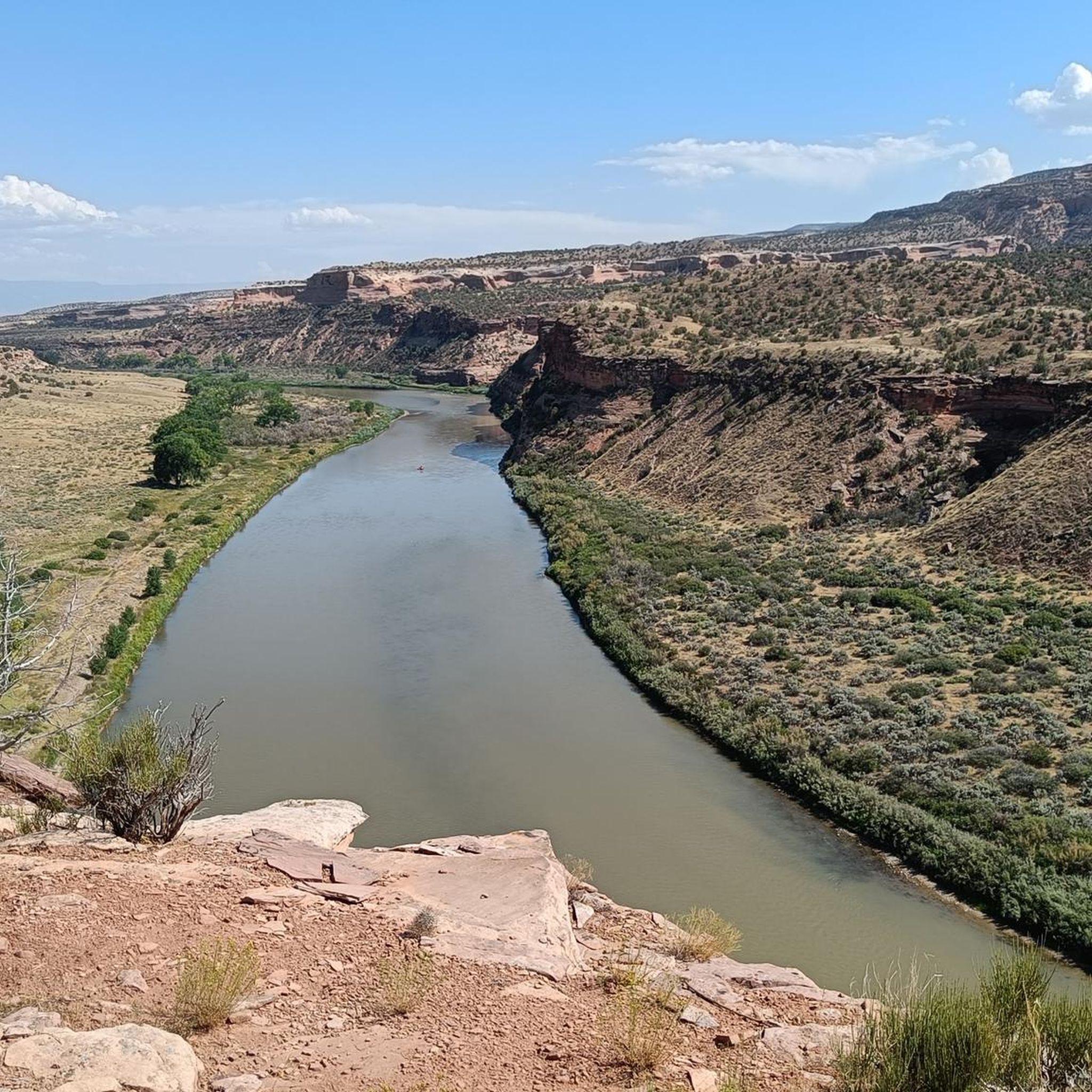
From this viewpoint you can look across the Colorado River into the Black Ridge Canyon Wilderness, which lies on the northwest flank of the Uncompahgre Plateau.
0
0
Frequently Asked Questions
Are dogs allowed in the Black Ridge Canyons Wilderness?
Yes, dogs are generally permitted in the Black Ridge Canyons Wilderness, but they must be kept under control at all times to protect wildlife and the natural environment. Keep in mind that the terrain can be rugged and water is scarce, so ensure your dog is prepared for the conditions and that you carry enough water for both of you.
What is the best time of year to hike in this area?
The best times to hike in Black Ridge Canyons Wilderness are spring and fall. These seasons offer moderate temperatures ideal for exploring the canyons. Summer can be extremely hot, while winter may bring snow and ice, making trails hazardous. Spring is particularly special as you might see ephemeral waterfalls after the snowmelt.
Are there any easy, family-friendly hikes?
Yes, there are several easier options. For a relatively short and gentle walk, consider the Rustler's Loop — Uncompahgre Plateau. It's a great introduction to the landscape without requiring a major time or energy commitment.
How do I get to the trailheads in Black Ridge Canyons Wilderness?
Primary access is from Grand Junction via roads leading to trailheads like Devils Canyon, or from Glade Park for access to the Rattlesnake Arches area. Be aware that many access roads are unpaved and rough. A high-clearance, 4x4 vehicle is strongly recommended for reaching the more remote trailheads.
Are there any fees or permits required for hiking?
There are generally no fees or permits required for day hiking or backpacking in the Black Ridge Canyons Wilderness itself. However, if you access the wilderness via the Colorado National Monument, the park entrance fee is waived for that purpose. For the most current regulations, it's always a good idea to check with the Bureau of Land Management.
What makes this area special for hiking?
The region is highly rated by the komoot community, with an average score of 4.7 stars. Hikers frequently praise the dramatic red rock canyons, the solitude, and the impressive concentration of natural arches, which is the second-highest in the country. The sense of remote, wild adventure is a key highlight.
Are there opportunities for multi-day backpacking trips?
Absolutely. The wilderness is well-suited for backpacking, offering challenging multi-day loops and technical scrambles for experienced hikers. The lack of established trails in many parts of the deeper canyons allows for true off-grid adventures. You must be self-sufficient with water, navigation, and supplies.
Can I see natural arches without doing a very long hike?
While the most famous arch collections require a significant hike, you can still experience the area's geology on shorter routes. The Rattlesnake Canyon — Uncompahgre Plateau trail offers a moderate journey into the landscape known for its geological wonders, giving you a taste of the canyon's character.
How does hiking here compare to the nearby Colorado National Monument?
Black Ridge Canyons Wilderness offers a more rugged, remote, and less-developed experience with fewer marked trails, appealing to those seeking solitude and adventure. Colorado National Monument has more established and accessible trails and infrastructure. While both feature stunning canyons, Black Ridge is particularly known for its high concentration of natural arches.
What kind of wildlife might I see?
The pinyon-juniper woodlands and canyons are home to a variety of wildlife. If you're observant, you might spot mule deer, desert bighorn sheep, and various birds, including golden and bald eagles. More elusive animals like mountain lions also inhabit the area, so it's important to be aware of your surroundings.
Is there water available on the trails?
No, you should not rely on finding water on the trails. This is a semi-arid environment, and natural water sources are scarce and unreliable. You must carry all the water you will need for your entire hike, especially during the hot summer months.
Most popular routes in Black Ridge Canyons Wilderness

Get inspired with the komoot mobile app


Explore more
Browse the best Hikes in other regions.
