Death Valley Wilderness
Death Valley Wilderness
Top 20 Natural Monuments in Death Valley Wilderness
Natural monuments in Death Valley Wilderness showcase a vast and extreme landscape, primarily located within Death Valley National Park. This region is recognized as the hottest, driest, and lowest place in North America, with over 93% of its area designated as wilderness. The natural landscape features unique geological formations sculpted by ancient lakes and volcanic activity. Visitors can explore diverse terrains, from expansive salt flats to towering sand dunes and colorful badlands.
Best natural monuments in Death Valley Wilderness
- The…
Last updated: October 13, 2026
Badwater Basin Salt Flats
Highlight • Natural Monument
Tip by

Mesquite Flat Sand Dunes Overlook
Highlight • Natural Monument
Tip by

Sign up now to discover places like this
Get recommendations on the best single tracks, peaks, & plenty of other exciting outdoor places.
Mosaic Canyon Trailhead
Highlight • Trail
Tip by
Gower Gulch
Highlight (Segment) • Canyon
Tip by
Dante's View — 1,669 m
Highlight • Viewpoint
Tip by
Sign up for free to discover even more natural monuments in Death Valley Wilderness.
Already have an account?
Start today with a free account
Your next adventure awaits.
Popular around Death Valley Wilderness
Tips from the Community

Water and sunglasses are essential!
1
0

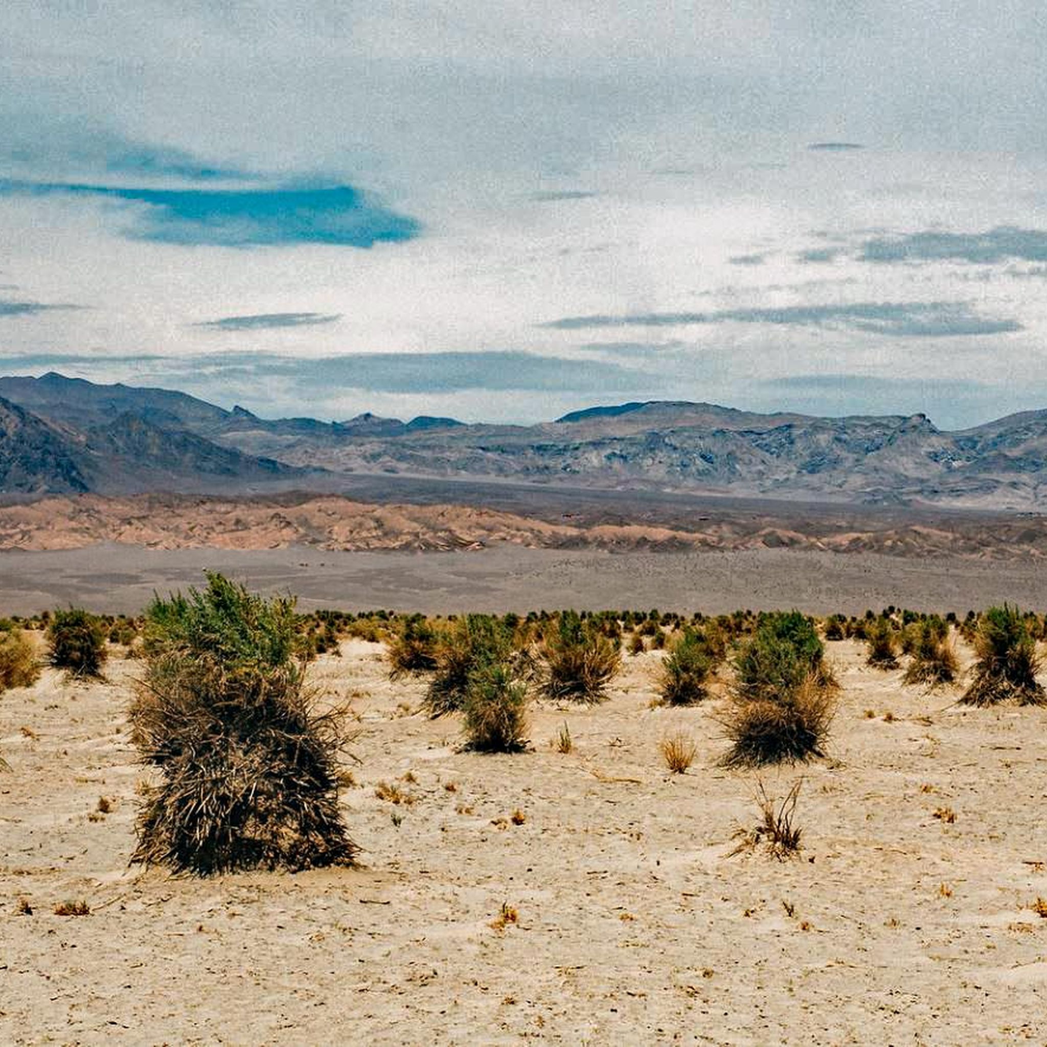
Badwater Basin is the lowest point in North America, at 280 feet (86 meters) below sea level. The salt flats here cover nearly 200 square miles (518 square kilometers) and are composed primarily of sodium chloride (table salt), along with calcite, gypsum, and borax. Stories suggest that Badwater Basin got its name when an early surveyor’s mule refused to drink from the spring-fed pool near the current boardwalk. The water here isn’t really “bad,” just very salty. Despite the high salt content, many organisms not only survive here, but thrive. The pool is home to an endemic snail that is native only to this location, and the rim is dotted with salt-tolerant plants, including samphire. Badwater Basin was once the site of the large, ancient inland lake Manly, which evaporated tens of thousands of years before the arrival of the man in 1849 for whom it is named. The lake had no outlet, so over time sediment and salt accumulated. When the lake eventually evaporated, it left behind concentrated salt layers. Today, fascinating geometric salt flats form on the plains as groundwater rises through these layers and evaporates.
4
1
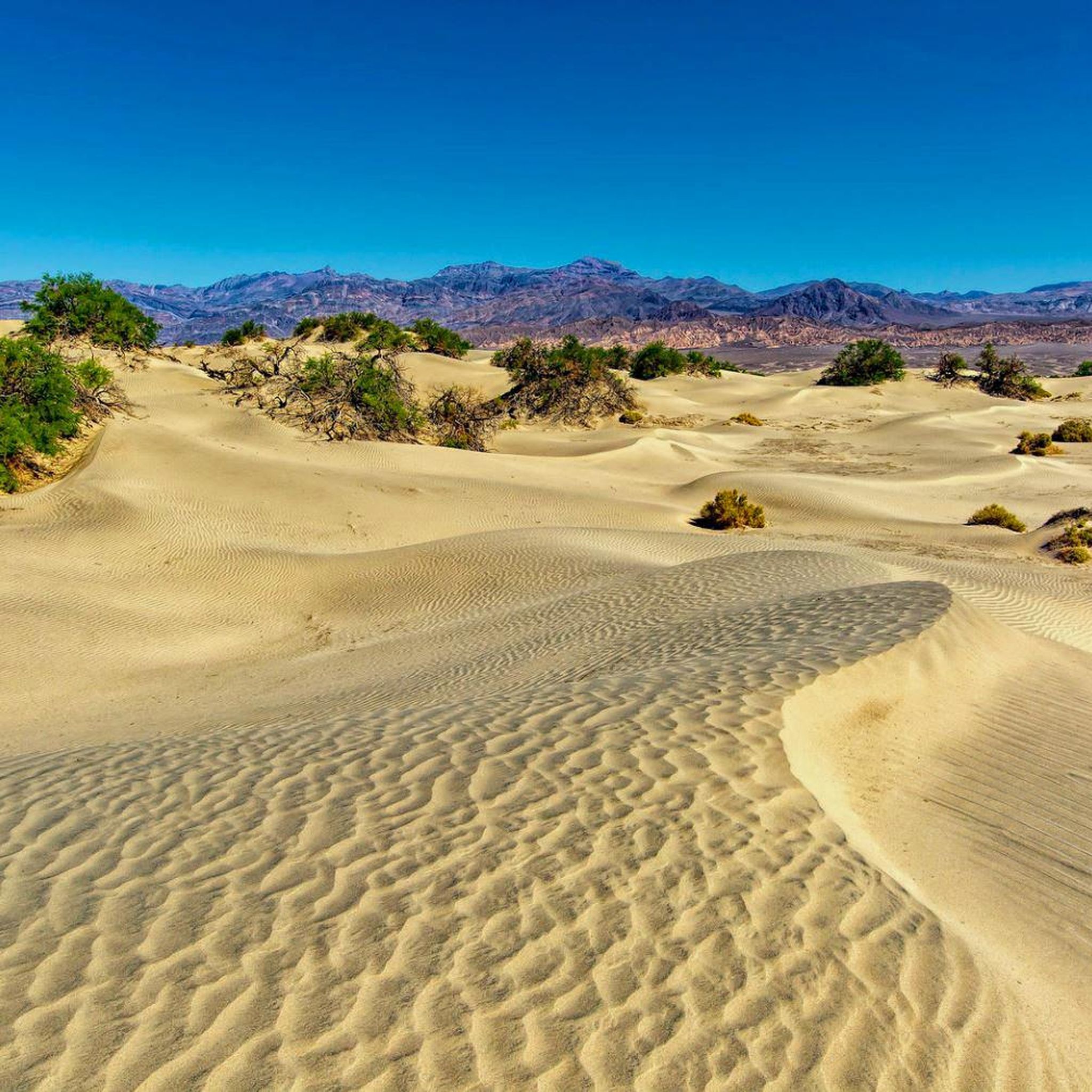
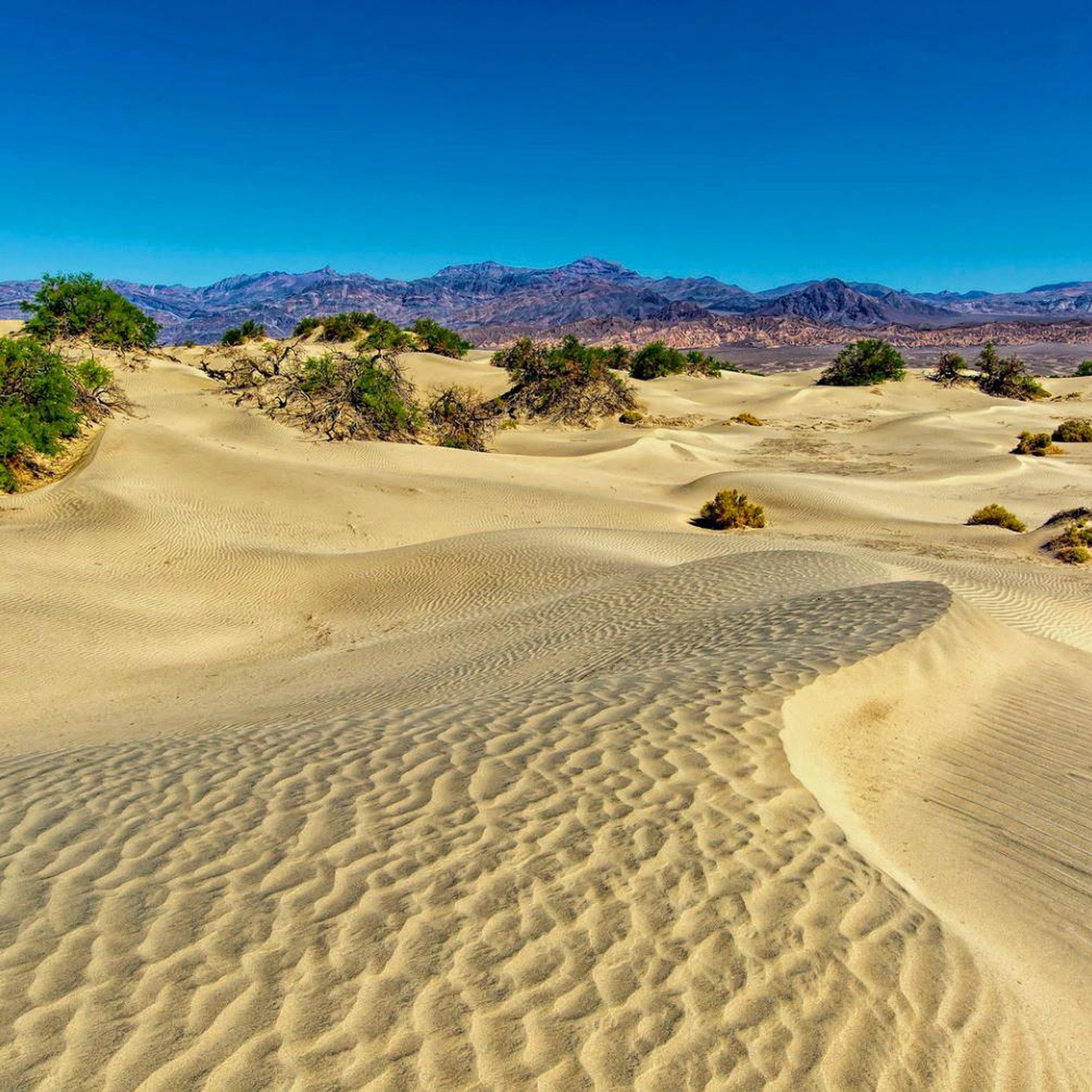
Although sand is present throughout the park, there are few places where large dune fields are created. To create sand dunes, you need a source of sand (in this case, the eroding mountains to the north), wind to move that sand, and a barrier to keep it from blowing further (the mountains to the south). The conditions at Mesquite Flat Sand Dunes are perfect for creating dunes, and while individual grains of sand move and ripple, the dune field remains. These dunes are named for the mesquite tree that grows in abundance in the area. The trees must turn and grow to avoid being buried, and bare, brown trunks are often exposed by the drifting sand. The arrival of spring brings an explosion of bright green leaves and yellow flowers from the upper branches of the trees. Mesquite bean pods are a traditional food of the Timbisha Shoshone, and the flour from these pods is now available in specialty stores. Sand dunes provide habitat for many animals, including nocturnal kangaroo rats and horned rattlesnakes. There are no official walking trails in the dunes, so be careful when exploring and do not disturb any burrows.
5
3

This is the lowest point of the continental USA. Badwater is about 282 feet (85.5 meters) below sea level. It is also one of the hottest places in the world with temperatures around 50 degrees Celsius in the summer months. A short walk across the salt desert is still worthwhile in any heat.
3
1

Incredibly hot but very beautiful.
1
0

Here is the lowest point in North America Badwater is about 85.5 meters below sea level.
2
3
what a beautiful view
2
2

Since you can swim in salt water, spare socks and a towel are very helpful!
1
2
Frequently Asked Questions
What unique geological formations can I expect to see in Death Valley Wilderness?
Death Valley Wilderness is renowned for its diverse geological formations. You can explore the dramatic, eroded badlands of Zabriskie Point, the vast salt flats with hexagonal polygons at Badwater Basin Salt Flats, and the spectacularly colorful rock formations at Artists Palette, where oxidized metals create vivid reds, pinks, yellows, and purples. The region also features towering sand dunes and deep canyons like Gower Gulch.
What is the best time of year to visit the natural monuments in Death Valley Wilderness?
The best time to visit Death Valley Wilderness is generally from late fall through early spring (October to April) when temperatures are milder. Summers can be extremely hot, with temperatures often exceeding 50°C (120°F), making extended outdoor activity challenging. Visiting during sunrise or sunset is often recommended for photography, especially at locations like Zabriskie Point and Mesquite Flat Sand Dunes, to capture the most vibrant colors.
Are there family-friendly natural monuments to visit in Death Valley Wilderness?
Yes, several natural monuments are suitable for families. Badwater Basin Salt Flats offers an easy boardwalk stroll to experience North America's lowest point. Mesquite Flat Sand Dunes Overlook provides an accessible starting point for exploring the dunes, and kids often enjoy playing in the sand. Dante's View, a mountain-top overlook, is also considered family-friendly for its breathtaking panoramic views.
Are there accessible trails for visitors with limited mobility at Death Valley's natural monuments?
Yes, some natural monuments offer accessible options. Zabriskie Point has a paved path from its large parking lot to the overlook, providing easy access to its dramatic badlands views. Badwater Basin Salt Flats features a boardwalk that allows visitors to experience the unique salt formations without extensive walking on uneven terrain.
Where can I find sand dunes in Death Valley Wilderness?
The most famous and accessible sand dunes in Death Valley Wilderness are the Mesquite Flat Sand Dunes Overlook. Located near Stovepipe Wells Village, these dunes cover approximately 14 square miles and feature crescent, linear, and star-shaped dunes. They are a popular spot for photography, especially during sunrise and sunset, and offer opportunities for exploring the unique desert landscape. You can learn more about them on the National Park Service website: nps.gov/deva/learn/nature/sand-dunes.htm.
Is there a waterfall in Death Valley Wilderness?
Surprisingly, yes! Darwin Falls, located on the western edge of Death Valley National Park, is a rare year-round, spring-fed waterfall. It creates a striking contrast to the surrounding arid desert, nurturing a lush oasis of greenery. The hike to the falls can be moderately challenging but rewards visitors with a unique display of water and verdant life amidst the harsh desert environment.
What kind of hiking trails are available near the natural monuments?
Death Valley Wilderness offers a variety of hiking trails. For easy walks, you can explore routes like the Badwater Basin Salt Flats Trail or the Natural Bridge Trail. For more moderate adventures, consider the Mosaic Canyon Trailhead, known for its colorful layers of rocks and narrow sections, or the Gower Gulch, which can be combined with other routes for longer explorations. You can find more hiking options in the Easy hikes in Death Valley Wilderness guide.
What should I wear for hiking in Death Valley's natural monuments?
When hiking in Death Valley, especially to natural monuments, it's crucial to wear sturdy footwear suitable for rocky or sandy terrain. Dress in layers, opting for light-colored, breathable clothing to protect against the sun. A wide-brimmed hat, sunglasses, and plenty of water are essential, regardless of the season, due to the intense sun and dry conditions. Sunscreen is also highly recommended.
Where are the best spots for photography among Death Valley's natural monuments?
Death Valley offers numerous incredible photography spots. Zabriskie Point is famous for its panoramic badlands views, especially at sunrise and sunset. The Mesquite Flat Sand Dunes Overlook provides classic desert scenes with dramatic shadows. Artists Palette, with its vibrant, multi-colored rock formations, is a feast for photographers, particularly around sunrise, sunset, or on overcast days. Badwater Basin Salt Flats offers surreal geometric salt formations and stunning reflections after rare rains.
What kind of wildlife can I expect to see around the natural monuments?
Despite its harsh environment, Death Valley's natural monuments support diverse wildlife. At the Mesquite Flat Sand Dunes Overlook, you might spot nocturnal creatures like kangaroo rats and sidewinder rattlesnakes. The spring-fed pool at Badwater Basin Salt Flats sustains resilient life forms such as pickleweed, aquatic insects, and the endemic Badwater snail. Darwin Falls, with its lush oasis, provides habitat for quail, amphibians, and bighorn sheep.
Are permits required to visit natural monuments in Death Valley Wilderness?
While specific permits are not typically required for general visitation to the natural monuments within Death Valley National Park, an entrance fee is required to access the park. This fee covers all visitors and is valid for seven days. For detailed information on fees and any specific regulations, it's always best to check the official National Park Service website for Death Valley.
What makes Dante's View a significant natural monument?
Dante's View — 1,669 m is a significant natural monument because it offers one of the most breathtaking panoramic viewpoints in Death Valley. Situated over 5,000 feet above the valley floor, it provides an expansive vista of the entire Badwater Basin, including North America's lowest point, and the surrounding mountain ranges. It's a popular spot for its dramatic scenery, especially at sunrise or sunset.
Most popular routes in Death Valley Wilderness
Most popular attractions in Death Valley Wilderness

Get inspired with the komoot mobile app


Explore more
Extend your search for the best caves by checking out these guides of the top ones in Death Valley Wilderness:
