The best running trails in Uncompahgre Wilderness
99
runners
13
runs
Jogging in Uncompahgre Wilderness offers diverse terrain within the north-central San Juan Mountains of Colorado. The region features elevations ranging from 8,400 to 14,309 feet, including prominent peaks like Uncompahgre Peak and Wetterhorn Peak. Its landscape is characterized by an extensive trail system, numerous forks of the Cimarron River, and dense aspen groves. Runners can experience varied environments, from rolling tundra in areas like American Flats to steep, rocky mountain paths.
Best jogging routes in Uncompahgre Wilderness
- The most popular jogging route is Wetterhorn Peak and Uncompahgre Peak, a 15.1 miles (24.3 km) trail that takes 3 hours 54 minutes to complete. This challenging route involves summiting two peaks over 14,000 feet.
- Another top favourite among local runners is Turkey Thief Lake – Sloan Lake loop from Cinnamon Creek, a difficult 10.8 miles (17.3 km) path. This route traverses varied mountain terrain, including lakes and creek areas.
- Local runners also love the Handies Peak via American Basin Trail, a 5.4 miles (8.7 km) trail leading through high alpine basins, often completed in about 1 hour 33 minutes.
- Jogging in Uncompahgre Wilderness is defined by majestic peaks, high alpine basins, and river valleys. The extensive network of running trails offers options for different ability levels, from moderate paths to challenging mountain ascents.
- The guide includes highly-rated routes that showcase the best of the region's landscape. More than 80 runners have used komoot to explore Uncompahgre Wilderness's varied terrain.
Last updated: June 25, 2026
2
runners
24.3km
03:55
1,450m
1,450m
Hard run. Very good fitness required. Mostly paved surfaces. Suitable for all skill levels.
8
runners
17.3km
03:02
1,310m
1,310m
Hard run. Very good fitness required. Mostly paved surfaces. Suitable for all skill levels.

Sign up for free
3
runners
8.73km
01:33
670m
670m
Hard run. Very good fitness required. Mostly paved surfaces. Suitable for all skill levels.
5.77km
00:57
370m
370m
Hard run. Very good fitness required. Mostly paved surfaces. Suitable for all skill levels.
14
runners
25.1km
03:16
1,050m
1,050m
Hard run. Very good fitness required. Sure-footedness, sturdy shoes and alpine experience required.
Get access to more routes and recommendations from other explorers.
Sign up for free
Already have an account?
Our route recommendations are based on thousands of hikes, rides, and runs completed by other people on komoot.
Start today with a free account
Your next adventure awaits.
Login or Signup
Popular around Uncompahgre Wilderness
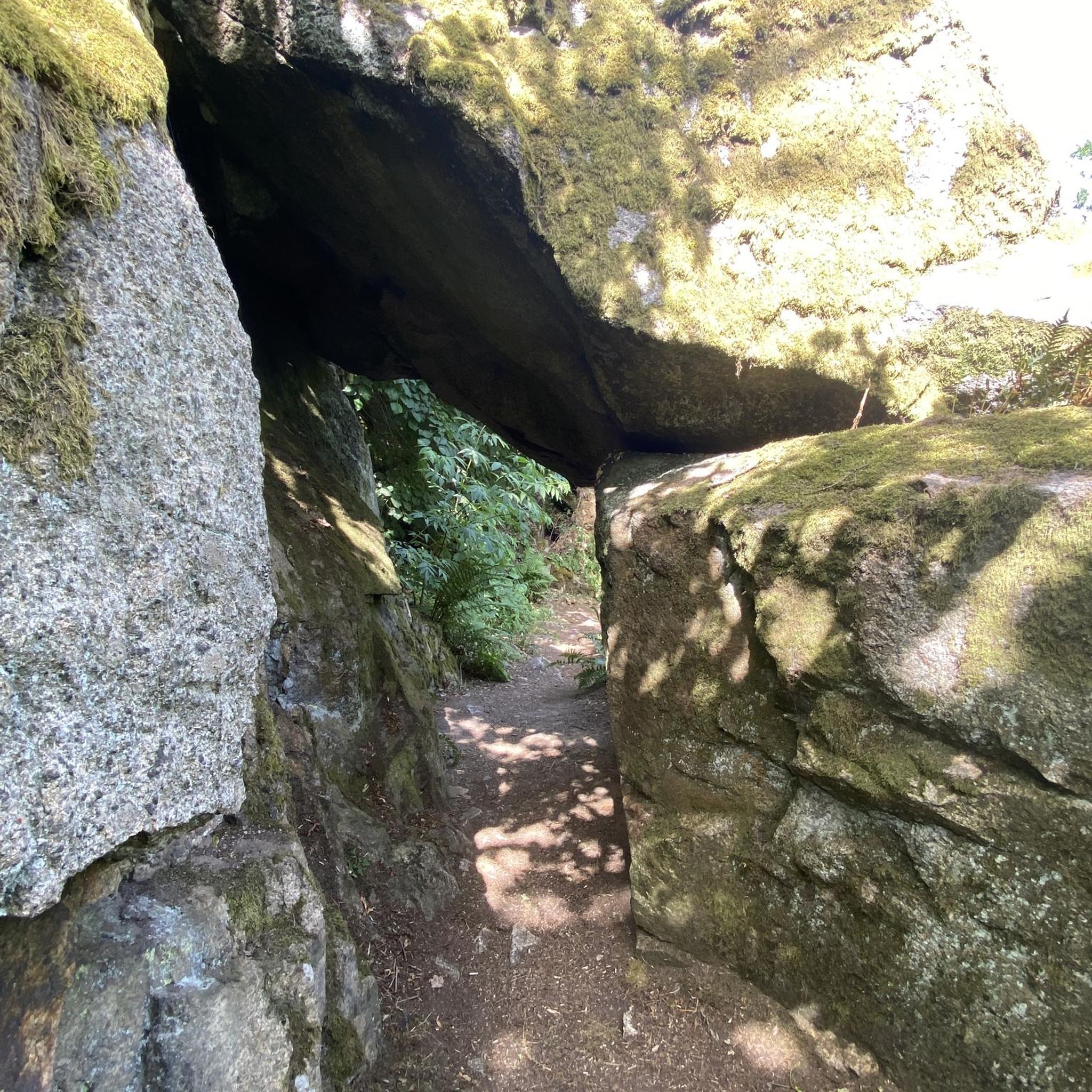
Tips from the Community

A rugged mountain run that follows a tumbling creek through a narrow canyon, with steep walls rising on both sides. The sound of rushing water and glimpses of small cascades keep the climb lively, while the cool air from the creek offers relief on warm days. A tough but scenic stretch on the way to higher ground or to Ouray.
0
0


The Perimeter Trail is one of the main trail in Ouray and gives you great views of the town and mountains. There is also one of several via ferrata accesses here.
0
0

This cliff is fairly clear of cars. Runners are often spotted running alongside this road. When taking pictures, watch out for oncoming vehicles
0
0

Two information boards and a medium sized parking lot are located at the American Basin Trailhead. This is a great starting point to summit Handies Peak since you are already pretty high up in elevation. To get here though, you should have a car with high-clearance and 4x4.
3
0
The American Basin is a popular spot along the Alpine Loop. There are some dispersed campsites, a reliable stream and the trailhead to summit Handies Peak that towers over the basin.
3
0
With an elevation of 14,058 feet, Handies Peak is one of the Colorado 14,000ers. You can access the summit either from the American Basin, passing beautiful Sloan Lake or via Grizzly Gulch from Cinnamon Pass Road on the other side of the mountain. The view from the top is spectacular! Keep in mind, that the weather can change quickly and expect thunderstorms especially during the summer months. So start your hike early and descent in the early afternoon at the latest.
3
0
Sloan Lake is nestled into a small basin and accessible via a short side trail. There are some nice flat spots if you want to spend the night in this alpine paradise. The lake with its crystal-clear water is home to cutthroat trouts.
3
0
Frequently Asked Questions
How many running trails are available in the Uncompahgre Wilderness?
The Uncompahgre Wilderness features over 10 dedicated running trails, catering to various skill levels. While many are challenging, there are options for different experiences within this vast landscape.
What kind of terrain can I expect on the jogging routes in Uncompahgre Wilderness?
Runners in the Uncompahgre Wilderness will encounter diverse terrain, from rolling tundra in areas like American Flats to steep, rocky mountain paths. The region's elevations range from 8,400 to 14,309 feet, ensuring a variety of challenges and scenic backdrops.
Are there any particularly challenging running routes for experienced trail runners?
Yes, the Uncompahgre Wilderness is known for its challenging routes. A prime example is the Wetterhorn Peak and Uncompahgre Peak trail, which covers 15.1 miles and involves summiting two peaks over 14,000 feet. Another difficult option is the Turkey Thief Lake – Sloan Lake loop from Cinnamon Creek, a 10.8-mile path traversing varied mountain terrain.
What are some notable natural features or landmarks I might see while running?
The Uncompahgre Wilderness is rich in natural beauty. You'll encounter majestic peaks like Uncompahgre Peak (14,309 feet) and Wetterhorn Peak (14,015 feet). Points of interest also include Slide Lake and Big Blue Creek, as well as numerous forks of the Cimarron River. In autumn, the dense aspen groves transform into stunning golden landscapes.
Are there any running routes that offer a more moderate or scenic experience without extreme difficulty?
While many trails are difficult, the approach to Uncompahgre Peak offers relatively flat and scenic initial stages before the more grueling climb. The American Flats area also provides a different kind of running experience with rolling, gentle tundra and expansive views. For a challenging but rewarding experience through high alpine basins, consider the Handies Peak via American Basin Trail.
What do other runners say about the trails in Uncompahgre Wilderness?
Over 80 runners have used komoot to explore the Uncompahgre Wilderness. They often praise the stunning mountainous vistas, the unique geological formations, and the extensive network of trails that offer options for various ability levels, from moderate paths to challenging mountain ascents.
Can I find any loop running trails in the Uncompahgre Wilderness?
Yes, there are loop options available. The Turkey Thief Lake – Sloan Lake loop from Cinnamon Creek is a difficult 10.8-mile route that allows you to experience varied mountain terrain, including lakes and creek areas, in a circular fashion.
What kind of wildlife might I encounter while jogging in the Uncompahgre Wilderness?
The Uncompahgre Wilderness is home to diverse wildlife. Runners might spot elk, mule deer, black bear, mountain lion, and bighorn sheep. It's always advisable to be aware of your surroundings and practice wildlife safety.
Are there any specific considerations for parking or trailheads for these running routes?
While specific parking details vary by trailhead, many routes, especially those leading to prominent peaks or basins, have designated access points. It's recommended to research the specific trailhead for your chosen route, such as the access points for American Basin or Cinnamon Creek, to plan your parking accordingly.
What is the best season for running in the Uncompahgre Wilderness?
The Uncompahgre Wilderness is best enjoyed for running during the warmer months, typically from late spring through early fall, when trails are clear of snow and weather conditions are more favorable. The fall, in particular, offers a picturesque landscape as the dense aspen groves turn golden.
Are there any long-distance running options in the Uncompahgre Wilderness?
Yes, for those seeking longer distances, the Uncompahgre Wilderness provides several options. The Wetterhorn Peak and Uncompahgre Peak route is a substantial 15.1 miles, offering a significant endurance challenge. Another long route is the Canyon Creek – Camp Bird Road Scenic Outlook loop from Ouray, which spans over 15 miles.
Most popular routes in Uncompahgre Wilderness

Get inspired with the komoot mobile app


Explore more
Browse the best Running Trails & Routes in other regions.
